Another Stormy Day…
 Highlights:
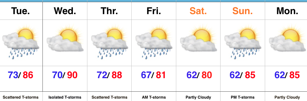
- Tuesday and Thursday appear to be the stormiest days
- Drier trend to close the week; open the weekend
- Humid air gives way to a more refreshing feel
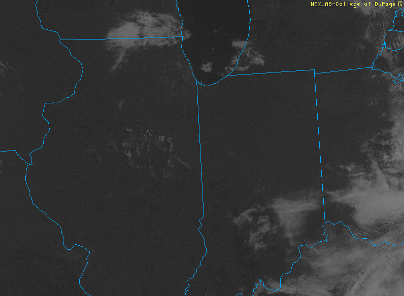
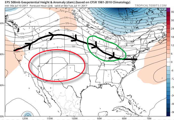
Stormy Periods…Storms are building across west-central Indiana this morning and these will settle into the city, itself, as the rush hour nears. This is only the beginning of multiple rounds of thunderstorms that will ride in a northwest to southeast fashion across central Indiana today. With dew points in the lower and middle 70s and precipitable water values exceeding 2″, additional flash flooding will result today for some communities where storms “train” over the same areas. A couple of strong-to-severe storms are also possible this afternoon with large hail and damaging straight line winds the biggest concern.
While we can’t rule out a passing storm Wednesday, overall storm coverage should be significantly reduced tomorrow as we get in on bit of a breather before another active time of things Thursday.
A surface front will settle south Friday. Best thunderstorm chances should occur during the front half of the day before a drier regime builds in from the north Friday evening and into Saturday. Temperatures will cool slightly, but we’ll really be able to notice a dramatic reduction in the humidity.
Sunday should be mostly dry, but we note a weak secondary boundary that will pass late in the day. This may be just enough to kick up a shower or thunderstorm Sunday afternoon or evening.
Upcoming 7-Day Precipitation Forecast:
- Snowfall: 0.00″
- Rainfall: 2″-3″ (locally heavier amounts)
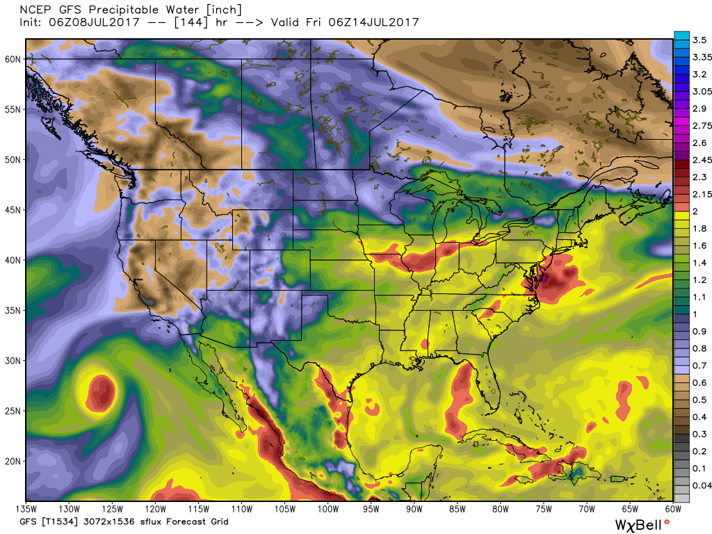
 A quick step outside this morning will tell the story on just how different it feels. Gone is the refreshing air mass we enjoyed over the weekend and in return we’ve transitioned to an oppressive, tropical feel. Dew points will remain in the 70s through the majority of the work week and precipitable water values will reach 2″+ at times. With such a moisture laden air mass in place, flash flooding will likely result for some communities as the storms continue to track over the same areas this week.
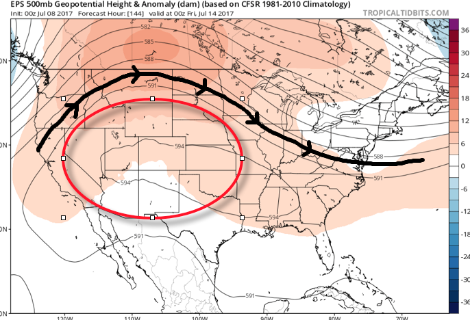
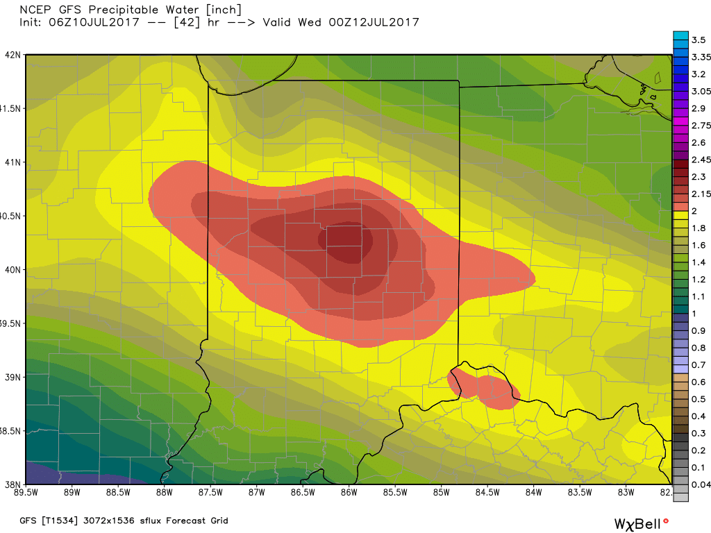 Additional waves of thunderstorms will impact the region through mid-and-late week before we advect some drier air into the state Friday evening into the weekend. Despite the lower dew points and cooler air, we still can’t rule out a shower or thunderstorm this weekend as a secondary front settles south.
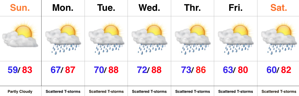 Highlights: