JMA Weeklies: Seasonal Pattern To Open August
The new JMA Weeklies are in and highlighted by the following:
- Central hot pattern doesn’t last
- Seasonal pattern takes hold
- Heat builds across the Northeast region
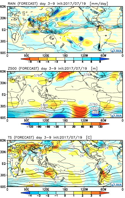
Week 1:
Hottest anomalies remain across the central region, but the days are numbered on this pulse of heat and the JMA Weeklies suggest a cooler, more seasonal, pattern looms to close July and open August. We note the wet regime across the Southwest region, where associated cooler anomalies are also located.
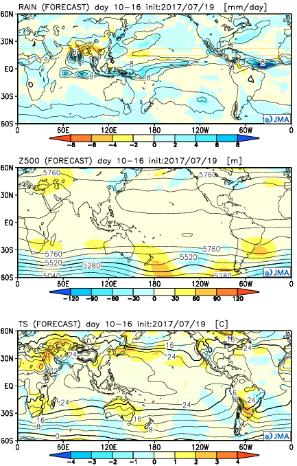
 Week 2:
It’s a “book end” hot pattern that includes heat along both the Northwest region and a developing hot pattern over the Northeast. The central region, including here on the home front, looks very seasonal. With a subtle northwest flow aloft, we’ll have to be mindful of storm complexes at times.
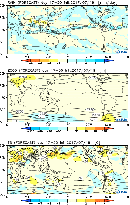
 Weeks 3-4:
Our attention is drawn to the heat across the Northeast region and the cooler, wetter regime (relative to average) across the Southwest. Locally, there aren’t any strong indications for big time heat or heavy rains.
 Highlights:
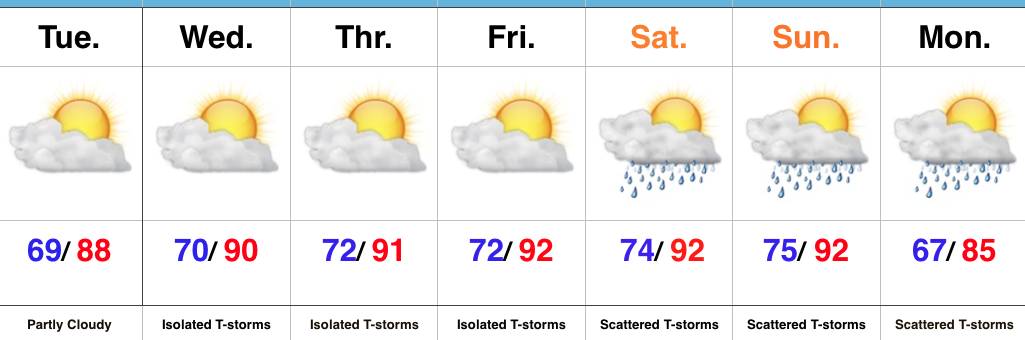
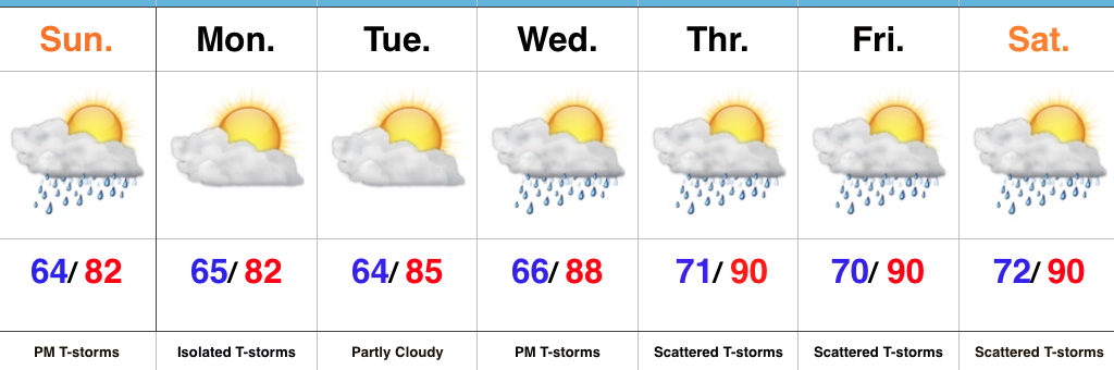
 2.) While the radar is rain and storm-free this morning, a left over boundary, combined with daytime heating will help spark isolated to widely scattered storm coverage this afternoon.
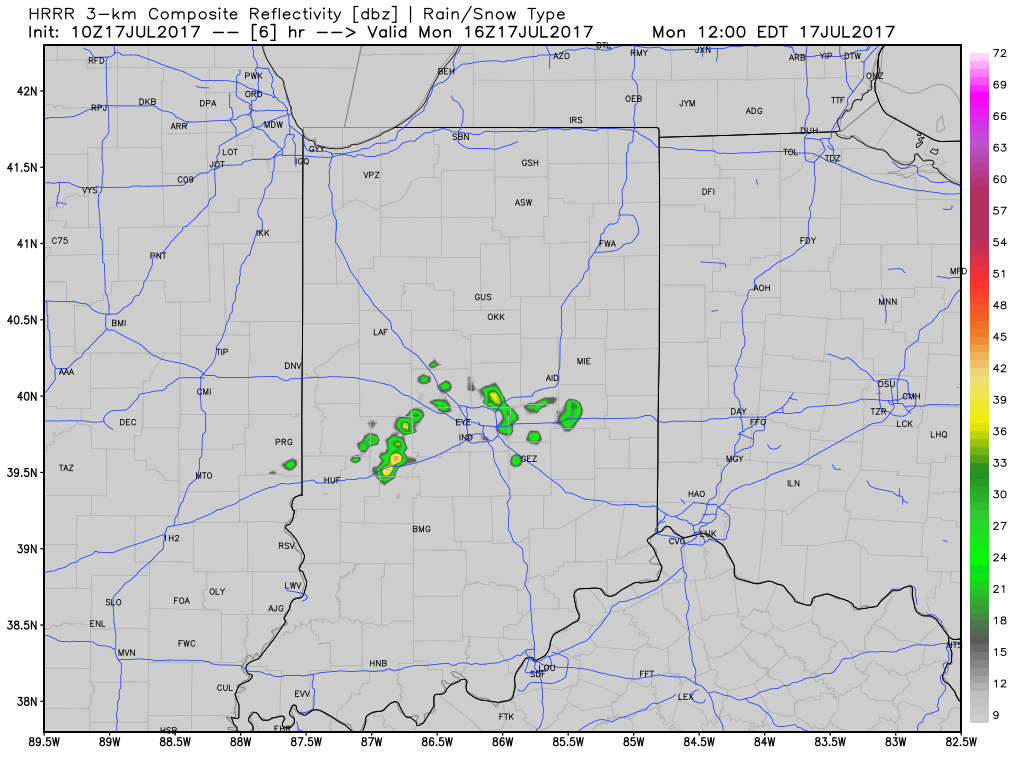 3.) The big weather story this week will be an increasingly hot and humid feel once to mid and late week, including the weekend. While today will continue the theme of slightly cooler than average from the weekend, we’ll more than make up for the refreshing feel later this week. Highs will push to around 90° Wednesday through Sunday as the ridge expands.
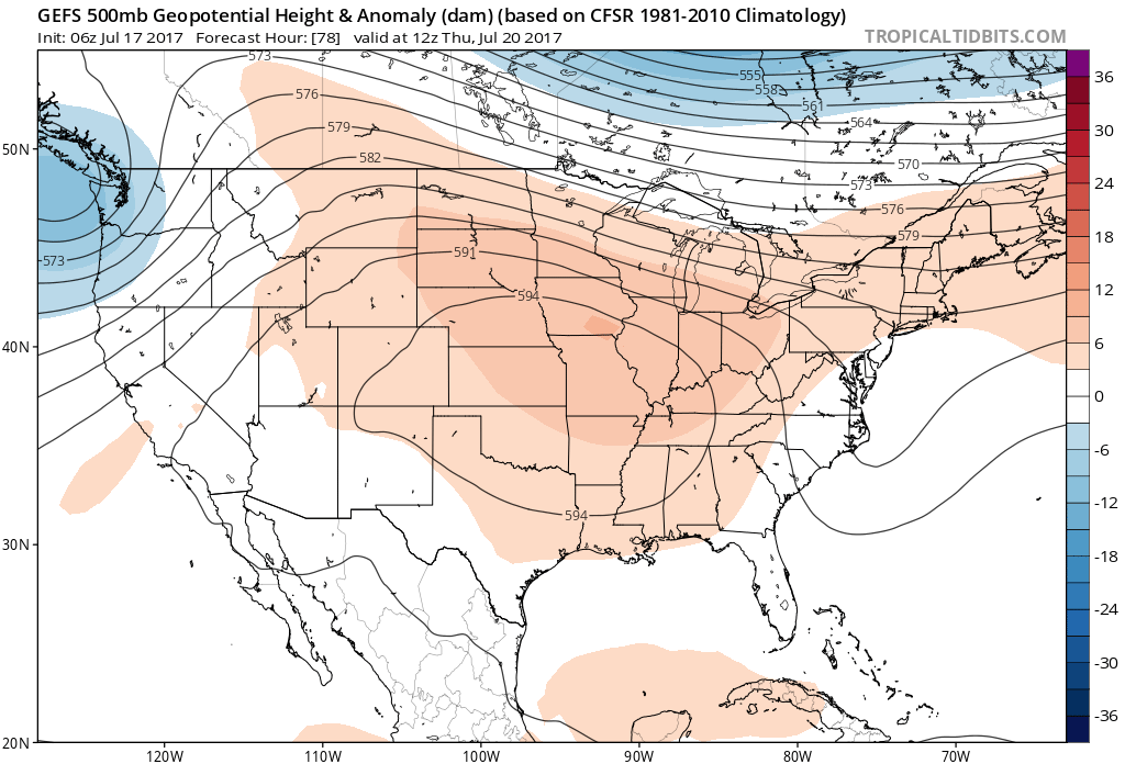 4.) Despite the hot and humid feel that develops this week, it won’t last. Like so many other times this summer that heat tries to build east, the transient weather pattern will continue to prevent it from “hitting and holding.” You guessed it, as we transition from the hot conditions to cooler weather next week, rain and storm chances will be on the increase, including the potential of heavy rain. As of now, best rain and storm chances appear lined up for late week through the weekend and into early next week.
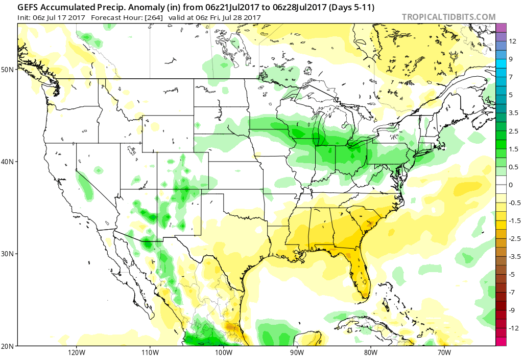
 Highlights:
 Highlights: