
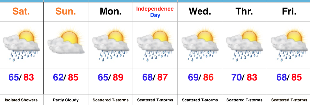
 Highlights:
- Mostly dry this weekend
- Unsettled next week
- Locally heavy rain
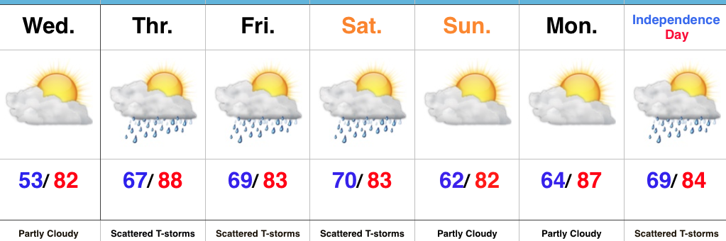
Classic Summertime Weather…While we’ll deal with some clouds from time to time today, most of the region will remain rain-free. Best chances of seeing a passing shower will be across the southern half of the state. Sunday will feature partly cloudy and seasonable conditions. It’ll be a great day to be outdoors!
Unsettled conditions will return next week, including Independence Day. Storm coverage will be most widespread during the afternoon and evening hours in this “rinse and repeat” pattern through late week. That said, each day will offer up many more dry hours than stormy. Just have a “plan B” in mind when those passing storms arrive.
Looking ahead, we may inject a drier and slightly cooler regime next weekend…
Upcoming 7-Day Precipitation Forecast:
- Snowfall: 0.00″
- Rainfall: 1.50″ – 2.00″
 2.) With the increasing warmth and humidity will also come an increase in shower and thunderstorm chances today through Saturday. Most widespread coverage of thunderstorms should occur during the evening hours today and Friday night into Saturday morning. Drier air will try and work in Saturday afternoon into Sunday. Here’s a look at the forecast radar valid at 7p this evening.
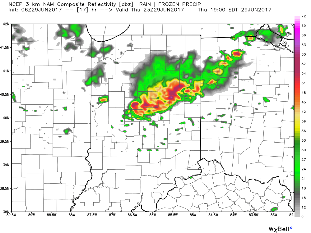 3.) While we should dry things out Saturday afternoon into Sunday, active times will return early next week. We’ll have to fine tune timing, but the period Monday into Independence Day may feature a rather strong storm complex moving in a southeast fashion across the region. Again, details still have to be determined. While strong storms are possible at some point during the period, more dry time than wet can be expected.
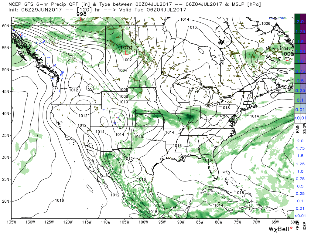 4.) The latest JMA Weeklies are in and while we’ll have a more extensive post this evening on the weekly breakdown, the screaming message to us is an active period continues along with cooler anomalies setting up shop across the central, including our region.
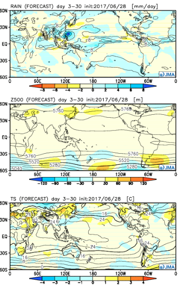
 Highlights:
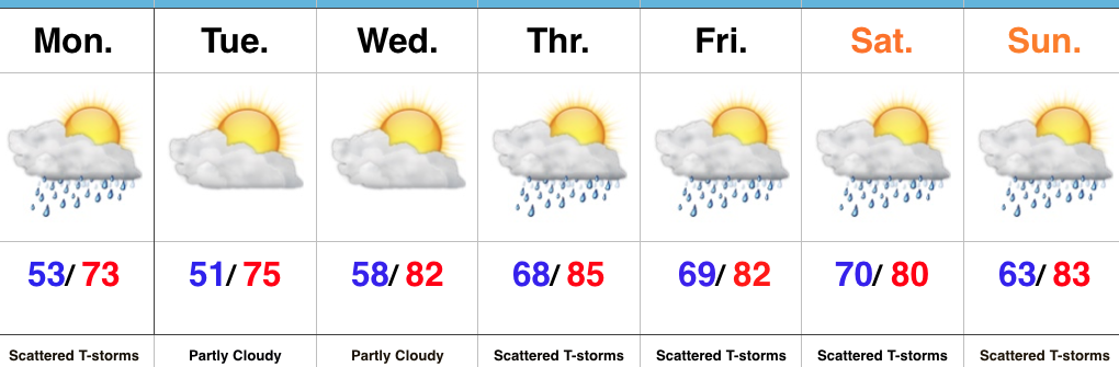 Highlights: