
 Highlights:
- Calm open to the work week
- Two cold fronts impact the region
- Much colder air blows in this weekend
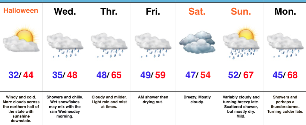
Calm Open; Busy Close…The work week will open with weak high pressure in control of our weather. This will result in sunshine returning along with unseasonably chilly conditions (average highs are in the mid 50s this time of year).
The first of two cold fronts will push through the state Wednesday. Clouds will increase Tuesday evening and showers will blow into town Wednesday morning. Breezy and chilly conditions will go along with the damp weather.
A second (stronger) cold front will impact the area to close the work week. Strengthening low pressure will move through the Great Lakes Friday evening and help pull a briefly warmer air mass into the state. Showers and thunderstorms will be widespread ahead of the approaching cold front and a few of these could be strong to severe. We’ll keep a close eye on things over the next couple of days and update accordingly. Strong and gusty southwesterly winds will reach 40 MPH+ before shifting around to the northwest once the trailing cold front sweeps through the region. This will drive a sharply colder air mass southeast and the potential is there for lingering moisture to end as a touch of wet snow late Friday night. The weekend will feature dry, windy, and unseasonably cold conditions.
Upcoming 7-Day Precipitation Forecast:
- Snowfall: Trace
- Rainfall: 1.00″ – 1.50″
 Highlights:
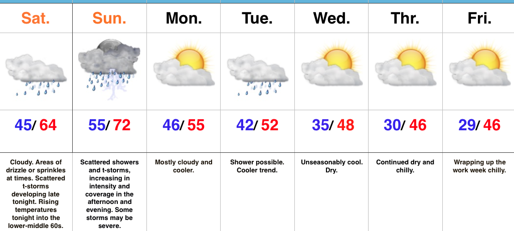
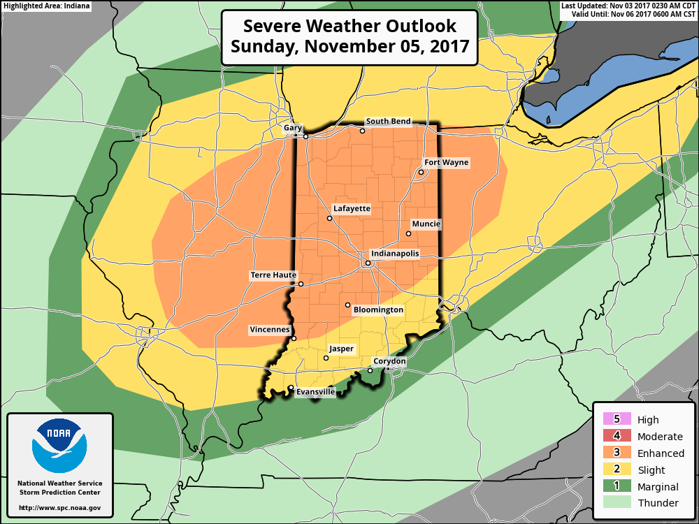 A trough and associated cold front will slice into an unseasonably warm and increasingly moist air mass Sunday. Ahead of the approaching front, temperatures should climb into the lower 70s Sunday afternoon (average high is in the upper 50s) and dew points will reach the lower to middle 60s. While the developing surface low isn’t expected to be terribly strong, as this feature moves northeast, it’ll help drag a cold front into this warm and increasingly unstable air mass late Sunday. From this distance, conditions seem favorable for a couple of super cells to develop Sunday afternoon and evening. We’ll have to keep a close eye on the northward extent of the warm front as this would be the areas of greatest concern for potential tornadic activity Sunday afternoon. Large hail and damaging winds are also included in Sunday’s severe threat. We’re in the second severe weather season, after all, and this kind of event isn’t unusual. Late November 2013 comes to mind.
 Highlights: