
I.) An unseasonably warm pattern will remain as we move into the middle of the week. A more summer-like feel can be expected as opposed to the increasingly chilly early October air we should be dealing with. Highs will reach the middle 80s this afternoon along with a gusty SW breeze.
 II.) After a windy and warm Wednesday, scattered showers and thunderstorms will return Thursday. Not everyone will get wet, but a few locally heavy downpours can be expected.
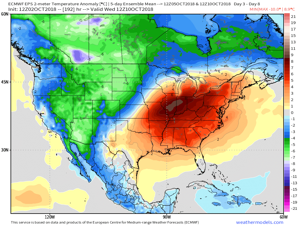
 III.) The ridge will “flex its muscle” into early and middle parts of next week and promote an extended (and unusual) stretch of 80s. Don’t put those shorts away just yet…
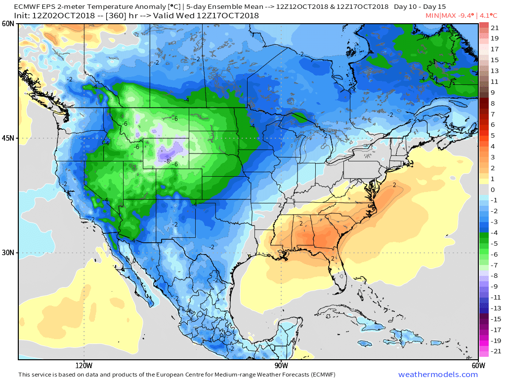
 IV.) A “game changer” of a cold front will approach late next week with better chances of organized rain and storms followed by a return of more seasonal times…
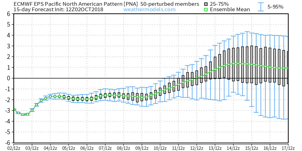
 V.) Ingredients are in place for a significant shift in the pattern around the middle of October and colder times continue to look like they will return as we flip the page into Weeks 2-3.
 The frontal boundary will sweep through the state late Tuesday and allow a cooler and drier air mass to filter into the region Wednesday. You’ll notice a true fall feel out the door Wednesday morning- low to mid 50s. Highs Wednesday afternoon will remain in the 60s.