Category: T-storms

Heavy Rain, Couple Strong Storms Possible Across Southern IN Tonight…

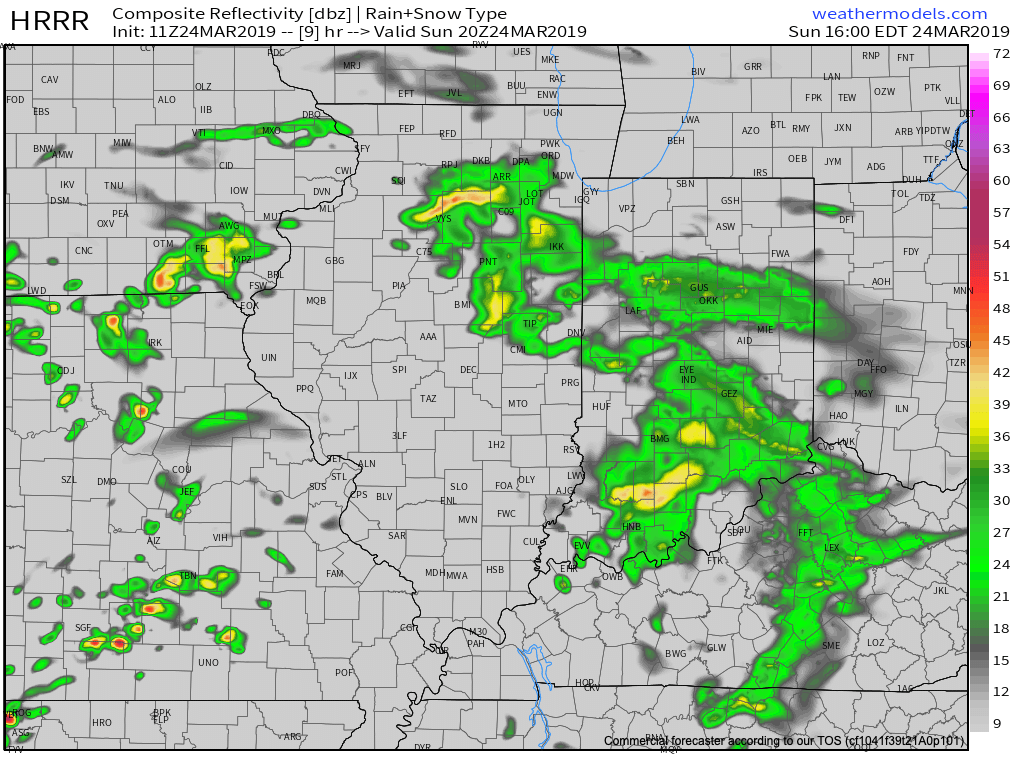
Scattered showers will spread across central Indiana at times through the day. Most of this rain will be light in nature through the afternoon hours, but a couple of moderate showers are also possible.

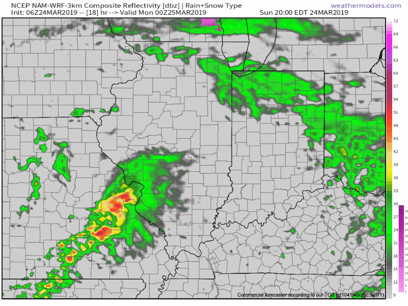
A surface low will track east across the lower Ohio Valley tonight and this will result in more concentrated heavy rain falling across the southern portion of the state this evening into early Monday morning. This is a bit further south than model guidance suggested yesterday. Additionally, a couple of strong thunderstorms are also possible tonight across far southern Indiana.

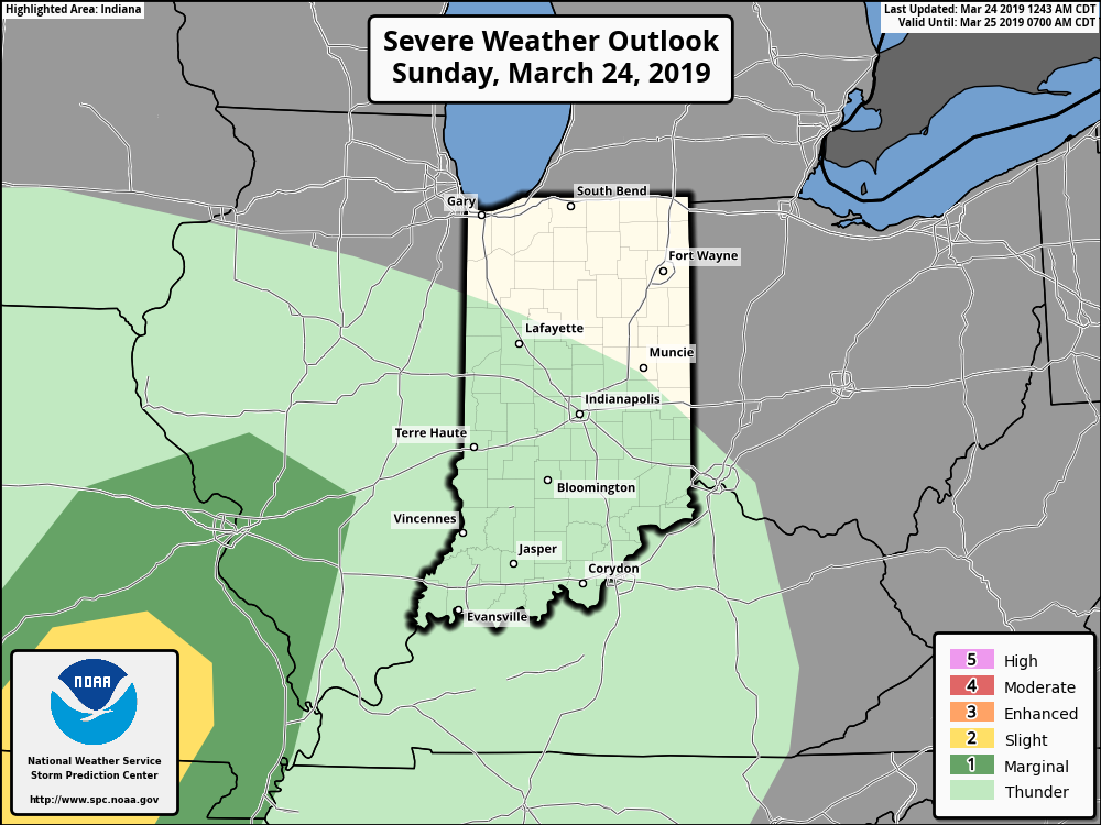
It wouldn’t surprise us to see the Storm Prediction Center (SPC) include portions of southern Indiana in a ‘Marginal’ or ‘Slight’ risk of severe weather tonight with future updates.

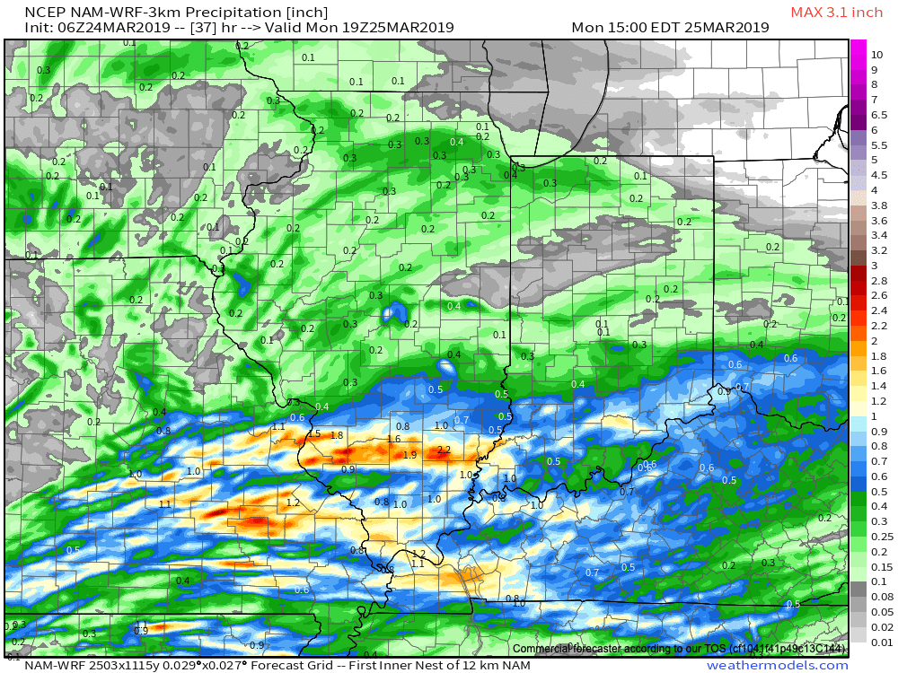
With the more southern track now expected from this storm system, the corridor of .50″ to 1″ rainfall totals will settle across the southern portions of Indiana, with 0.10″ to 0.25″ expected for central Indiana on average.

Rain will come to an end for all of the state by mid to late morning Monday with dry conditions returning Monday evening into the middle of the week, thanks to high pressure.

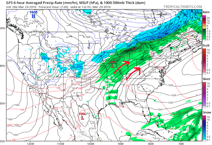
Dry and pleasant conditions will remain in place through the daytime hours Thursday before a storm system approaches Thursday night into Friday. The gusty southwesterly air flow in advance of this storm will help pull warmer conditions northeast into the Ohio Valley. Highs between 65-70 are on tap by Thursday afternoon. Unsettled weather is anticipated to remain through next weekend along with progressively colder conditions.

Permanent link to this article: https://indywx.com/heavy-rain-couple-strong-storms-possible-across-southern-in-tonight/

Gorgeous Saturday; Active Pattern Awaits…

You must be logged in to view this content. Click Here to become a member of IndyWX.com for full access.  Already a member of IndyWx.com All-Access?  Log-in here.

Permanent link to this article: https://indywx.com/gorgeous-saturday-active-pattern-awaits/

Quiet Pattern Turns Much More Active As We Close March…

This week is about as boring as it gets around these parts in mid to late March. With the active pattern as of late, we’ll gladly take it.

While we have a weak system that will deliver raw conditions and light rain Wednesday (touch of light snow and, or sleet across northern and east-central Indiana), that’s about it for “excitement” between now and early next week. High pressure will return as we get set to close the work week and head into the weekend, along with increasing sunshine and moderating temperatures. We still forecast highs to reach the 50s Thursday and Friday and 60s over the weekend.

It’d be wise to enjoy the “lull” in the action now, as things turn much more active as we flip the page forward to Week 2.

First up, in what will be a series of storm systems to impact the area as we close March and open April, will be a coast-to-coast storm that tracks east during the early portions of the Week 2 time frame. More specific to our area, this would likely be a system that begins to impact central Indiana during the early to middle parts of next week.

We’ve highlighted a couple of the items that have our attention, and if they come to fruition, will result in one more wintry “setback” before we say spring has officially sprung.

This is a bullish signal for an ominous spring storm, including the risk of severe weather to the south of the storm’s track and late season wintry potential to the north. It’s, obviously, far too early to get specific with this event, but it’s worth keeping a close eye on. Note that as the surface low (SL) is tracking east, a late season arctic high is pegged to be dropping southeast.

By the time we get to the middle of next Tuesday, the surface low is deepening across the TN Valley region. Despite the strong high nosing into New England, I’d expect a northward trend in the system as time gets closer, especially considering we’ll be in late March by this time. Stay tuned.

Thereafter, the pattern is set to remain quite active as we head into the 4th month of the year (2019 is flying by already). Buckle up; the well deserved quiet times now won’t last much longer…

By the way, despite what may be one last push of wintry conditions early next week, data remains in excellent agreement of a significant warmup as we flip the page to April. We continue to believe the month, overall, will average above normal in the temperature department.

Permanent link to this article: https://indywx.com/quiet-pattern-turns-much-more-active-as-we-close-march/

Now We’re Talking…

Meteorological Spring has gotten off to a cold start- to the tune of nearly 5 degrees below average at IND through 3/15.

Note the brutal cold across the Northern Plains and Rockies.

The upcoming week will feature a positive PNA pattern and associated cooler than average theme to open, before beginning to moderate mid-to-late in the work week.

That said, time is limited on the chilly pattern and an overall significant shift to more of a sustained spring-like pattern awaits to close March and as we head into April.

Note the warmth that follows:

This will result in many more days in the 60s and 70s as we put a wrap on March and open April.

While weak systems will continue to impact the area (tomorrow, Wednesday, and again next Sunday), the deeper, moisture-laden storms will take a “backseat” during the fast-moving northwest flow. That begins to change during the last few days of the month and on into April. The latest ensemble guidance sees the return of a more active pattern, likely complete with heavier rain events and the potential of stronger storms.

Permanent link to this article: https://indywx.com/now-were-talking-4/

VIDEO: 50/50 Weekend; Closer Look At The Late March-Early April Pattern…

A quiet open to the weekend is replaced with accumulating snow for portions of the state Sunday…

You must be logged in to view this content. Click Here to become a member of IndyWX.com for full access.  Already a member of IndyWx.com All-Access?  Log-in here.

Permanent link to this article: https://indywx.com/video-50-50-weekend-closer-look-at-the-late-march-early-april-pattern/