Updated 05.07.22 @ 8:46a
You must be logged in to view this content. Click Here to become a member of IndyWX.com for full access. Already a member of IndyWx.com All-Access? Log-in here.

May 07
Updated 05.07.22 @ 8:46a
You must be logged in to view this content. Click Here to become a member of IndyWX.com for full access. Already a member of IndyWx.com All-Access? Log-in here.
Permanent link to this article: https://indywx.com/video-here-comes-the-sun-extended-stretch-of-quieter-weather/
May 06
Updated 05.06.22 @ 7:50a
You must be logged in to view this content. Click Here to become a member of IndyWX.com for full access. Already a member of IndyWx.com All-Access? Log-in here.
Permanent link to this article: https://indywx.com/video-rain-becomes-more-widespread-by-evening-vast-weekend-improvements-and-looking-ahead-to-a-taste-of-summer-next-week/
May 05
Updated 05.05.22 @ 7:50a
You must be logged in to view this content. Click Here to become a member of IndyWX.com for full access. Already a member of IndyWx.com All-Access? Log-in here.
Permanent link to this article: https://indywx.com/video-same-upper-low-were-tracking-this-morning-remains-on-the-playing-field-into-late-next-week-heat-builds-in-the-week-ahead/
May 04
Updated 05.04.22 @ 7:54a
You must be logged in to view this content. Click Here to become a member of IndyWX.com for full access. Already a member of IndyWx.com All-Access? Log-in here.
Permanent link to this article: https://indywx.com/video-wet-close-to-the-work-week-before-a-vastly-improved-weekend-summer-like-pattern-next-week/
May 03
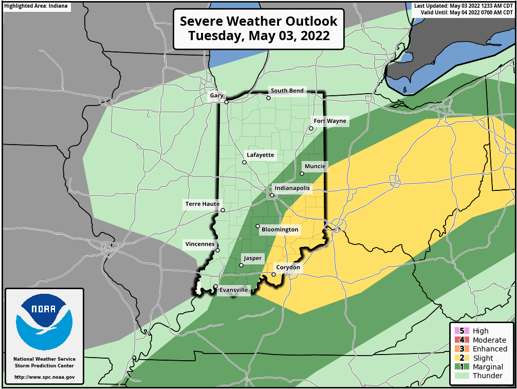
Updated 05.03.22 @ 7:37a
Rain and embedded thunder is widespread across the state this morning.
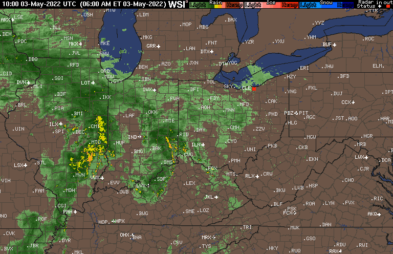
Most of the morning round of rain and storms will end from southwest to northeast (may linger through a good chunk of the day across northern parts of the state) by late morning. Should we work any sort of sunshine into the mix, that will only further aid in destabilizing the local atmosphere for what will likely be a 2nd round of storms this afternoon into the early evening hours.
High resolution guidance shows this 2nd round of storms firing up around 2 to the 3 o’clock. A few of these could become strong to severe, especially from Indianapolis and points east.

Thankfully, things will quieten down quickly come evening. Most, if not all, of the storms should be to our east by 8p. That will then set the stage for a much more pleasant day Wednesday, complete with sunshine.
Enjoy it as our next storm system will arrive quickly Thursday. After a bit of sun to start our day, clouds will quickly increase and showers and thunderstorms will follow by afternoon. As low pressure traverses the Ohio Valley, unsettled weather will persist Friday.
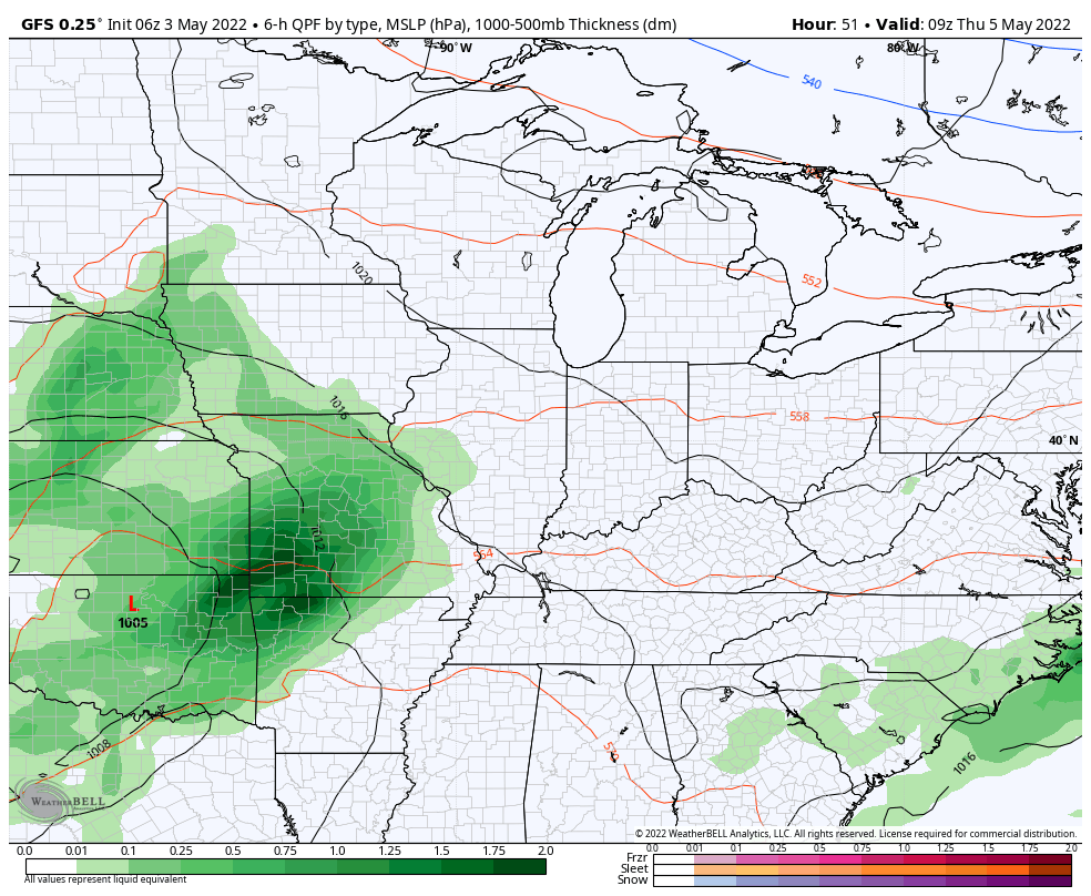
A drier and cooler air mass will work in here for the weekend. By that time, additional rainfall amounts in excess of 2″ can be expected across many central IN communities.
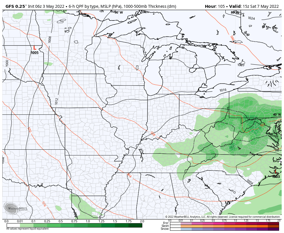
Saturday will feature dry conditions and improving skies as we progress through the day, complete with a northeast breeze. Dry conditions should also remain in place for Mother’s Day.
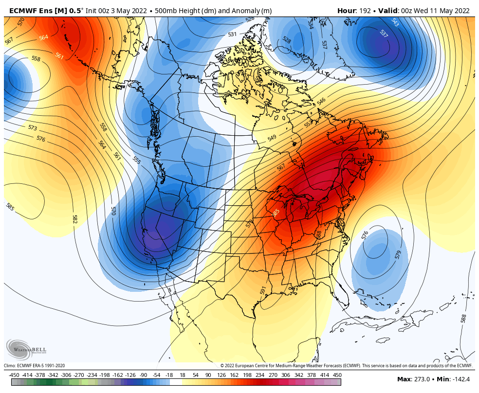
Longing for a quieter, more pleasant pattern? You may be in luck as we rumble into mid-May. An upper level ridge is expected to expand across the region which will go a long way in helping provide a stretch of drier and significantly warmer weather. In fact, we should see a “taste” of summer towards the early and middle parts of next week. Hang in there, friends.
Permanent link to this article: https://indywx.com/going-back-to-back-still-looking-to-dry-things-out-this-weekend-pattern-change-on-deck-mid-month/