Category: T-storms

Another Wet Day…

Screen Shot 2016-08-16 at 7.37.17 AMHighlights:

  • Periods of rain
  • Increasing sunshine as we push into late week
  • Weekend cold front

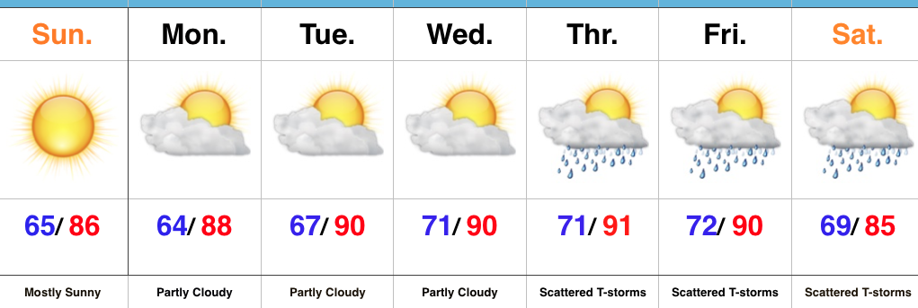
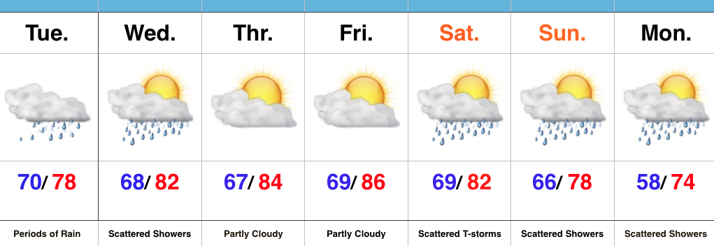
Keep The Rain Gear Handy…Whew, after an incredibly busy evening, things will be much quieter today.  Despite not having a severe threat, we will have to deal with wet times as periods of rain continue.  Rain coverage will diminish Wednesday, but we’ll keep scattered showers in the forecast.

Drier air will arrive Thursday and Friday, including a partly cloudy sky.  The next weather item on the horizon is a weekend cold front.  This frontal boundary will help increase storm chances Saturday into early Sunday (a few storms Saturday evening could be on the strong side).  MUCH cooler, early fall-like, air awaits next week…

Upcoming 7-Day Precipitation Forecast:

  • Snowfall: 0.00″
  • Rainfall: 0.75″-1.25″

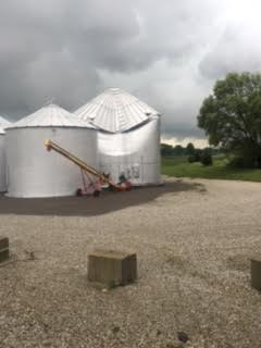
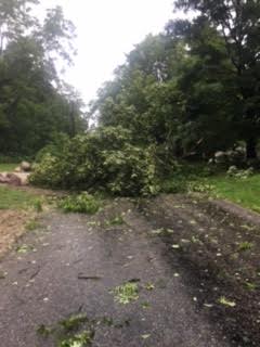
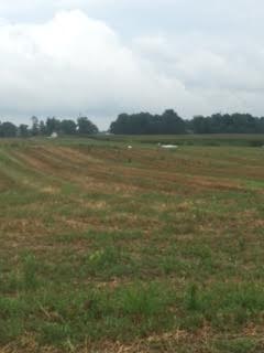
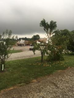
Here are a few photos I shot Monday evening (8.15.16), between 6:47p-6:55p, just after the tornado touched down in Whitestown.
Tornado81516

Tornado281516

Tornado381516

Tornado481516

Tornado581516

Permanent link to this article: https://indywx.com/2016/08/16/another-wet-day/

Dry And Turning Hot; Watching Late Week…

Screen Shot 2016-08-07 at 10.47.30 AMHighlights:

  • Sun-filled days
  • Heat cranks up
  • Late week questions

Turning Up The Heat…After a refreshing weekend, the heat returns later this week.  Look for highs in the lower 90s with an oppressive feel to the air, as humidity builds.  “Air you can wear” will be an appropriate forecast title come mid week.  The forecast is easy through the midweek stretch with sunshine as the rule.

Things become more unclear as we approach the back half of the week and the weekend.  We note the GFS is rather progressive in swinging a cold front through here with scattered showers and thunderstorms, followed by a significantly cooler/ drier air mass a week from today.  On the  other hand, the European solution is drastically different as it slows the front to a “crawl” coming through the Ohio Valley and also entrains GOM (Gulf of Mexico) moisture from the serious rain/ flood maker later this week across the Gulf states.  It’s a significantly wetter look, locally, and a situation we’ll continue to keep a close eye on in the coming day, or two.

Upcoming 7-Day Precipitation Forecast:

  • Snowfall: 0.00″
  • Rainfall: 0.50″-1.00″

Permanent link to this article: https://indywx.com/2016/08/07/dry-and-turning-hot-watching-late-week/

Storms For Some; More Winter Chatter…

You must be logged in to view this content. Click Here to become a member of IndyWX.com for full access.  Already a member of IndyWx.com All-Access?  Log-in here.

Permanent link to this article: https://indywx.com/2016/08/04/storms-for-some-more-winter-chatter/

Lots Of Sunshine…

Screen Shot 2016-08-02 at 7.14.48 AMHighlights:

  • Lots of sunshine
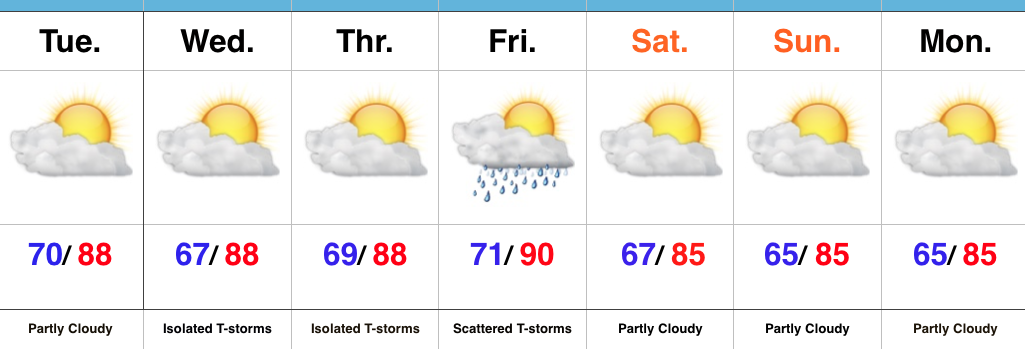
  • Best storm chances Friday this week
  • Turning less humid this weekend

Sunglasses Required…The storm axis has set itself up to our west, including IA and MO.  At one point, data and upper level steering currents seemed to align in a manner that would be further east, but that’s obviously not the case.  The end result here will be a drier forecast, overall.  We’ll still have to remain on our toes for storm potential through week’s end, but the confidence is low and the drier regime looks good this morning.

Less humid air will push in this weekend, along with continued sunny conditions.  All in all, the first weekend of August looks very pleasant.  Plans to go to the State Fair anyone?

Upcoming 7-Day Precipitation Forecast:

  • Snowfall: 0.00″
  • Rainfall: 0.25″-0.50″ (locally heavier totals)

Permanent link to this article: https://indywx.com/2016/08/02/lots-of-sunshine/

More Active Pattern Early Week…

The Corn Belt and parts of the Ohio Valley will be in a favorable position for periods of storminess as we progress through the early portions of the new week.

It’s an admittedly tricky pattern when it comes down to the all-important details (timing, track, etc.), but just know from this distance, it’s a pattern conducive for thunderstorm development and localized flash flooding.

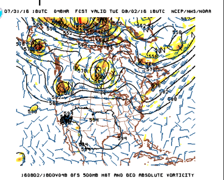
The region will be located on the NE flank of a hot dome centered to our SW.

The region will be located on the NE flank of a hot dome centered to our SW.

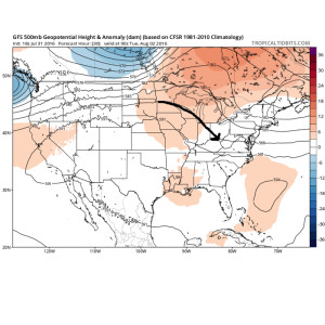
Disturbances love to ride northwest to southeast around the periphery of the ridge.  Accordingly, the subtle northwest flow aloft will likely send a couple disturbances into the region over the early week stretch.

NWFlowThe atmosphere will be loaded with moisture and precipitable water values (2″+) will promote localized flash flooding within the storm complexes.
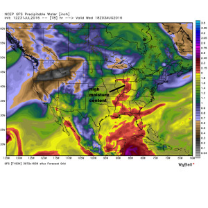
MoistureWe think the initial wave of storms will ride southeast late tonight and early Monday and could encompass SW portions of the forecast area.  The pattern is favorable for additional storm complexes to travel southeast Tuesday and Wednesday, however.
With the moisture content in the atmosphere, localized flash flooding will result where training takes place.  We caution that this won’t be a uniform event (some neighborhoods will see a half inch of rain this week while others may see as much as 3″-4″).  We’ll have to treat each complex as they come and fine tune the specifics within the forecast.

Permanent link to this article: https://indywx.com/2016/07/31/more-active-pattern-early-week/

The Last Month Of Meteorological Summer Is Upon Us…

You must be logged in to view this content. Click Here to become a member of IndyWX.com for full access.  Already a member of IndyWx.com All-Access?  Log-in here.

Permanent link to this article: https://indywx.com/2016/07/30/the-last-month-of-meteorological-summer-is-upon-us/

Storms Fire Later This Afternoon And Evening For Some…

It’s a nice start to the day, though patchy dense fog is impacting some communities this morning.  Sunshine will burn through the fog over the next hour, or two.

Screen Shot 2016-07-29 at 7.43.54 AMThat said, things will change as we progress into the prime heating hours of the afternoon and evening.  Upper level energy will rotate east out of the Plains (this morning) and across Indiana this afternoon and evening.
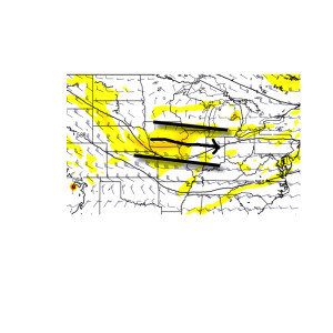
UntitledThis will help ignite thunderstorm development during the afternoon and evening.  While a storm could impact any given neighborhood this evening, best concentration of storms should lie north of the I-70 corridor.  Locally heavy rain will be a good bet with the stronger storms.  Localized rainfall amounts in excess of 2″ will be possible.
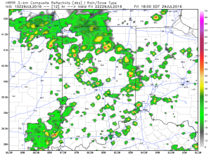
hrrr_ref_indy_13Additional scattered thunderstorm activity will continue Saturday, but there will be many more dry hours than wet/ stormy.
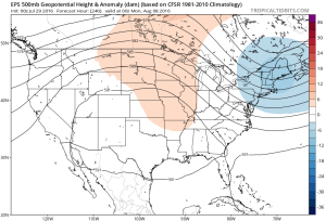
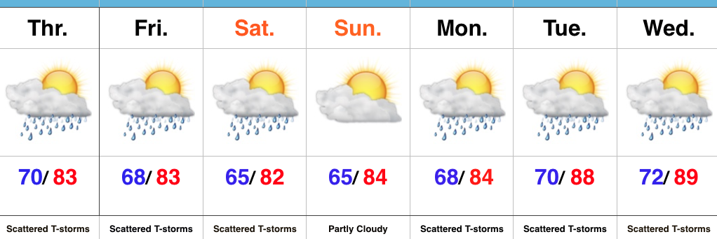
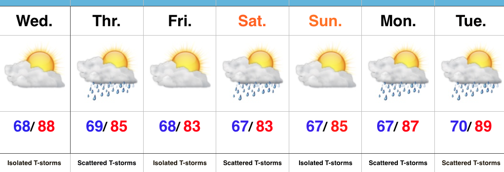
Looking ahead, a shot of heat will come out next week (lower 90 potential), but this will be transient.  By the 8-10 day period, we’re back into an active NW flow type look.  You know the drill by now.  That means potential storm complexes and the worst of the heat to our west, relative to averages.

ecmwf-ens_z500a_us_11

Permanent link to this article: https://indywx.com/2016/07/29/storms-fire-later-this-afternoon-and-evening-for-some/

Storms Increase In Coverage This Afternoon…

Screen Shot 2016-07-28 at 7.27.22 AMHighlights:

  • Storm coverage increases
  • Cooler than days past
  • Unsettled pattern next week

Stormy At Times…Widespread thunderstorms have resulted in as much as 4″-5″ of rain across southeastern IN during the early morning hours.  Flash flooding has resulted (including in and around the Cincy area, as well).  Closer to the home front, upper air energy will combine with a weak surface wave of low pressure to result in an enhanced storm chance this afternoon and evening across central IN.  Some locally heavy rain will accompany the stronger storms that develop, along with vivid lightning.

Scattered storm chances will remain Friday into Saturday, but there will also be plenty of dry hours, as well.  Drier air should keep most of the state rain-free Sunday before an unsettled regime returns for early and middle parts of next week.

Upcoming 7-Day Precipitation Forecast:

  • Snowfall: 0.00″
  • Rainfall: 0.75″-1.25″ (locally heavier totals)

Permanent link to this article: https://indywx.com/2016/07/28/storms-increase-in-coverage-this-afternoon/

Storm Chances, But Plenty Of Dry Time…

Screen Shot 2016-07-27 at 7.14.50 AMHighlights:

  • Storm chances, but timing needs fine tuning
  • Turning slightly cooler over the weekend
  • Unsettled regime continues early next week

More Sunshine Today…Areas of heavy rain resulted in localized flooding across south-central IN yesterday.  While we can’t go with a completely dry forecast today, it will be an overall drier day when compared to Tuesday.  An isolated thunderstorm is possible, but most should remain dry.

Upper level energy and increased moisture will lead to a more widespread coverage of showers and thunderstorms Thursday.  With precipitable water values approaching 2″ in spots Thursday, localized hefty downpours will again be possible.

We’ll continue scattered storm chances this weekend, particularly Saturday, as renewed upper level energy moves overhead.  After a slightly cooler stretch of weather, compared to normal, we’ll begin to heat things back up next week.

Upcoming 7-Day Precipitation Forecast:

  • Snowfall: 0.00″
  • Rainfall: 0.50″-1.00″ (localized heavier totals)

Permanent link to this article: https://indywx.com/2016/07/27/storm-chances-but-plenty-of-dry-time/

Stormy For Some This Morning; Transient Pattern Into August…

You must be logged in to view this content. Click Here to become a member of IndyWX.com for full access.  Already a member of IndyWx.com All-Access?  Log-in here.

Permanent link to this article: https://indywx.com/2016/07/26/stormy-for-some-this-morning-transient-pattern-into-august/

IndyWx.com