Updated 04.12.24 @ 7:48a Today will certainly be another less than ideal weather day across central Indiana, but the trade off for what awaits Saturday will be worth it. You’ve…
You must be logged in to view this content. Click Here to become a member of IndyWX.com for full access. Already a member of IndyWx.com All-Access? Log-in here.
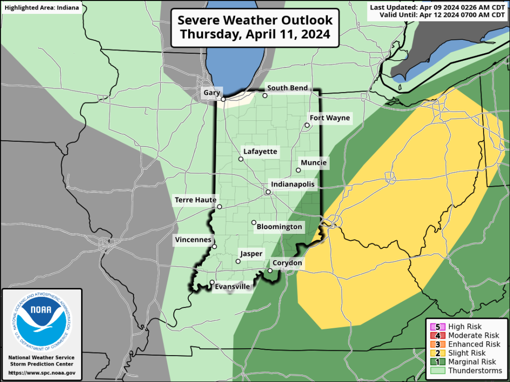
Updated 04.11.24 @ 7:39a Masters Thursday will be a wash-out up this way. Thankfully, down at Augusta, GA we’re talking about better weather- at least relatively speaking. 🙂 Additional showers…
You must be logged in to view this content. Click Here to become a member of IndyWX.com for full access. Already a member of IndyWx.com All-Access? Log-in here.
Updated 04.10.24 @ 7:40a We’re only dealing with a few light showers out the door this morning, but a heavier and more widespread area of rain will develop through the…
You must be logged in to view this content. Click Here to become a member of IndyWX.com for full access. Already a member of IndyWx.com All-Access? Log-in here.
Permanent link to this article: https://indywx.com/video-heavy-rain-develops-later-today-into-thursday-keeping-an-eye-on-the-potential-of-strong-storms-early-next-week/
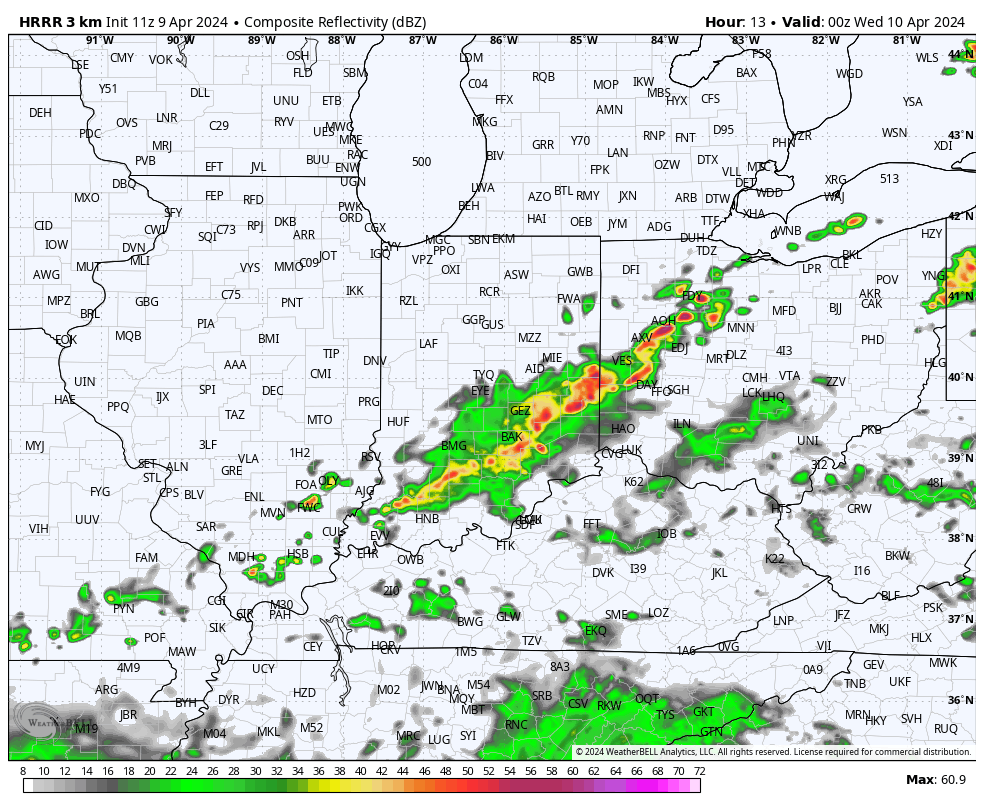
We’ll have a lot of clouds around today but the lions share of our Tuesday will be dry. That changes this evening as we target better chances of showers and storms to develop across southern and southeastern Indiana- primarily south and east of the city, itself.
This is the beginning of another unsettled and dreary stretch as a surface low lifts north and tracks through the Ohio Valley midweek.
Periods of heavy rain can be expected Wednesday evening into Thursday and we continue to monitor the potential of strong to severe storms in the “warm sector” across Ohio Thursday.
In general, most central IN rain gauges should accumulate 1.5” to 2.5” of rain but there will be locally heavier amounts.
Upper level energy will whip in behind the departing low keeping showers in play as we wrap the work week up on Friday.
The weekend still looks like it’ll open on a great note with increasingly sunny and mild conditions Saturday before another opportunity for scattered showers and embedded thunder Sunday.
Updated 04.07.24 @ 10:12a Pleasant conditions this morning will give way to an increasingly cloudy sky throughout the afternoon and evening and scattered storms will follow. It continues to appear…
You must be logged in to view this content. Click Here to become a member of IndyWX.com for full access. Already a member of IndyWx.com All-Access? Log-in here.