Less Humid Today…
 Highlights:
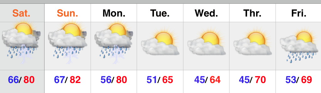
- Less humid today
- Best rain chances Saturday, but plenty of dry time too
- Much cooler early next week
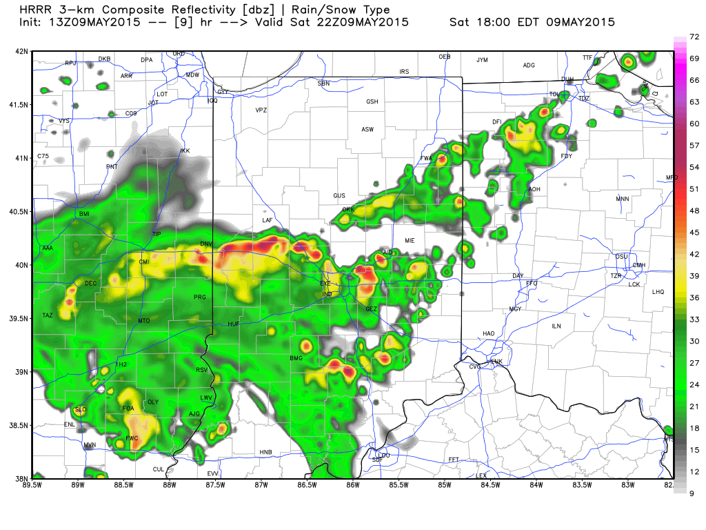
High pressure and a northeast flow will help provide a much less humid feel today, but it’ll still be warm. Moisture will slowly increase again Friday and isolated to widely scattered storm coverage will return. Best rain and storm chances will arrive Saturday afternoon and evening as a cold front passes through the region, but we want to make sure we also stress there will be plenty of dry time, as well. The big story early next week will be a MUCH cooler air mass moving into the region. Models are behaving in an inconsistent manner Sunday in regards to the timing and position of the frontal passage. As of now, we’re leaning towards the drier solutions, but stay tuned.
Upcoming 7-Day rainfall potential: 1″ to 1.2″