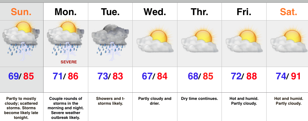
PM Storms; Cooler And More Pleasant Air Coming For Mid Week

Screen Shot 2015-07-14 at 7.52.49 AMHighlights:

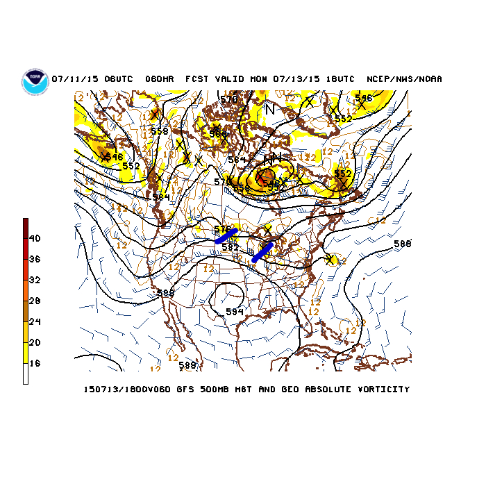
  • Another round of PM storms
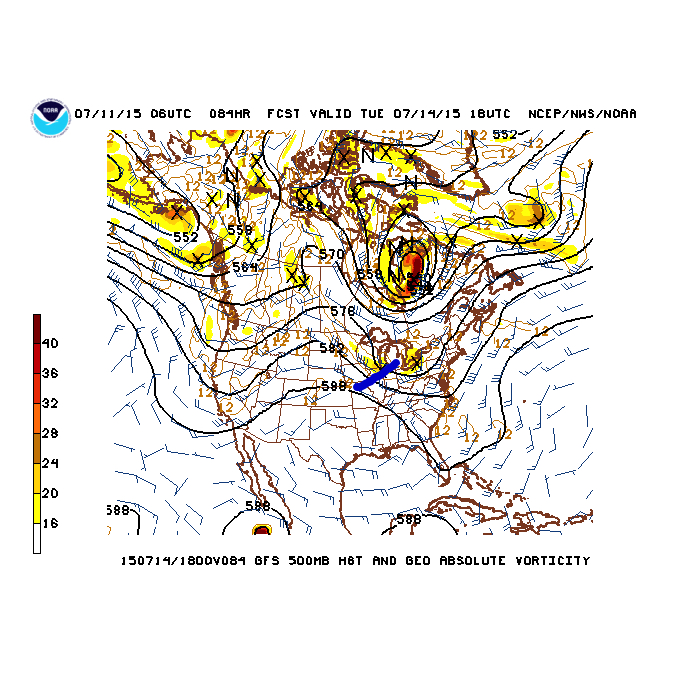
  • Cooler; drier stretch of weather midweek
  • Storms rumble Friday as hot and humid weather builds
  • Hot and very humid weekend

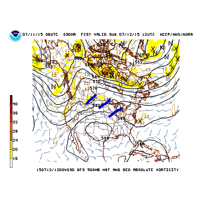
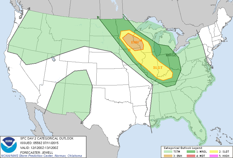
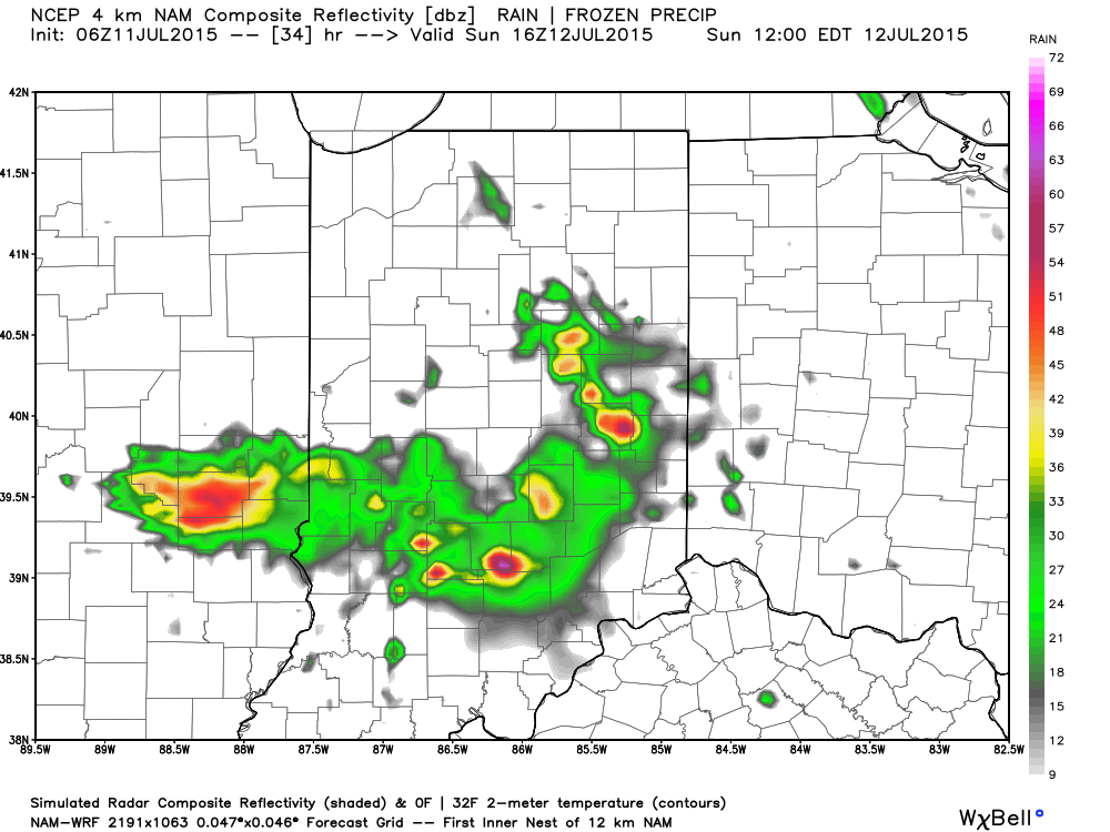
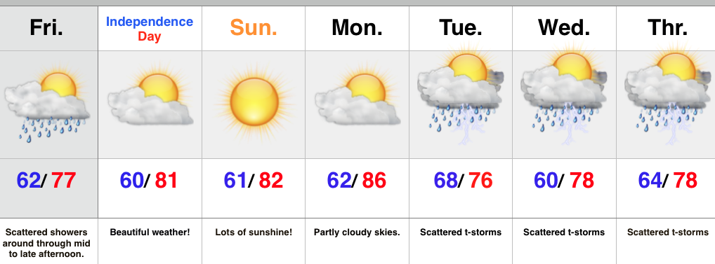
One more round of showers and thunderstorms will fire this afternoon, some of which may be strong to severe.  Thankfully, needed drier (and cooler) air will build in tonight and help set up a very pleasant mid week.

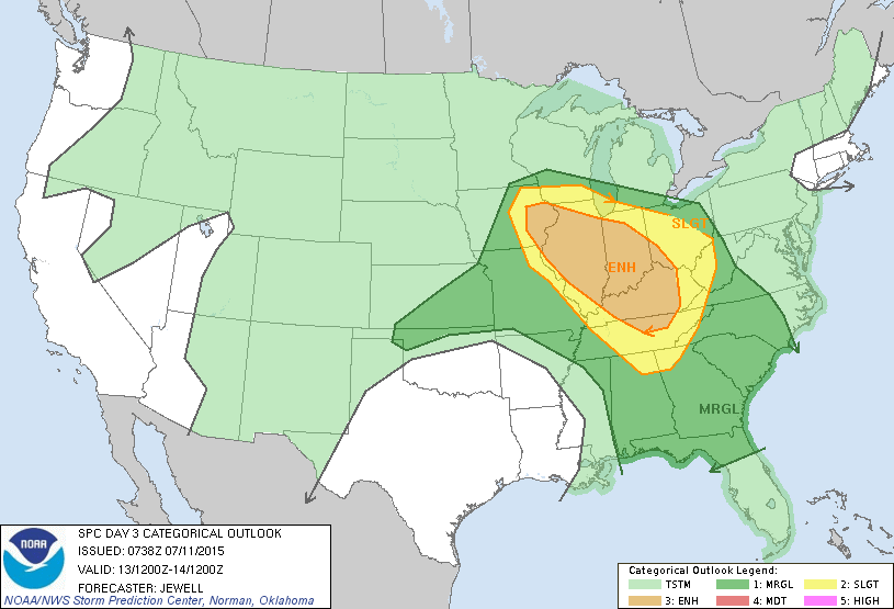
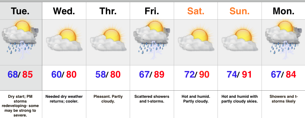
With all of the rain, hot weather fans haven’t been able to enjoy much in the way of significant summer heat this summer; however, things will change (briefly) this weekend.  Very humid air will expand into the region over the weekend, including true summer heat as highs go into the lower 90s both Saturday and Sunday.  Showers and thunderstorms may accompany the push of hot, humid air, Friday but we think the weekend will be dry at this point.

The hot, humid weather won’t last long as a cold front moves in Monday with widespread showers and thunderstorms.  A much cooler air mass will return next week behind the frontal boundary.

Upcoming 7-Day Rainfall Forecast: 1″ – 1.5″

Active Pattern; Severe Weather A Major Concern…

Screen Shot 2015-07-12 at 9.43.43 AMHighlights:

  • Another round of strong to severe storms rumble in tonight
  • Significant severe weather outbreak Monday
  • Storms and flood threat continue Tuesday
  • Drying out and turning hot late week

A very active weather pattern will remain through the short-term.  Overnight storms have exited to the southeast and we’re now dealing with dry weather and sunshine. A few storms could bubble up this afternoon in the very humid air mass, but the more widespread showers and thunderstorms will hold off until late tonight as another northwest to southeast moving complex rumbles in.  Similar to early this morning, flash flooding will be a concern, along with the potential of damaging wind, and hail.

Perhaps more concerning is what we think will be a secondary thunderstorm complex Monday evening into Monday night.  Furthermore, conditions appear to favor the threat of a couple super cells developing in advance of the big storm cluster.  These individual super cells will have the potential of producing tornadoes and large hail.  We’re then concerned of a widespread damaging wind threat with the large storm complex as it moves southeast.  Torrential rains and flash flooding will also be a big concern.

Showers and thunderstorms will continue Tuesday, but there’s a light at the end of this wet tunnel by mid week.  We forecast a few days of dry weather in the Wednesday through Saturday time period.  As ridging expands, heat and humidity will build in a big time way.  For those holding out for true summer heat, next weekend may be your time!  That said, the long range pattern still supports a wetter/ cooler than normal regime quickly returning so enjoy!

Upcoming 7-Day Rainfall Forecast: 2″-3″ with locally heavier totals

Multiple Rounds Of Severe Weather Beginning Sunday…

Good morning and happy Saturday, friends!  After a prolonged stretch of clouds, rain, drizzle, and fog, today will feature a good deal of sunshine and very pleasant conditions.  Unfortunately, the sunshine and pleasant weather won’t last long as storms and severe weather chances ramp up beginning Sunday, and continues through Monday.

A hot dome (high pressure ridge) will be centered over Texas and this will place our immediate region under a rather busy northwest flow.  Multiple disturbances (highlighted in blue below) will rotate northwest to southeast around the periphery of the Texas ridge.  Each disturbance will be capable of producing heavy rain and thunderstorms, including severe weather.

Sunday morning

1Monday morning

2Tuesday morning

3The Storm Prediction Center has outlined the region for a risk of severe weather both Sunday and Monday, and they mention large hail, widespread damaging wind potential, and isolated tornadoes- particularly with Monday’s event.

Day Two Outlook (Sunday)

SundayDay Three Outlook (Monday)

MondayWe’ll begin the action late tonight/ Sunday morning (forecast radar below is a time stamp series from 7a to 12p Sunday) with the first in the expected series of thunderstorms rumbling in from the northwest.  

Moral of the story? Enjoy today’s sunshine, but get ready for more active weather in the coming days!


Beautiful Weekend Shaping Up…

Screen Shot 2015-07-03 at 7.32.25 AMHighlights:

  • Scattered showers around today
  • Awesome weekend weather on tap
  • Dry conditions continue into early next week
  • Cold front delivers unsettled weather

A disturbance is moving along a cold front that sits to our south this morning.  This will keep scattered showers around central IN through the afternoon hours.

As we move into the holiday weekend we expect the frontal system to sink further south and focus best shower and thunderstorm coverage through the TN Valley.  Dry air will move in this evening and set the stage for perfect weekend weather- look for lots of sunshine, comfortable temperatures, and a light northeast breeze Saturday.

Our next weather maker will head our direction early next week in the form of a cold front. Shower and thunderstorm coverage will be on the uptick Tuesday into the mid week period as the front stalls nearby.

Upcoming 7-Day Rainfall Forecast: 0.75″-1″