Awesome Open To The Weekend; Wet Pattern Quickly Returns…
 Highlights:
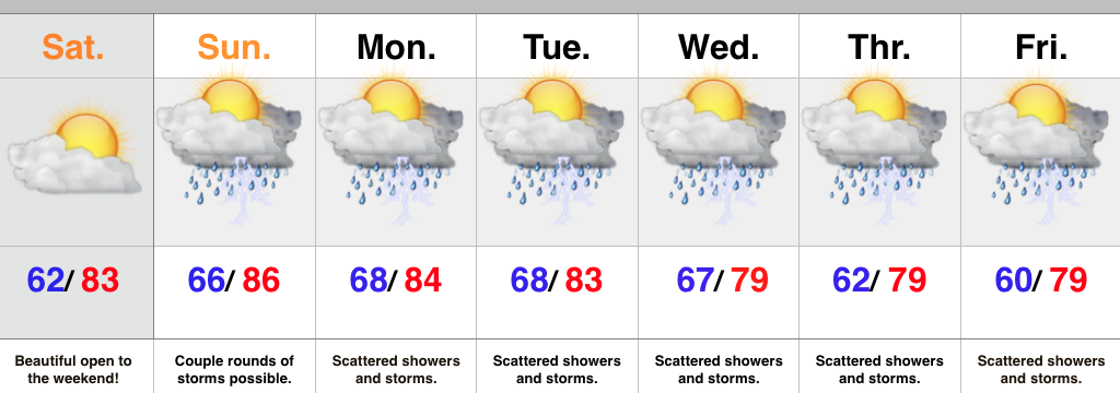
- Beautiful Saturday ahead
- Wet and stormy pattern returns
- Cooler than normal air arrives
We couldn’t ask for a better start to the weekend. Today will feature lots of sunshine, pleasant humidity and temperatures, and absolutely perfect conditions to spend time outdoors! Enjoy because active times return for the second half of the weekend that will carry us into next week.
As promised, we’re heading back into a very busy weather pattern. The hot dome of air (ridge of high pressure) will shift southwest and allow multiple disturbances to ride the outer periphery of the ridge in a northwest to southeast fashion. Each disturbance will be capable of producing periods of showers and thunderstorms- some of which may produce locally heavy rainfall.
As we progress into the latter portion of the work week questions abound. How far does drier air penetrate south? What’s the precise location of the ridge? Both will have to be answered in due time. For now, we’re sticking with an unsettled regime with progressively cooler air. If some of the drier solutions verify then we’ll remove rain and storms altogether once past Thursday and introduce even cooler air. Stay tuned.
Upcoming 7-Day Rainfall Forecast: 1.5″ – 2″ (locally heavier totals)
