Thursday Evening Video Update…
You must be logged in to view this content. Click Here to become a member of IndyWX.com for full access. Already a member of IndyWx.com All-Access? Log-in here.
You must be logged in to view this content. Click Here to become a member of IndyWX.com for full access. Already a member of IndyWx.com All-Access? Log-in here.
The first (12) days of June are in the books and we’re running drier and warmer than average, month-to-date. Officially, IND reports a temperature departure of 3 degrees above normal and a rainfall deficit approaching 1″.
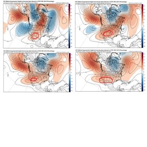
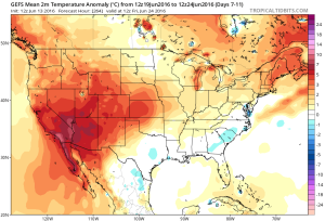
As we look ahead, the pattern is one that seems to favor the most sustained hot dome (mean ridge) position across the 4 Corners region and Southwest states. This morning’s European ensemble data shows this well:
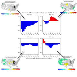
 The teleconnections aren’t much help in trying to generate longer term thoughts. They would favor more of a “normal” period temperature-wise, locally. (BTW, thanks to the fine folks at MAD US Weather and ESRL for the data below).
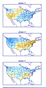
On another note, there are different times through the year when the respected positive and negative phases of the teleconnections below have more of an impact on our weather, particularly during the fall through spring months.
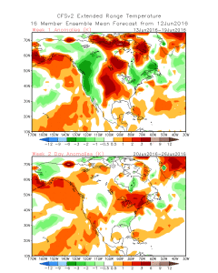
 Looking at some of the model data, the general consensus is for a warm look to go through the back half of the month, but we caution that we can’t simply “broad brush” the forecast through the EOM as warm and relatively quiet (a note on that in a moment).
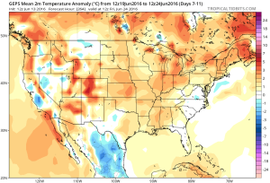
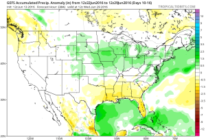
 As mentioned above, despite an overall warm look on the models there will likely be periods of cooler “jabs” and it sure looks like a rather transient pattern to us across the Mid West and Ohio Valley, featuring more of the sustained heat across the Southwest region. Transient patterns usually also yield for potential wetness and we note the GFS Ensembles trending in that direction to wrap up the month.
 In the shorter term, there will also be localized heavy downpours, but it’s a continued case of “haves and have nots.” There won’t be any particular rhyme or reason to the specific placement of heavy, gully-washer type showers and storms mid week.
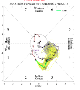
Finally, to close, perhaps the MJO shows the pattern best over the next couple weeks. Best word to describe the MJO’s idea? Transient. 🙂
A hot and humid weekend is in store, but we’re eyeing increasingly wet and unsettled times by the middle of next week…
You must be logged in to view this content. Click Here to become a member of IndyWX.com for full access. Already a member of IndyWx.com All-Access? Log-in here.
You must be logged in to view this content. Click Here to become a member of IndyWX.com for full access. Already a member of IndyWx.com All-Access? Log-in here.
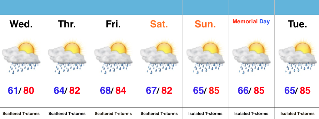 Highlights:
Ready To Sweat? A much more humid and oppressive feel will develop Wednesday (dew points likely surge to 70 by afternoon). Along with the muggy air mass, we expect scattered showers and embedded thunderstorms to develop. We’ll maintain mention of scattered storms into the weekend, but want to stress that these won’t be uniform in the least. That said, with all of the moisture in the air, stronger storms will be capable of producing locally heavy rainfall.
We continue to keep a close eye on the data for Sunday and Monday. Thankfully, latest indications suggest we see an overall decrease in aerial coverage of showers and storms both days. We’ll call it “isolated” for now. It’ll be plenty hot and humid.