Hot Now, But Changes Coming…
 Highlights:
- Warmth continues
- Dry weather through the weekend
- Timing issues early next week
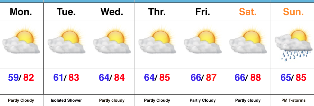
Sunglasses Required…The first half of the period is as easy as the second half is difficult so we won’t waste any time on it. Look for lots of sunshine, unseasonably warm temperatures, and dry conditions through the weekend. A “backdoor” cold front will be close to the region Sunday, but the impact it has on our immediate region will be minimal. Eastern portions of the state will experience a cooler second half of the weekend with a breezy easterly flow.
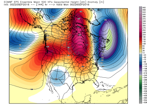
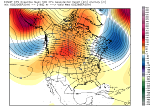
The challenging period arrives to open up the work week and the GFS and European couldn’t be further apart. There’s a 48 hour difference between when the GFS slides the strong cold front through (Monday) and European (Wednesday). You can imagine, the sensible weather differs from a continuation of the unseasonably warm and dry conditions until Wednesday (European) or a true blast of fall air arriving Monday (GFS).
For the purpose of this forecast, we’ll lean more towards the GFS. While it hasn’t been perfect, it’s easy to argue it’s been handling things in a much more consistent manner than the European as of late. Furthermore, when the European completely “lost” this front earlier in the week, the GFS at least kept the idea alive and kicking. Now the European model is having to play “catch up.” With all of that said, we expect the cold front to deliver scattered showers and thunderstorms Monday followed by a significant drop in temperatures Monday night. Unsettled weather would continue Tuesday with the much cooler air. Stay tuned.
Upcoming 7-Day Precipitation Forecast:
- Snowfall: 0.00″
- Rainfall: 0.50″ – 0.75″
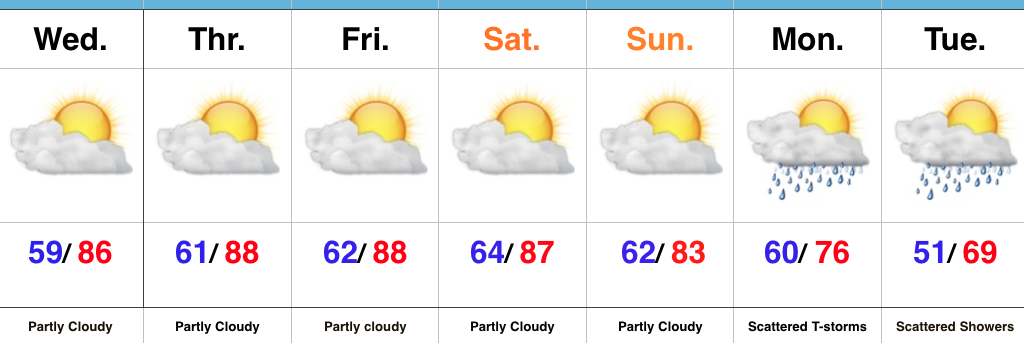
 The warmth continues in the days ahead, but we’re going to run much drier, overall, as strong ridging remains the dominant factor through late week.
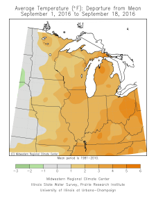
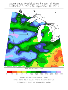
 The past (90) days have featured hefty rains across the Mid West.
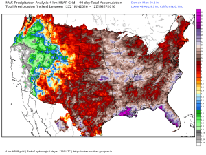 Late season heat will grip most of the east over the upcoming (7) days. Note those population areas (nearly 90% of the lower 48) to experience at, or above, 80 degree heat between now and next Tuesday. Even areas into the Lakes and New England get in on the late summer feel.
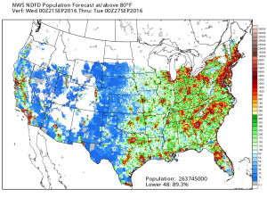 In the shorter term, an isolated shower is possible this evening, but most should remain dry as the air is very dry across the region.
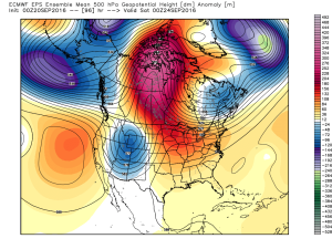
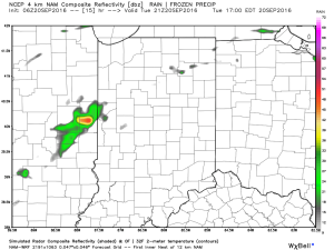 The upper air pattern features strong ridging over the central and east over the upcoming several days. A cold front and associated trough will deliver cooler air by the early to middle part of next week.
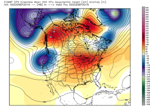
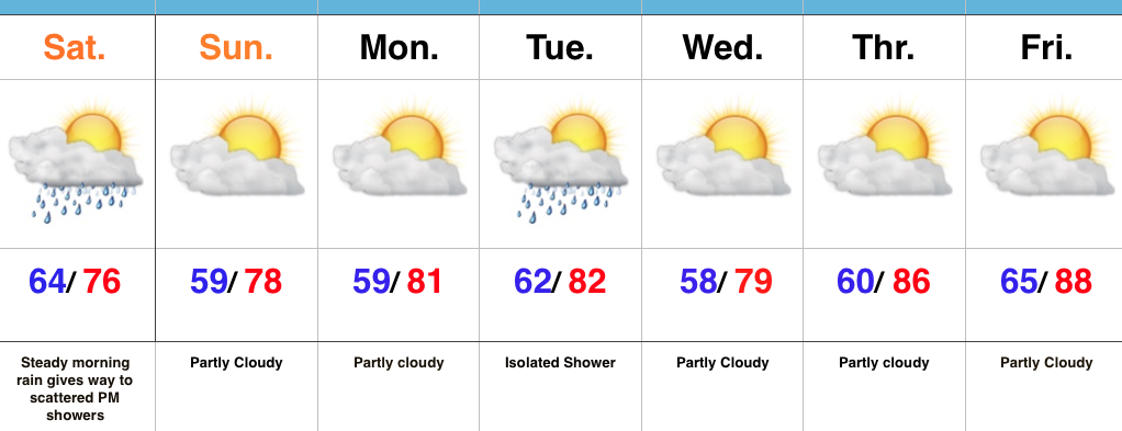
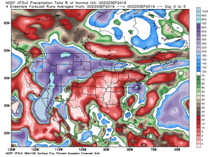
 In between the warmth and pending cooler, more fall-like, air will be a round of scattered showers and thunderstorms early next week. Modeling differs on precipitation amounts, but, as of now, heavy rains aren’t looking likely.
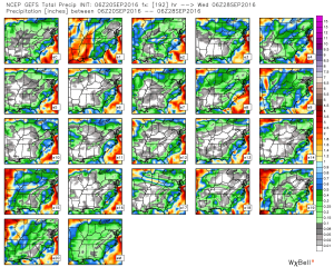 As mentioned, early to middle parts of next week should feature temperatures much closer to where we should be this time of year, if not a few degrees below average.