Rain Returns; Late Week “Backdoor” Cold Front…
 Highlights:
- Rain and storm chances increase
- Late week cold front
- Gearing up for a bigger blast of fall air
Dry Close To The Weekend…First and foremost, our thoughts and prayers are with Texas as one of the worst flood events in our country’s history is unfolding this morning. With days of heavy rain ahead, an additonal 20″-30″ will fall on eastern Texas. Just horrific.
Here on the home front, we’ll wrap up the weekend on a dry note, but upper level energy will drift overhead late tonight and help generate scattered showers and thunderstorms as early as the predawn hours Monday. We’ll maintain a bit of an unsettled regime into Tuesday before dry conditions return Wednesday.
A backdoor cold front will push through central Indiana Thursday and a broken line of showers and thunderstorms may accompany this frontal passage. A northeasterly flow will usher in an unseasonably cool, early fall-like, close to the work week.
Looking ahead, an even stronger cold front has it’s eyes set on the region late next weekend or early the following week. Strong thunderstorm potential is present with this storm system followed by the coolest air since last spring…
Upcoming 7-Day Precipitation Forecast:
- Snowfall: 0.00″
- Rainfall: 0.50″ – 1.00″
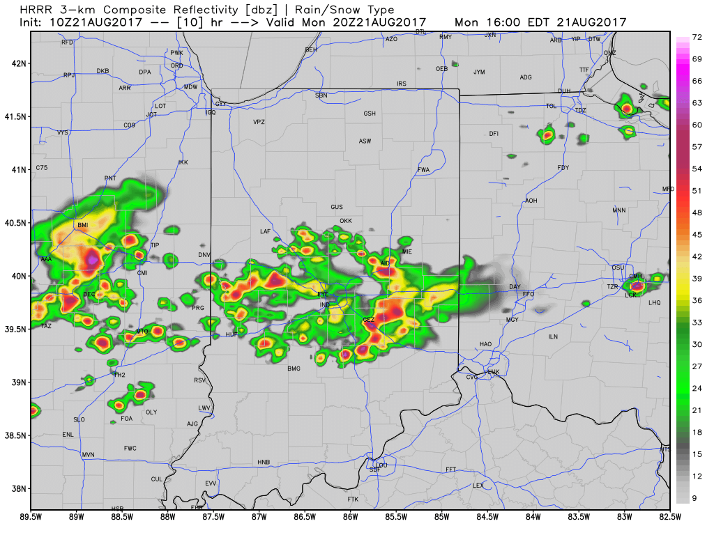
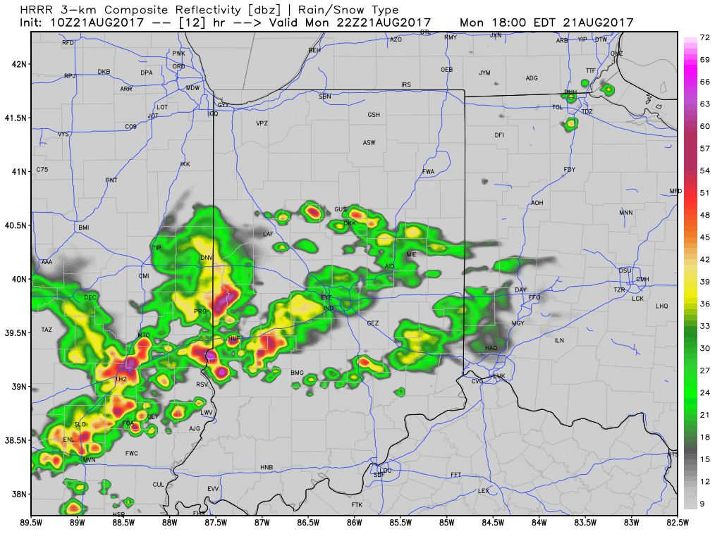
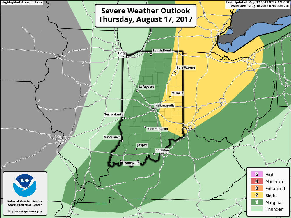
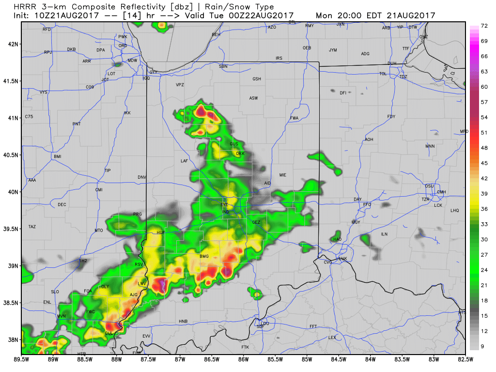 With leftover boundaries from early morning storms across northern parts of the state (likely will serve as a “trigger” for PM storm development), combined with a hot and muggy airmass, confidence is increasing on numerous showers and thunderstorms across central Indiana this afternoon and evening. Widespread heavy rain isn’t expected this afternoon, but localized hefty downpours are a good bet with precipitable water values (PWATs) approaching 2″ this afternoon.
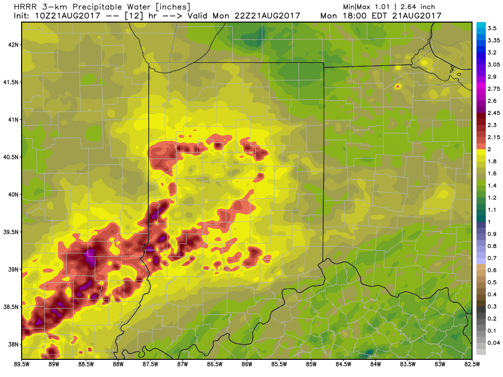 Unsettled times remain Tuesday before a much cooler regime looms for the second half of the week…
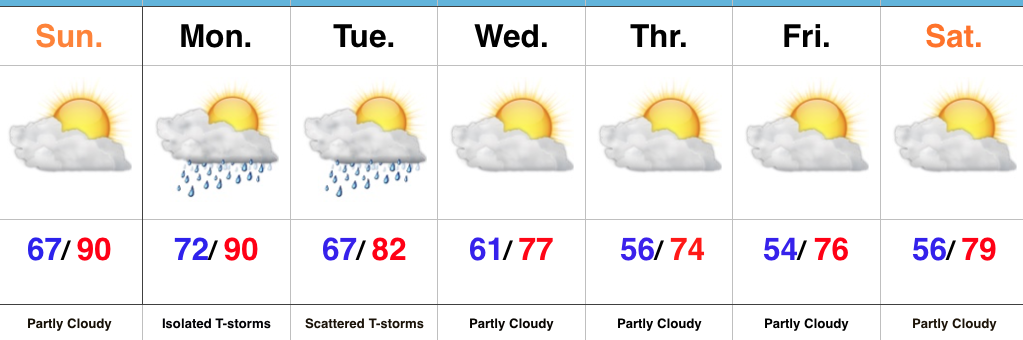 Highlights:
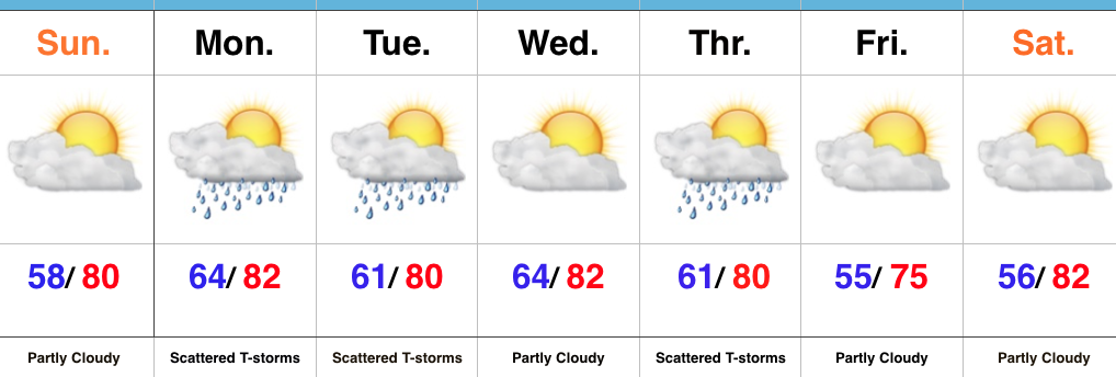
 III. Ridging will return early next week and, though brief, a shot of late-summer heat will eject northeast across the Mid West and Ohio Valley. Sunday through Tuesday will feature temperatures that top out in the upper 80s to around 90°.
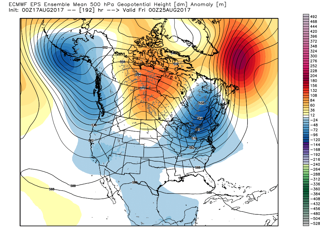
 IV. A cold front will drop in by the middle of next week. Scattered showers and thunderstorms will accompany the frontal boundary, but the bigger story will be a dramatic change to a much cooler regime as we get set to put a wrap on the month of August. In fact, temperatures may grow cool enough to allow some 40s to develop across central and northern parts of the state at night. Meteorological summer sure looks like it’ll end with more of a fall-like feel…