Tropical Feel With Daily Storm Chances…
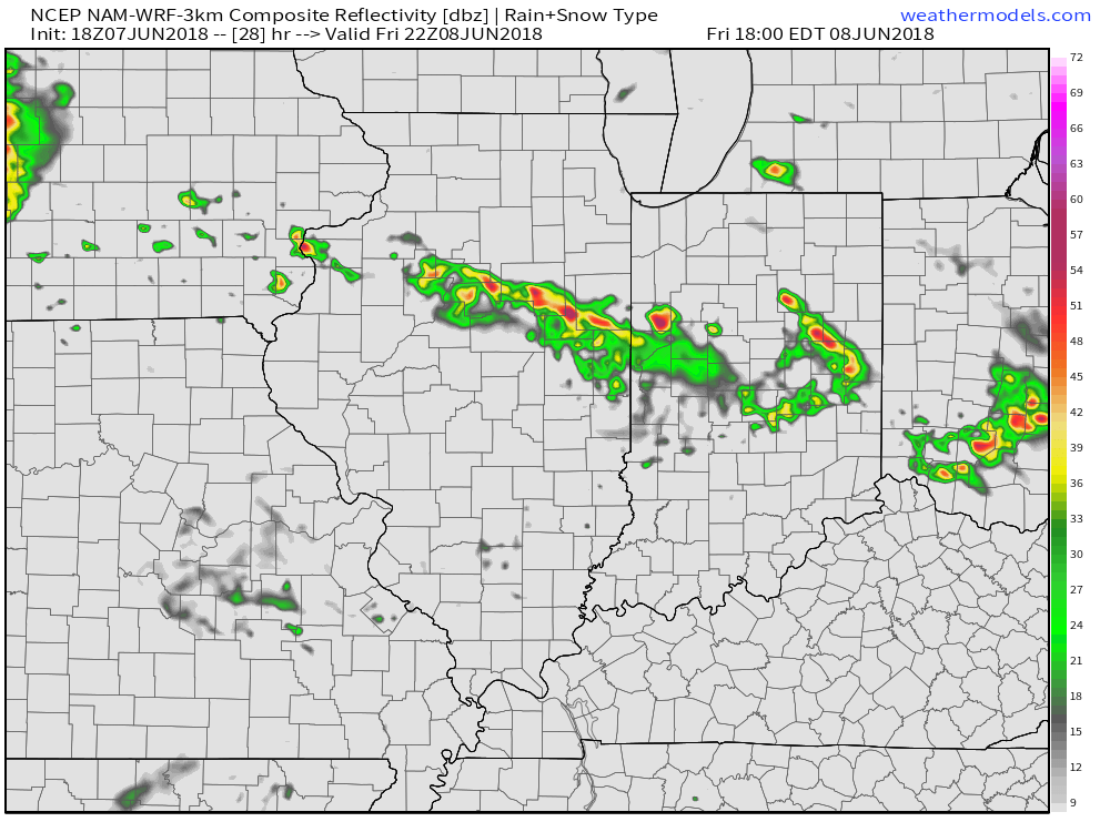
Slow moving thunderstorms are currently producing small hail and torrential rainfall north of Lafayette (as of 5:45p Thursday). We have reports of 1″ to as much as 1.5″ of rain falling near Battle Ground in less than an hour.
 Eventually these storms should pick up momentum and head off to the southeast later tonight.
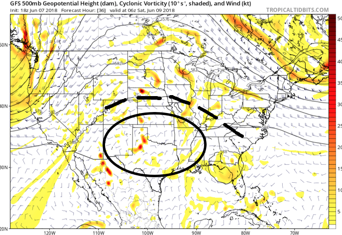
This is only the beginning of daily rain and storm chances in a warm and humid air mass through the weekend and on into early next week. The culprit? An upper level ridge centered over the southern Plains and “spokes” of energy, or upper level disturbances, rotating around the periphery of the hot dome to our southwest.
 An increasingly muggy air mass will take hold of the region as we close the work week, with dew points approaching 70° at times. The term “air you can wear” comes to mind. As impulses of energy interact with this tropical air mass, thunderstorms will blossom- particularly in the afternoon and evening hours.
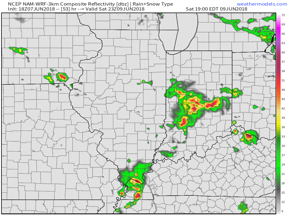
We’ll have to nail down specifics with storm coverage and timing within our short-term forecast products and updates, but each day into early next week will feature coverage of storms across central Indiana. Future forecast radar products show scattered to numerous storms around Friday evening and again Saturday. Get used to this look.
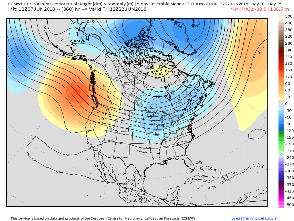
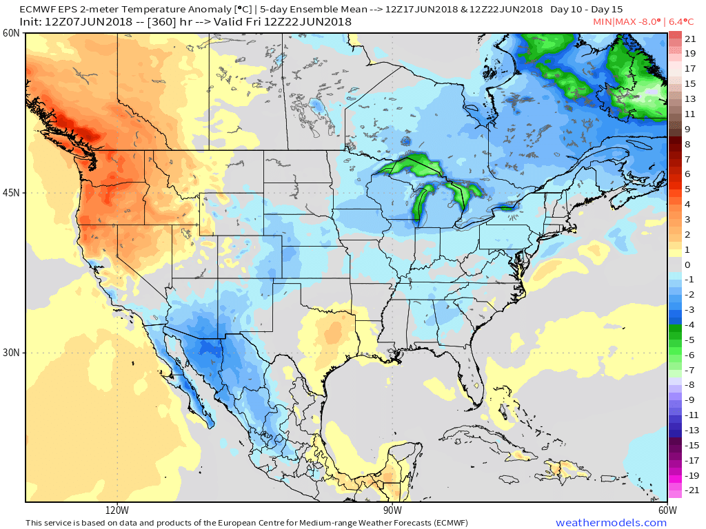
 Looking down the road, a “sticky” summer feel will remain intact through next week, but changes are brewing in the longer range. These changes would support a cooler regime developing just past mid-June (in the 10 to 15 day time frame). While the duration is up for debate, it’ll be nice for at least a few days of cooler air…