Florence Continues To Impact The Carolinas; Mostly Dry Here…
You must be logged in to view this content. Click Here to become a member of IndyWX.com for full access. Already a member of IndyWx.com All-Access? Log-in here.
You must be logged in to view this content. Click Here to become a member of IndyWX.com for full access. Already a member of IndyWx.com All-Access? Log-in here.
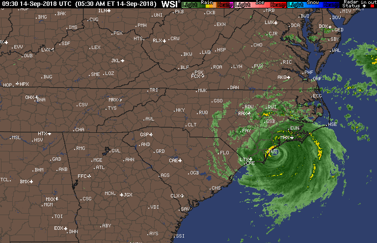
Florence made landfall around 7:15 this morning near Wrightsville Beach, NC. Within the past 30 minutes, a wind gust was reported to 105 MPH in Wilmington, NC.
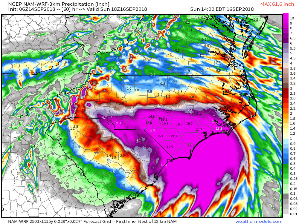
 Florence will crawl through the Carolinas this weekend and spread devastating flooding well inland- 20″ to 30″. Even the high ground of the North Carolina Blue Ridge will experience severe flooding Sunday into Monday- 6″ to 12″. These are forecast radar totals shown now through 2p Sunday. The Blue Ridge will see heavy rain continue into Monday evening.
 Back here on the home front, expect an extended stretch of dry and warm weather. Plentiful sunshine can be expected as we head into the weekend along with a warming trend- mid 80s and lows in the mid to upper 60s. High pressure will remain in firm control.
 The next item of excitement for our region will be from a cold front late next week. This will help increase shower and thunderstorm chances along with delivering cooler air next weekend.

You must be logged in to view this content. Click Here to become a member of IndyWX.com for full access. Already a member of IndyWx.com All-Access? Log-in here.
You must be logged in to view this content. Click Here to become a member of IndyWX.com for full access. Already a member of IndyWx.com All-Access? Log-in here.
You must be logged in to view this content. Click Here to become a member of IndyWX.com for full access. Already a member of IndyWx.com All-Access? Log-in here.