Storms Return Thursday; Summer-Like Weekend…
You must be logged in to view this content. Click Here to become a member of IndyWX.com for full access. Already a member of IndyWx.com All-Access? Log-in here.
You must be logged in to view this content. Click Here to become a member of IndyWX.com for full access. Already a member of IndyWx.com All-Access? Log-in here.
I.) An unseasonably warm pattern will remain as we move into the middle of the week. A more summer-like feel can be expected as opposed to the increasingly chilly early October air we should be dealing with. Highs will reach the middle 80s this afternoon along with a gusty SW breeze.
 II.) After a windy and warm Wednesday, scattered showers and thunderstorms will return Thursday. Not everyone will get wet, but a few locally heavy downpours can be expected.
 III.) The ridge will “flex its muscle” into early and middle parts of next week and promote an extended (and unusual) stretch of 80s. Don’t put those shorts away just yet…
 IV.) A “game changer” of a cold front will approach late next week with better chances of organized rain and storms followed by a return of more seasonal times…
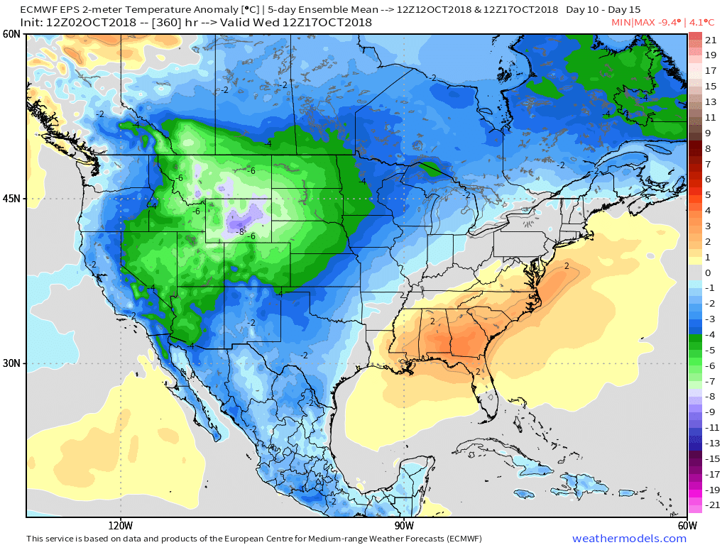
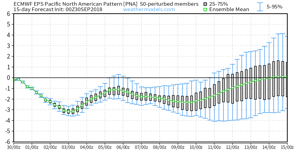
 V.) Ingredients are in place for a significant shift in the pattern around the middle of October and colder times continue to look like they will return as we flip the page into Weeks 2-3.
You must be logged in to view this content. Click Here to become a member of IndyWX.com for full access. Already a member of IndyWx.com All-Access? Log-in here.
The past couple of days have provided a classic fall feel across the region, but changes loom.
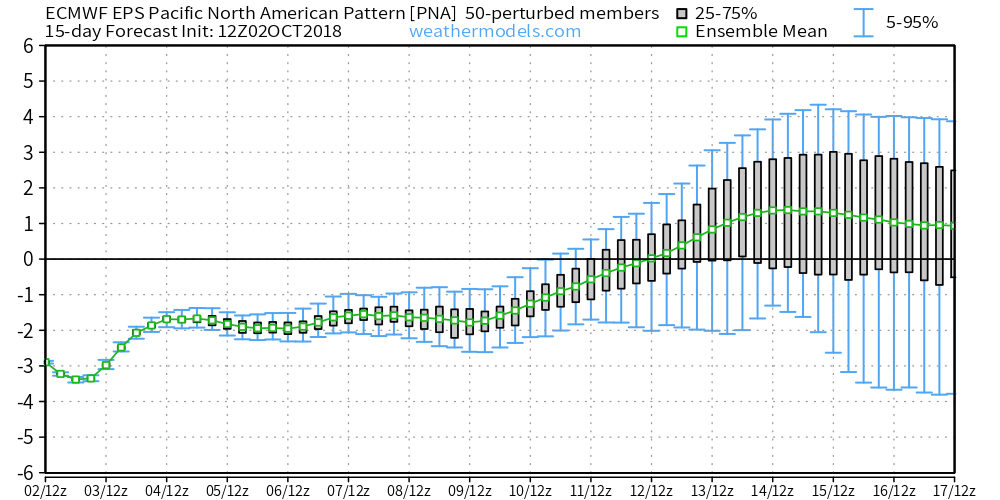
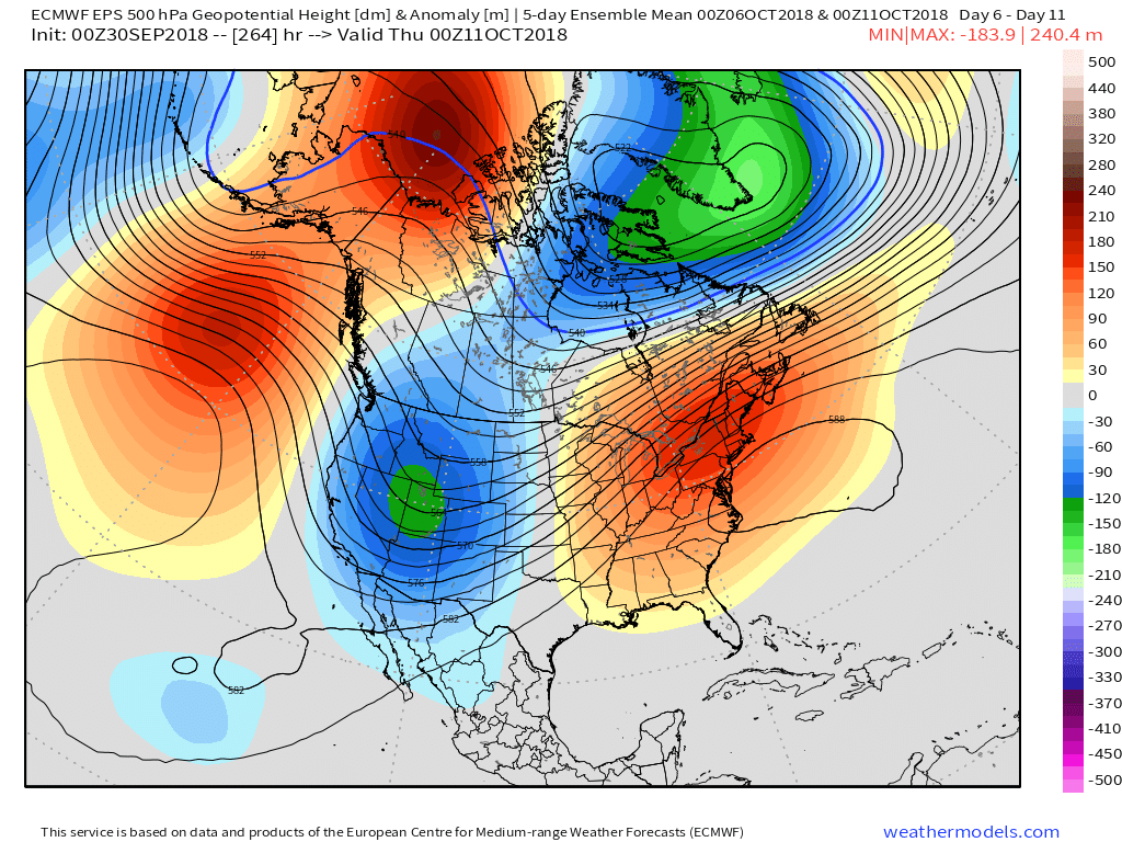
The PNA (Pacific North America Pattern) is forecast negative- at times, strongly so- through the better part of the first half of October.
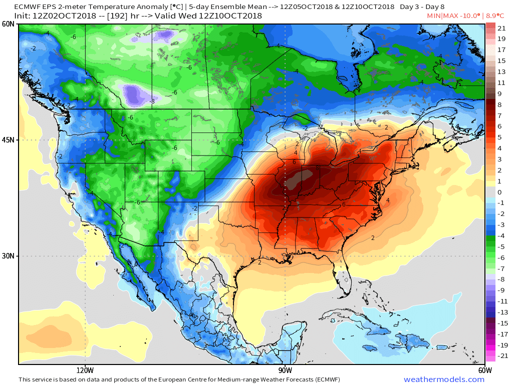
 Accordingly, we would expect to see a deep trough across the west and ridging/ associated warmer pattern across the east. Sure enough, that’s what the modeling is painting.
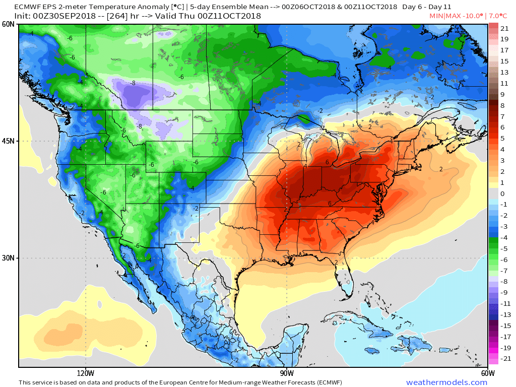
 A prolonged stretch of unseasonably warm and humid weather will be with us through the first couple weeks of the month. Unfortunately, for fall foliage enthusiasts, for the second straight year, this will have a negative impact on the peak color season. Highs in the middle 80s and lows in the upper 60s to around 70° will be common during the period. Summer isn’t finished yet…
You must be logged in to view this content. Click Here to become a member of IndyWX.com for full access. Already a member of IndyWx.com All-Access? Log-in here.