April 2020 Outlook…

Average highs in April rise from the upper 50s early in the month to the upper 60s by late-April. We also tack on an average of 10° on overnight lows (upper 30s early on to upper 40s by late April) with 3.8″ of rain and an average of 0.2″ of the white stuff.

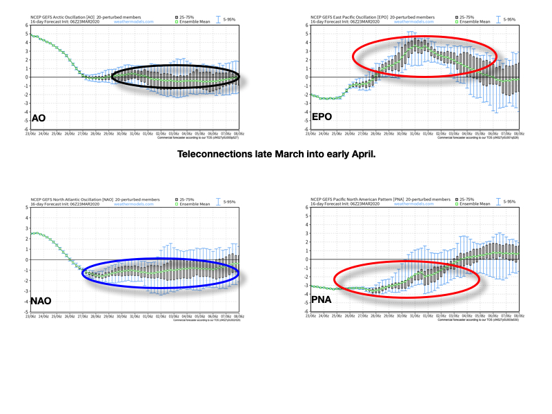
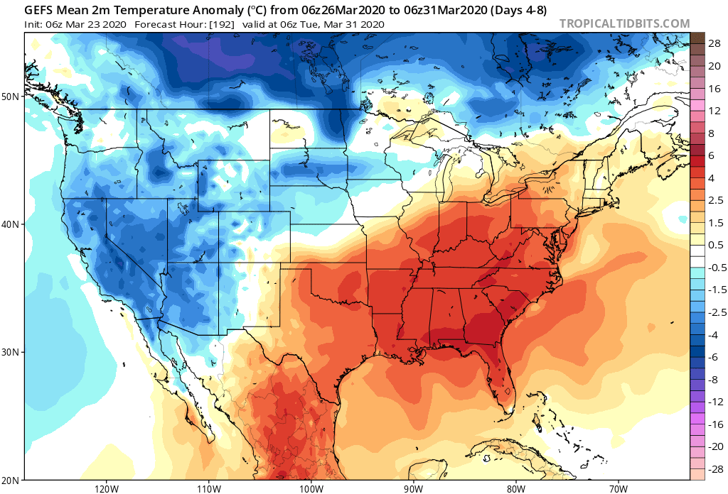
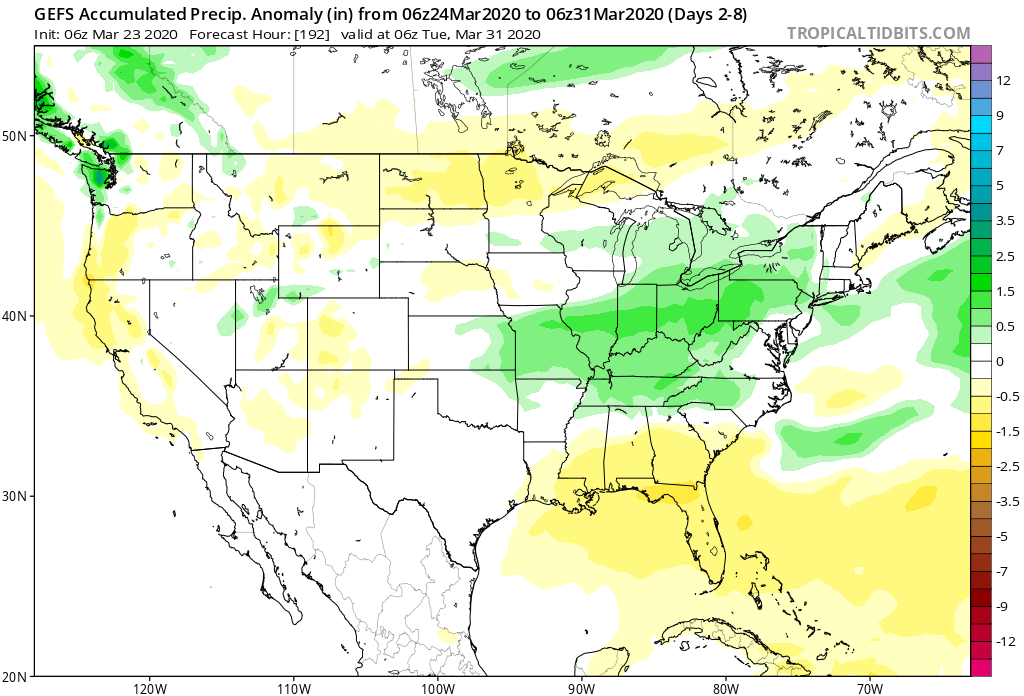
As we look at April 2020, there are growing indications for cooler and drier than normal conditions- at least during the 1st half of the month. A lot of this has to do with teleconnections finally aligning with one another (as opposed to all of the conflicting signals we dealt with throughout the bulk of the winter).

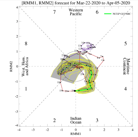
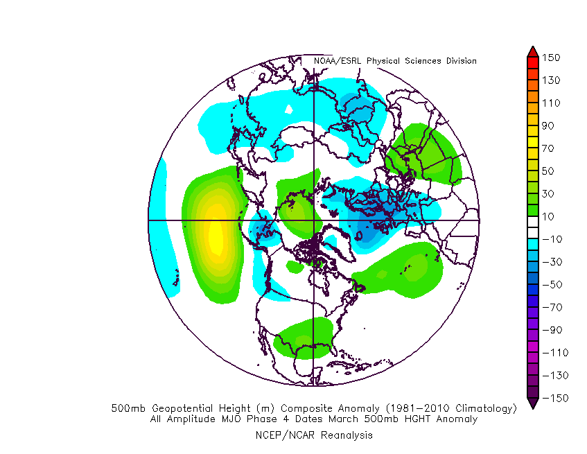
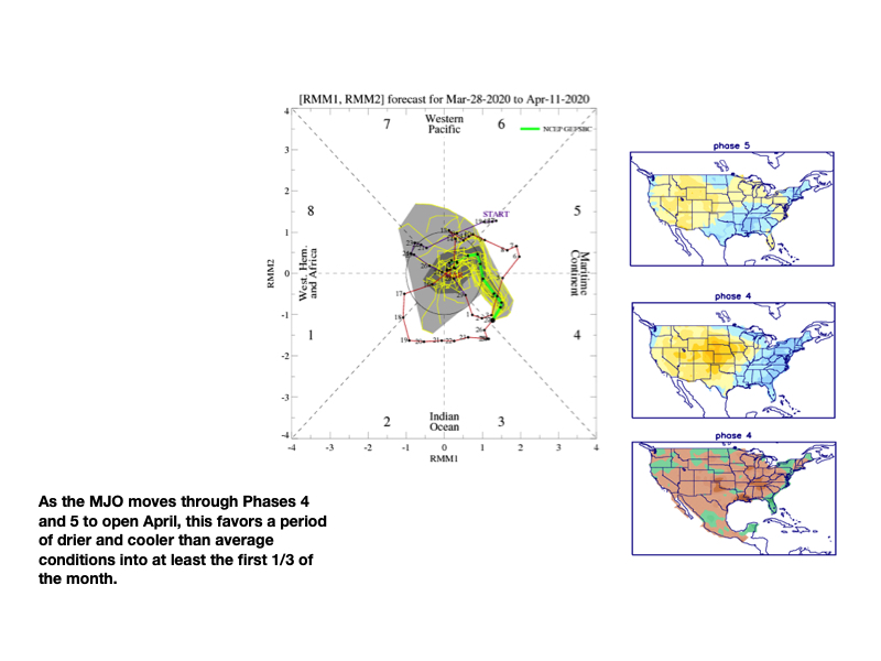
Additionally, the MJO is expected to move through Phases 4 and 5 over the next couple of weeks and this also is a cooler, drier look, overall for our portion of the country.

The majority of long range data is going to this cooler, drier look through the 1st half of the month.

JMA Weeklies Weeks 3-4
European Ensemble – Temperature Anomalies
European Ensemble- Precipitation Anomalies
GFS Ensemble- Temperature Anomalies
GFS Ensemble- Precipitation Anomalies
Canadian Ensemble- Temperature Anomalies
Canadian Ensemble- Precipitation Anomalies

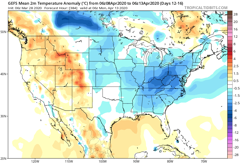
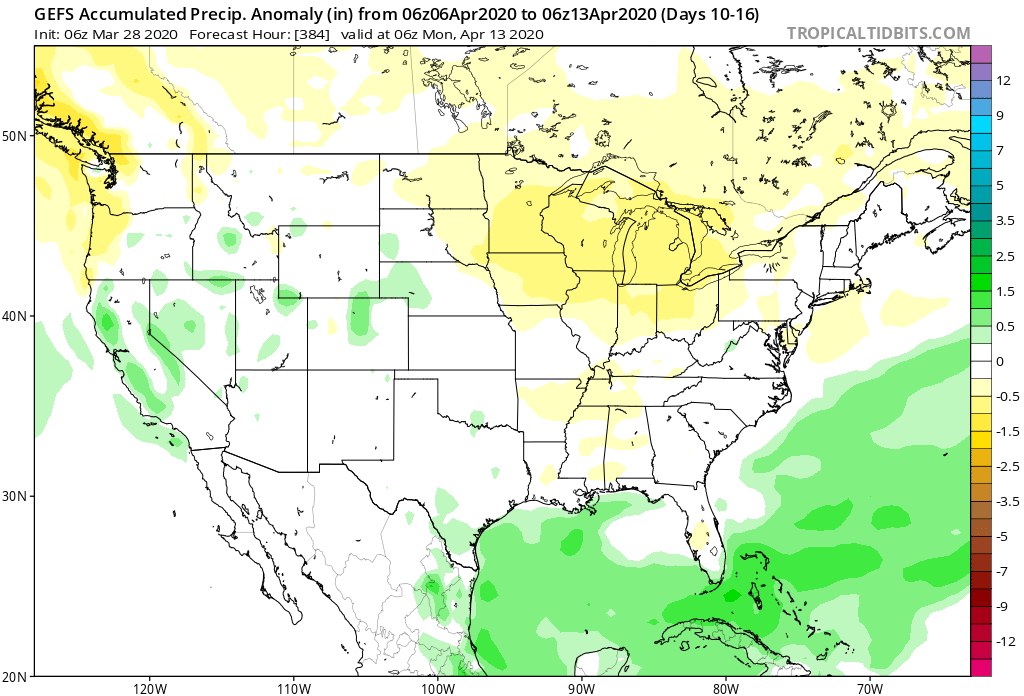
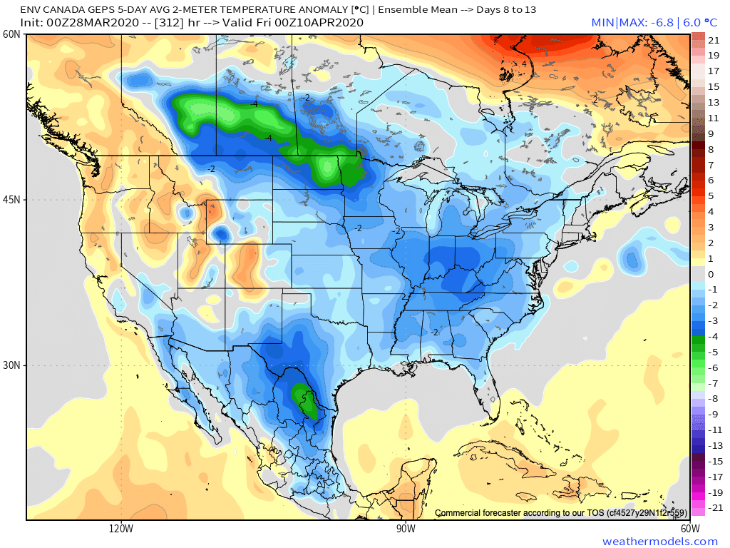
With the guidance painting an overall cooler and drier than normal theme through the 1st half of the month, the question then becomes what takes place for the 2nd half of April? We’re thinking a rebound is ahead, including a more active, warmer period, but the timing of this shift is admittedly tough (does this take shape mid-month or the last week to 10 days of the month)? With a boiling warm Gulf of Mexico, the threat of an increasingly busy time of things in the severe weather department is also anticipated for late April. This, of course, is after what should be an unusually quiet time of things through the first half of the month.

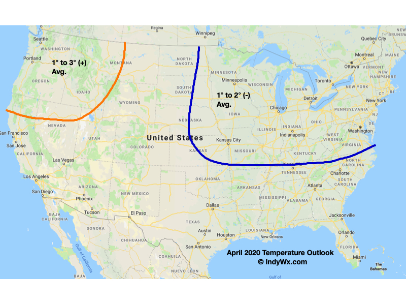
With all of this in mind, here’s our April Outlook:

VIDEO: Heavy Rain And Storms On Deck This Weekend…

Heavy rain and storms will increase late week and this weekend. This morning’s video takes a closer look, including the threat severe weather makes it as far north as the…

You must be logged in to view this content. Click Here to become a member of IndyWX.com for full access.  Already a member of IndyWx.com All-Access?  Log-in here.

Teleconnections Still Aren’t Playing Nice; Does This Change In April?

Seemingly all winter, we’ve been unable to get the NAO, AO, EPO, PNA, and MJO to cooperate and align. The end result is an overall pattern that has been unable to produce widespread, sustained cold. As we progress through the remainder of the month, the contradicting signals will continue.

Despite the negative NAO (a signal notorious for drawn out cold patterns this time of year), the deeply negative PNA and developing strongly positive EPO will hold off any significant cold. Even in the immediate term, notice how the signals are’t matching up (i.e. strongly positive NAO with a negative EPO).

The MJO is forecast to rumble into Phase 4 to close the month and this is also a phase that favors eastern ridging.

Given the above, to no surprise, the consensus of model data is for a warm, wet close to the month.

Does this pattern change in April and we actually see some alignment with our teleconnections? What about the MJO? Does the current movement continue and do we get into the colder Phase 1 as currently shown? Interesting times ahead as we sort through the data. Our official April Outlook will be online late week.