Thursday Morning Rambles: More “Exciting” Weather Creeps Back In…

Updated 04.13.23 @ 6a

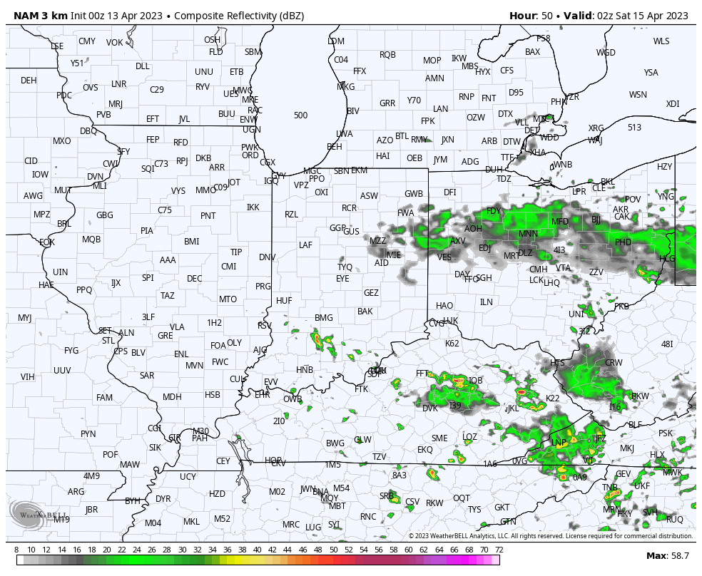
I. We’ve got one more boring wx day on our hands before conditions slowly begin to turn more active as we head into the weekend. Short-term, high resolution data suggests a couple scattered showers or storms are possible Friday afternoon and evening. While the best forcing will remain to our south and east, we may be able to crank out a couple downpours as moisture levels increase through the PM. This certainly isn’t anything to cancel plans over, but just prepare for a passing downpour in spots.
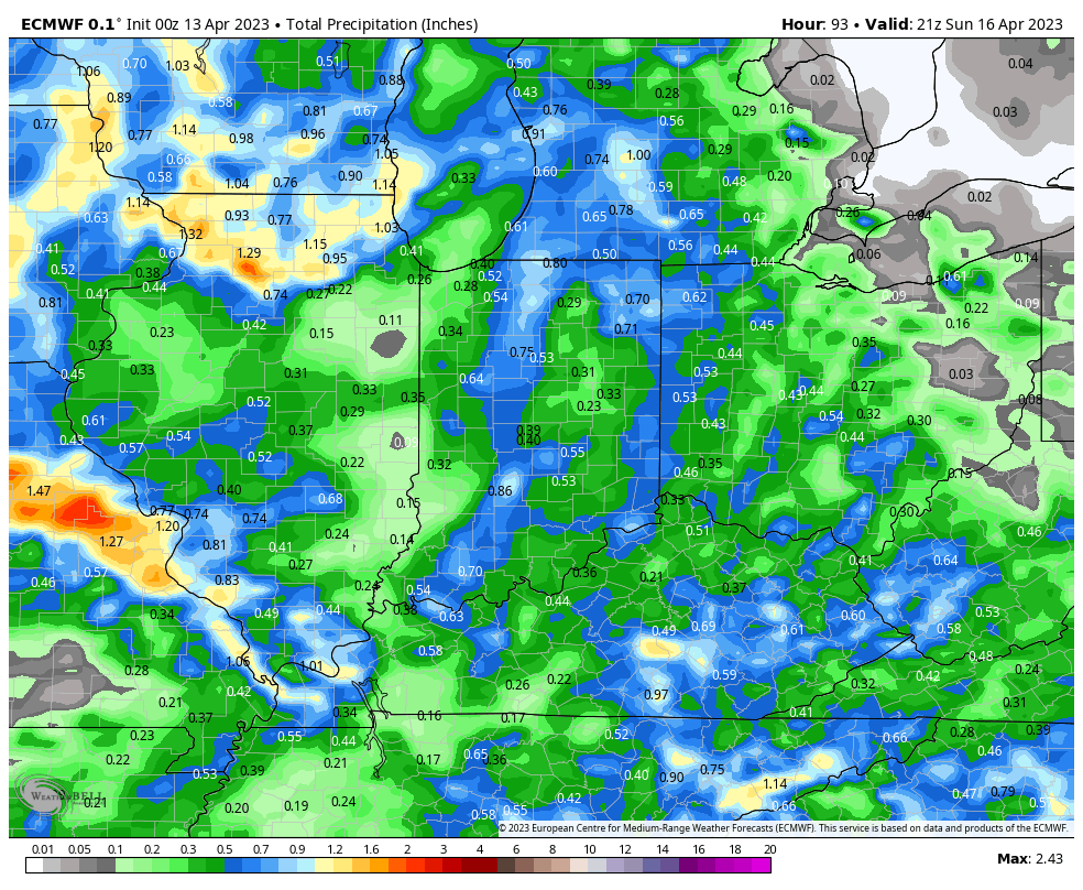
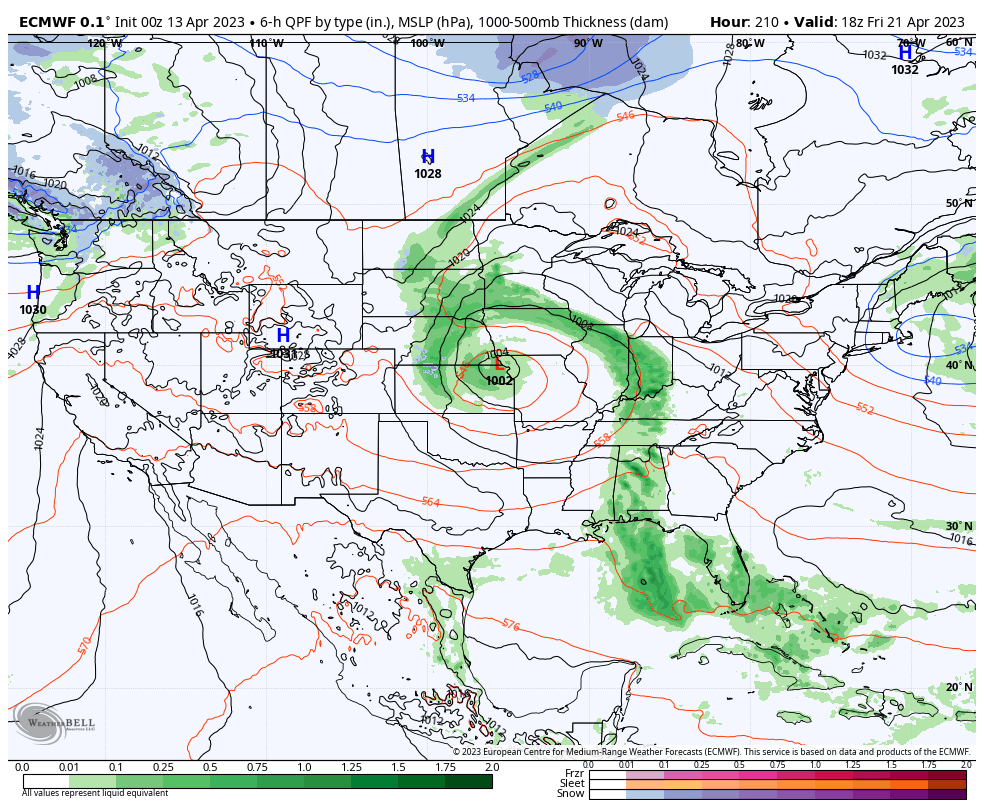
II. Better chances of more organized rain and thunder will arrive Saturday evening into Sunday morning. While this still doesn’t appear to be a particularly heavy event for most of the region, guidance continues to trend wetter with this system. What all week looked like a 0.10” to 0.25” type situation now very well may end up in the 0.50” to 1” range. Not terrible for a region running drier than average month to date.

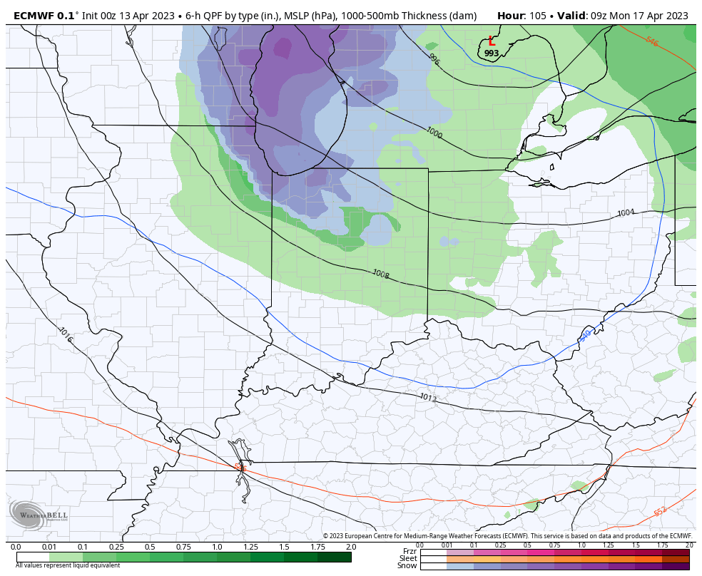
III. As colder air sweeps in behind the system, rain will mix with wet snow across northern parts of the state as we open the new week. The rest of us can expect a couple days (Monday and Tuesday) with highs in the mid to upper 50s and lows in the mid to upper 30s.
IV. The early portion of the work week will feature a return of dry weather but it’s safe to say next week won’t be nearly as uneventful as a whole. We’re tracking a midweek system that will deliver a few showers Wednesday and a more organized storm system that should provide a better coverage of rain and embedded thunder to close the work week. More on all of this and a long range look ahead in tonight’s Client video discussion!
You Knew It Was Coming: Cold “Jab” Dialed Up Early Week 2…

Updated 04.09.23 @ 4:37p

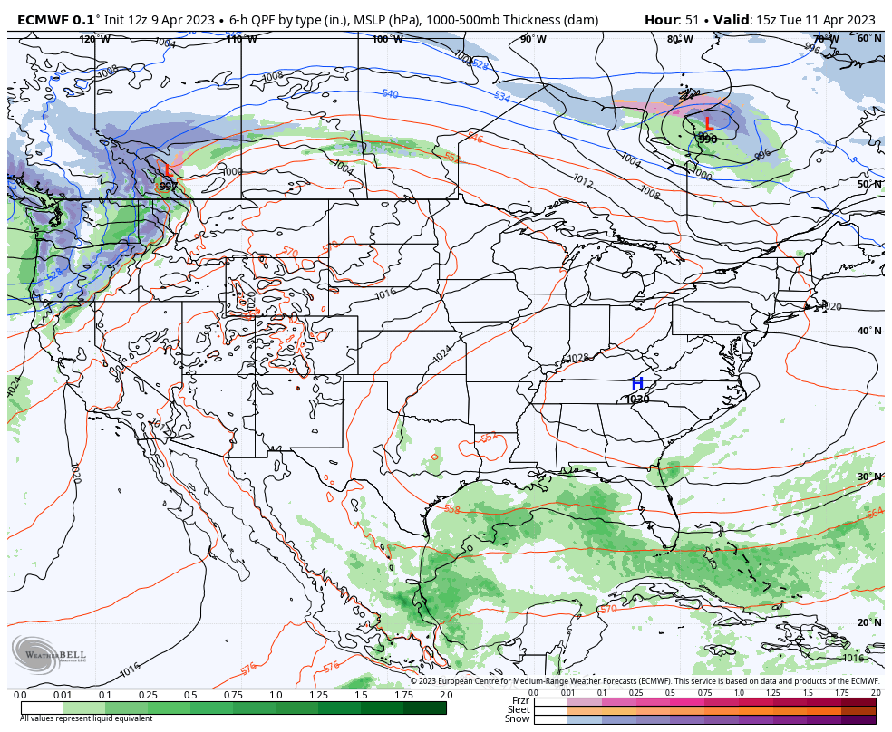
First and foremost, here’s wishing you and your family a very happy and blessed Easter Sunday! The week ahead doesn’t offer up much “excitement” in the weather department, but that comes to a screeching halt early week 2 as a potent storm system finally delivers a return of precipitation, and perhaps more notably, an unseasonably cold “jab” of air!

In the short-term, high pressure will dominate the upcoming work week, including a “rinse and repeat” regime of sunny days along with moderating temperatures.

Highs will climb into the mid to upper 70s by the 2nd half of the work week. Dry conditions will prevail.

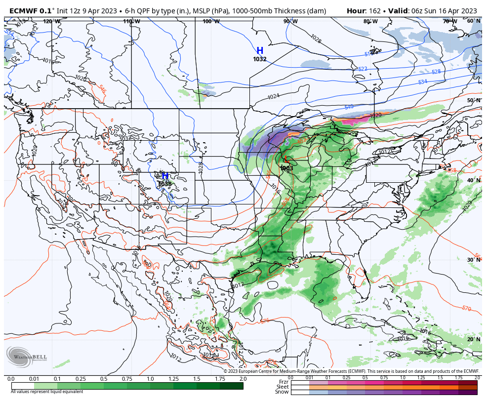
It’s not until this weekend when unsettled weather will return to central Indiana and the Ohio Valley as a whole. This is all thanks to a cold front and associated area of low pressure.

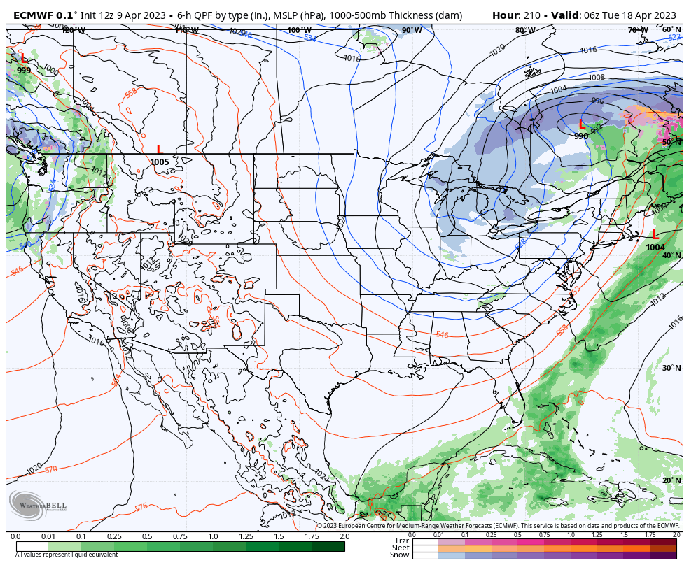
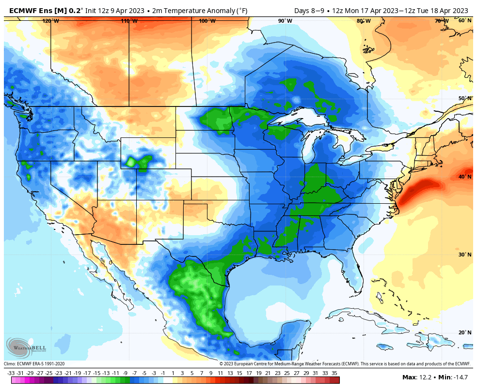
Though early, model consensus shows a “cut off” low developing early next week, keeping unsettled conditions in play. It’s not just the likelihood of lingering precipitation, but a significant push of late season chilly air is also dialed up to plunge into the region. In fact, it wouldn’t be surprising to see the air grow cold enough where rain showers may mix with and change to wet snow showers.

Regardless if we’re talking snow or not, highs in the 40s with lows in the 20s will be a bitter pill to swallow after the extended stretch of pleasant (and increasingly warm) weather we’ll continue enjoying through the week…

We’re targeting early next week for a “jab” of unseasonably cold air.

Needless to say, this system will be a topic of discussion through the upcoming week. More in our Client video discussion Monday morning!

Unsettled Close To The Work Week; Cold Weekend On Tap…

Updated 03.15.23 @ 6:58a

Let’s start with the good news and that’s today’s forecast. Despite a bitterly cold start (most are waking up to temperatures between 18° and 22°), expect plentiful sunshine today. Though it’ll be unseasonably chilly, that March sun angle will go a long way in making it feel a lot better by this afternoon.

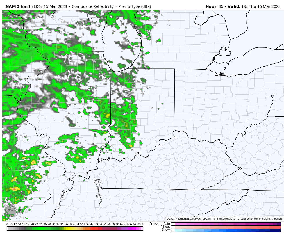
Clouds will increase overnight and Thursday morning and eventually give way to light rain by afternoon. We anticipate rain to reach the city, itself, between 2p and 3p.

Rain will become steadier and more widespread as we progress through the evening and Thursday night.

Precipitation may end as a brief period of snow Friday morning, but “brief” is the key word. In general, heaviest rain is expected to fall across the southern half of the state, mostly along and south of the I-70 corridor. This is a 0.25” to 0.75” type event for most.

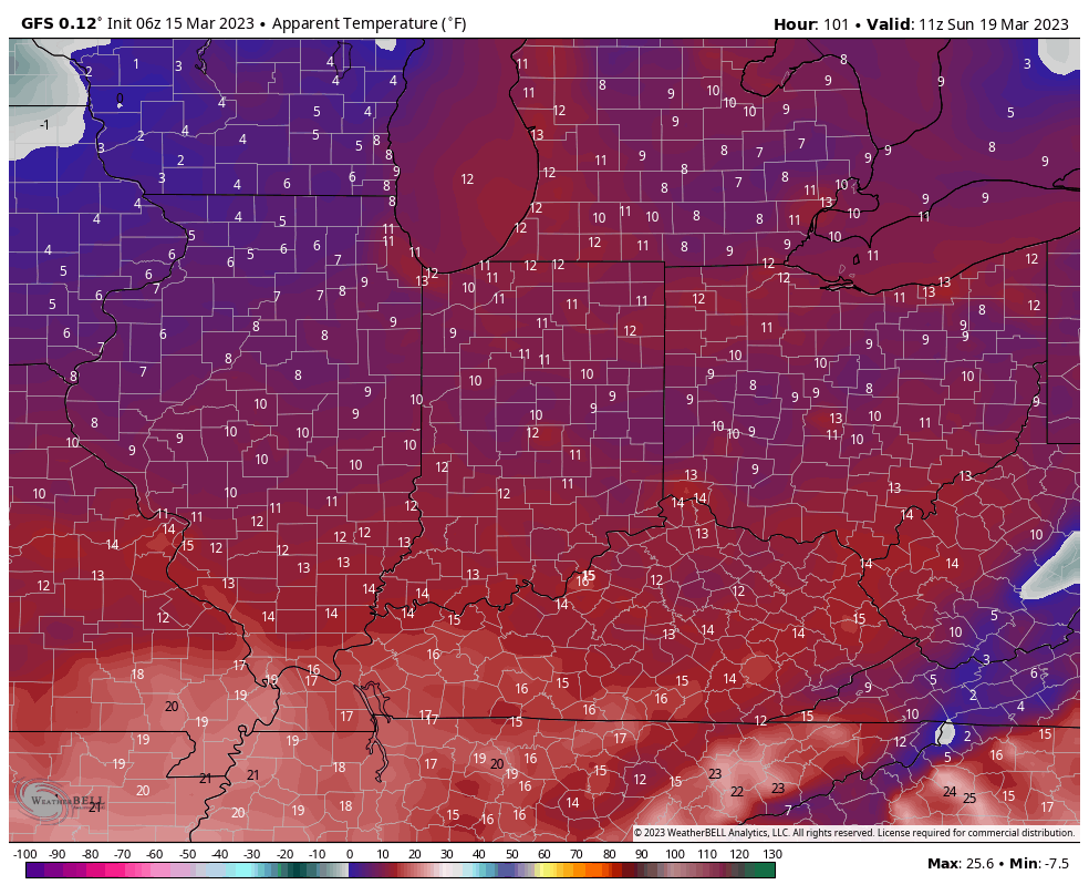
The bigger story comes in the form of another late season arctic “jab” behind the frontal passage. Highs both Saturday and Sunday will remain stuck in the 30s with overnight lows once again dropping into the upper 10s to lower 20s. Wind chill values will fall into the single digits to lower 10s.