Tonight’s video update focuses on the dangerous cold, more accumulating snow Thursday afternoon, and looks ahead to another winter event looming Sunday night and Monday.
Your latest snowfall forecast brought to you by the fine folks at indysportsreport.com:
Dangerous Weather…Severely cold, arctic, air will continue to pour into the region today. Snow showers accompanied the arctic push during the early morning hours and a few flurries can be expected from time to time today (heavier lake effect snows northeast). Winds will be strong and gusty, including considerable blowing and drifting snow. Wind chill values will approach 30 degrees below zero this afternoon into Thursday morning. Needless to say, have a winter survival kit in your car if you must travel.
Additional impulses of energy will rotate through the region Thursday and Friday with periodic scattered snow shower potential Thursday afternoon into early Friday.
A second surge of arctic air will invade Friday night and Saturday morning and result in temperatures, yet again, below zero.
As we move forward, all eyes will turn to the potential of new “wintry fun and games” late in the weekend into early next week.
The snow storm that moved through northern and central Indiana deposited half a foot, or more, of “champaign powder” for the northern Indianapolis suburbs overnight into this morning with amounts tapering dramatically further south.
Left behind will be a day that will provide “decent” conditions for digging out. We’ll introduce sunshine and temperatures will be downright “balmy” when compared to what blows into town tonight. Though well below average, today’s high in the lower 20s will feel like a heat wave when we look ahead to the upcoming couple days.
Things begin to change in a big way tonight as arctic air invades. Additionally, winds will increase and lead to all sorts of blowing and drifting concerns. This dry/ powdery snow will be blown about quite easily and lead to reduced visibilities tonight and Wednesday along with significant drifting. Some additional light snow will accompany the initial arctic push tonight.
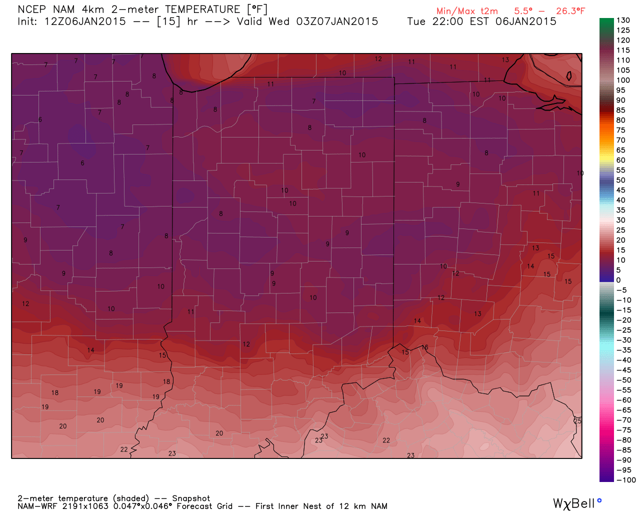
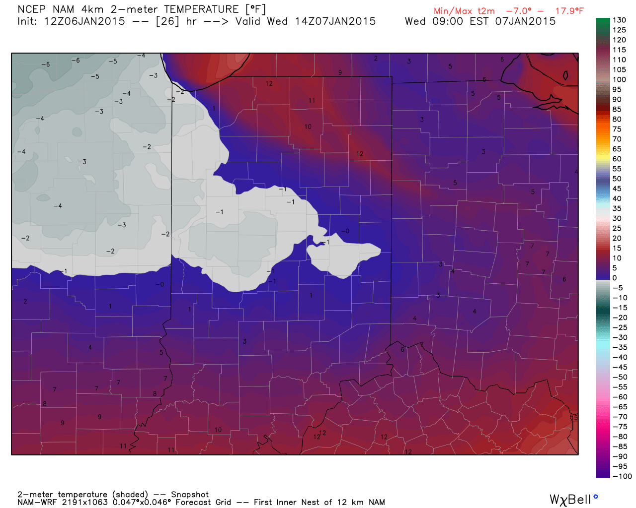
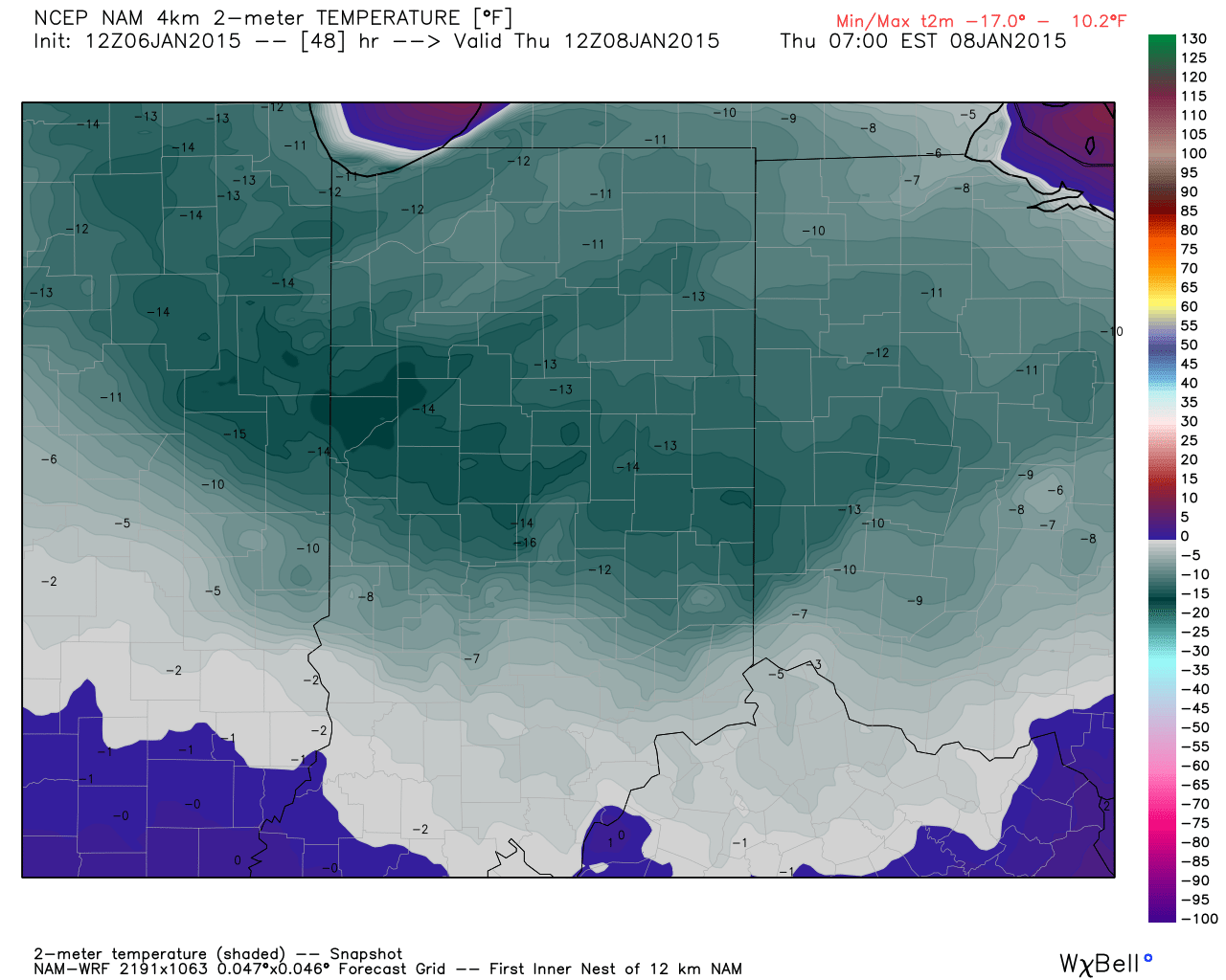
Note the temperature crash that’s coming:
Temperatures fall into the single digits by 10pm.Wednesday morning lows.Modeled forecast lows Thursday morning.
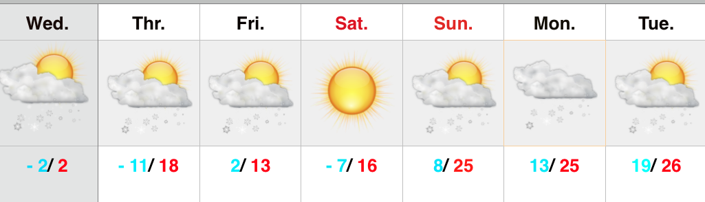
Officially we forecast the following:
Wednesday morning low: -2
Wednesday high: 2
Thursday morning low: -13
* Wind chill values will fall to 25 to 30 degrees below zero Wednesday into Thursday morning.
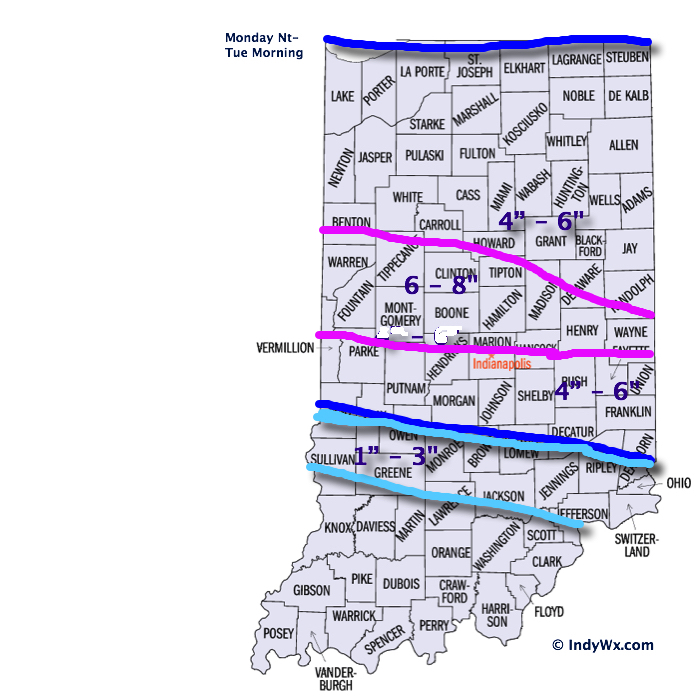
First, here’s a look at our updated snowfall forecast….we’ve tried “honing in” on where we think banding may set up and create heaviest totals. As stated last night, snowfall rates…
You must be logged in to view this content. Click Here to become a member of IndyWX.com for full access. Already a member of IndyWx.com All-Access? Log-in here.