Frosty Mornings; Late Week Storm System…

screen-shot-2016-11-13-at-10-19-07-amHighlights:

  • Dry stretch of weather remains
  • Late week storm system offers up rain; t-storm chances
  • Much colder next weekend

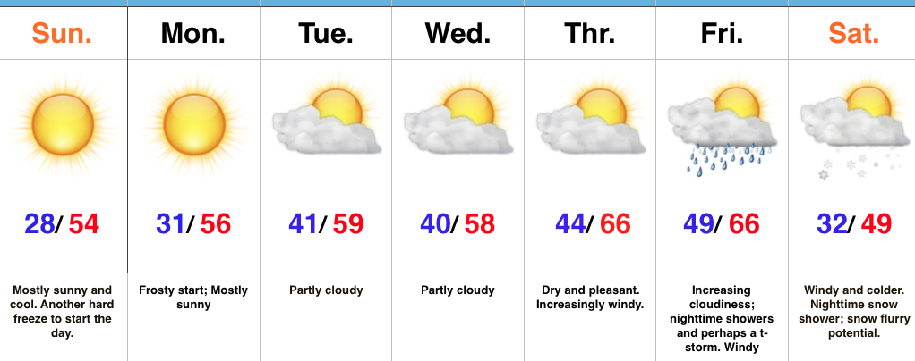
Frosty Mornings To Start The Week…High pressure will dominate our weather pattern to open the new week.  As such, skies will remain mostly sunny and temperatures will be very pleasant.  Monday morning will feature the third morning in a row with sub-freezing air.  Expect another frosty start to the day, including outlying neighborhoods into the 20s yet again.

Looking ahead, our weather will remain rather uneventful until Thursday.  Dry conditions will remain, but southwest winds will become increasingly gusty by the afternoon.  This is in advance of an approaching storm system that will deliver showers, and perhaps a clap of thunder, Friday evening.  Timing will have to be fine tuned as we progress through the week.  Behind the boundary, much colder air will pour into the region on gusty northwest winds next weekend.  In fact, the air will grow cold enough to potentially lead to scattered snow showers Saturday night into Sunday in the left over “back lash” moisture.

Upcoming 7-Day Precipitation Forecast:

  • Snowfall: 0.00″
  • Rainfall: 0.25″ – 0.50″

Winter Ideas…

We continue to finalize our winter forecast, which will be posted, as always, here later this month.

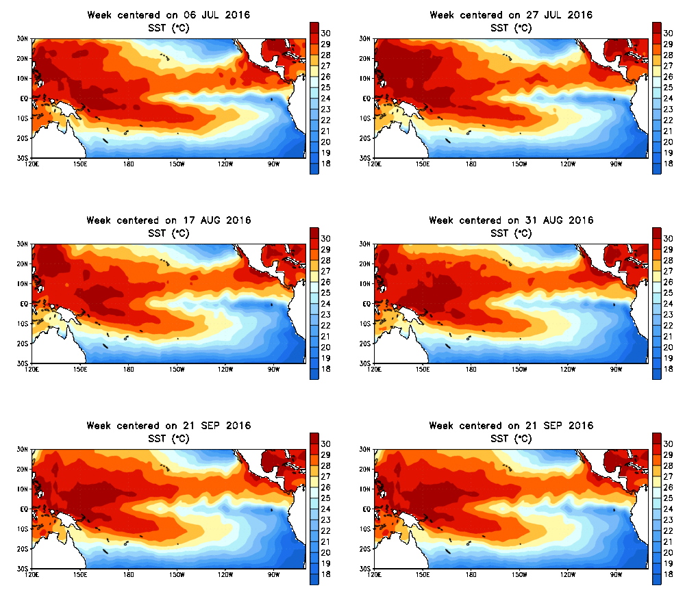
As little as only a few months ago, data suggested a major La Nina for the upcoming winter season.  That data has since backed off significantly.  In fact, some runs suggest we’re back into a weak-ish El Nino state by spring.  At the very least, we are confident on avoiding a strong La Nina this winter and lean more in the direction of a weak Nina, at best, to neutral signal.  The CFSv2 is interesting, as always, with the spread in region 3.4.
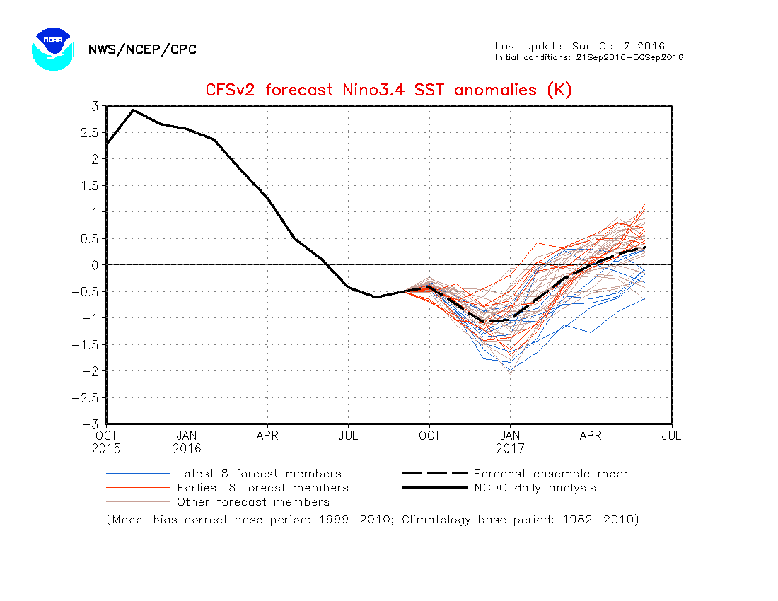
nino34monadj

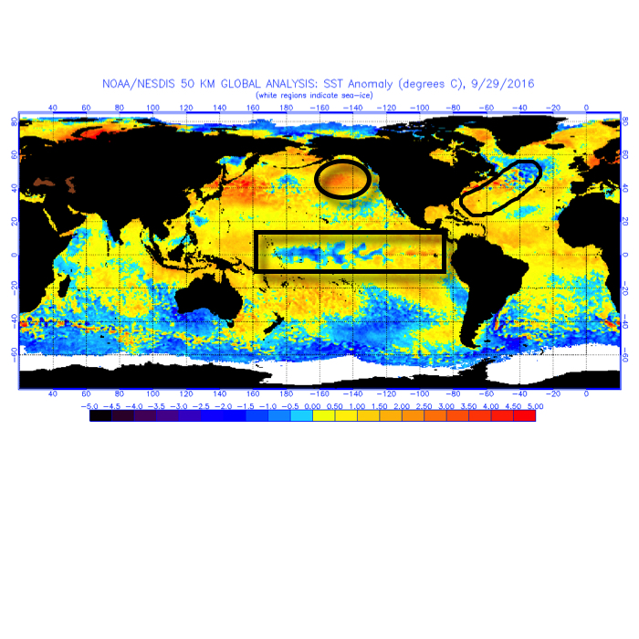
sstanimIn addition to the central PAC anomalies, we also are keying in on some other items of interest in the overall SST configuration:

I. Warmth in the GOA (Gulf of Alaska)

Argues for central cold this winter, spreading east with time.

II. Warmth off the eastern seaboard

Will likely serve to limit the ability for the cold to spread east early on in the season
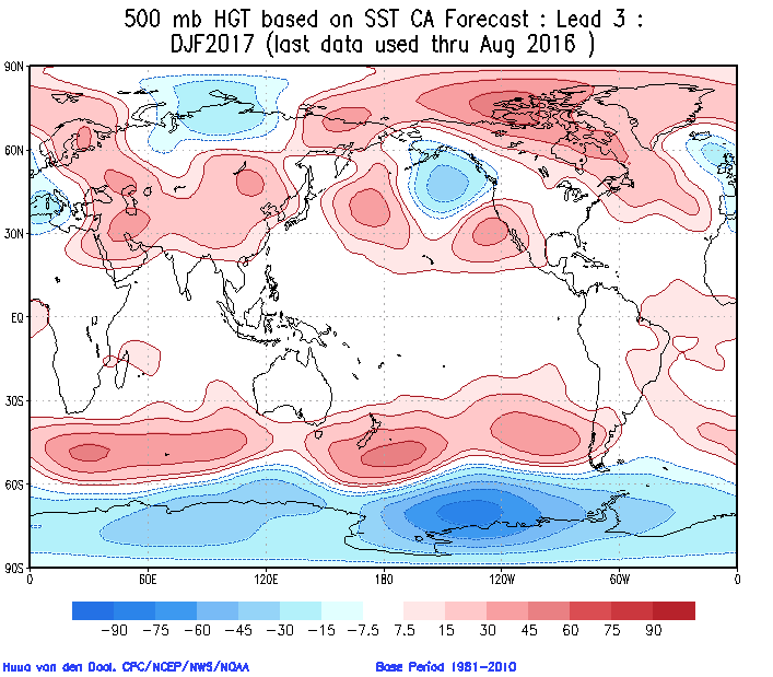
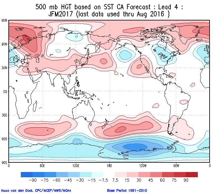
92916sstThe SST CA model is quickly becoming one of our more trusted seasonal forecast models.  We note how it becomes increasingly bullish on a central and eastern trough as winter wears on (by the way, this is likely to go deep into spring this year, too).
screen-shot-2016-10-02-at-10-52-54-am

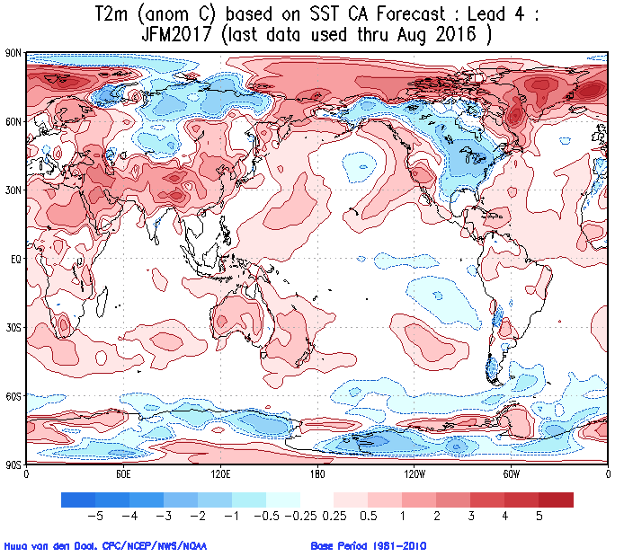
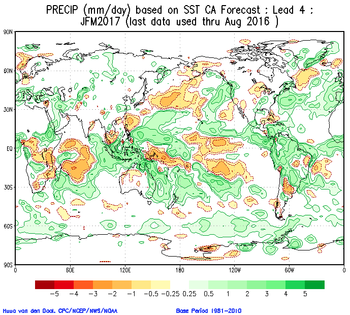
screen-shot-2016-10-02-at-10-53-04-amCold overwhelms the pattern and when you combine it with the active storm track (noted by the green hues, suggesting above normal precipitation through our neck of the woods), confidence is continuing to grow for an above normal snow season.
screen-shot-2016-10-02-at-10-58-16-am

screen-shot-2016-10-02-at-10-58-05-amThe SST configuration on the JAMSTEC would suggest a cold, stormy set-up, locally.  That said, while it sees the above average precipitation, it’s awfully warm at the surface.
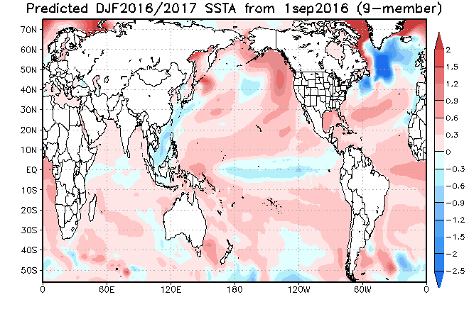
ssta-glob-djf2017-1sep2016

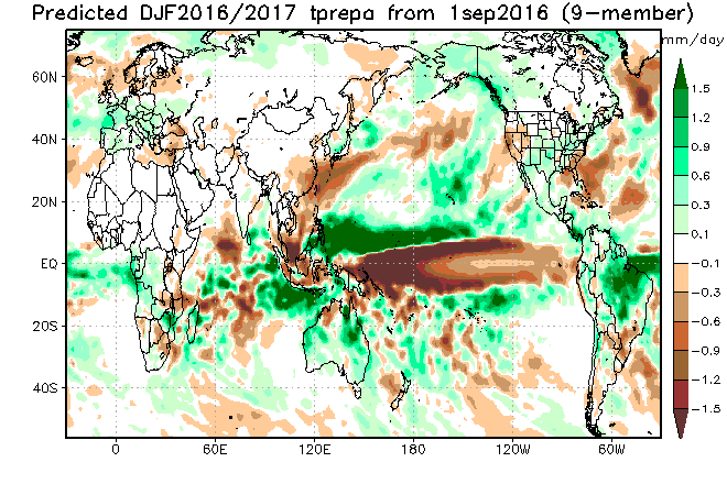
tprep-glob-djf2017-1sep2016

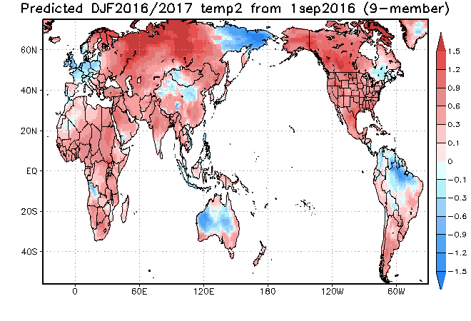
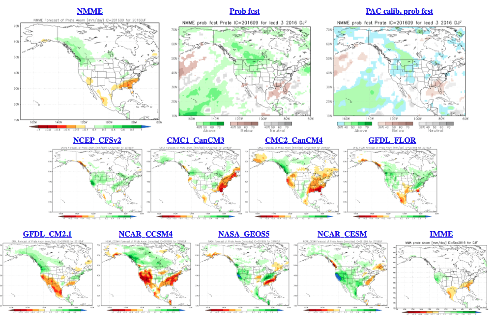
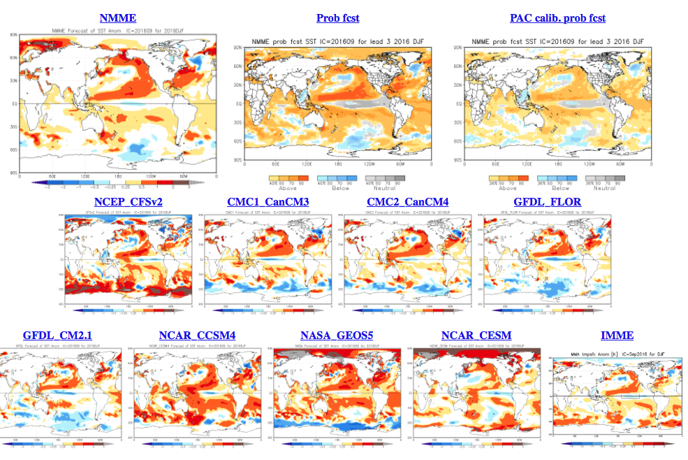
temp2-glob-djf2017-1sep2016The NMME (to no surprise…) would suggest a very warm, wet winter.
screen-shot-2016-10-02-at-11-08-26-am

screen-shot-2016-10-02-at-11-09-00-am

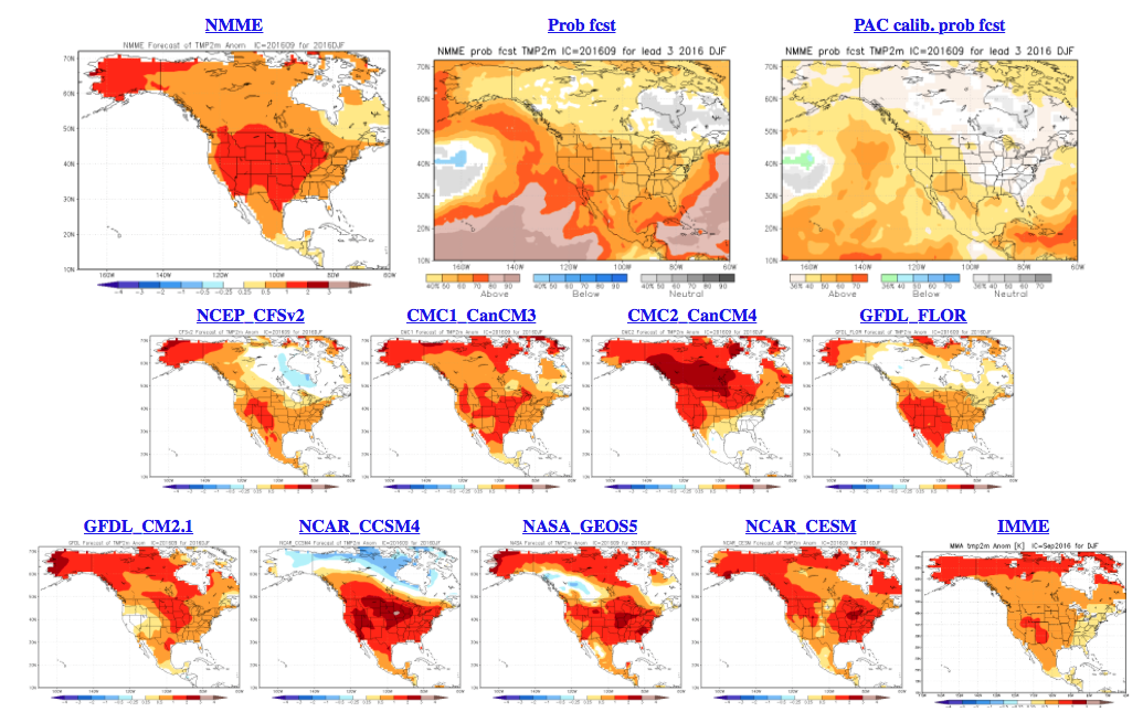
screen-shot-2016-10-02-at-11-08-47-amAs a reminder, our complete and final annual winter outlook will be posted here during the second half of October.  That will include additional model data, along with several other points behind our reasoning for our winter forecast.  As we always do, we’ll put “pen to paper” when it comes to our winter forecast, including our expected temperature and snowfall anomalies.  Given the data above, including the warm JAMSTEC and NMME, it’s going to be very, very hard to see a warm winter here.  In fact, our idea is for the exact opposite, given the SST configuration, and lines up more closely with the SST CA idea at this point.  We’re also in the camp of a very, very active storm track through the Ohio Valley.  “Big-hitter” potential is present from a winter storm perspective, especially given that we are likely to see resistance from the SE ridge.

Much more later this month…
New SST CA Model Weighs In On Winter…

The updated Sea Surface Temperature Constructed Analog model is in for the winter. In short, it suggests a slow start to winter gains momentum and turns much colder as mid and late winter arrive. It’s also a stormy look, locally, and would imply big-hitter potential in the Ohio Valley.

500mb pattern

*Note how the trough becomes more established over the central and east during the January through March period. 

Temperature anomalies


The consistency is remarkable on the bullish cold signal for the central and east for the January-March time frame. We note high agreement, month-over-month, on the J-M time frame being significantly cold. 

Precipitation anomalies

*No doubt a stormy signal through the Ohio Valley.

Time is ticking…winter will be here before we know it! Our official annual winter outlook will be out in October. 

Bitterly Cold By April Standards…

Screen Shot 2016-04-09 at 8.09.05 AMHighlights:

  • Cold times continue
  • Rain arrives Sunday
  • Monday storms
  • Slowly moderating late next week

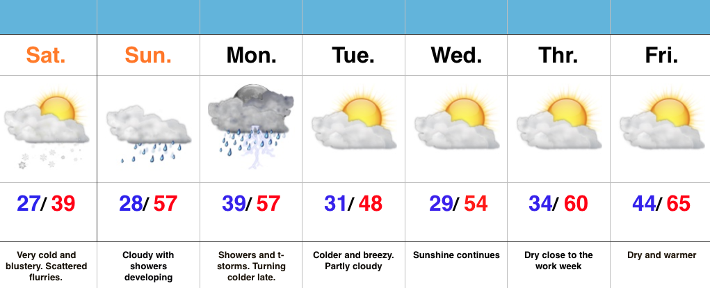
Bundle Up…With temperatures in the middle and upper 20s this morning and ‘chills in the 10s, it’s hard to believe we’re nearing mid-April!  It’s simply downright bitter by April standards.  Early snow showers and flurries should diminish as we progress into the afternoon hours with decreasing cloudiness, as well.

Dry times won’t last long as a warm front approaches Sunday.  This will deliver a thick overcast back to the region, along with developing showers and embedded thunder into Monday.  Early rain numbers into the forecast office offer up the potential of 0.75″-1.25″ on average in the Sunday-Monday time period.

We’ll turn colder and breezy (surprise, surprise) Monday night into the middle of the week, BUT moderating temperatures will develop by late week!  60s are in store for afternoon highs Thursday-Friday with lots of sunshine!  Hang in there, friends!

Thundersleet and Thundersnow Possible Later Today…

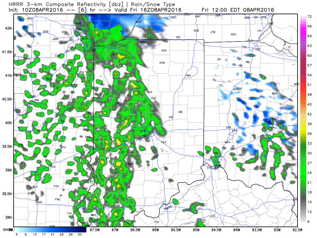
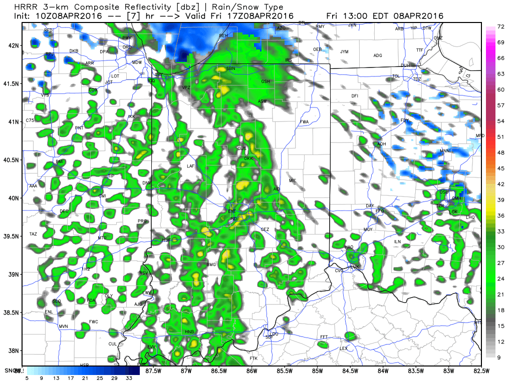
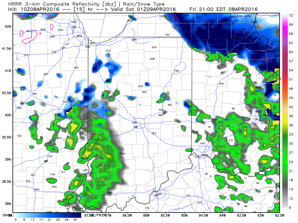
While the morning is off to a frigid and quiet start, changes will begin to take place as early as late morning into the early afternoon hours.  Another disturbance will rotate through central IN this afternoon and evening and interact with the unseasonably cold air (both aloft and at the surface) to ignite convective showers.  Some of these showers, mixed at times with sleet and snow, will be accompanied by thunder.

1

2Eventually, as cold air is reinforced this evening, all precipitation should transition to snow this evening into early Saturday.  While it won’t snow for everyone, scattered heavy snow bursts will be plenty capable of producing a quick coating for some neighborhoods tonight.

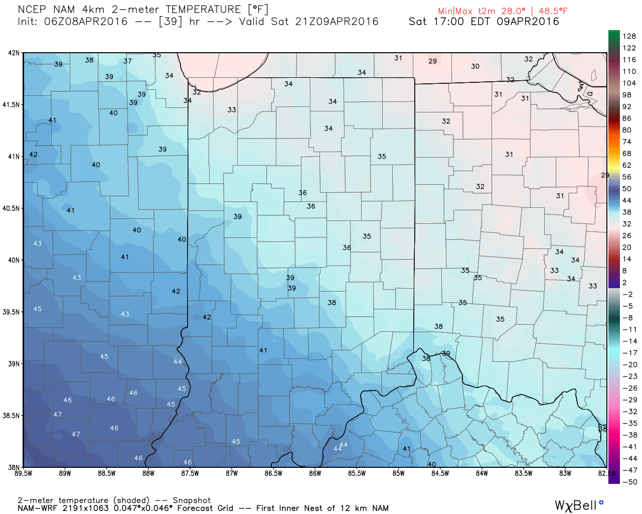
3Speaking of the cold, highs Saturday will remain in the 30s for most.  Yes, this is April…

4Hang in there, friends.  After another chilly week next week, changes are in the offing for late month.  Warmth is coming….eventually.  🙂