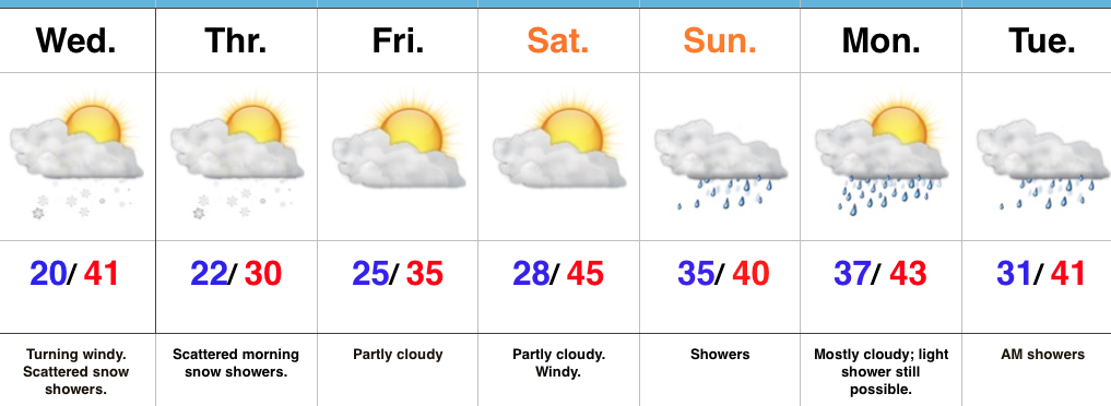
Wednesday Evening Rambles…Cold Reinforcements Tonight; Weekend Moderation…
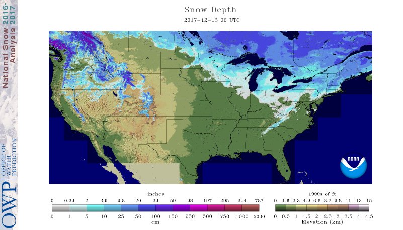
I. A look at the current snowpack shows the northwest flow nicely, and another storm is just missing central Indiana to the north and northeast this evening (not included in this morning’s snowpack update). The southern Appalachians have also been capitalizing in this northwest flow pattern, not to mention the southern stream event that dumped hefty snows on the Deep South.
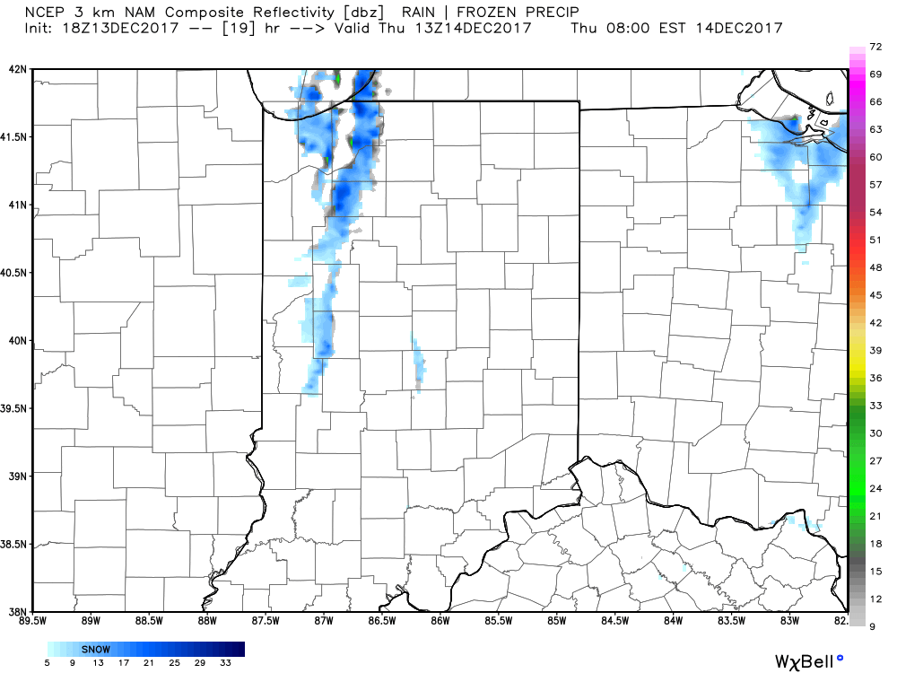
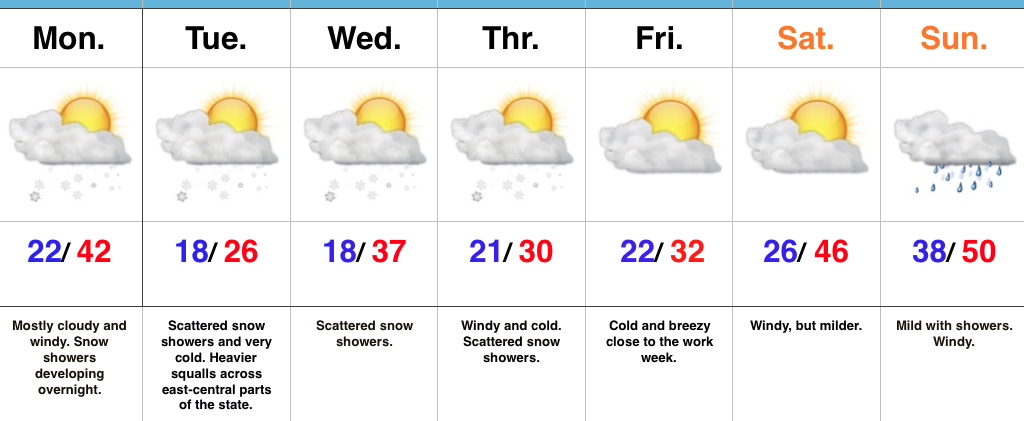
 II. While the sticking snows will miss us this go around, scattered snow showers will impact central IN overnight into early Thursday morning. There’s also still the potential of a skinny lake effect snow band to impact a narrow portion of western and north-central IN early Thursday.
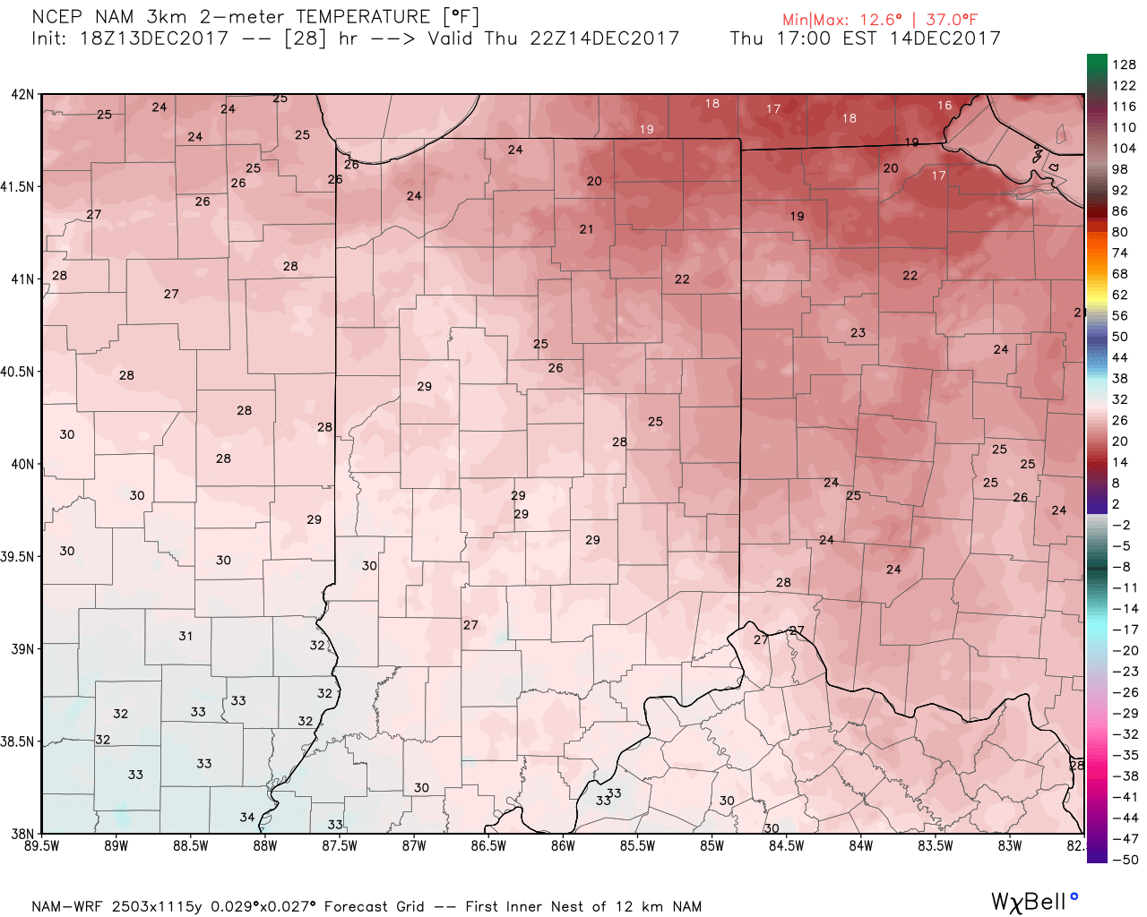
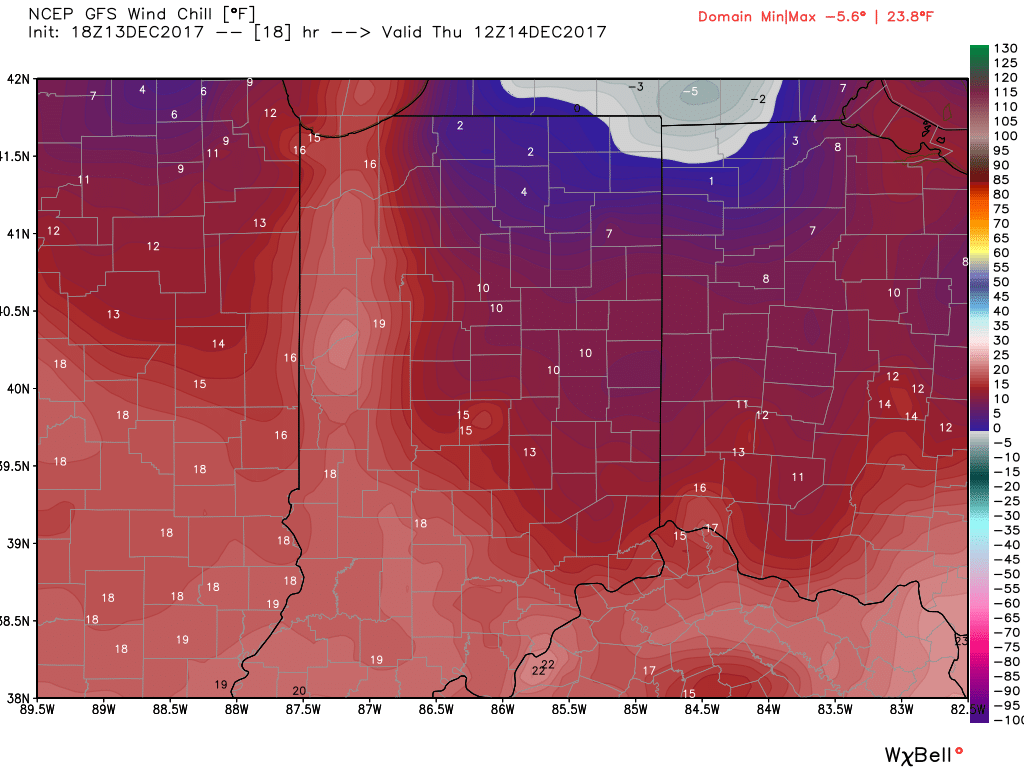
 III. Reinforcing cold air will plunge south Thursday. Highs will remain below freezing along with wind chill values in the 10s most of the day.
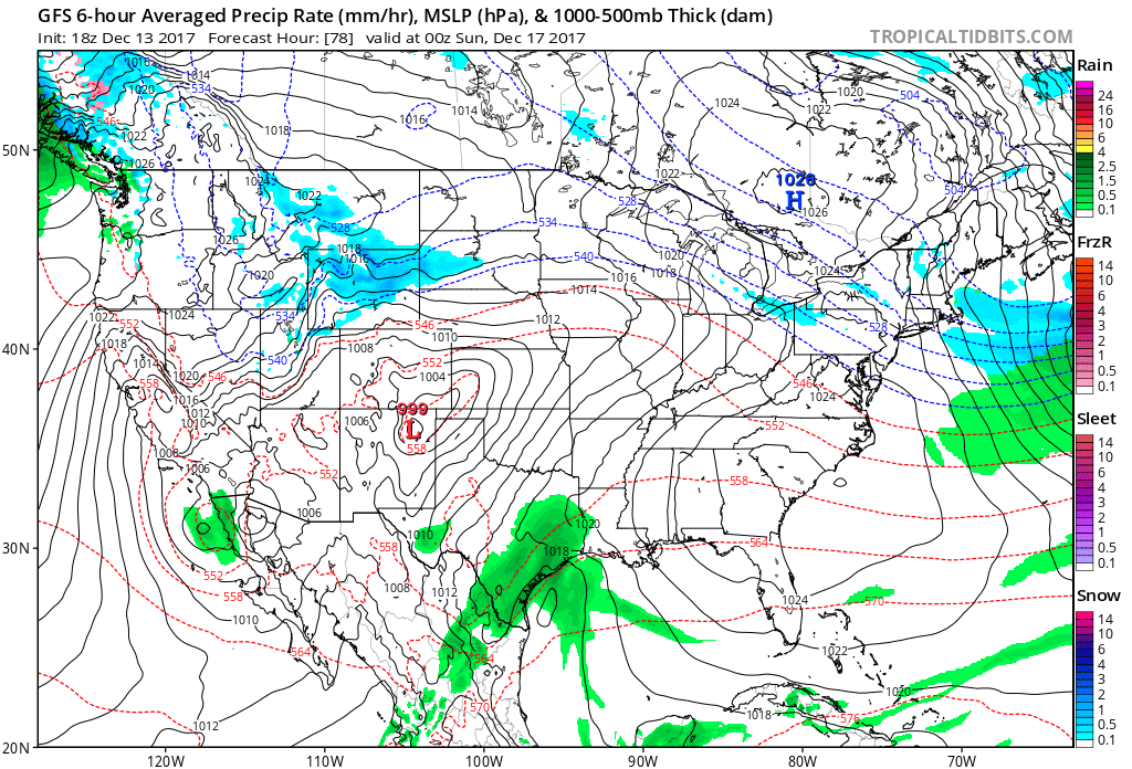
 IV: A milder southwesterly air flow will result in slightly “warmer” temperatures this weekend (mid 40s for highs Saturday) before showers arrive to close the weekend. Despite the slight relaxation of the cold, this will come with a gusty breeze over the weekend.
 Highlights:
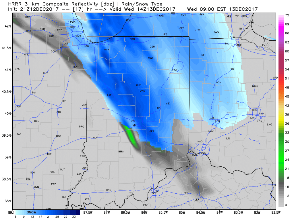
 III. A period of brief moderation will come in this pattern early Christmas week, but all eyes continue to focus on the period between December 22nd through December 26th for the potential of impactful weather across our region. For model “worshipers” out there, we suggest paying more attention to overall trends, and a blend of ensemble data, as opposed to specifics associated with operational runs. It’s a “jailbreak” pattern of sorts as true arctic air will be pouring down the Plains while the southeastern ridge tries to fight for a time. The resistance from the southeastern ridge and associated tight thermal gradient should promote a very stormy regime for the interior (Ohio Valley into the interior northeast) as we head into the true holiday/ Christmas stretch. As of now, we favor the idea of multiple waves along the pressing arctic boundary, as opposed to one big storm. Looking back through the records shows some of the heaviest snows at IND have come from similar set-ups. Understanding each set-up is unique, the overall pattern does have to raise an eye brow for potential of wintry weather in, or around, our region as Christmas approaches…
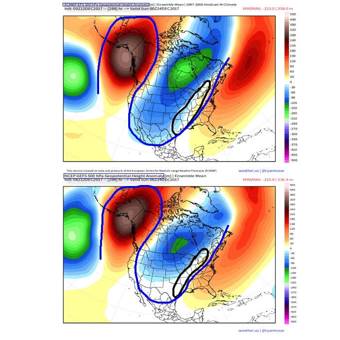
 Highlights: