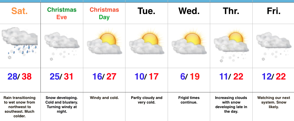
An “Appetizer” To Christmas Eve’s “Main Course…”
In general, northern ‘burbs picked up between 1″ to 3″ of wet snow earlier this morning before drier conditions arrived for the afternoon hours. A couple of reports include Whitestown with 1.6″, Carmel with 2″, and Lebanon with 2.5″. A sharp cut-off with slushy coatings to less than 1″ made it as far south as the city, itself. Today’s event will be viewed as the “appetizer” to Christmas Eve’s “main course.”
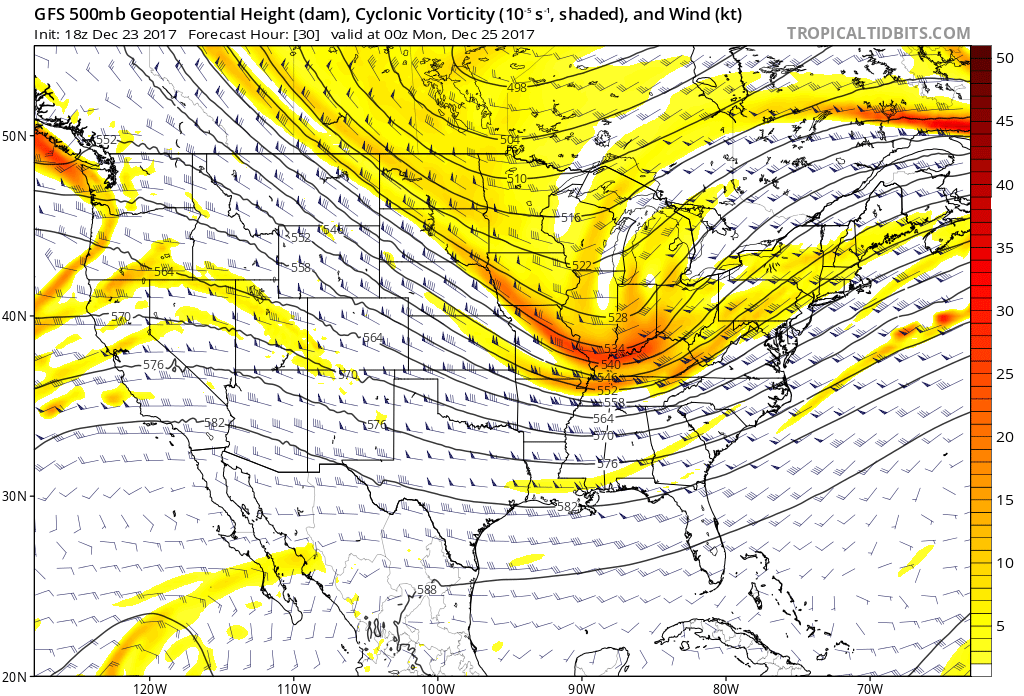
Vigorous upper level energy will track through the Ohio Valley Christmas Eve afternoon into the evening, itself.
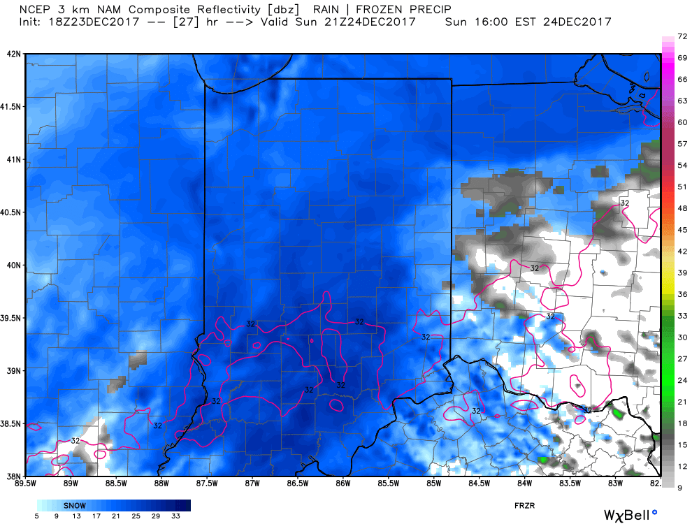
 Snow will begin to overspread the state, especially north of the I-70 corridor during the mid-to-late morning hours and we expect a steady snow to fall across the northern half of the state throughout the majority of the day. A period of moderate to heavy snow should develop during the mid-to-late afternoon, continuing into the evening hours across central Indiana. Road conditions will begin to really deteriorate during this time frame as surface temperatures fall into the 20s.
 Eventually, snow will end from west (around 8p) to east (around midnight) tomorrow night, but not before depositing a widespread swath of 3″-5″ for areas generally north of I-70. For the city, itself, we think 2″ to 3″ is a good call, with generally an inch, or less across far southern portions of the state.
 Don’t be surprised if enough Christmas “magic” results in localized heavier totals with potential banding that develops tomorrow afternoon into the evening hours. All in all, this will be a classic, picturesque snow event for Christmas Eve. Hoosiers will wake up Christmas morning with a fresh blanket of white.
We have additional wintry fun and games to track later next week!
 Highlights:
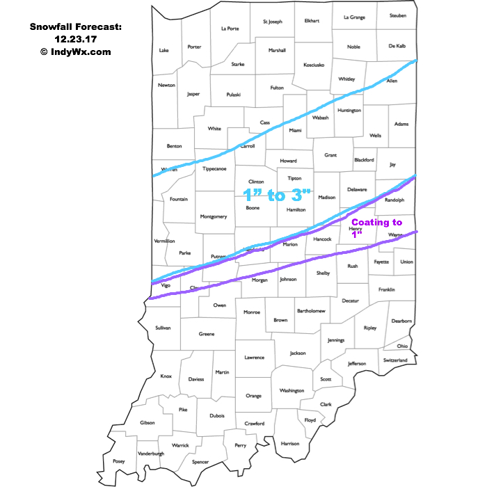 A more widespread, “uniform” (easier to forecast, as well :-)) snow event will arrive Christmas Eve. Upper level energy will cross the Ohio Valley and combine with arctic air in place to maximize moisture production. We expect an expanding area of snow to encompass most of the state Christmas Eve, likely becoming most widespread Christmas Eve afternoon. With cold air in place, roads will likely get slick in spots so plan accordingly with your travels.
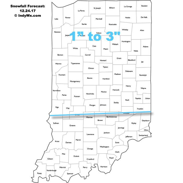 The hits keep coming as we progress into next week. An additional accumulating snow event may arrive Christmas night into Tuesday, followed by a more widespread and potentially major event late next week…
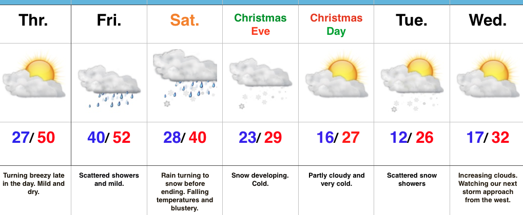 Highlights: