Prolonged Bitterly Cold Pattern Rolls Along…
 Highlights:
- Dangerously cold pattern
- Midweek snow showers
- Messy weekend
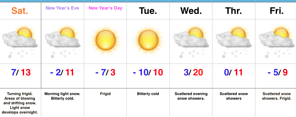
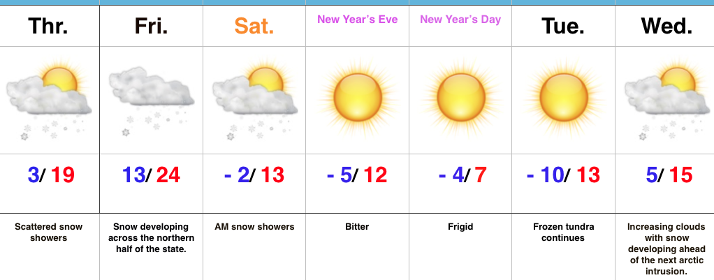
Take The Cold Seriously…Dangerously cold conditions will continue this week. With clear skies and a fresh snowpack, temperatures will quickly tumble tonight into double-digit below zero territory across most of central Indiana. Add in even the slightest wind and wind chill values will plummet to 20 to 30 degrees below zero. Limit time outside, check on your neighbors, and ensure your pets are cozy indoors, as well.
Next up on the agenda will be upper level energy moving southeast across the region Wednesday. This will spark an area of snow showers with light accumulations for our hump day followed by reinforcing bitter cold to close out the week. Additional upper level energy and some lake moisture will provide the chance of snow showers Friday in spots, as well.
A more widespread and significant storm system will arrive over the weekend. Clouds will increase Saturday night into Sunday morning and a messy mixture of snow, sleet, and freezing rain will invade Sunday afternoon and evening. Renewed bitterly cold, arctic air will plunge southeast early next week. Additional sub-zero days are likely just beyond the forecast period…
Upcoming 7-Day Precipitation Forecast:
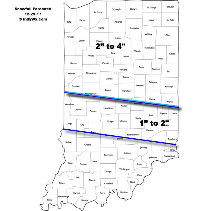
- Snowfall: 1″ to 3″
- Rainfall: 0.10″
 Highlights:
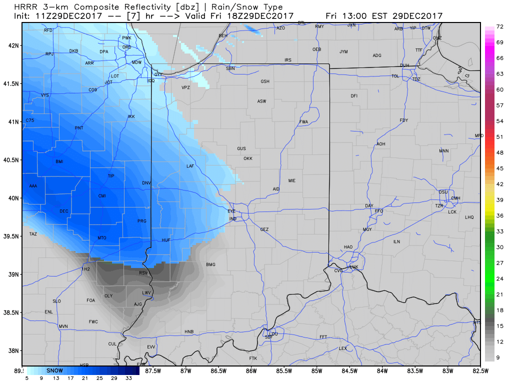 Snow will then encompass most of the state as we progress into the late afternoon and evening hours.
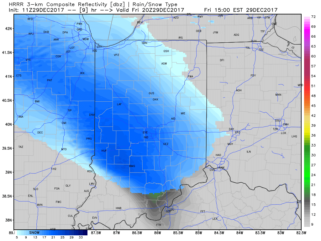
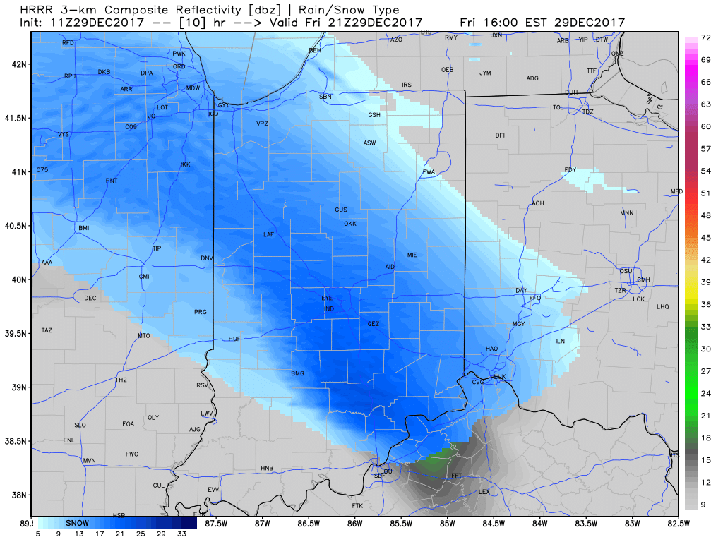 At times, we expect moderate snow to be falling across central Indiana and this will, unfortunately, make for a messy evening commute. Plan for snow covered and snow packed roads and slick conditions. Leave extra time to reach your destination.
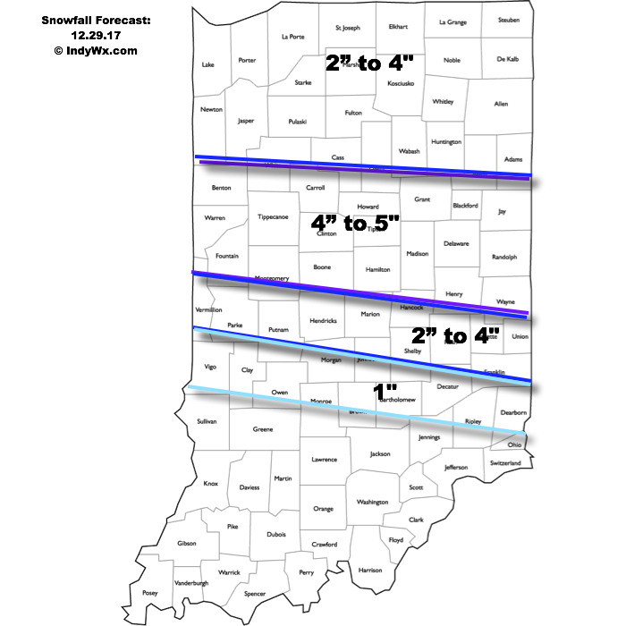 Attention once to Saturday will shift to the problems associated with blowing and drifting snow as winds increase and temperatures tumble. Strong and gusty northwest winds will continue into early next week and not only will this lead to continued issues with blowing and drifting, but will also drive dangerously cold air into the area.
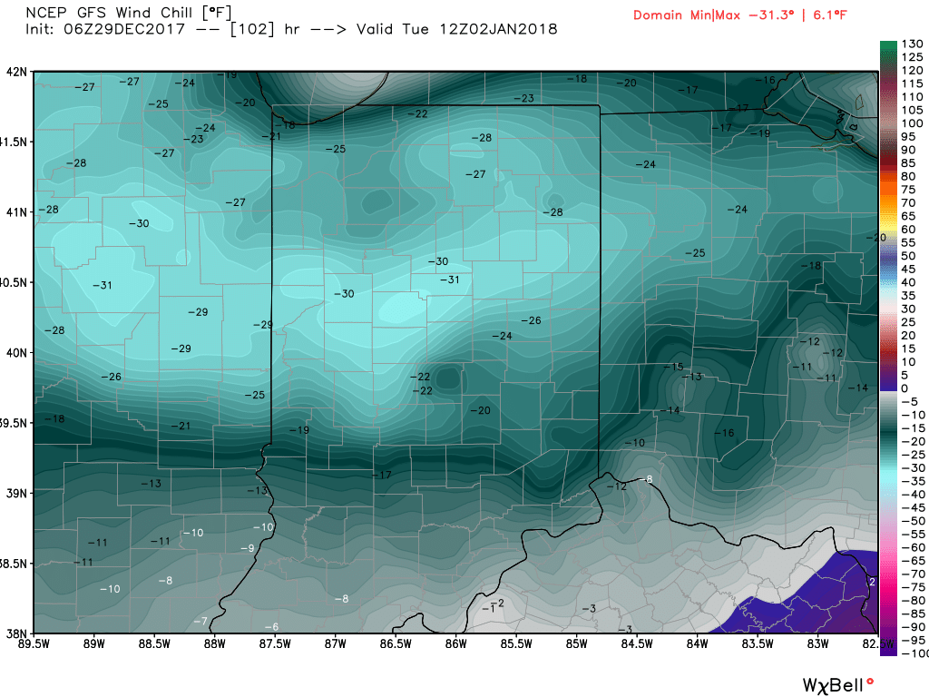
 Highlights: