Brilliant Close To The Weekend; Wet Snow Thump For Some Early Week…
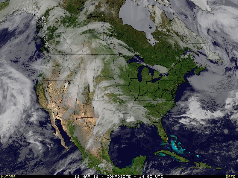
Though we were greeted with a cold and frosty start to our Sunday, high pressure will supply plentiful sunshine as we wrap up the St. Patrick’s Day weekend. Find a patio this afternoon that’s showing the Madness and soak up that Vitamin D. The increasingly powerful March sun angle will help boost temperatures into the middle to upper 50s for most of central Indiana.
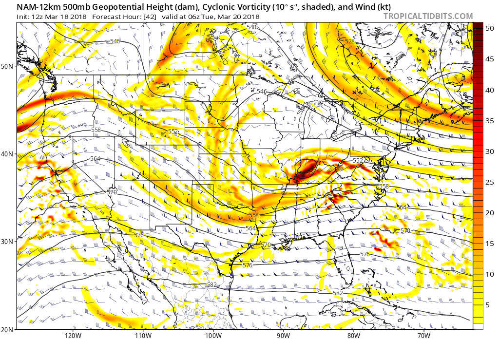
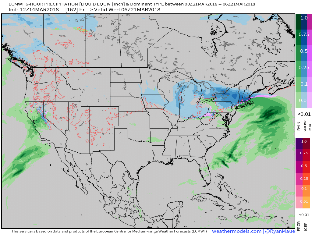
 Things will begin to change as we open up a new work week. Surface low pressure will track out of the central Plains into the lower Ohio Valley Monday into Tuesday. This will spread moisture into the southern half of the state Monday evening. With air just cold enough, precipitation will mix with and perhaps change to a wintry mix of sleet and wet snow along the northern periphery of the precipitation overnight into Tuesday morning.
 March snow events can offer “surprises” and we’ll need to keep a close eye on the precise details pertaining to the track of the upper low Monday night into Tuesday. Under and just north of these little bundles of energy can often times be the spot for a wet snow “thump” this time of year. For now, it appears areas from southern IN into Ohio may be the sweet spot for a late season accumulating snow event.
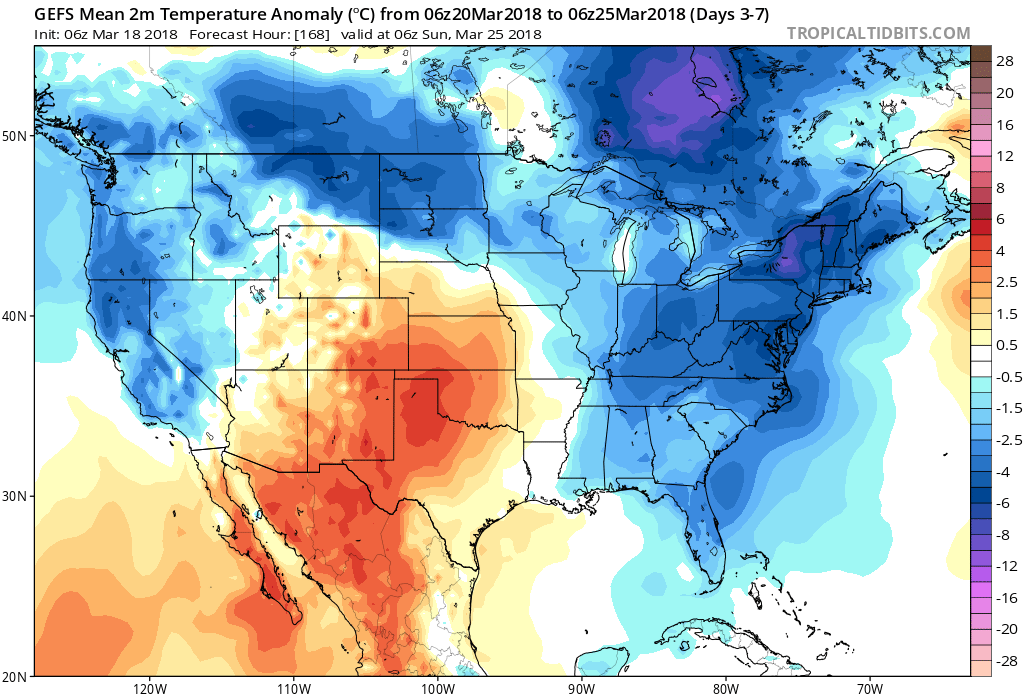
 The mid week stretch should be showcased by dry, but unseasonably chilly conditions. Lows in the 20s and highs in the 40s aren’t what many Hoosiers on Spring Break want to deal with…
 Our next item of significance arrives Friday as a warm front lifts northeast through the Ohio Valley. This will result in a wet close to the work week.
 Looking ahead, the weather pattern sure looks active to wrap up March and open April, including above average precipitation and potentially an “uptick” in severe weather episodes…

 A couple of storm systems continue to have our attention over the upcoming week:
 From this distance, neither storms seem to be a “big deal” for central Indiana. However, we know March storms can “surprise.” Just ask our friends across KY earlier this week. 🙂 Spring warmth attacking south of systems combined with unusually cold air, associated with the blocking, just to our north can lead to all sorts of fun and models may have to play catch up last minute in some areas. At the very least, we recommend keeping an eye on the forecast over the next week, or so.