We need to continue to keep close eyes on the potential of a sneaky wave developing along the arctic front Wednesday evening. It’s entirely possible that portions of southern Indiana pick up a light accumulation with this wave prior to the arctic reinforcements to close the week. We’ll be back into the forecast office tonight and have a Client video posted on today’s trends.
Our attention will then turn to the threat of a vigorous clipper system Sunday PM. With arctic air in place, expect the “fluff factor” to be in full effect with this system. Again- tonight’s video will look further at trends.
As a whole, the pattern is turning more active and that should continue to be the case as we head into early February.
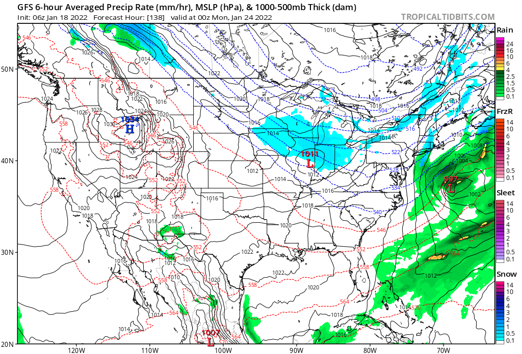
The week ahead will feature a couple of reinforcing shots of arctic air. The first of these arrives Monday morning and will be coupled with light snow. After a dry close to the weekend, Martin Luther King Jr day will feature light snow expanding in coverage prior to sunrise. Light snow will continue across central Indiana into mid to late morning before shutting off. Further northeast, some light accumulation is possible with lake enhancement (around 1” of snow across the northeast Indiana snow belt, otherwise it’s nothing more than a coating for most throughout central Indiana).
Light snow will be flying across the state early Monday morning.
While Indianapolis may sneak back to 30° Monday afternoon, most of the day will be stuck in the 20s.
Weak high pressure will then control our weather Tuesday and Wednesday. As a southwesterly air flow gets briefly back involved, temperatures will moderate back into the upper 30s to lower 40s with dry conditions.
The next push of arctic air will blow into town Thursday. As of now this appears to be a dry frontal passage but we will monitor (occasionally these reinforcing cold fronts can feature an arctic wave with a brief opportunity for snow). Cold will be a big deal to close the week- Thursday, Friday, and Saturday should feature highs in the low-mid 20s and lows in the single digits to lower 10s. Wind chill values will dip below zero at times. Lake effect will get going during this time frame across the traditional snow belt.
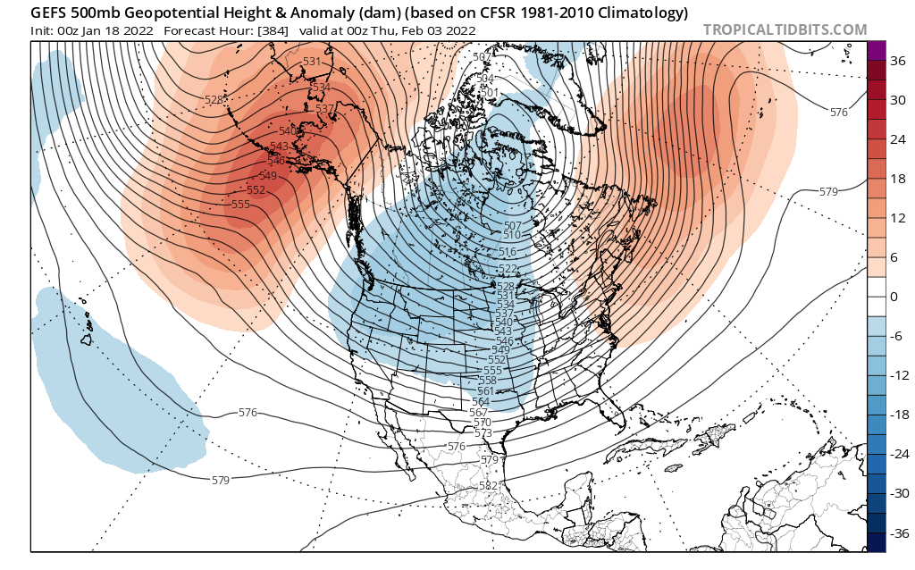
Longer term, the pattern still looks to support a colder than average regime to wrap up January.
Updated 01.14.22 @ 6:05p With each passing the day, the desperation from central Indiana snow lovers is being felt more and more. 😉 This weekend’s significant (memorable in many instances)…
You must be logged in to view this content. Click Here to become a member of IndyWX.com for full access. Already a member of IndyWx.com All-Access? Log-in here.
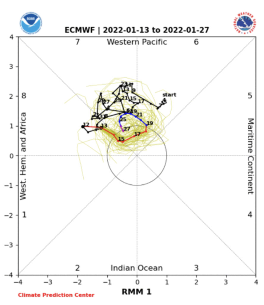
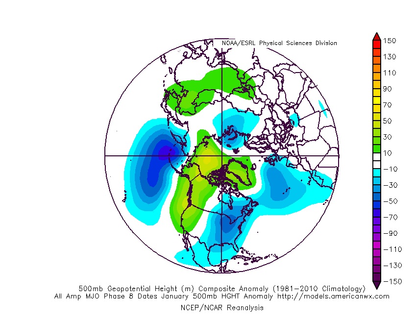
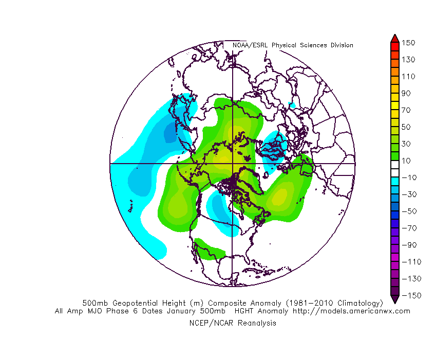
The primary driver (the Madden Julian Oscillation, or MJO) will be in a favorable phase to allow colder than average temperatures to take up residence across the eastern part of the country as we close out January. To no surprise, these particular phases favor positive heights over the high latitudes (blocking) which helps drive more of a persistent colder than normal pattern.
We’ll keep an eye if the MJO gets stuck in the neutral phase, but the “loop” around into Phase 6 this time of year would continue to favor cooler (to colder) than normal conditions across our portion of the country.
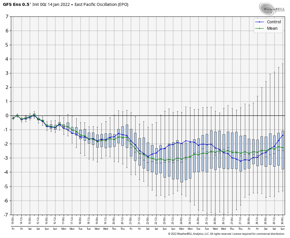
That brings us to our teleconnections. The “big 3” (this time of year include the AO, EPO, and PNA) are also all in favorable position to deliver a colder than normal pattern to close January.
One could also build a case that February would at least open colder than normal based off a combo of the above (MJO and teleconnections) and we agree with that idea, but do believe a “flip” in the regime is ahead after the first week, or so, of the month to milder times.
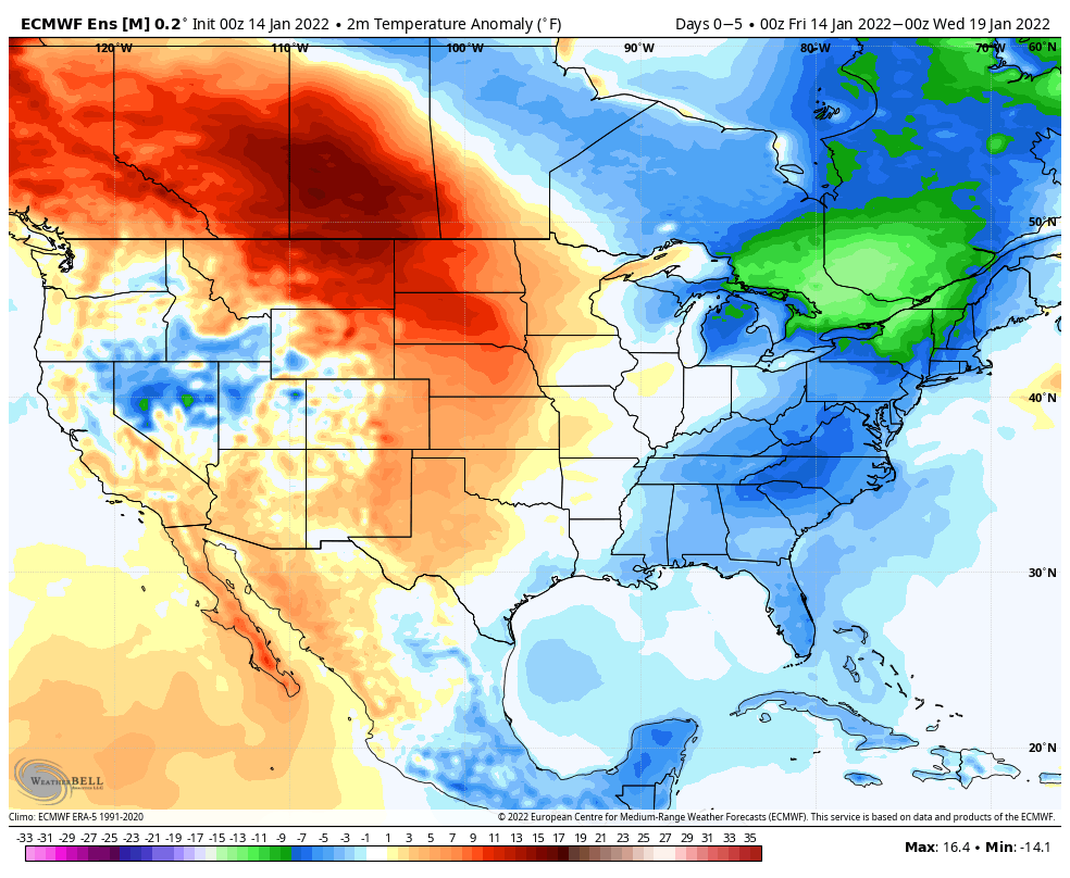
To no surprise, modeling is showing this cold close to the month.
The opportunity is present for Week 2 to be bitterly cold, as the European is hinting above. Sub-zero temperatures are on the table, especially if we can get some snow down.
Speaking of snow, this pattern should produce a couple opportunities for central Indiana to get in on the act before the end of the month, or beginning of February. Despite the incredibly slow start to the season, take any one particular solution with a grain of salt when looking at operational guidance 2 weeks out.
You must be logged in to view this content. Click Here to become a member of IndyWX.com for full access. Already a member of IndyWx.com All-Access? Log-in here.