
The Storm Prediction Center has issued a Severe Thunderstorm Watch in effect until 7p.
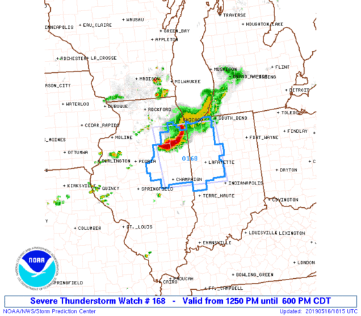
Greatest concern has to do with the Southwest flank of the thunderstorm complex that will continue to push southeast into the evening hours. (This is the same complex of storms that moved through MN and WI earlier this morning).
As we look at the ingredients needed for severe weather, there’s reason to believe this complex will hold together, including occasionally producing severe weather (large hail and damaging winds remain the biggest concerns) into portions of central Indiana by early to mid evening (5p-8p time frame).
This shouldn’t have any impact on another, more widespread, complex of storms that will initiate well to our north late tonight before rumbling south into central Indiana around, or just after, midnight in a weakening state…
More later!
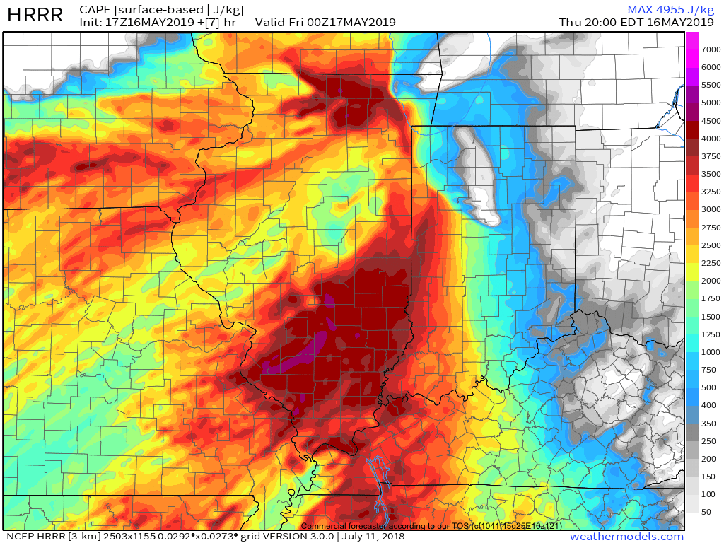
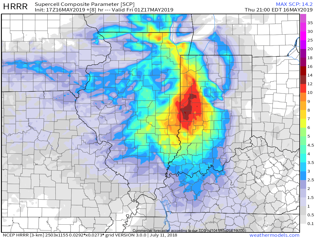
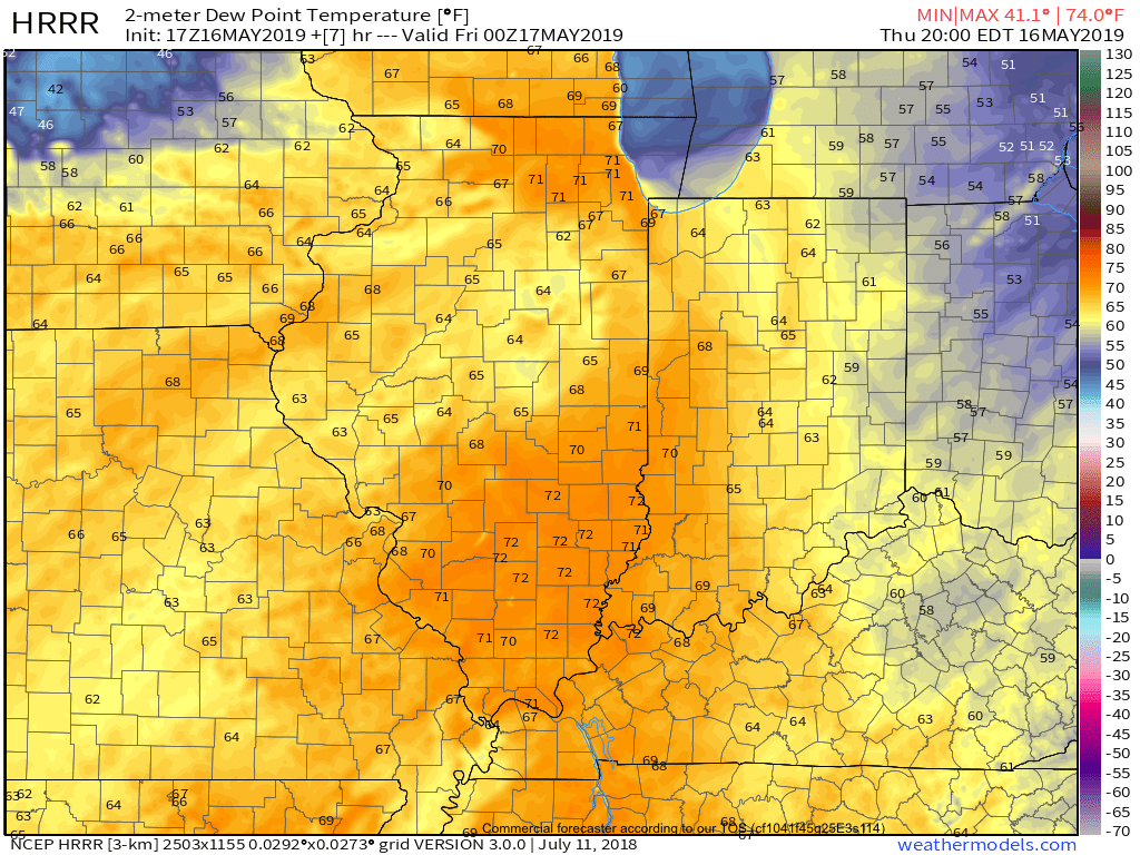
 Latest highlights: