Category: Severe Weather

Weekly #AGwx And #Severe Weather Outlook…

Updated 04.13.24 @ 12p

While unseasonably warm air will build in here early next week, don’t put away the cold weather gear just yet. We’re likely even looking at additional frost threats as we get towards late next weekend and/ or early Week 2. More details below in this week’s #AGwx and #Severe Weather Outlook.

“Transitional” is the word to describe the upcoming couple weeks worth of weather around these parts. The warmth to open the period will cool significantly next weekend and early Week 2, only to give way to renewed warming late April.
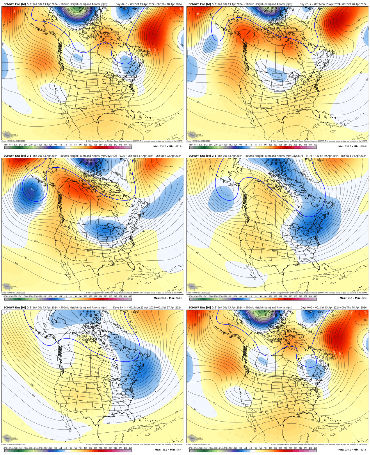
Note the roller coaster in the temperature anomalies over the next couple of weeks.

The active pattern in the week ahead will dry significantly late in the forecast period as the cooler airmass takes hold.

In the more immediate term, we’re tracking 2 storm systems in the week ahead: Tuesday – Wednesday and again Thursday night into Friday.

The Storm Prediction Center includes western Indiana in a risk of severe weather Tuesday. We’ll monitor for the potential of a further east extension of this risk area.

We think (2) rounds of storms are on deck Tuesday. The first round likely is associated with a warm front lifting north through the state Tuesday morning (hail threat) followed by a second round of activity Tuesday night into Wednesday morning (main concern being damaging straight line winds with this round). As of now, storm total rainfall amounts of 0.50″ to 1″ seem likely during this timeframe.

Another round of showers and embedded thunder will precede a blast of chilly air next weekend. We bracket Thursday night into Friday morning for this particular round of rain. An additional half inch, or so, of rain seems reasonable from this distance.

By the time we get to next weekend and early Week 2, drier and much cooler, more stable air should take up residence.

We note the warm open, chilly finish in the 10-day meteogram. Also note the frost threat at the end of this period.

Upcoming *10-Day Rainfall Projection: 1″ to 1.5″

Permanent link to this article: https://indywx.com/weekly-agwx-and-severe-weather-outlook-51/

VIDEO: Mother Nature Is Making Us Earn It Saturday; Long Range Pattern Remains Active/ Stormy…

Updated 04.12.24 @ 7:48a Today will certainly be another less than ideal weather day across central Indiana, but the trade off for what awaits Saturday will be worth it. You’ve…

You must be logged in to view this content. Click Here to become a member of IndyWX.com for full access.  Already a member of IndyWx.com All-Access?  Log-in here.

Permanent link to this article: https://indywx.com/video-mother-nature-is-making-us-earn-it-saturday-long-range-pattern-remains-active-stormy/

VIDEO: Heavy Rain Develops Later Today Into Thursday; Keeping An Eye On The Potential Of Strong Storms Early Next Week…

Updated 04.10.24 @ 7:40a We’re only dealing with a few light showers out the door this morning, but a heavier and more widespread area of rain will develop through the…

You must be logged in to view this content. Click Here to become a member of IndyWX.com for full access.  Already a member of IndyWx.com All-Access?  Log-in here.

Permanent link to this article: https://indywx.com/video-heavy-rain-develops-later-today-into-thursday-keeping-an-eye-on-the-potential-of-strong-storms-early-next-week/

VIDEO: Saturday Stunner Gives Way To Sunday Storms; “Perfect Timing” Monday Ahead Of More Heavy Rain…

Updated 04.06.24 @ 11:06a We couldn’t ask for better weather today (after that cold start). You earned it, friends! Clouds quickly return Sunday and give way to late afternoon and…

You must be logged in to view this content. Click Here to become a member of IndyWX.com for full access.  Already a member of IndyWx.com All-Access?  Log-in here.

Permanent link to this article: https://indywx.com/video-saturday-stunner-gives-way-to-sunday-storms-perfect-timing-monday-ahead-of-more-heavy-rain/

Bumpy Ride This Afternoon…

Updated 04.02.24 @ 6:44a

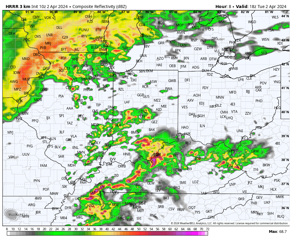
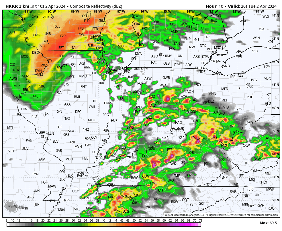
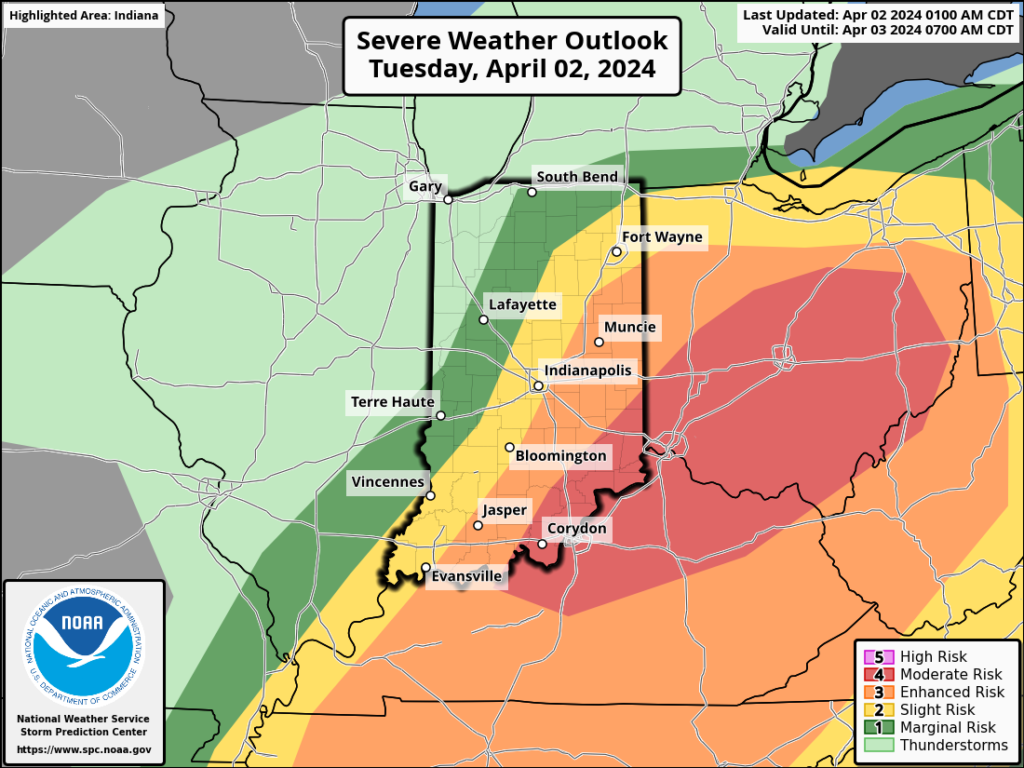
It’ll be important to remain weather-aware this afternoon as a final round of severe storms move through the state. Morning rain will come to an end soon and then we’ll see a “lull” in the action late morning. Upstream satellite images are concerning as it appears we’ll break into sunshine for a while late morning into early afternoon. This will quickly get to work on the atmosphere and aid in a turbulent time of things through the early and mid afternoon. In fact, as the Storm Prediction Center gets a look at the setup post-sunrise, it wouldn’t surprise us if each of the respective risk areas gets pulled back further west.

Regardless, storms will redevelop just after lunchtime across western Indiana and intensify on their journey east through the afternoon. By evening, most if not all of the activity will be out of the state.

All modes of severe weather will be possible area-wide today. We’re particularly worried about an elevated tornado outbreak across the Ohio Valley, especially if clearing takes hold for a while late morning. Take warnings seriously if and when they are issued, friends.

Forecast radar 1p
Forecast radar 3p

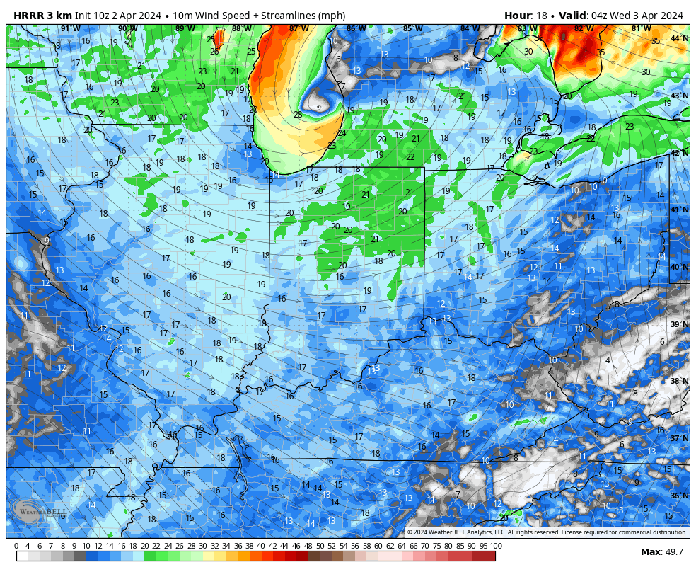
Strong westerly winds will take hold by evening, quickly pushing a colder and more stable airmass into town, thankfully.

Permanent link to this article: https://indywx.com/bumpy-ride-this-afternoon/