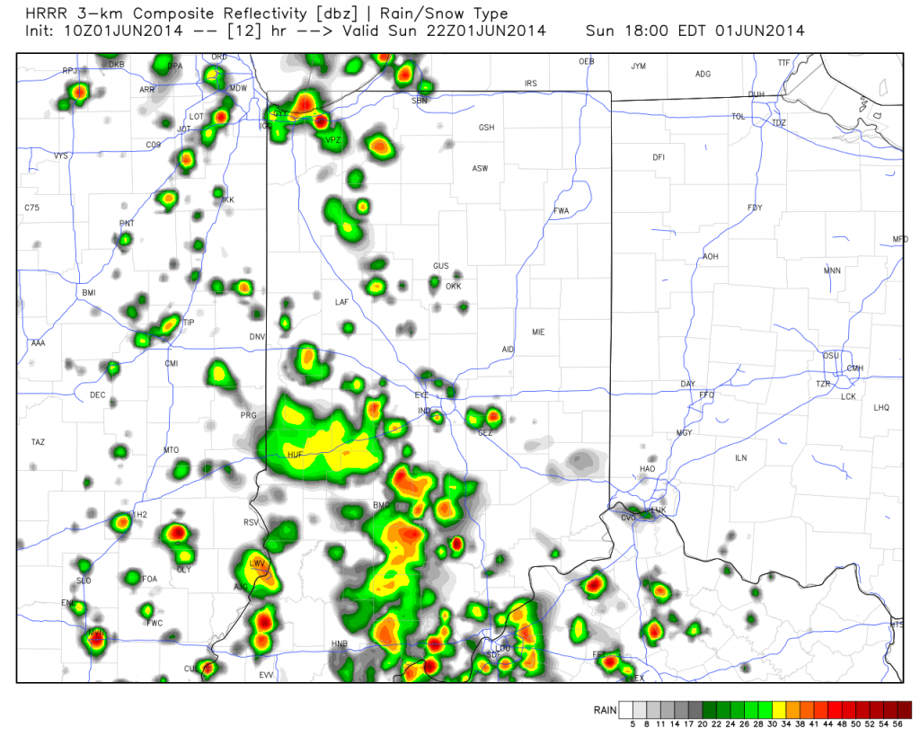
Many central Indiana neighborhoods picked up copious amounts of rainfall within a short time period this afternoon and evening. We received 2″ here at the IndyWx.com HQ within just under 90 minutes.

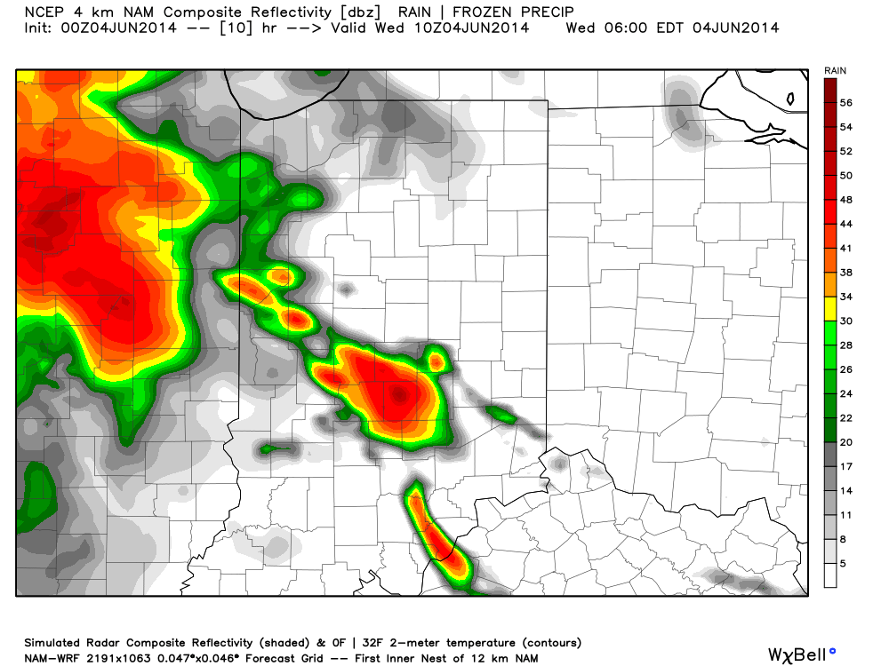
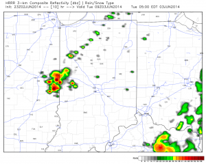
Forecast radar 5am Tue
The rest of the evening will feature a drier theme as the axis of slow moving, torrential, downpours presses east. That said, a couple of “rumblers” may be present during the early Tuesday morning period as a boundary slowly sinks south. We’re not talking about widespread heavy rain and storms, such as this evening, but a couple of thunderstorms may rumble across central Indiana early Tuesday morning before we dry things out and introduce sunshine for the majority of your Tuesday.
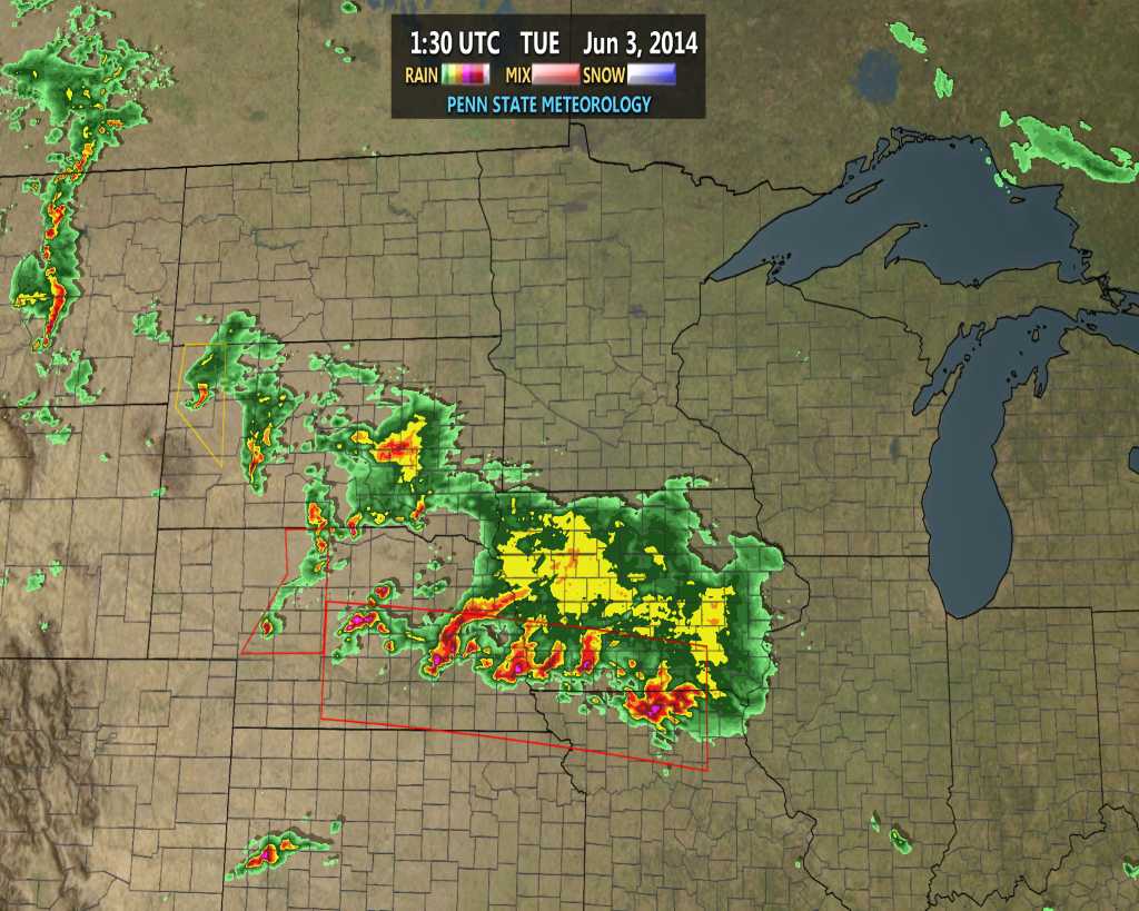
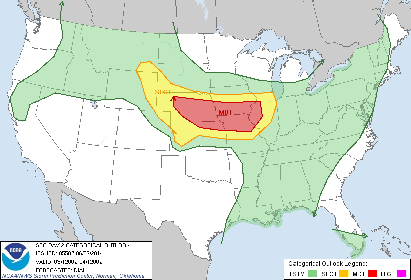
Our attention will then shift to another round of heavy rain and thunderstorms Wednesday. A severe weather outbreak will unfold to our northwest late Tuesday afternoon. While this severe weather episode is likely to begin with individual severe thunderstorms (including potentially tornadic super cells), the activity should eventually morph into a mesoscale convective complex (otherwise referred to as a MCC in the wonderful meteorological world) during the night Tuesday as the storms roll towards our neck of the woods.
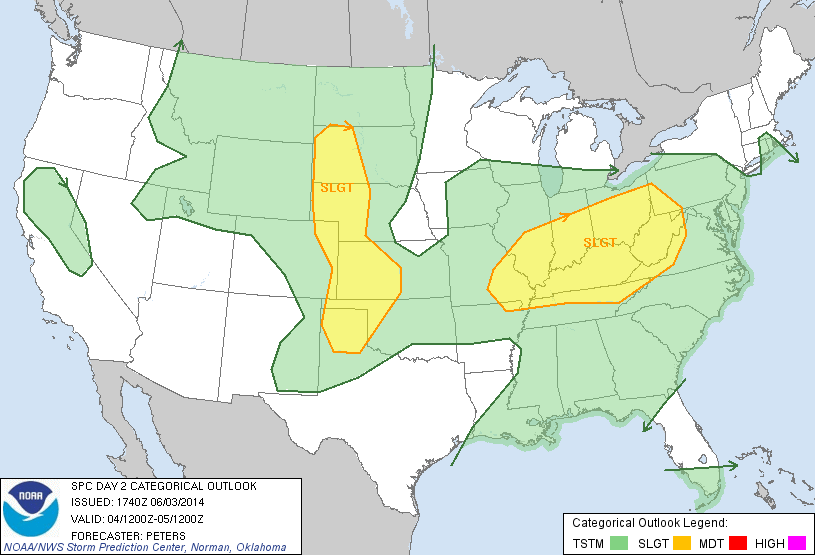
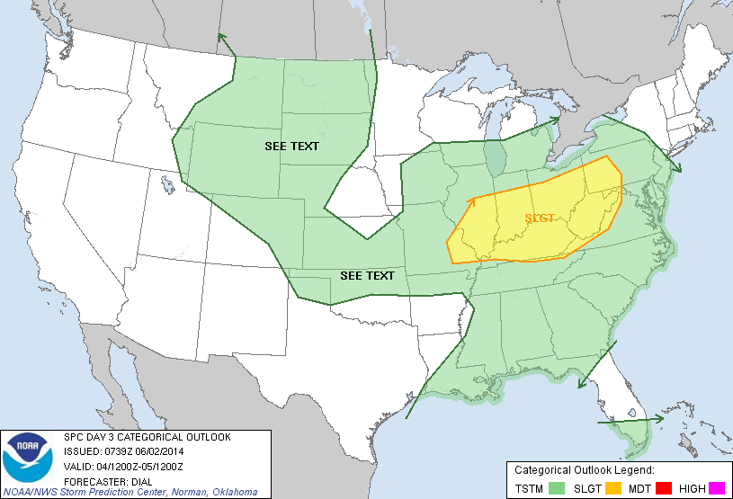
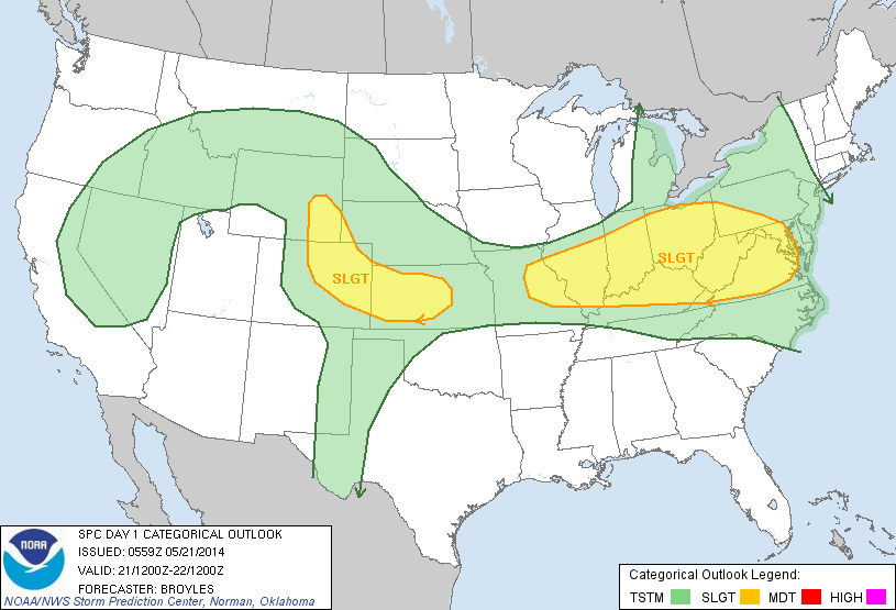
The Storm Prediction Center (SPC) highlights the region for a Slight Risk of severe weather Wednesday.

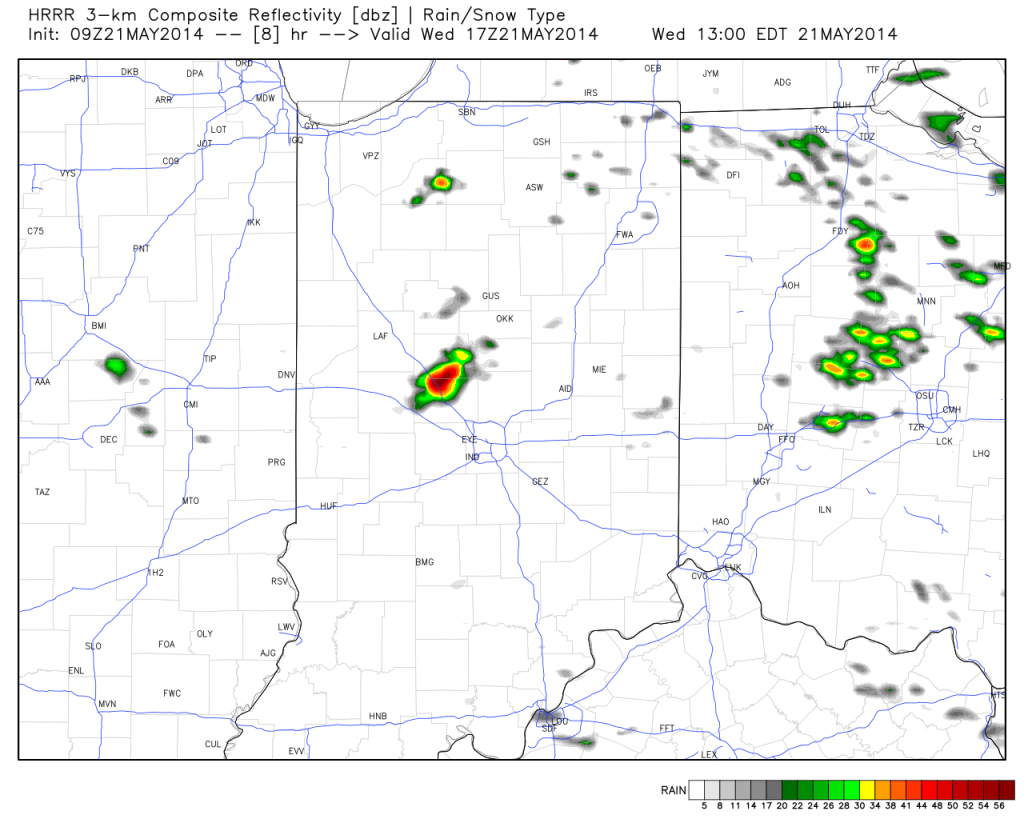
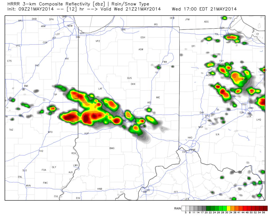
We want to stress that this particular severe weather episode is far from etched in stone. Diving into our short to mid term forecast models would suggest the initial round of heavy rain and thunderstorms rumble into the state around 4-6am Wednesday- potentially in a weakened state when compared to what our friends and neighbors off to our north and west will experience Tuesday night. Now it’s important that we insert the timing disclaimer to the equation as similar events in the past have been known to accelerate forward motion and arrive “ahead of schedule.” (We’ll keep a close eye on the timing side of things and update Tuesday).


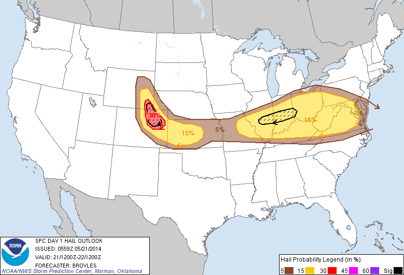
We’re confident we’ll be dealing with heavy rain around these parts Wednesday morning along with plenty of thunder and lightning. That said, there are many more questions than answers at the moment around whether or not severe levels will be reached, at least in our humble opinion. Should severe weather be an issue, it would most likely come from the following two impacts- damaging straight line winds and large hail. Again, we’re leaning more towards this initial round of showers and thunderstorms blowing into town in a weakening state.
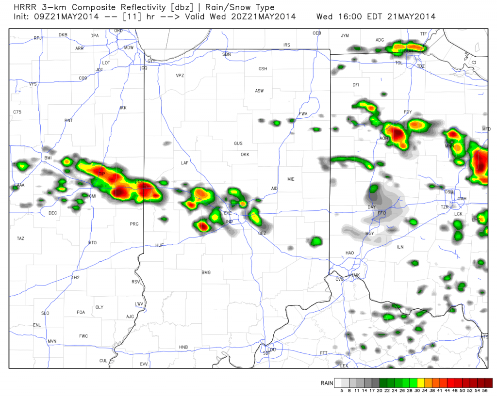
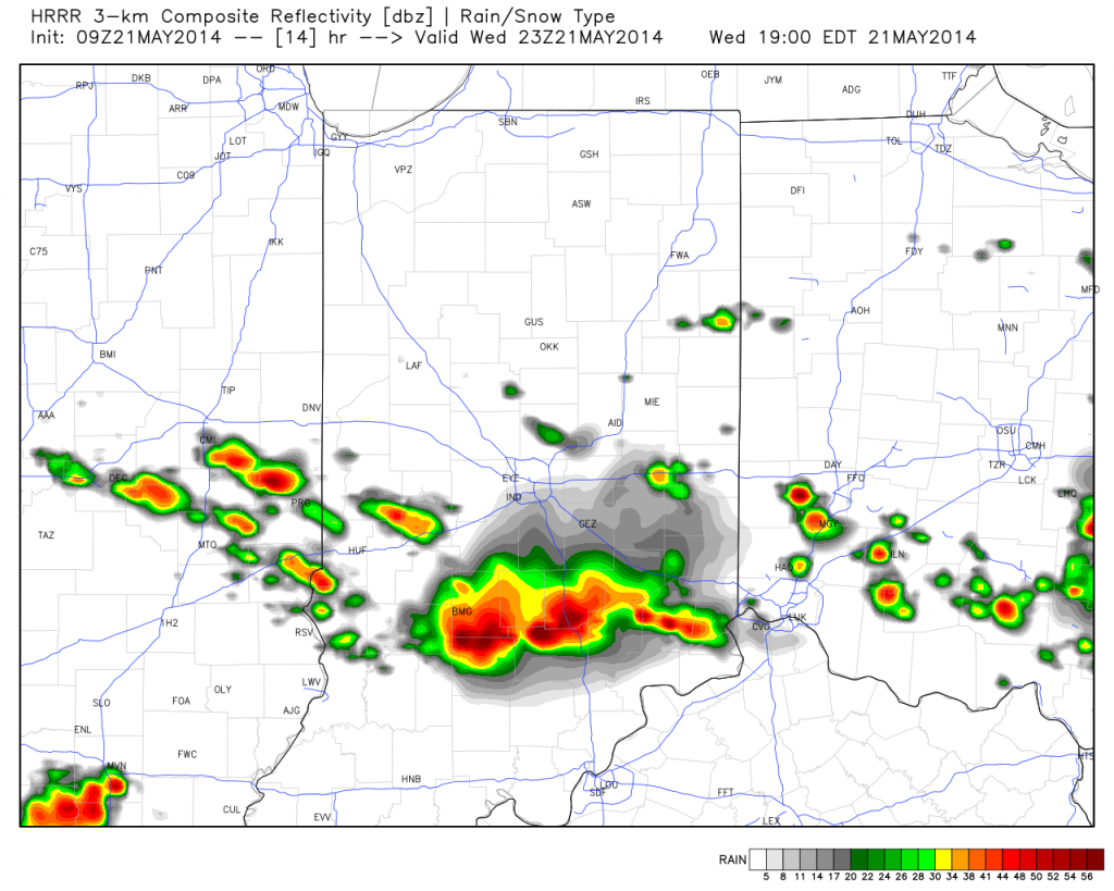
Finally, there will be one more opportunity for strong to severe thunderstorms Wednesday afternoon, but this will be fueled by just how quickly the local air mass can warm and destabilize. There are, again, questions around heating potential across the local area (central Indiana) and our thinking currently places a greater concern for damaging severe weather across southern Indiana into Kentucky (folks traveling to Louisville Wednesday afternoon would need to prepare for damaging severe potential). Should we recover quicker than currently expected from Wednesday morning’s convection then we would need to hit the severe threat harder across central Indiana Wednesday afternoon. Stay tuned for updates!

Storms will likely strengthen yet again Wednesday afternoon, especially across southern Indiana.


