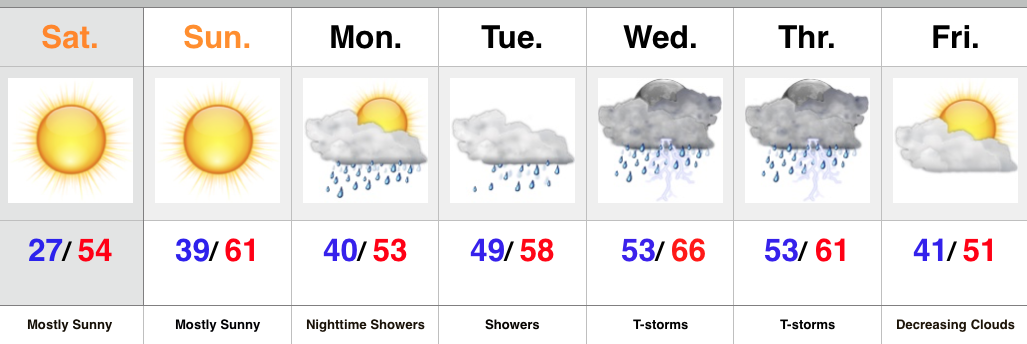
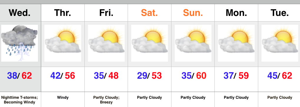
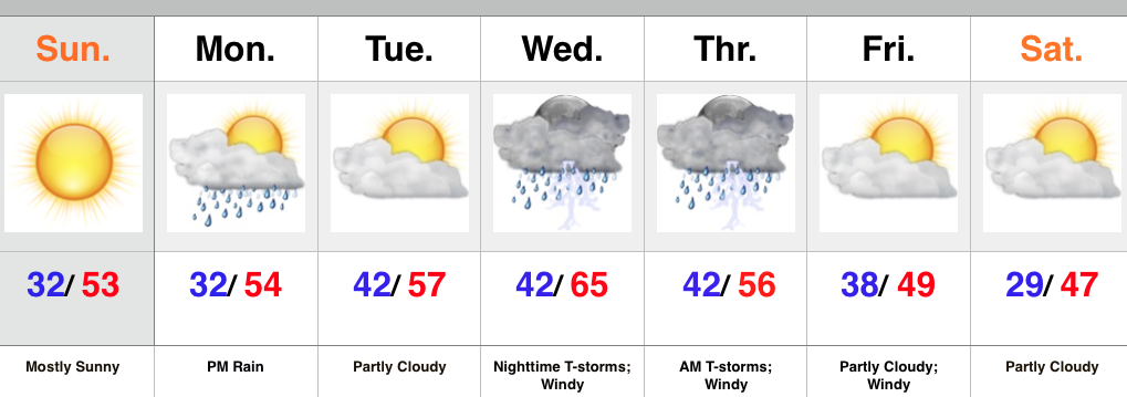
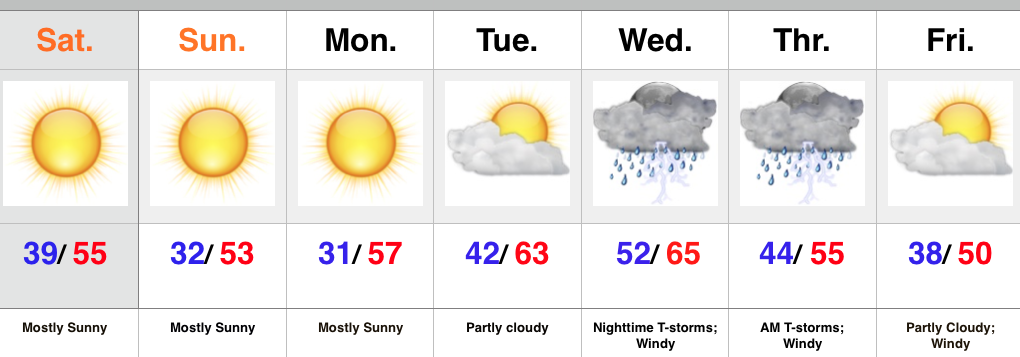
A very active weather day is in store for central IN. As we type this (6:30 am), temperatures are hovering around 60 degrees. Simply put, that’s hard to believe. We’re on our way to a record warm day, with highs in the middle 60s across central IN.
The main story, however, will be the severe weather our area may have to deal with in (2) waves this afternoon/ evening.
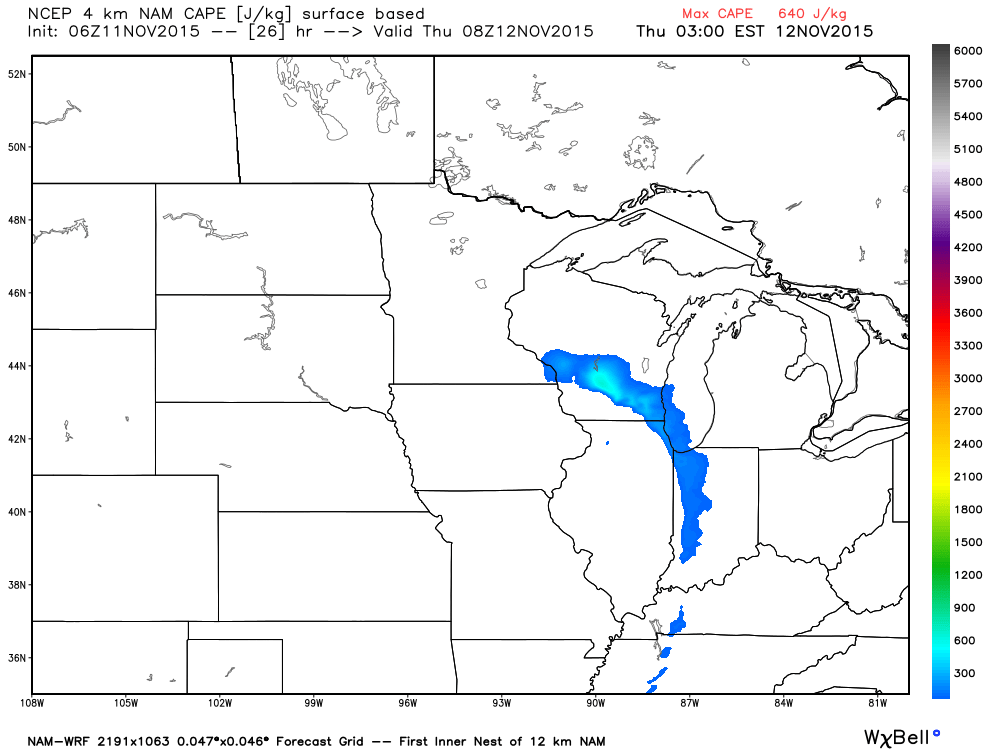
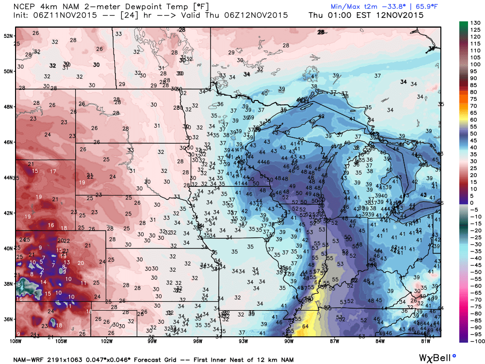
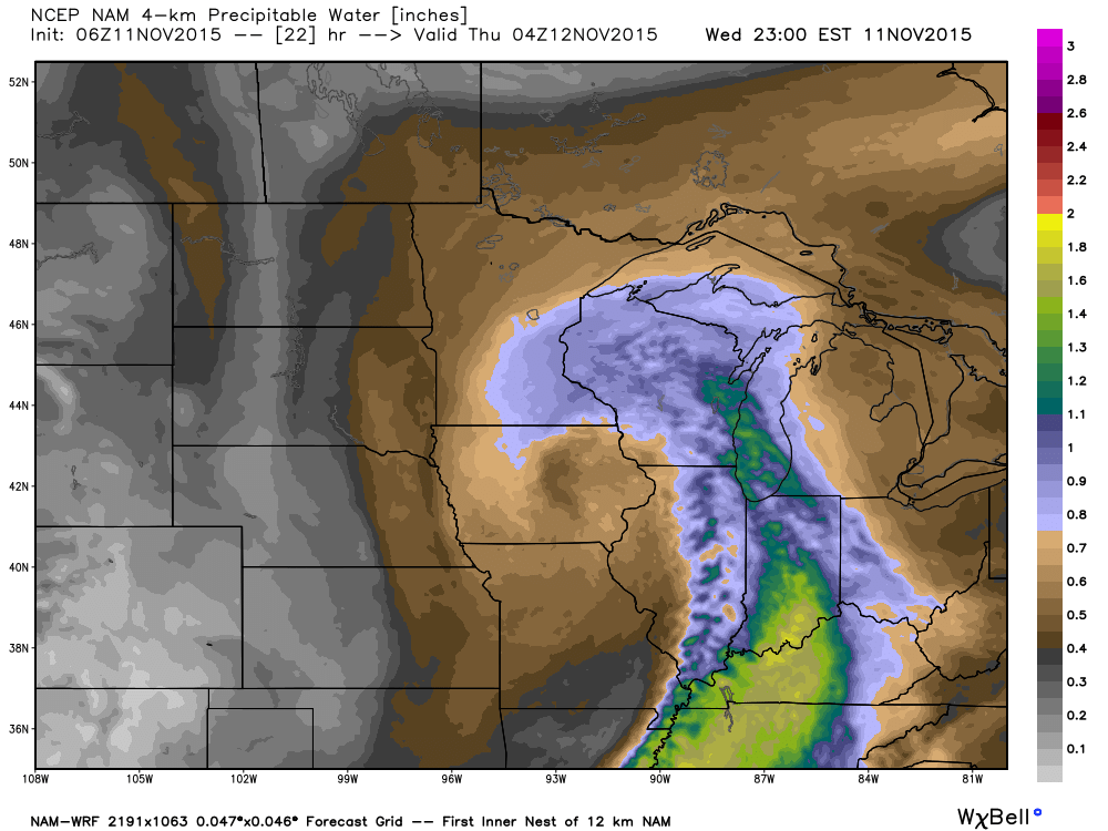
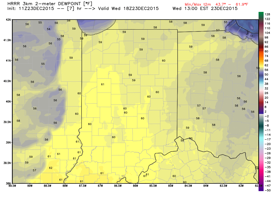
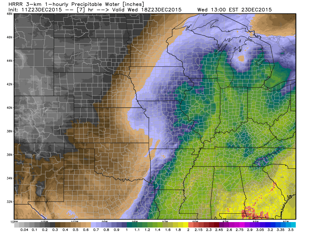
The Set-up: A short wave trough will eject out of the southern Plains into the Great Lakes region. A surface low and associated cold front will accompany this trough. Unseasonably warm and moist air will spread north this afternoon and evening, including surface dew points in the lower 60s. PWATs (precipitable water values) will exceed 1.25″.
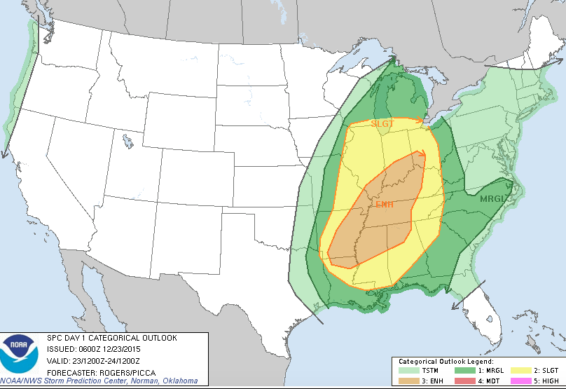
 The Storm Prediction Center has expanded the Slight Risk of severe for all of the state, including an Enhanced Risk across southern IN.
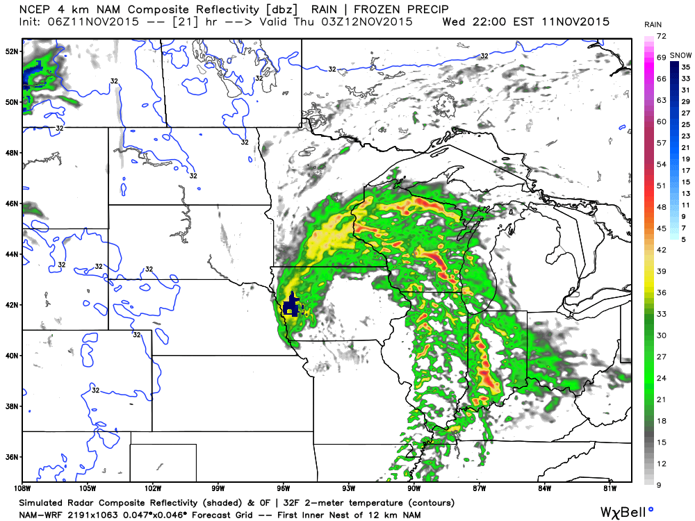
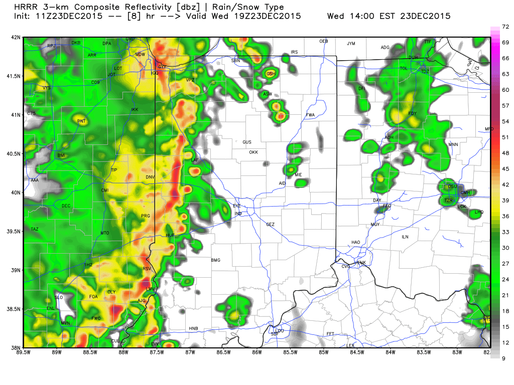
 Timing: We think potentially (2) waves of storms will rumble through the state today. The first likely comes during the early afternoon with a potential second line of storms blowing through the area in direct association with the cold front later this evening/ tonight. Admittedly, it’s tough to pin point the second potential wave of activity until we see what/ how the first round of storms impact the local air mass.
*As always, the forecast radar products we show should not be taken verbatim. These are used for guidance in building our forecast and provide a look at what the radar may look like during a given time frame.
2p forecast radar, courtesy of Weatherbell.com
 Impacts: We remain most concerned for the potential of damaging thunderstorm winds, but stress that we can’t rule out a quick spin-up tornado with this type set-up.
Most importantly, have a means of getting the latest weather information today, especially if you’re traveling. Set those weather radios to alert you of any watches or warnings that may come later today.
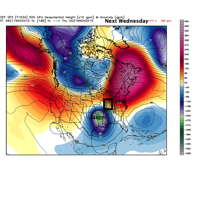
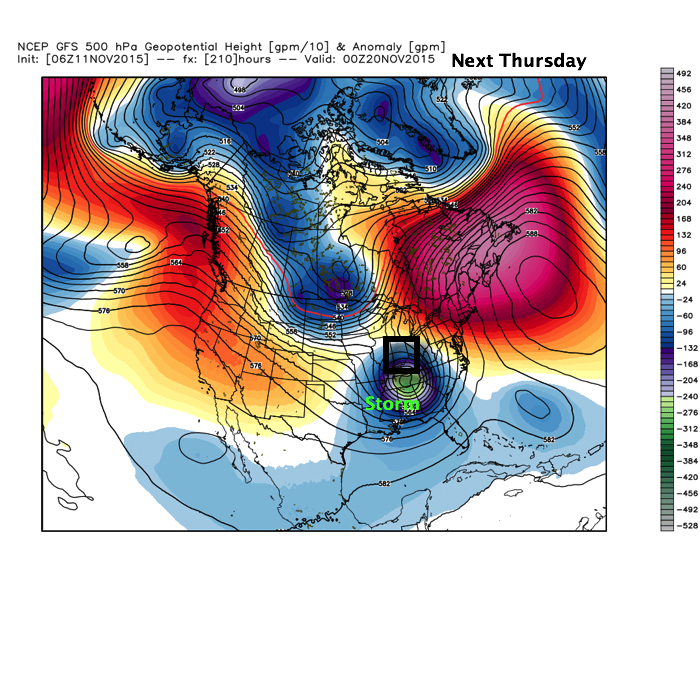
Looking ahead: We still forecast a significant rain event that will likely lead to flooding early next week. Model data remains very consistent on the potential of 4″-6″ of rain over the upcoming 7-day period. Afterwards, a blast of arctic air looks to invade to welcome in 2016. More on both of these events after we deal with today’s severe.