Nice Saturday Gives Way To A Wet And Stormy Sunday…
Updated 06.10.23 @ 7:14a
Today is easy. Despite some lingering haze, sunshine will be with us for the better part of the day along with unseasonably pleasant humidity levels. Highs will top out in the middle 80s for most of central Indiana.
Things begin to change overnight as moisture levels rise. For instance, about the time most head off to bed, dew points will still be quite low for this time of year (low 50s), but as we head through the morning and on into the afternoon Sunday, dew points will rise into the muggy 60s. This is all thanks to a surface area of low pressure and associated cold front. These 2 features will deliver the best opportunity for a widespread, soaking rain we’ve seen around these parts in close to 2 months.
We think rain showers early Sunday morning congeal into a more widespread, area-wide rain with embedded thunder late morning into the afternoon and evening hours.
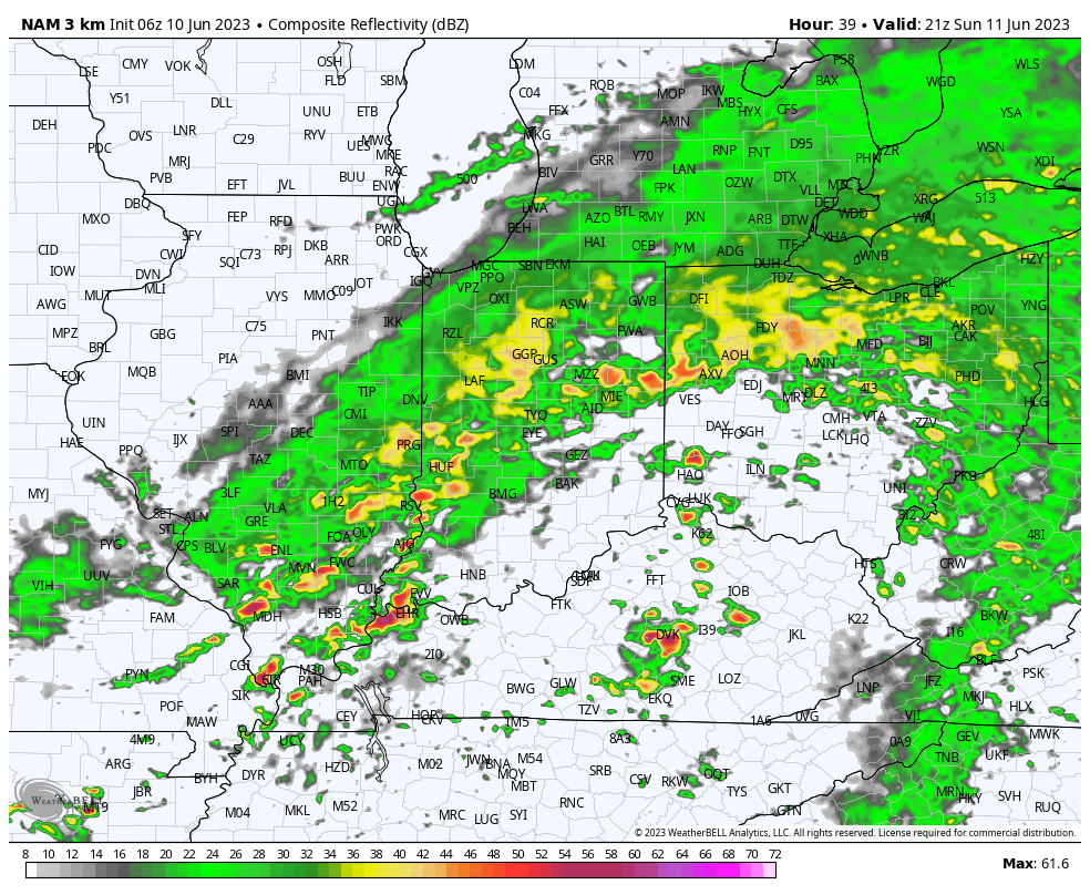
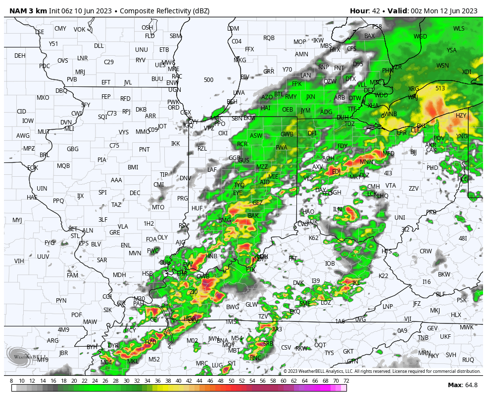
There will also be an opportunity of some stronger storms downstate during this time period.

Rain will end from west to east late Sunday evening into the overnight hours and we’ll be left with an unseasonably cool but dry Monday. By that point, most area rain gauges can expect to pick up between 0.50″ and 1.00″ of badly needed rain, but there will be a few “winners” with amounts well in excess of 1″. Despite the timing of this occurring during the weekend, I don’t suspect we’ll hear many complaints…

More on the week ahead a bit later today in our updated client video discussion.