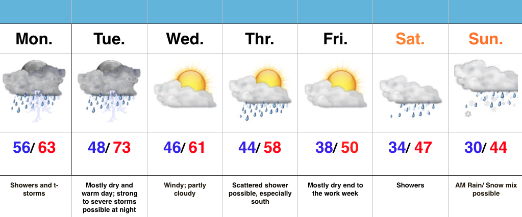
 Highlights:
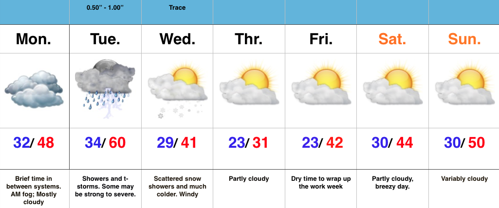
- Rainy open to the week
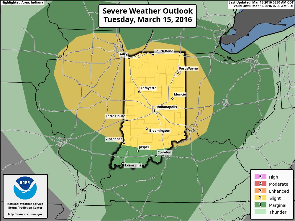
- Severe storms possible Tuesday night
- Active pattern continues this week
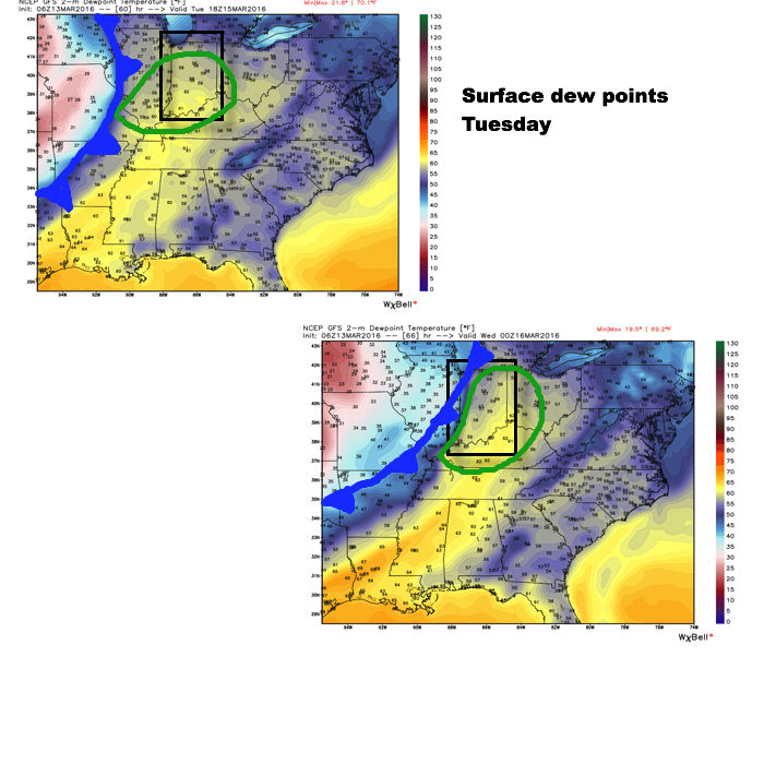
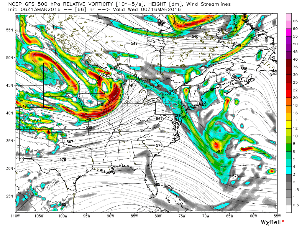
Rainy Monday; Severe Storms Possible Tuesday…A disturbance is helping push showers and thunderstorms north into central IN to open the work week. Most of the rain and embedded thunderstorms will fall during the morning into the afternoon hours before drier air works in here tonight. That will set us up for a mostly dry, breezy, and warm Tuesday, but all attention will be on Tuesday night. We still think thunderstorms that ignite in IL Tuesday afternoon will race eastward and impact Indiana Tuesday night. More specifically, we’re bracketing the hours of 8p-2a for severe prospects locally. All modes of severe weather are in play, particularly damaging winds and hail. Stay tuned.
As we progress into the second half of the week, things remain rather busy. A couple weak disturbances could offer up Thursday showers (especially south). The evolution of things this weekend is still very much up in the air, but for now we’ll go with increasing clouds Saturday giving way to showers. As colder air gets involved with this storm system, precipitation may mix or end as wet snow Sunday.
7-Day Precipitation Forecast:
- Snowfall: Trace
- Rainfall: 1.25″ – 1.75″ (locally heavier totals)