 Highlights:
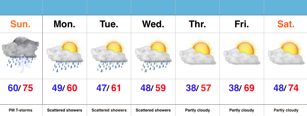
- Strong storms develop this evening
- Scattered showers through mid week
- Unseasonably cool open to May
Watching For Evening Storm Development…The morning has gotten off to a beautiful start across central IN, but the sunshine will likely be enough to help destabilize things just enough to assist in afternoon/ evening thunderstorm development. Additionally, a frontal boundary remains draped across the state and we’ll await a wave of low pressure to move along the front this evening. A few strong to severe thunderstorms will be possible with large hail and damaging straight line winds the biggest concerns. We’ll keep an eye on the radar later today.
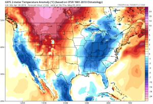
We’ll flip the page and turn much cooler for the upcoming week. Reinforcing cool air will be accompanied by showers at times through the mid week period, but we should turn drier late week (and eventually warmer).
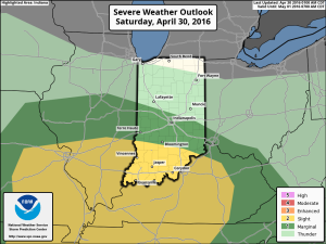
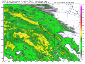 After a break in the rain, we’ll have to keep an eye on the potential of strong to severe storms developing this afternoon and evening (especially across southern IN). Hail and damaging winds are of greatest concern with storms that develop, but a tornado is also possible.
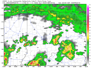
 Another round of scattered thunderstorms will rumble across the state Sunday.
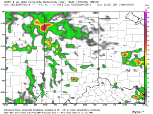 Widespread weekend rainfall totals should fall in the 1″-1.5″ range for most, but there will also be some locally heavier totals.
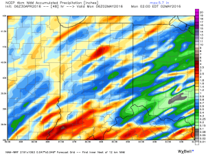 As we progress into the upcoming week, cool air will be the big weather story. Perhaps the coolest days will be next Thursday-Friday (lows in the 30s and highs in the 50s).