
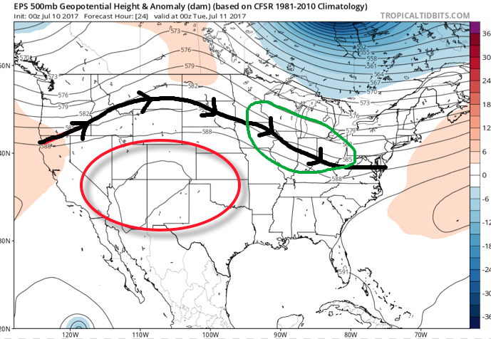
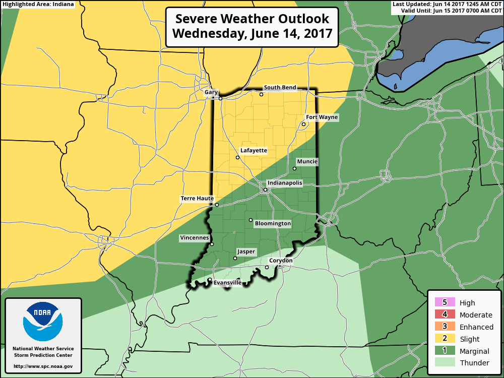
The overall set-up this week will include a northwest flow aloft with multiple disturbances riding southeast out of the upper Mid West into the Ohio Valley. Each disturbance will aid in helping ignite more widespread rain and thunderstorms. The first couple waves of rain and thunderstorms look to impact central Indiana late morning into the early afternoon before the potential of additional thunderstorms late evening into the overnight. Some of the storms may become severe, including damaging winds.
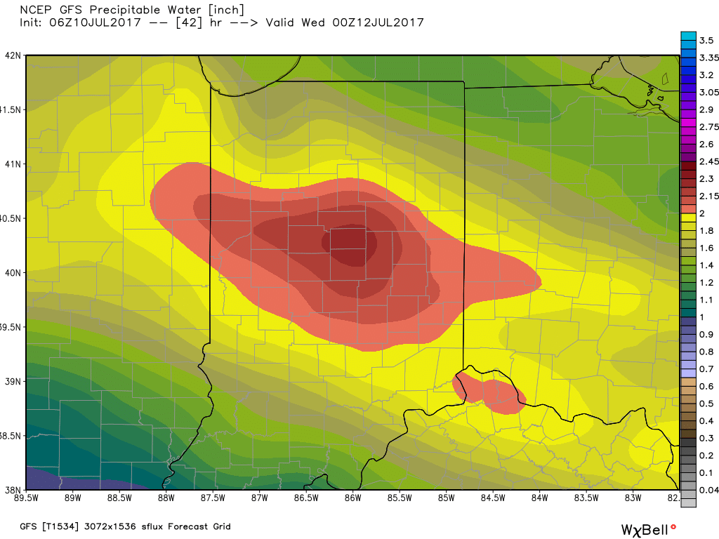
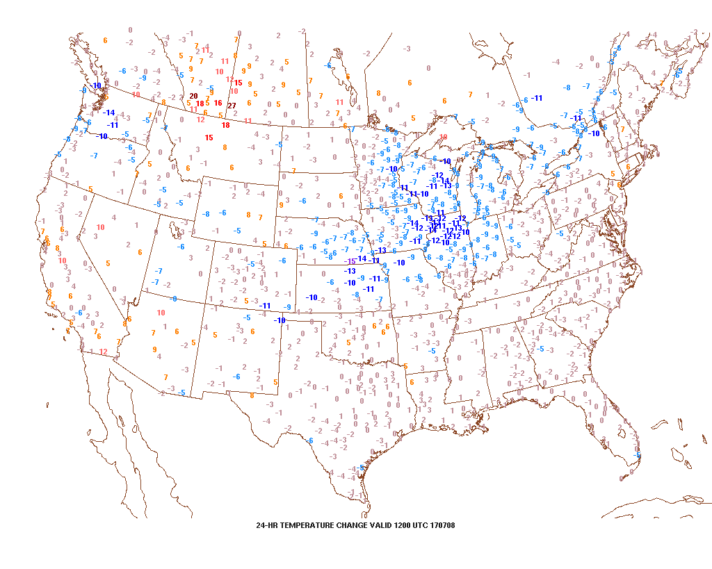
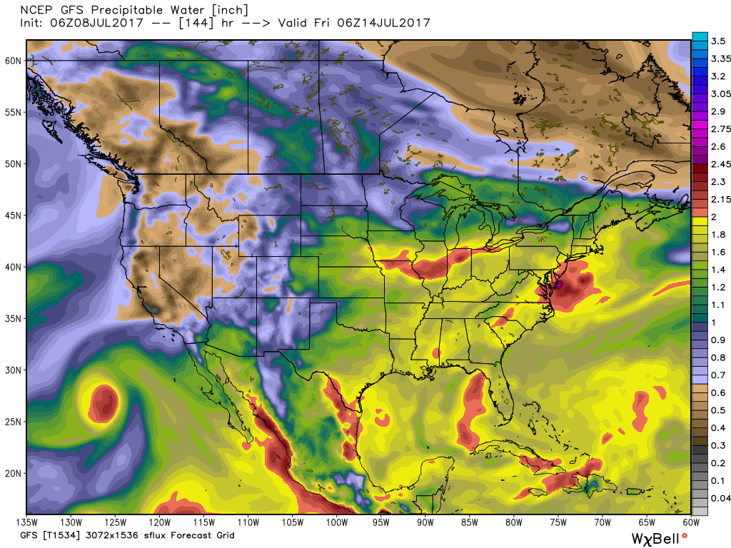
 A quick step outside this morning will tell the story on just how different it feels. Gone is the refreshing air mass we enjoyed over the weekend and in return we’ve transitioned to an oppressive, tropical feel. Dew points will remain in the 70s through the majority of the work week and precipitable water values will reach 2″+ at times. With such a moisture laden air mass in place, flash flooding will likely result for some communities as the storms continue to track over the same areas this week.
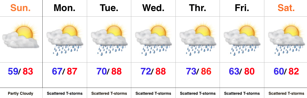
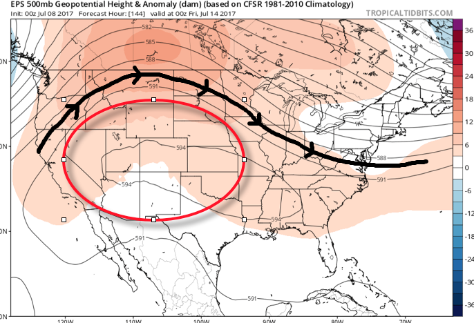
 Additional waves of thunderstorms will impact the region through mid-and-late week before we advect some drier air into the state Friday evening into the weekend. Despite the lower dew points and cooler air, we still can’t rule out a shower or thunderstorm this weekend as a secondary front settles south.
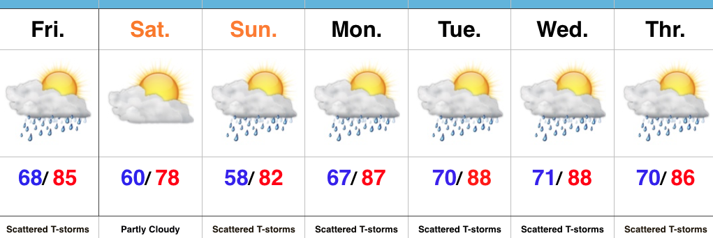
When we total things up in the rainfall department through Saturday, widespread 2″-3″ can be expected, however, as mentioned, where storms “train,” much higher totals of 3″-6″+ will be a good bet.
 Highlights:
 Highlights:
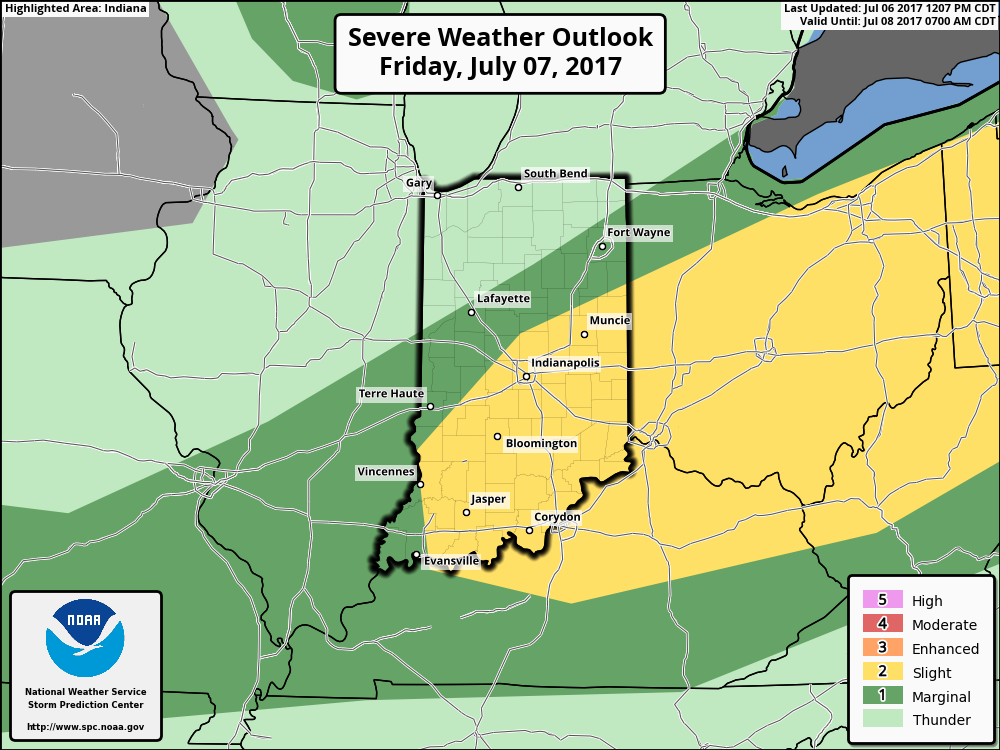
 II: A weak upper level disturbance will drift overhead Monday afternoon and help spark scattered showers and thunderstorms into the evening hours. Not everyone will get wet Monday evening, but a couple gusty storms are possible. Here’s a look at the radar valid at 6p Monday.
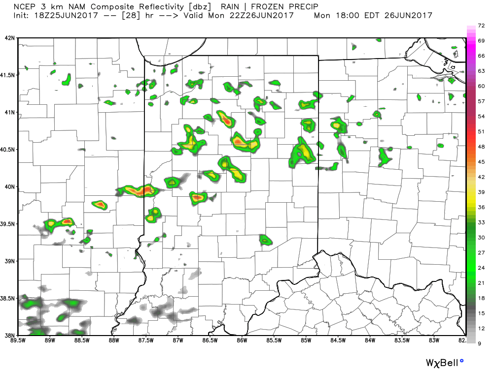 III. After a dry Tuesday and Wednesday, better shower and thunderstorm chances will return to our forecast for late week into next weekend. Additionally, temperatures and humidity levels will return to closer to seasonal norms.
 IV. An active pattern will remain with us as we progress through the first half of June. A busy NW flow aloft will likely send multiple storm clusters southeast into the region and we’ll have to be mindful for the potential of some of these storm complexes containing strong-to-severe storms and excessive rainfall.
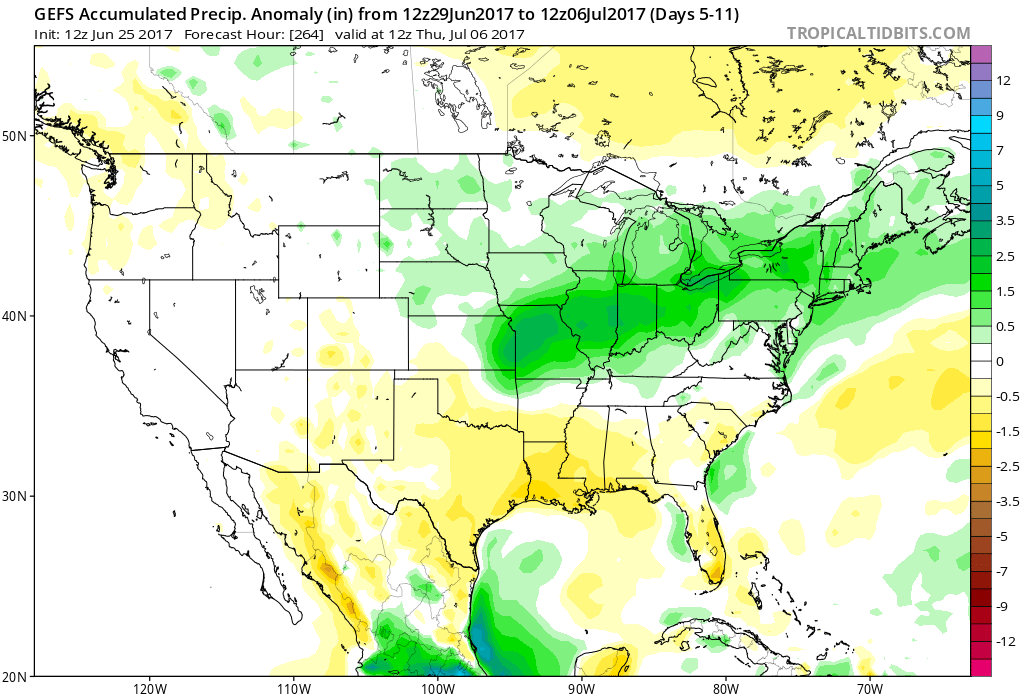
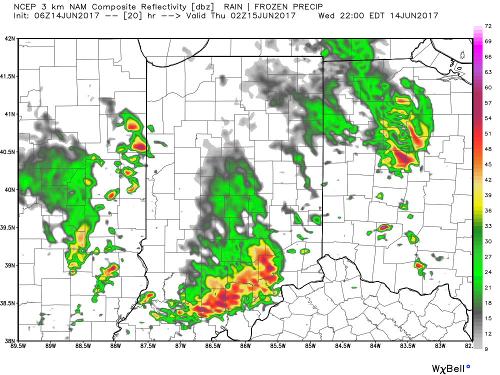
 Similar to Tuesday, any storms that develop will be capable of locally heavy rain and flash flooding. While storms should move in a quicker fashion today, precipitable water values (PWATs) remain downright tropical and will exceed 2″ later this afternoon.
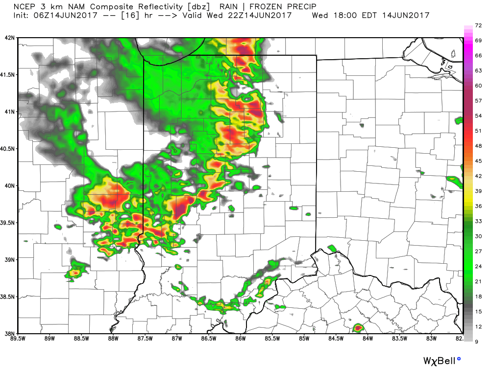
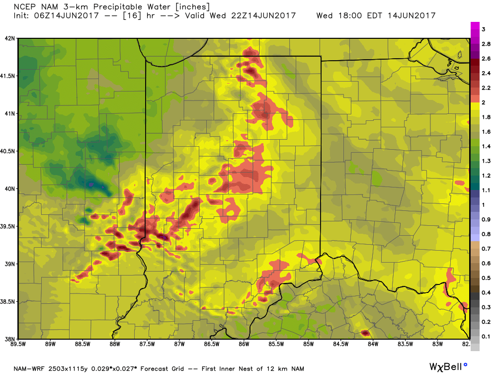 Overall storm coverage should become more widespread as we push into the afternoon and evening hours. Here’s what the radar may look like during the 4p, 6p, and 10p time frames:
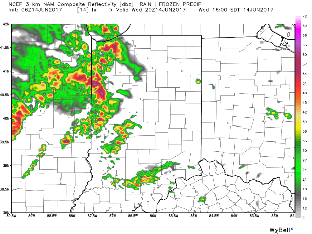
 From a severe perspective, the biggest concern is damaging straight line winds with stronger storms. Remain weather-aware later today, friends!
 Despite having to dodge a couple rounds of gusty storms this weekend, we want to stress that the majority of the holiday weekend should feature rain-free hours, and certainly isn’t worth cancelling any outdoor plans. In fact, after a beautiful Carb Day, most of the daytime hours both Saturday and Sunday should be rain and storm free. Have a means of getting the latest weather information, but plan to enjoy long stretches of rain-free hours this weekend.