
You must be logged in to view this content. Click Here to become a member of IndyWX.com for full access. Already a member of IndyWx.com All-Access? Log-in here.
Category: Severe Weather
Permanent link to this article: https://indywx.com/2018/05/09/video-late-evening-update-on-storms-looking-ahead-into-next-week/
May 09
Timing Out Storm Chances Tonight…
We continue to monitor things closely for the potential of strong to severe thunderstorms this evening into tonight. As of this morning, we still believe greatest threats of severe weather…
You must be logged in to view this content. Click Here to become a member of IndyWX.com for full access. Already a member of IndyWx.com All-Access? Log-in here.
Permanent link to this article: https://indywx.com/2018/05/09/timing-out-storm-chances-tonight/
May 08
Attention Shifts To Wednesday Evening…
The Storm Prediction Center has expanded the Slight Risk of severe to encompass more of central Indiana as of the latest update:
 Concern is on the increase for the potential of strong to severe thunderstorms to impact central parts of the state Wednesday evening and night. That said, there are questions with how quickly the atmosphere will be able to recover from morning cloudiness and scattered thundershowers.
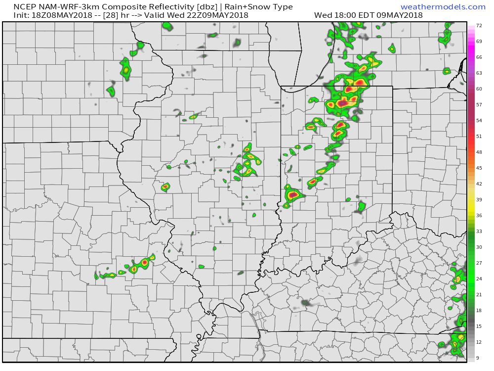
Forecast radar shows scattered showers and embedded thunder scooting through the state Wednesday morning, especially between the hours of 9a and noon.
 Current thinking leans towards a brightening sky through the mid and late afternoon hours which will help destabilize things for potentially a “more significant” event Wednesday evening and night (bracketing the hours of 6p to midnight from west to east).
We note the latest high resolution forecast radar guidance shows rather explosive development as we near the 6 o’clock hour.
 Storms are expected to exit off to the east by midnight:
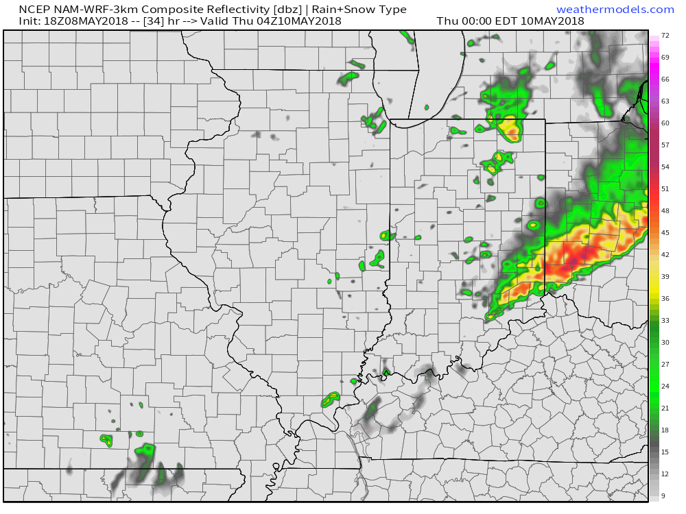 The primary concern that severe thunderstorms may deal central Indiana lies around damaging straight line winds and large hail, however, it should also be noted current parameters also suggest a couple of storms could spawn a tornado.
Bottom line, it’ll be important to keep close tabs on tomorrow’s forecast updates and ensure you have a means of receiving the latest information around watches and warnings that will likely come.
Permanent link to this article: https://indywx.com/2018/05/08/attention-shifts-to-wednesday-evening/
May 03
VIDEO: Short-Term Update On Storms Moving In & Looking At The Weekend…
You must be logged in to view this content. Click Here to become a member of IndyWX.com for full access. Already a member of IndyWx.com All-Access? Log-in here.
Permanent link to this article: https://indywx.com/2018/05/03/video-short-term-update-on-storms-moving-in-looking-at-the-weekend/
May 01
VIDEO: Summer-like Feel Wednesday Helps Fuel Storm Chances; Longer Range Thoughts…
For the first time this spring, you’ll really notice the muggy nature to the air by Wednesday afternoon, as dew points climb from the pleasant 50s (Wednesday morning) to near…
You must be logged in to view this content. Click Here to become a member of IndyWX.com for full access. Already a member of IndyWx.com All-Access? Log-in here.
Permanent link to this article: https://indywx.com/2018/05/01/video-summer-like-feel-wednesday-helps-fuel-storm-chances-longer-range-thoughts/
Apr 14
Week Ahead: Cool Continues To Dominate…
A significant spring storm system will continue to grab headlines through the short-term. In addition to a raging blizzard across the northern tier into the Great Lakes, severe weather will be an issue across the deep South today. Here on the home front, morning rain will give way to drier conditions for the afternoon and evening hours only to return yet again tonight and into Sunday morning.
 At times, rain will fall at a moderate to heavy intensity tonight into Sunday, especially across the eastern half of the state. Additional rainfall totals of 1″ to 2″ can be expected in and around the city, itself, and points east.
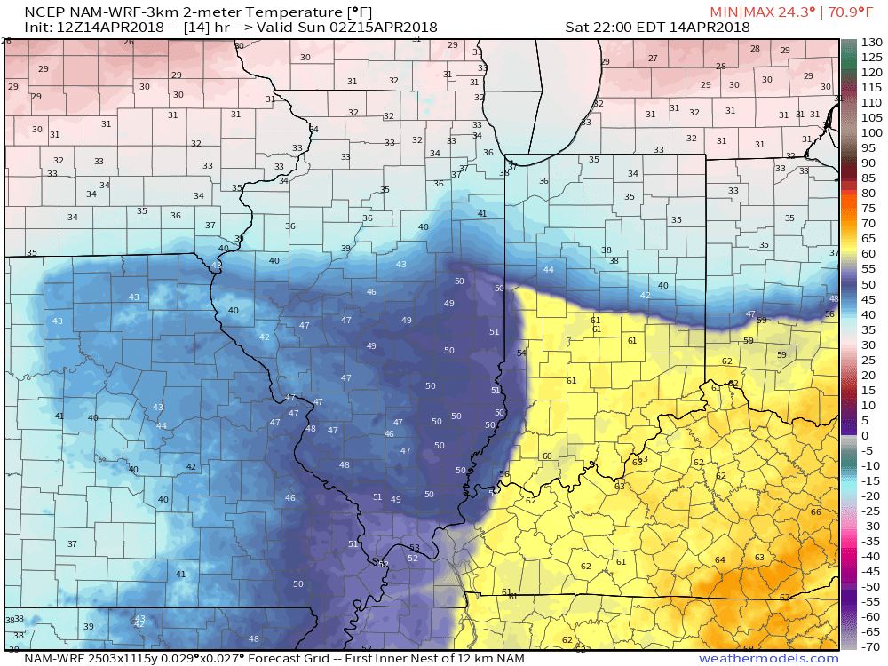
 The other item of interest tonight will be the tight temperature gradient across the state. Don’t be surprised by perhaps as much of a 30° spread from north to central parts of the state this evening as the “backdoor” cold front begins to drop south. You’ll certainly notice once the front passes.
 Eventually, cold will overwhelm and the second half of the weekend will wrap up on a downright “raw” note. As precipitation wraps around the area of low pressure Sunday night and Monday, it’ll fall as snow here. In fact, snowfall intensity is likely to be great enough to put down a coating in spots Monday morning across central Indiana.
 Drier weather returns Tuesday before a weak weather system deliver gusty winds and a possible shower Wednesday (not a big deal). The majority of the upcoming week will run well below average- highlighted by the coldest day on Monday and reinforcing chill Thursday and Friday.
 Our next storm system of significance will be slated for an arrival next weekend. While we’ll have to fine tune timing as we get closer, plan on increasing rain chances as the day progresses next Saturday.
Permanent link to this article: https://indywx.com/2018/04/14/week-ahead-cool-continues-to-dominate/
Apr 03
VIDEO: One Day Of Spring Before We Go Back To Winter…
You must be logged in to view this content. Click Here to become a member of IndyWX.com for full access. Already a member of IndyWx.com All-Access? Log-in here.
Permanent link to this article: https://indywx.com/2018/04/03/video-one-day-of-spring-before-we-go-back-to-winter/
Apr 02
Another Busy Week…
I. On the heels of a record-setting Easter snow event, attention will turn to showers (by this evening) and even the potential of gusty thunderstorms (Tuesday).
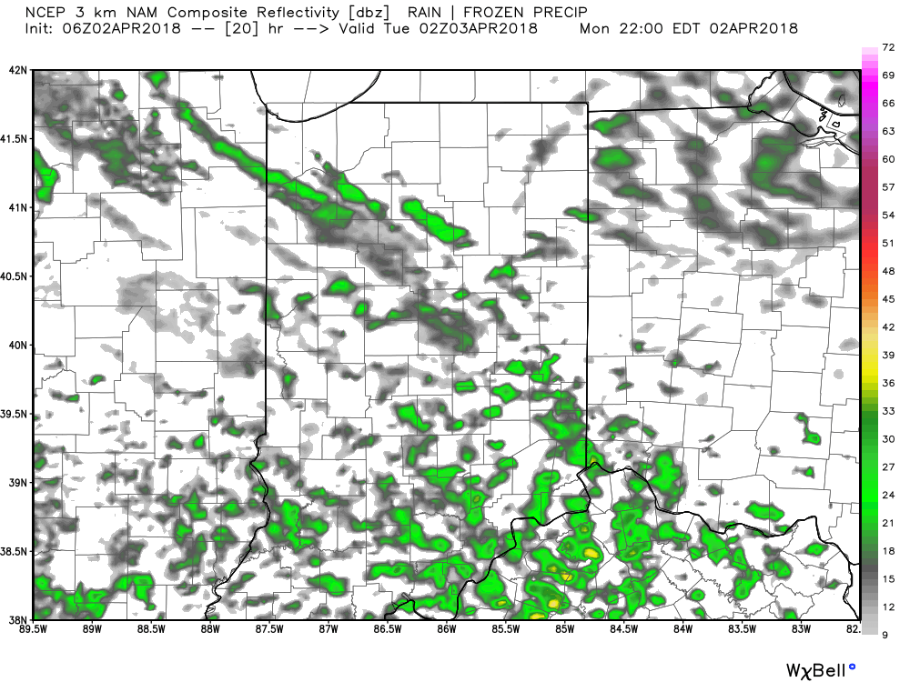
Forecast radar 10p.
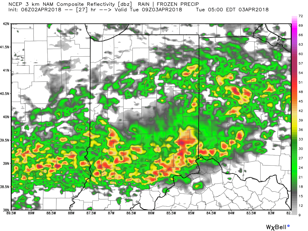
Forecast radar 5a Tuesday.
Best chance of the possibility of a strong to severe thunderstorm will lie within the southern half of the state, primarily south of the I-70 corridor. Greatest threats are large hail and damaging straight line winds.
All of us stand the chance of a thunderstorm as the cold front sweeps through the state Tuesday night.
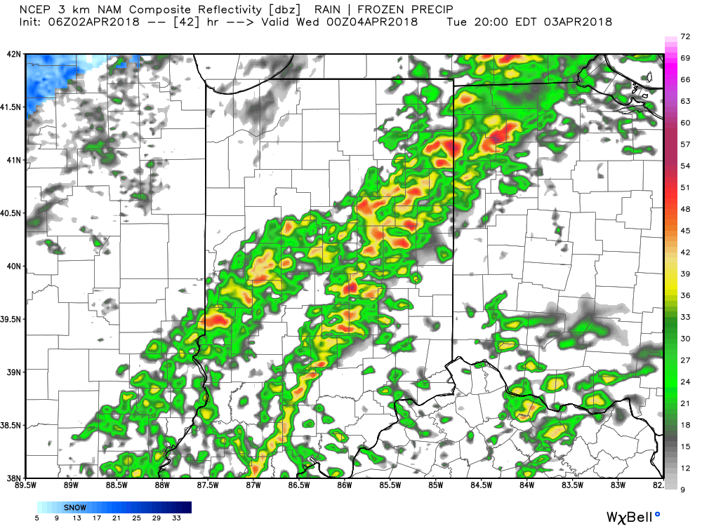
Forecast radar 8p Tuesday.
II. Much colder air will rush back into Indiana Tuesday night and the air will grow cold enough to allow lingering precipitation to transition to snow showers Wednesday morning. Don’t expect any accumulation this go around.
 III. Our next focus is on the prospects of late week/ weekend snow. Models will continue to struggle with the finite details over the next few days. I’m not so sure the suppressed look displayed currently is the correct one. Let’s remember, this time last week models were taking our Easter storm well to our south. We’ll keep a close eye on things over the next few days.
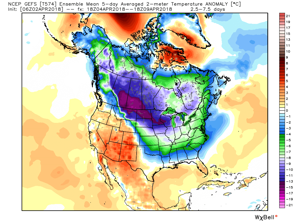
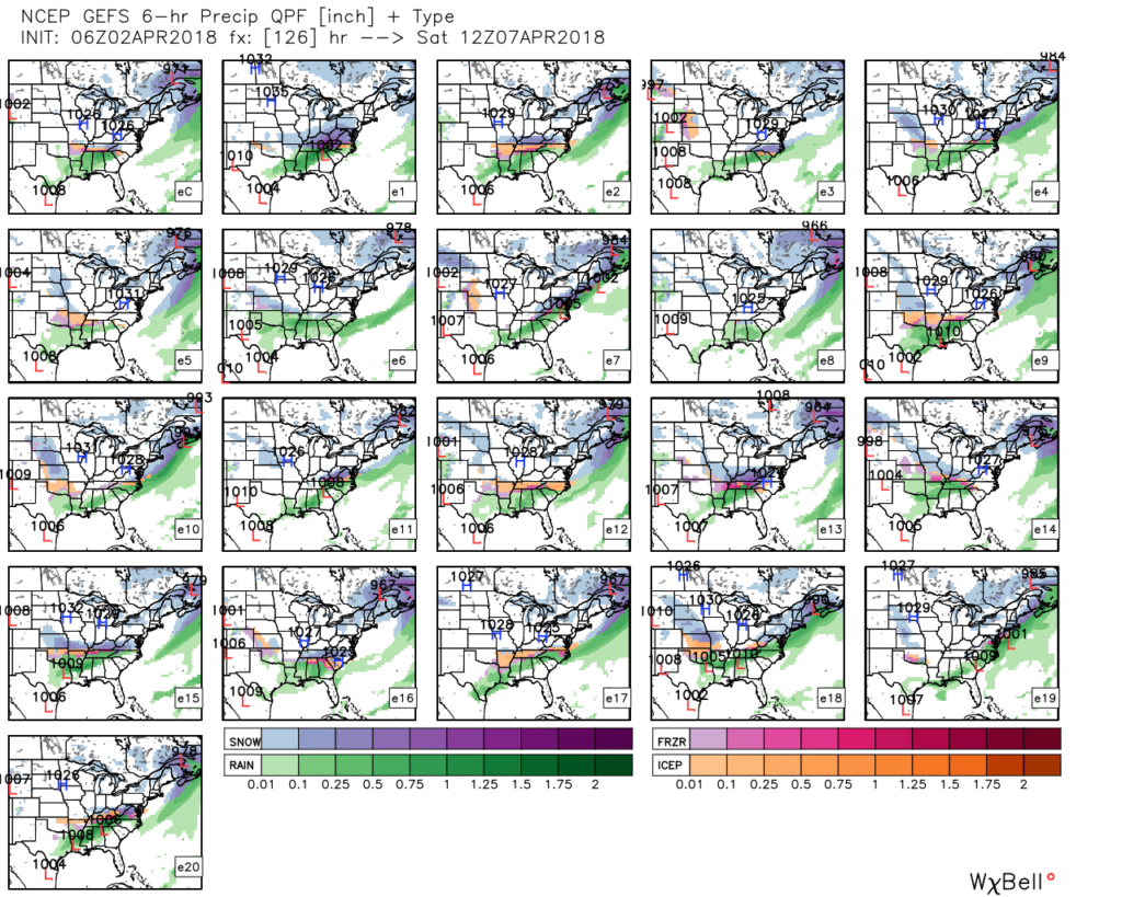 IV. Regardless of whether we get additional snow down or not, a first-class late season arctic blast will drill south this weekend. This will be cold enough to keep temperatures in the 30s for highs Friday and Saturday. Brutal stuff for early-April when average highs are around 60…
Permanent link to this article: https://indywx.com/2018/04/02/another-busy-week/
Mar 18
Brilliant Close To The Weekend; Wet Snow Thump For Some Early Week…
Though we were greeted with a cold and frosty start to our Sunday, high pressure will supply plentiful sunshine as we wrap up the St. Patrick’s Day weekend. Find a patio this afternoon that’s showing the Madness and soak up that Vitamin D. The increasingly powerful March sun angle will help boost temperatures into the middle to upper 50s for most of central Indiana.
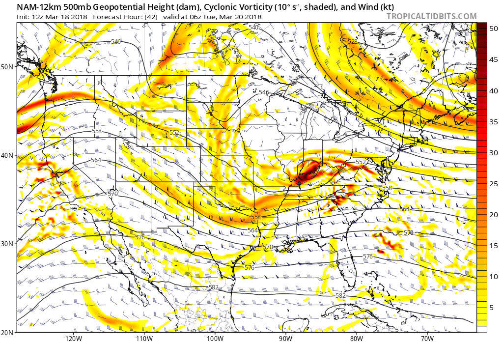
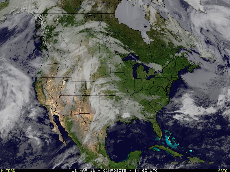 Things will begin to change as we open up a new work week. Surface low pressure will track out of the central Plains into the lower Ohio Valley Monday into Tuesday. This will spread moisture into the southern half of the state Monday evening. With air just cold enough, precipitation will mix with and perhaps change to a wintry mix of sleet and wet snow along the northern periphery of the precipitation overnight into Tuesday morning.
 March snow events can offer “surprises” and we’ll need to keep a close eye on the precise details pertaining to the track of the upper low Monday night into Tuesday. Under and just north of these little bundles of energy can often times be the spot for a wet snow “thump” this time of year. For now, it appears areas from southern IN into Ohio may be the sweet spot for a late season accumulating snow event.
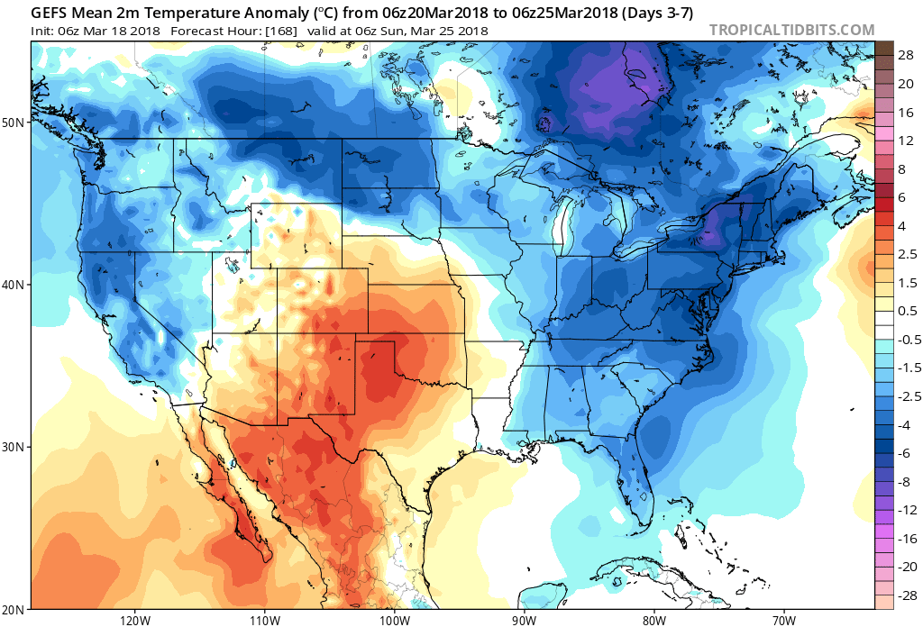
 The mid week stretch should be showcased by dry, but unseasonably chilly conditions. Lows in the 20s and highs in the 40s aren’t what many Hoosiers on Spring Break want to deal with…
 Our next item of significance arrives Friday as a warm front lifts northeast through the Ohio Valley. This will result in a wet close to the work week.
 Looking ahead, the weather pattern sure looks active to wrap up March and open April, including above average precipitation and potentially an “uptick” in severe weather episodes…

Permanent link to this article: https://indywx.com/2018/03/18/brilliant-close-to-the-weekend-wet-snow-thump-for-some-early-week/
Mar 14
Only The Messenger…
While we continue to believe more of a wholesale pattern change awaits early-mid April, we still have a long way to go before we can shake the overall wintry pattern. When the pattern does flip, the potential is certainly there (as alluded to last weekend) for a rather “turbulent” time, including an uptick on the severe front.
Before we get to April, we still have a prolonged period of overall colder than normal conditions to deal with. We don’t have any changes to the idea the northern Plains are ground-zero for coldest anomalies, but, it’ll also be plenty chilly, locally, as well.
 A couple of storm systems continue to have our attention over the upcoming week:
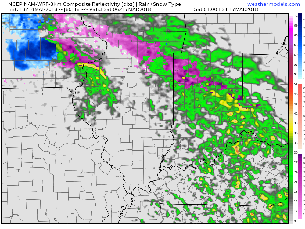
Potential of freezing rain, especially across the northern half and northeastern parts of the state Friday night into the morning hours Saturday.
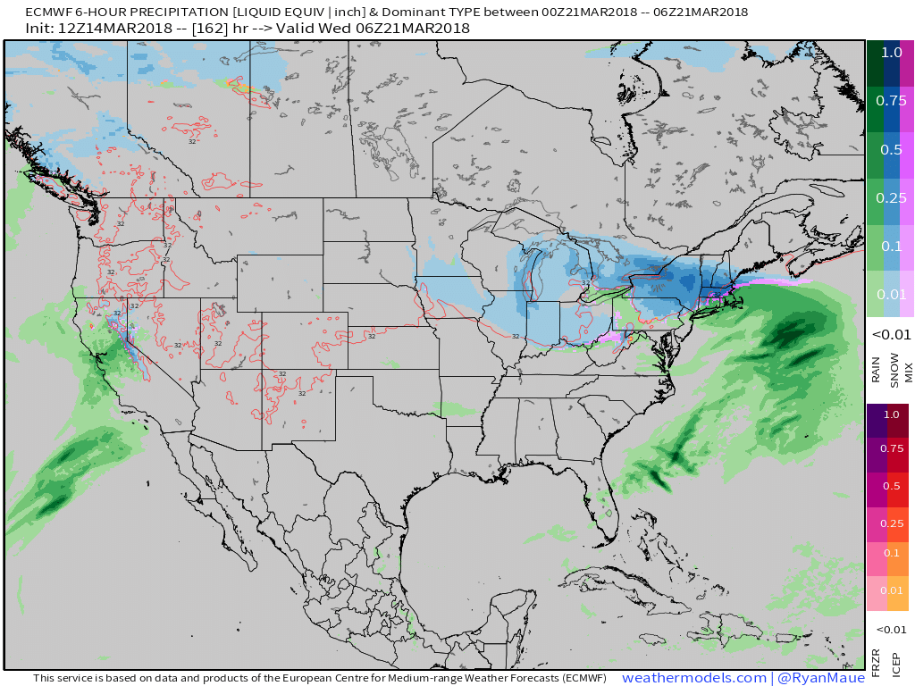
Secondly, rain arriving on the scene Monday that will transition to wet snow Tuesday into Wednesday morning, as illustrated by the European model below.
 From this distance, neither storms seem to be a “big deal” for central Indiana. However, we know March storms can “surprise.” Just ask our friends across KY earlier this week. 🙂 Spring warmth attacking south of systems combined with unusually cold air, associated with the blocking, just to our north can lead to all sorts of fun and models may have to play catch up last minute in some areas. At the very least, we recommend keeping an eye on the forecast over the next week, or so.
On a more positive note, it still looks like we’ll enjoy plentiful sunshine tomorrow and after a raw, damp start to our St. Patrick’s Day, drier times should win out Saturday afternoon into Sunday.
Much more later!
Permanent link to this article: https://indywx.com/2018/03/14/only-the-messenger/