
A warm front is draped across the state this evening. At the same time, surface low pressure is spinning across north-central MO with a trailing cold front entering IL. This evening, a warm and moist airmass continues to advect into central Indiana.
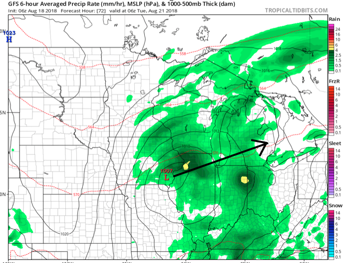
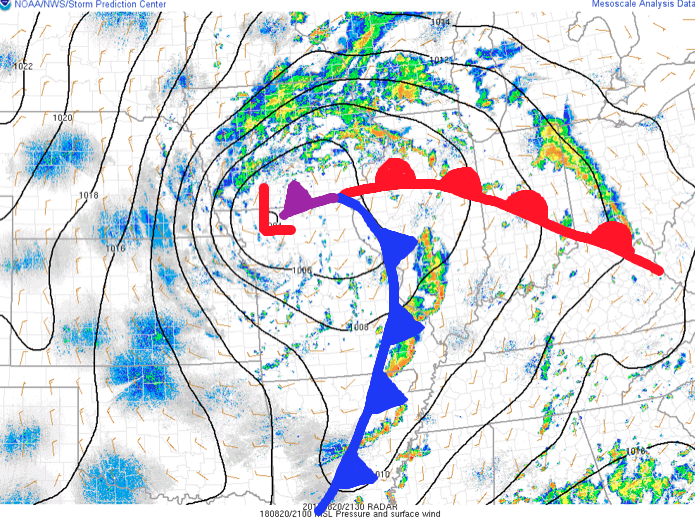 As we type this update, widely scattered thunderstorms are impacting areas from Lafayette to the northeast side of Indianapolis. A more organized complex of thunderstorms is firing to our southwest- from south-central IL to southeastern MO and into AR. This is ahead of the cold front.
Looking at forecast radar products, the majority of data brings a couple rounds of showers and thunderstorms through central parts of the state around 9p to 10p, continuing into the overnight and predawn hours.
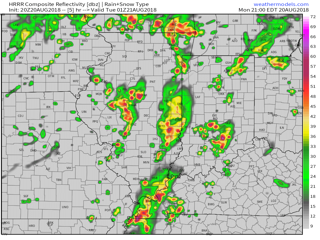
9p forecast radar

11p forecast radar

2a forecast radar
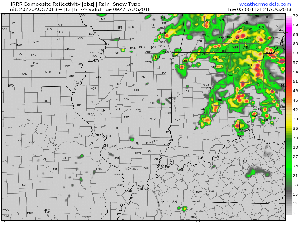
5a forecast radar
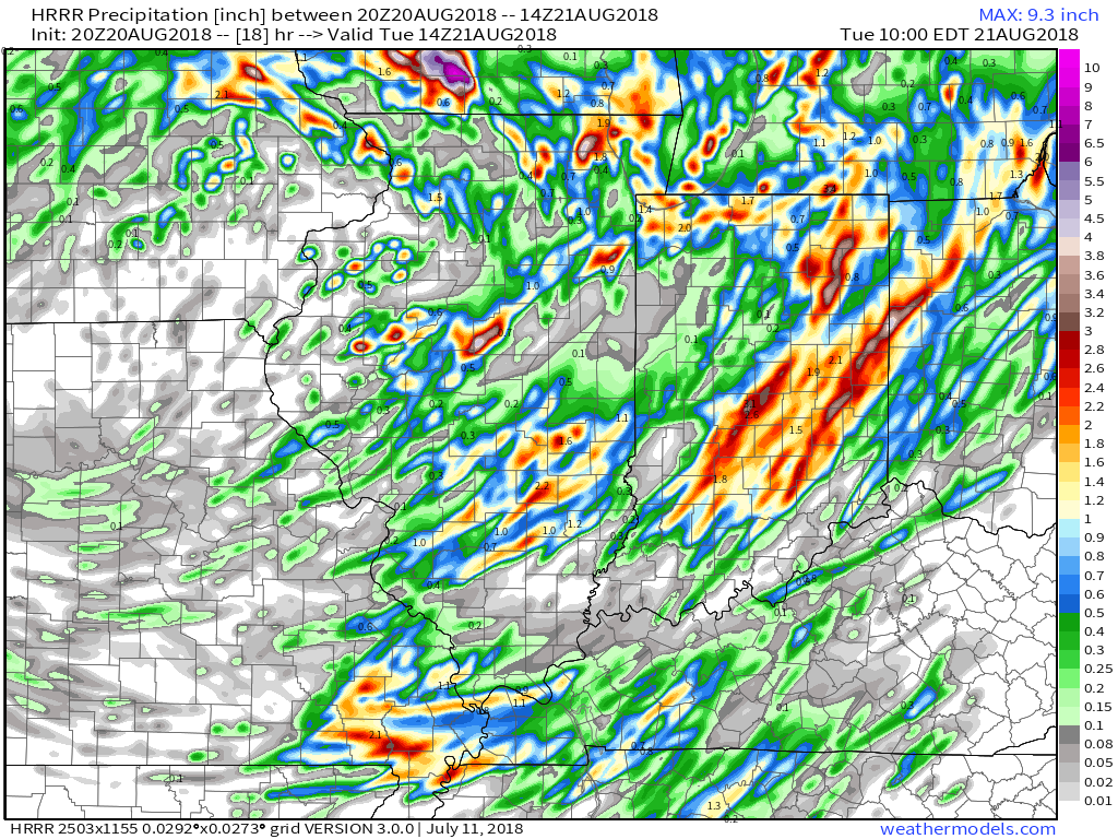
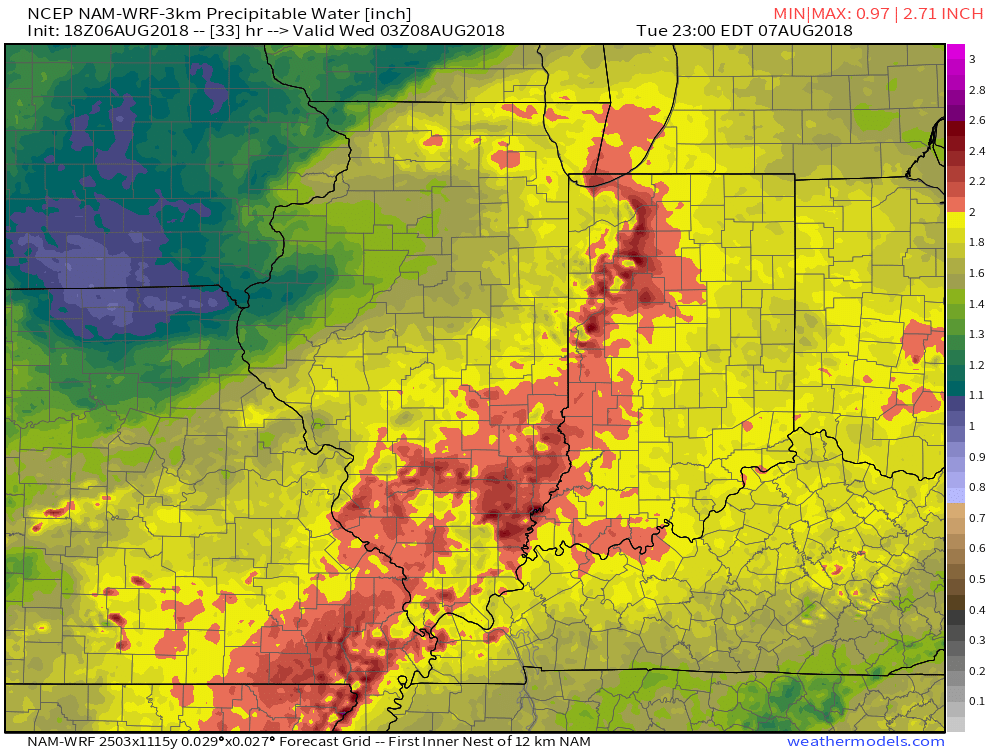
With high precipitable water values in place (approaching 2″ through tonight), locally heavy rain is likely with thunderstorms through the night. We expect widespread additional rainfall tonight of 0.50″ to 1″ with locally heavier amounts. A few embedded strong to severe storms are also possible tonight with the primary concern being damaging straight line winds and large hail, but an isolated quick spin-up tornado can’t be ruled out. We suggest ensuring your weather radio is set with the ‘alert mode’ on tonight.
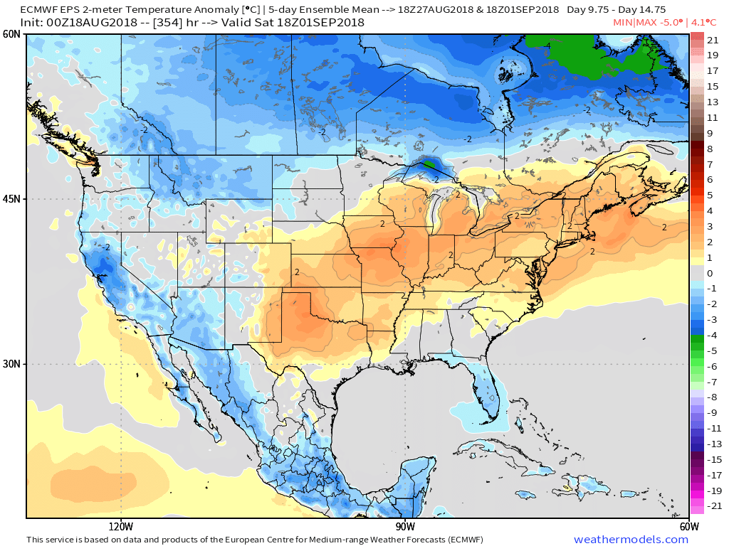
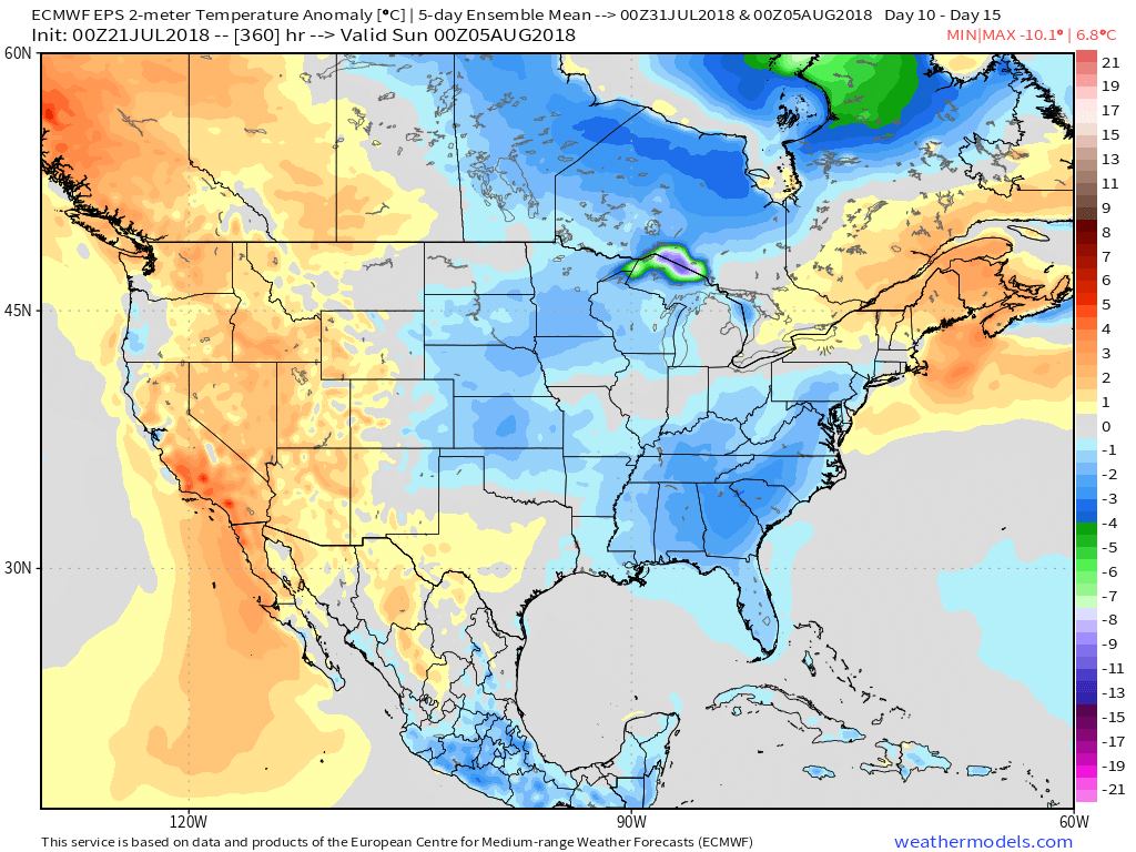
As we flip the page, a few scattered showers will remain in our forecast Tuesday PM before a much cooler and drier air mass invades Tuesday evening- continuing into Friday morning. Several central Indiana neighborhoods will dip into the 40s Thursday and Friday mornings.
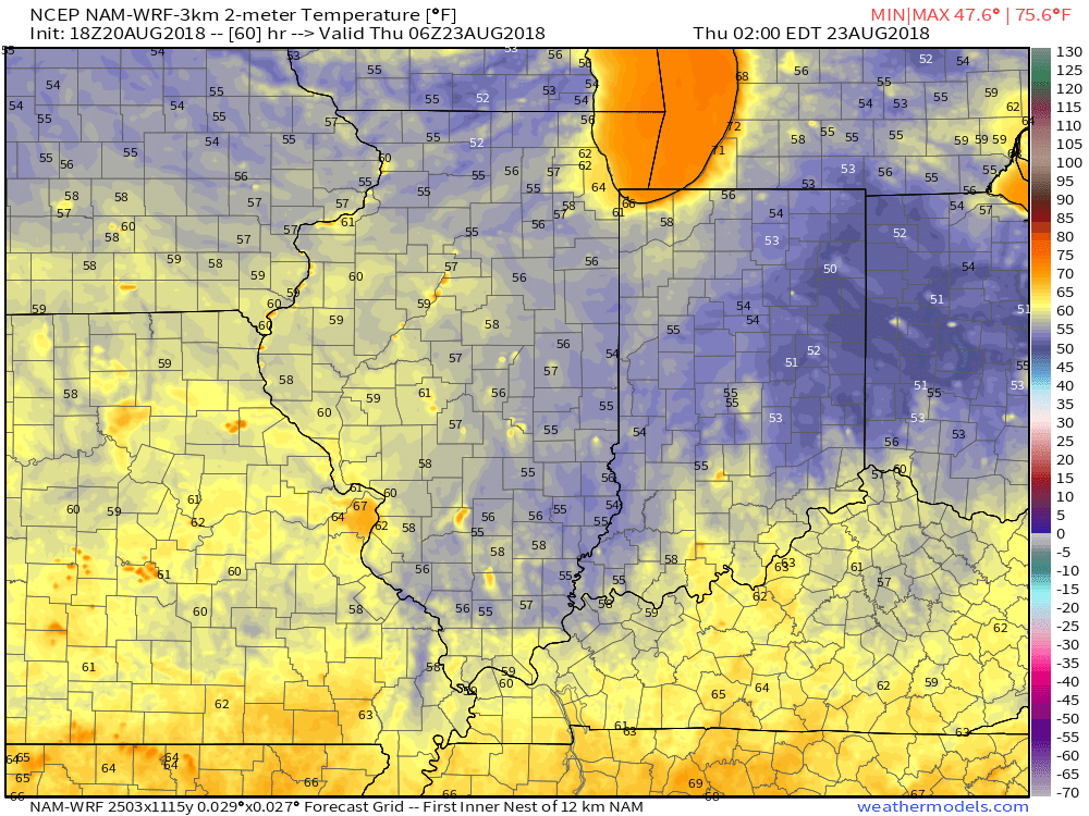
2a forecast temperatures Thursday.
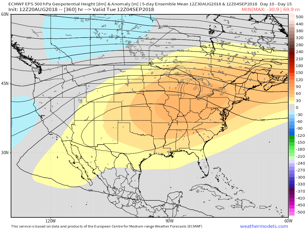
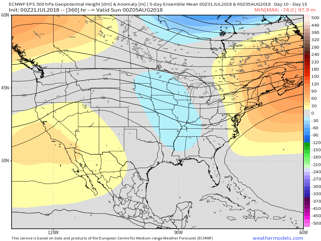
Enjoy the cooler air while you’ve got it, as a developing heat wave will engulf much of the region as we close the month and open September. Needless to say, despite the unofficial end to summer just around the corner, there’s still plenty of summer left in the tank. This is the type pattern that can produce an extended stretch of lows around 70° and highs around 90°.
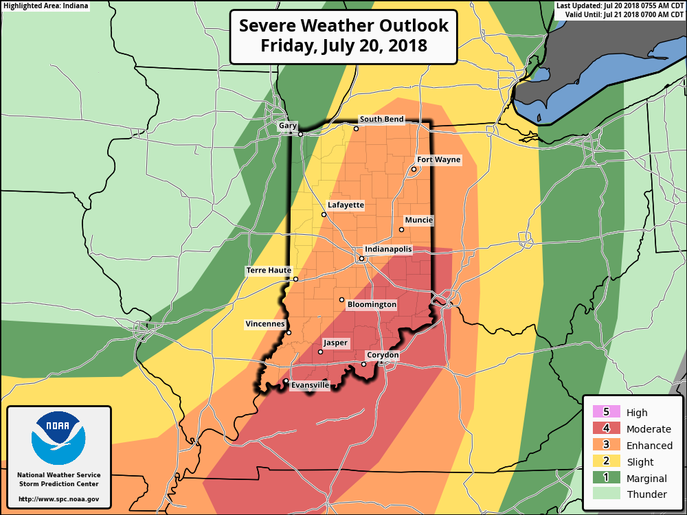
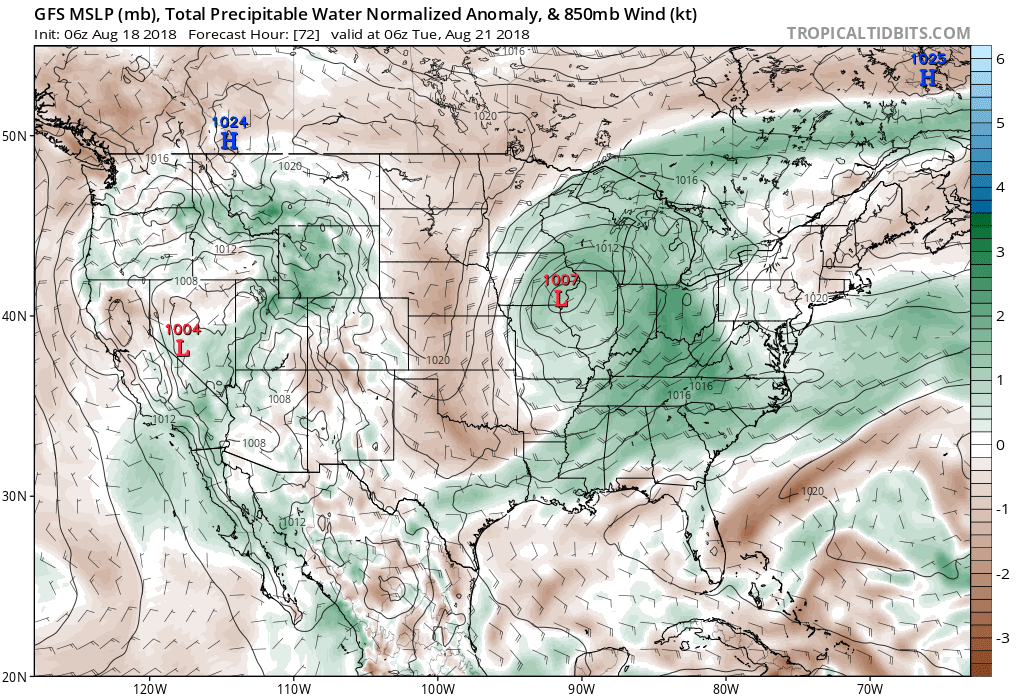 Scattered thunderstorms will return as early as Monday afternoon, but more widespread shower and thunderstorm activity is expected Tuesday. While not a textbook set-up for widespread severe weather by any means, enough ingredients are in place to at least raise an eyebrow for a few severe storms ahead of the cold frontal passage. Don’t be surprised if the ‘marginal’ risk is upgraded to a ‘slight’ risk for Tuesday in future updates from the Storm Prediction Center.
 Once the cold front moves through, a rather abrupt wind shift will drive a much drier and cooler air mass southeast and it’ll feel like early autumn around these parts as we progress through the second half of the work week. Not only will the significant drop in humidity be nice, but some outlying areas away from the city will likely fall into the 40s for overnight lows Thursday and Friday mornings. Highs will only top out in the mid to upper 70s.
 Looking longer term, summer isn’t finished just yet. Ridging will return for the Labor Day weekend and support building warmth as we put a wrap on August and open September.
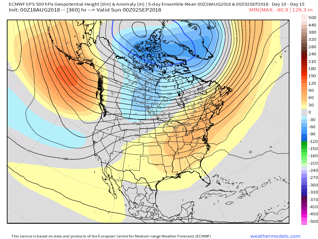
 Some of the storms across the northern third of the state may “pulse” to severe levels this evening, including the potential of large hail and damaging winds. (This complex will weaken as it surges south later tonight).
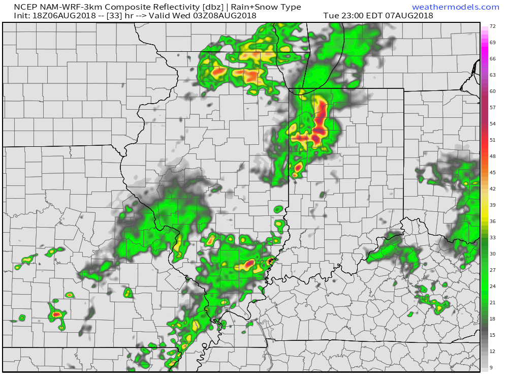 Eventually, drier times will return by mid-week. Beforehand, most central Indiana rain gauges should receive somewhere between 0.50″ to 1″ of rain. With a rich, tropical airmass in place, there will be some locally heavier totals.
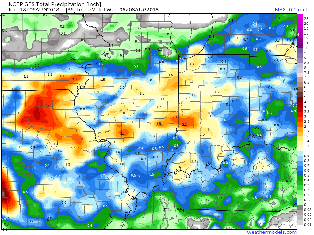
 As we look ahead, our weekend weather will continue to be dominated by a “cut off” area of low pressure. As it meanders around the region, shower and thunderstorm chances will remain. Aerial coverage of rain will reach greatest heights during the afternoon and evening hours today and Sunday. With the colder air aloft, don’t be surprised if a few of the stronger showers produce hail.
 Additionally, highs today will run close to 10° below the average high of the mid-80s.
 Longer term, the NEW JMA Weeklies suggest the worst of the summer heat is now behind us as they keeps the Weeks 3-4 time period unseasonably refreshing…
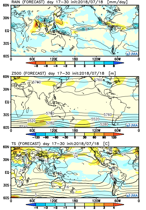
 Part of the reason behind today’s severe weather has to do with an overall pattern shift. An intense short wave trough (especially for this time of year) will dig into the Great Lakes and Ohio Valley. At the surface, an area of low pressure will track from southern WI (this morning) before “cutting off” over the Ohio Valley this weekend. Additionally, a couple of frontal boundaries will swing through the state- the most potent being the boundary that surges east this afternoon and evening. The combination of ingredients spell trouble across at least a portion of the region- especially from Indianapolis and points south and east this afternoon and evening.