A warm front is draped across the state this evening. At the same time, surface low pressure is spinning across north-central MO with a trailing cold front entering IL. This evening, a warm and moist airmass continues to advect into central Indiana.
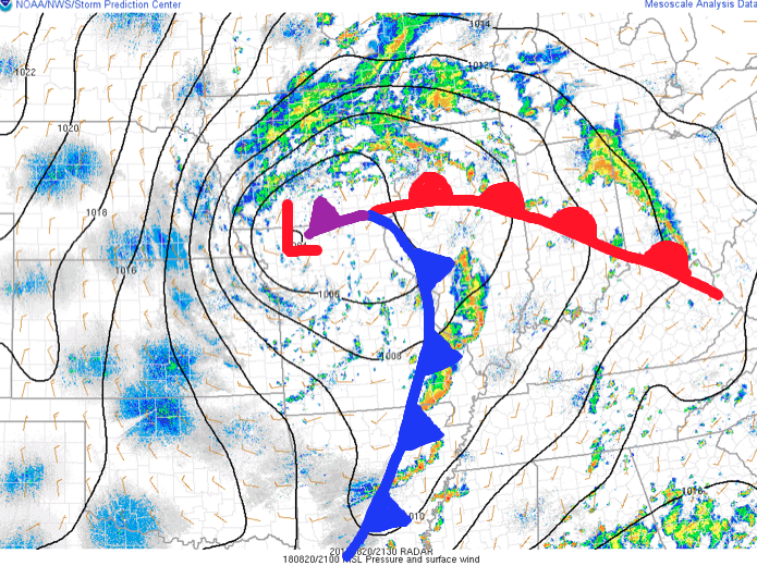 As we type this update, widely scattered thunderstorms are impacting areas from Lafayette to the northeast side of Indianapolis. A more organized complex of thunderstorms is firing to our southwest- from south-central IL to southeastern MO and into AR. This is ahead of the cold front.
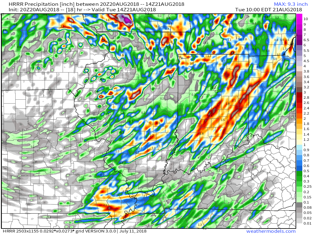
Looking at forecast radar products, the majority of data brings a couple rounds of showers and thunderstorms through central parts of the state around 9p to 10p, continuing into the overnight and predawn hours.
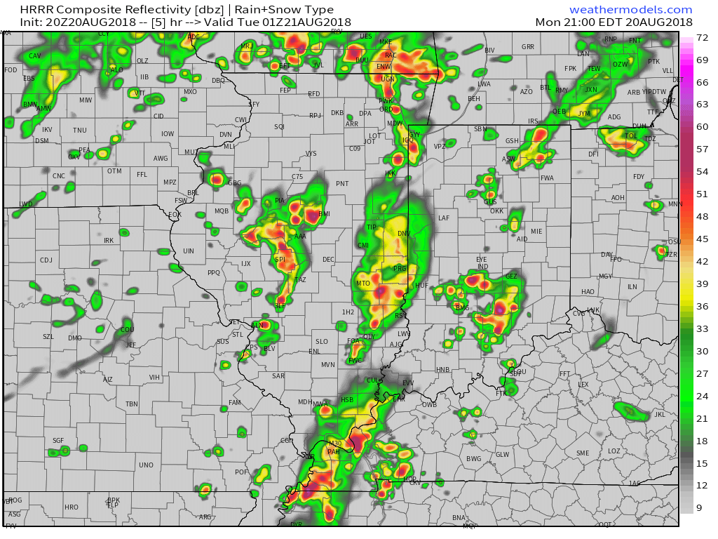
9p forecast radar

11p forecast radar

2a forecast radar
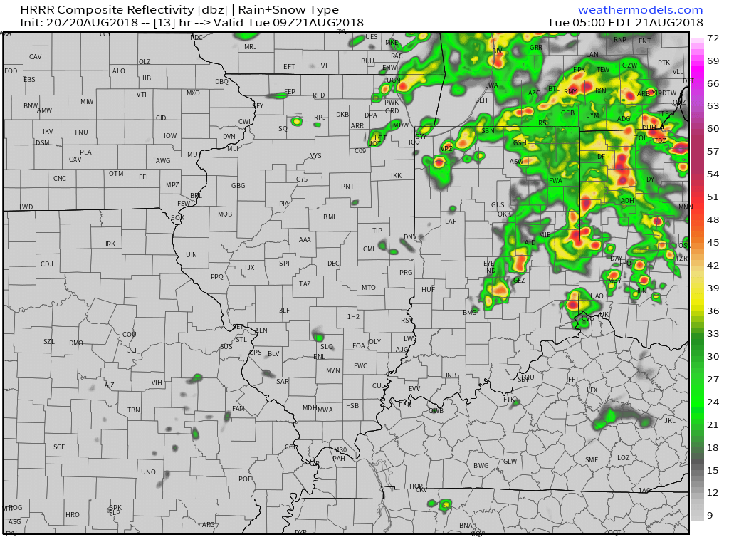
5a forecast radar
With high precipitable water values in place (approaching 2″ through tonight), locally heavy rain is likely with thunderstorms through the night. We expect widespread additional rainfall tonight of 0.50″ to 1″ with locally heavier amounts. A few embedded strong to severe storms are also possible tonight with the primary concern being damaging straight line winds and large hail, but an isolated quick spin-up tornado can’t be ruled out. We suggest ensuring your weather radio is set with the ‘alert mode’ on tonight.
As we flip the page, a few scattered showers will remain in our forecast Tuesday PM before a much cooler and drier air mass invades Tuesday evening- continuing into Friday morning. Several central Indiana neighborhoods will dip into the 40s Thursday and Friday mornings.
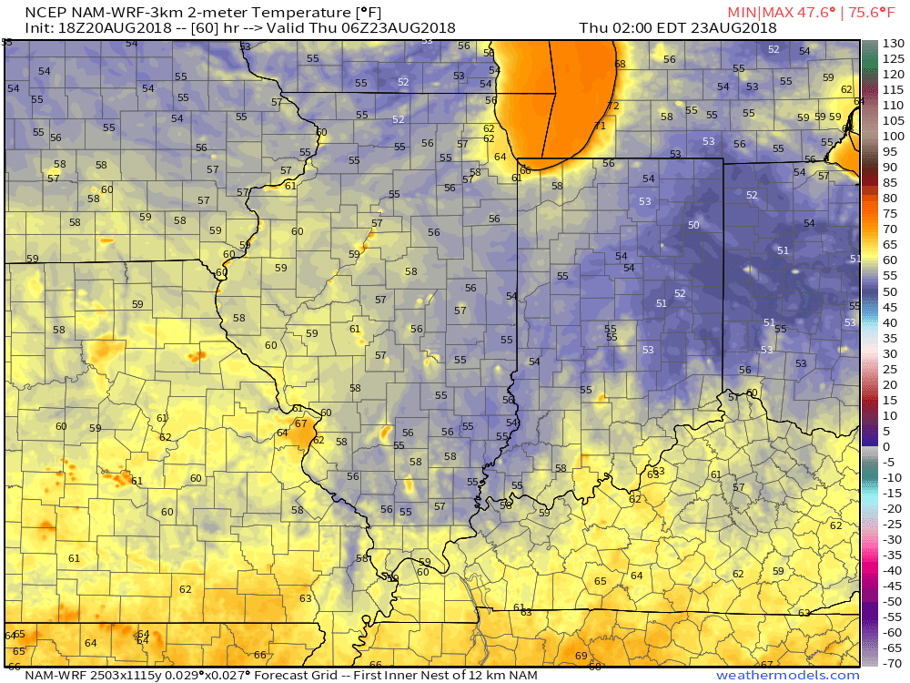
2a forecast temperatures Thursday.
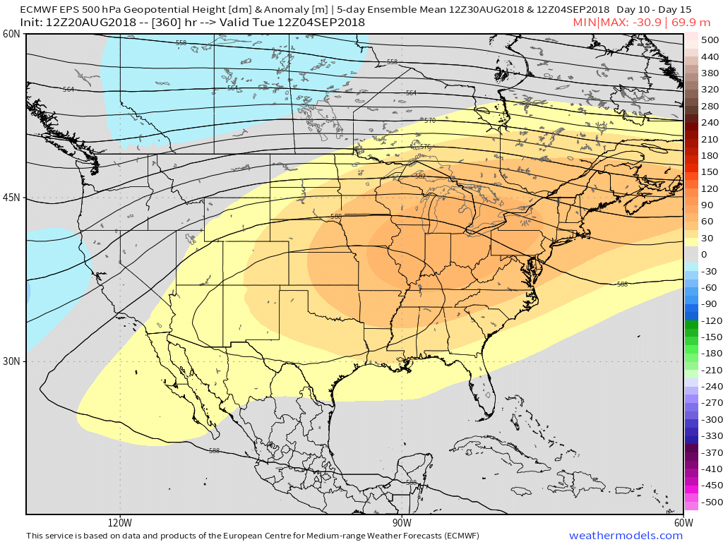
Enjoy the cooler air while you’ve got it, as a developing heat wave will engulf much of the region as we close the month and open September. Needless to say, despite the unofficial end to summer just around the corner, there’s still plenty of summer left in the tank. This is the type pattern that can produce an extended stretch of lows around 70° and highs around 90°.