Category: Severe Weather

All-Access Video: Looking Deeper Into The Reasons To The Cold Open To March & Mid-Month Changes…

Discussing the reasons behind the frigid open to March and the mid-month changes that await…

You must be logged in to view this content. Click Here to become a member of IndyWX.com for full access.  Already a member of IndyWx.com All-Access?  Log-in here.

Permanent link to this article: https://indywx.com/2019/02/26/all-access-video-looking-deeper-into-the-reasons-to-the-cold-open-to-march-mid-month-changes/

Frigid Open To March And Late Month Musings; Reviewing The NEW European Weeklies…

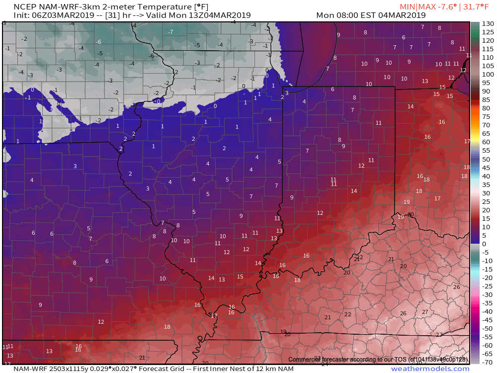
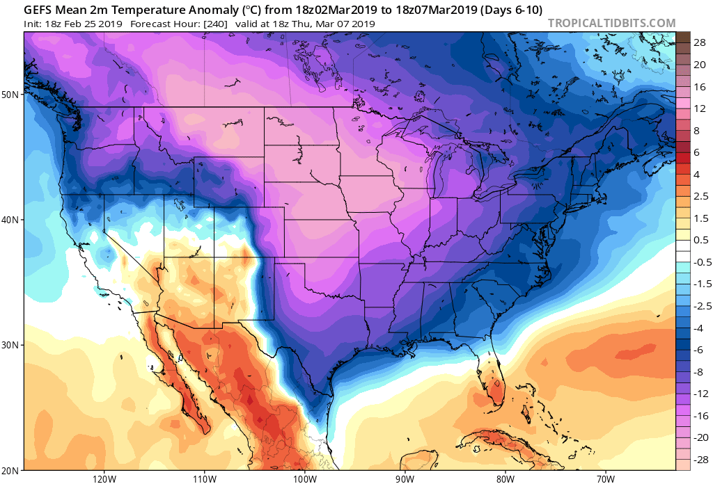
Average temperatures through the 1st (5) days of the month include highs of 46 F and a low of 29 F at Indianapolis. Instead, a frigid pattern will grip the region as we move through early March, including highs that will likely only top out in the lower to middle 20s and lows in the upper single digits to lower 10s as we move through the first week of the month (coldest centered on Sunday through next Wednesday).

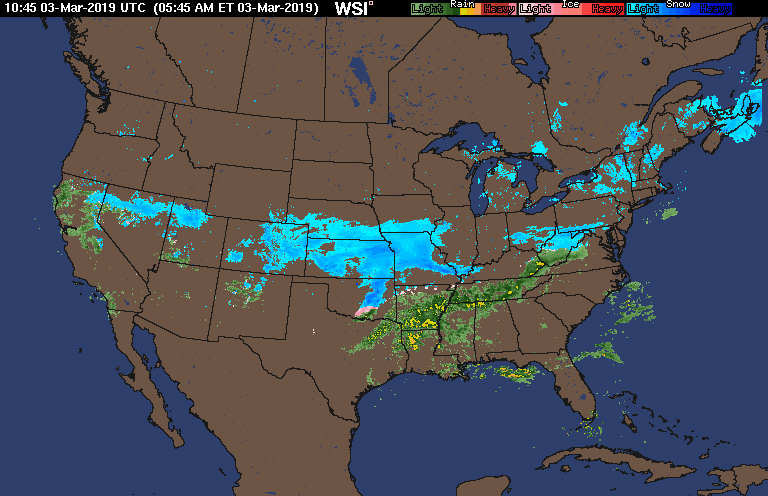
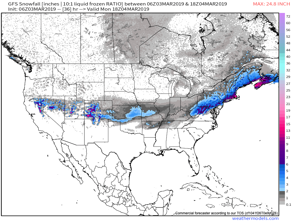
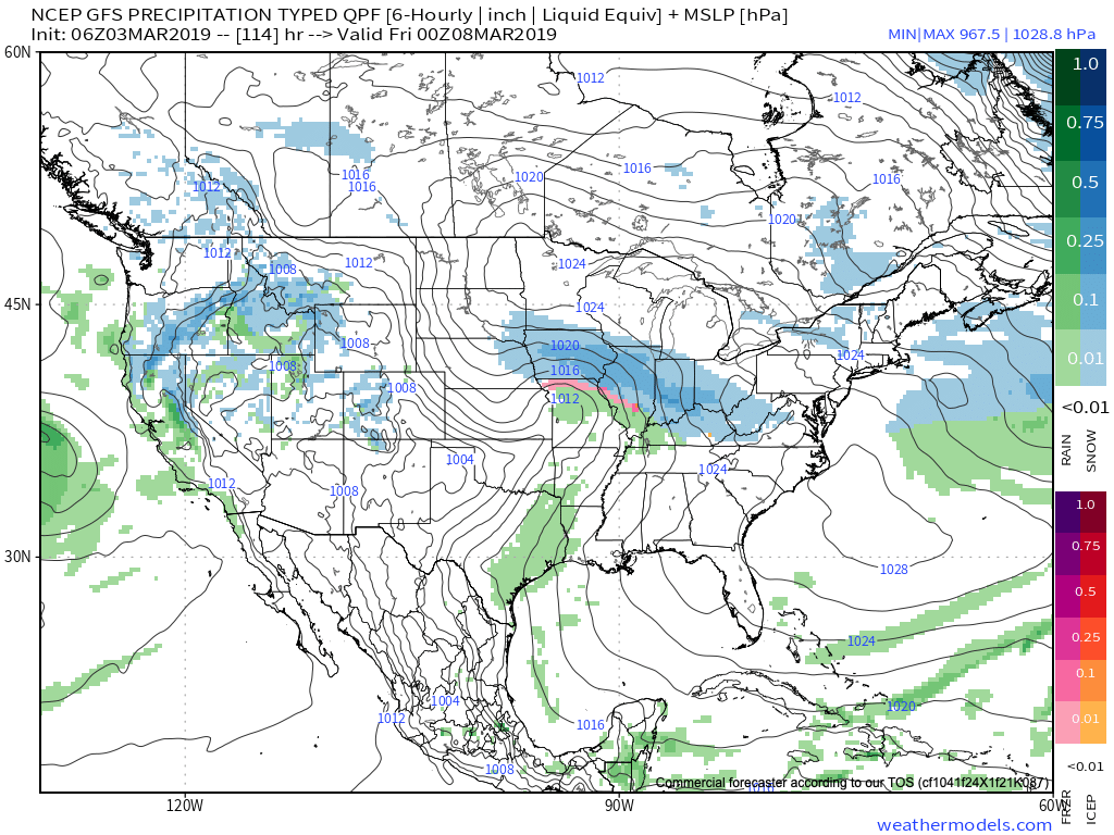
Should we get any sort of snow down during the period (still up for debate as of this evening), lows will likely approach 0 F. The best opportunity for accumulating snow over the upcoming week would come Friday night into Saturday, but confidence remains low. Thereafter, we prefer the “suppressed” ideas currently portrayed by modeling as more meaningful winter storm threats impact the lower Ohio/ TN Valley and southern Appalachian region- especially with such an anomalously cold pattern in place.

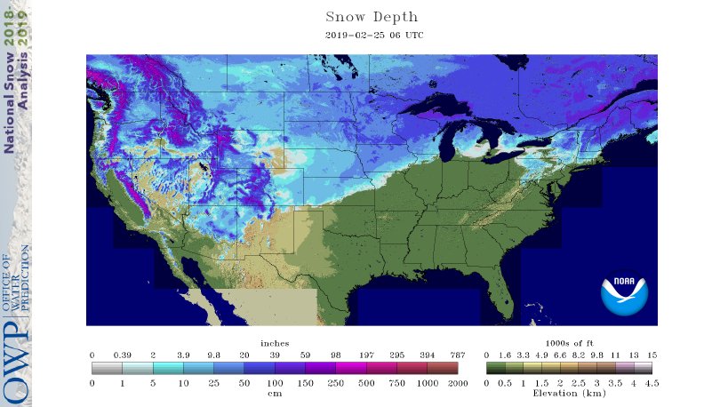
Speaking of cold, the deep and expansive snowpack across the central and northern Plains won’t allow the late season taste from the arctic to modify as much as it may otherwise. As the frigid air mass settles southeast, below zero wind chill values are a good bet early next week across the northern half of the state. “Tap the breaks” on meteorological winter kicking off March 1st…

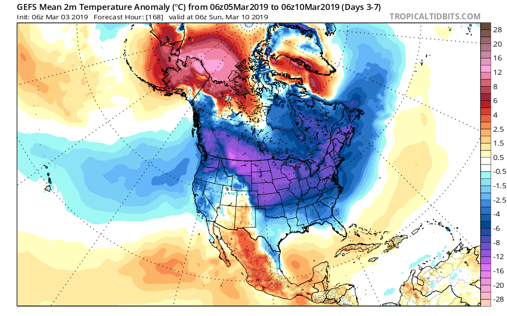
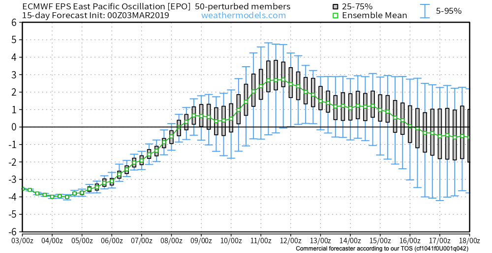
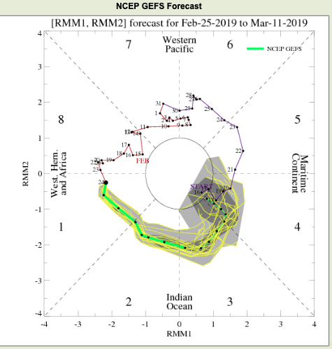
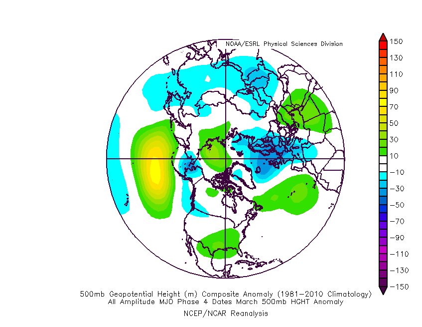
With that said, the NAO and AO are expected to remain positive and while initially “trumped” by the significantly negative EPO, this will trend positive by mid-month. These all suggest the cold is limited and that there shouldn’t be any change to the idea that we really begin to feel more spring-like by the middle of March. This is backed up by the continued idea that the MJO rumbles into Phase 4 by mid-March, as well (again argues for warmth).

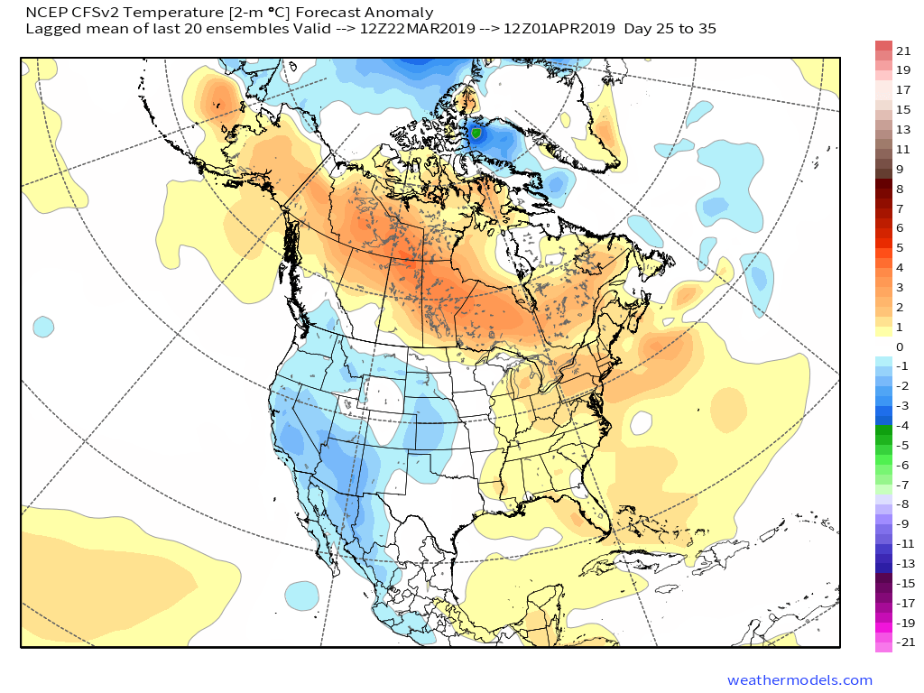
Sure enough, longer range models show the ridging and associated warmer times ahead:

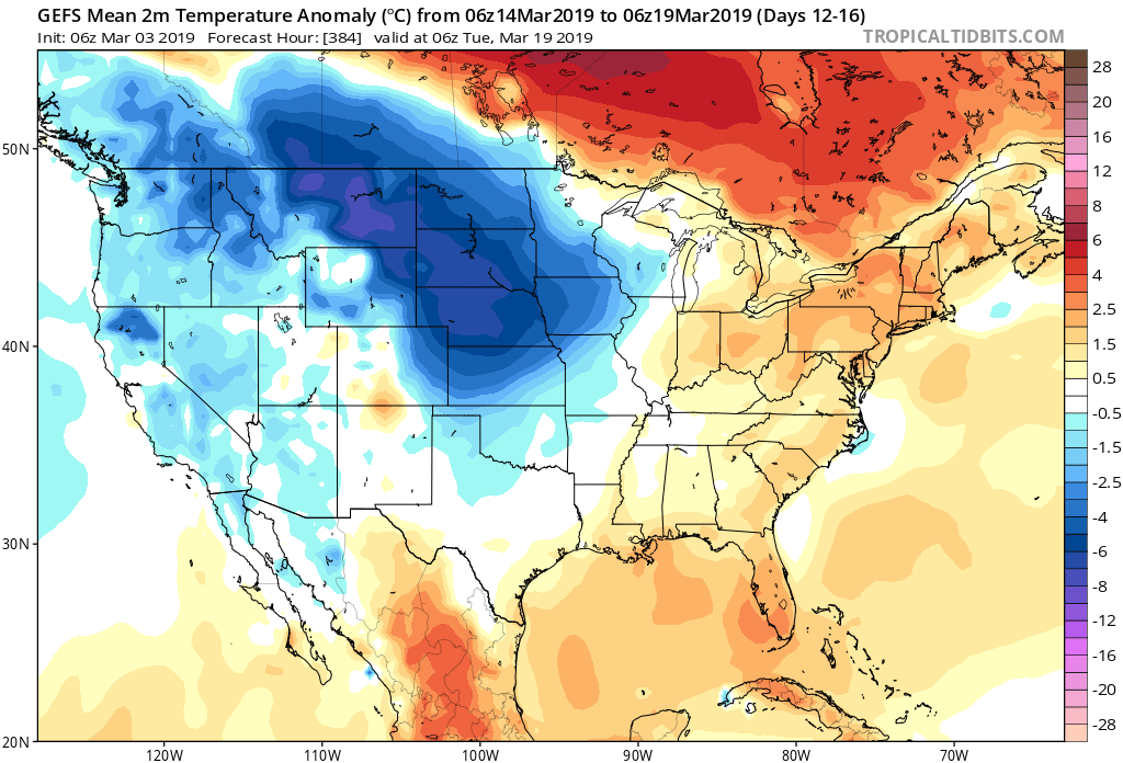
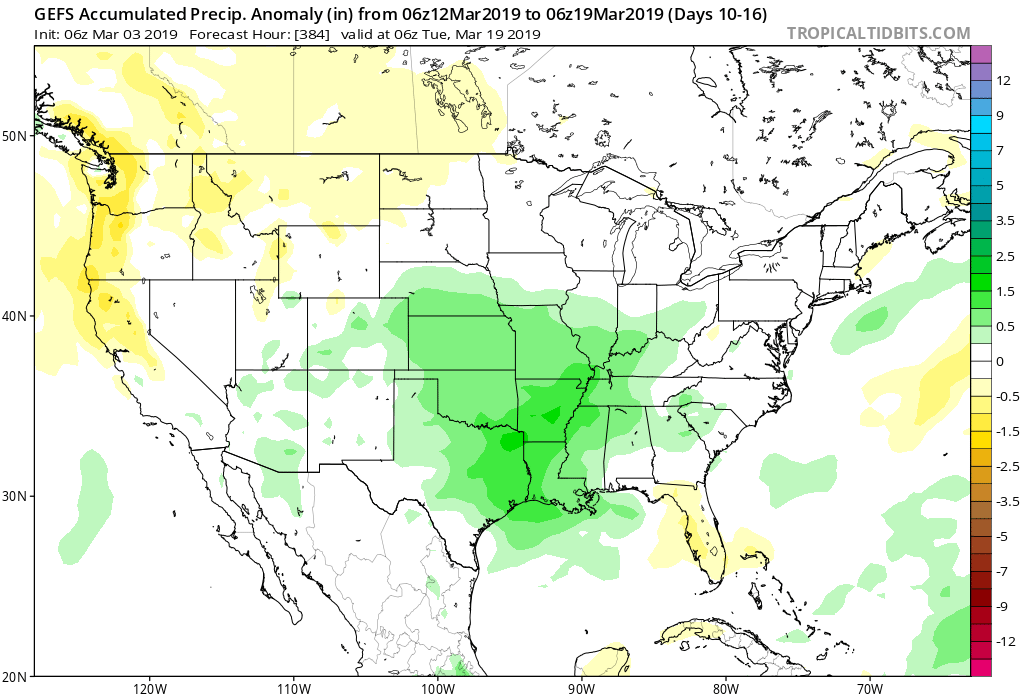
It should be noted that with the mean trough position taking up shop across the western portion of the country mid-March, not only should we moderate, but we should also see a return of wetter/ stormier times. With the GOM (Gulf of Mexico) running above normal, early season severe weather outbreaks will have to be closely monitored…

The new European Weeklies in this evening also back up the idea of an unseasonably cold 1st half of the month giving way to milder conditions by mid month. The model paints a drier than normal pattern over the Ohio Valley and Mid West over the next couple of weeks before wetter signals return by the middle of March.

Permanent link to this article: https://indywx.com/2019/02/25/frigid-open-to-march-and-late-month-musings-reviewing-the-new-european-weeklies/

Saturday Afternoon Video Update: Damaging Winds Develop Late Tonight; More Conversation Around The March Pattern…

You must be logged in to view this content. Click Here to become a member of IndyWX.com for full access.  Already a member of IndyWx.com All-Access?  Log-in here.

Permanent link to this article: https://indywx.com/2019/02/23/saturday-afternoon-video-update-damaging-winds-develop-late-tonight-more-conversation-around-the-march-pattern/

Batten Down The Hatches…

A rapidly strengthening surface low will track out of the Plains today into the Great Lakes by Sunday.

On the warm side of the storm, a severe weather outbreak will develop across the MS River Valley and western TN Valley today. A few strong, long-track, tornadoes are likely, unfortunately. To the northwest of the low’s track, an out and out blizzard will develop across the upper Midwest.

Here on the home front, an unsettled Saturday awaits. While late morning and afternoon showers are possible, better chances of more organized and heavier downpours and embedded thunder will arrive this evening into tonight.

In general, we anticipate between 0.25″ to 0.50″ of rain with this storm system. A few gusty storms are possible across southern Indiana, but widespread severe weather isn’t expected.

The cold front will pass Sunday morning and you’ll know it. Winds will increase overnight, but turn particularly gusty Sunday.

Sustained 25-30 MPH winds can be expected Sunday with gusts of 50 to 60 MPH. These kind of speeds will be plenty capable of downing trees and power lines and we’d recommend having your storm-ready kit handy in the event you lose power Sunday.

Light snow will be blown about by the strong winds Sunday morning into the afternoon, but we’re not expecting much in the way of accumulating (trace to a dusting in some areas).

We’ll have an updated video posted a bit later this afternoon! Make it a great Saturday!

Permanent link to this article: https://indywx.com/2019/02/23/batten-down-the-hatches/

VIDEO: Scattered Storms Saturday Give Way To Damaging Winds And Snow Showers To Close The Weekend…

A busy weekend awaits as stormy Saturday evening give way to a 12-18 hour period of potentially damaging wind gusts. Rain will end as wind-whipped snow to close the weekend…

You must be logged in to view this content. Click Here to become a member of IndyWX.com for full access.  Already a member of IndyWx.com All-Access?  Log-in here.

Permanent link to this article: https://indywx.com/2019/02/22/video-scattered-storms-saturday-give-way-to-damaging-winds-and-snow-showers-to-close-the-weekend/

Friday Morning Video Update: Unsettled Saturday Gives Way To Very Strong Winds Sunday; Colder Times On The Horizon…

You must be logged in to view this content. Click Here to become a member of IndyWX.com for full access.  Already a member of IndyWx.com All-Access?  Log-in here.

Permanent link to this article: https://indywx.com/2019/02/22/friday-morning-video-update-unsettled-saturday-gives-way-to-very-strong-winds-sunday-colder-times-on-the-horizon/

All-Access Long Range Update: Walking Through March…

Recently, a “transient” pattern has dominated. This has kept any sort of long-lasting cold at bay and resulted in above normal precipitation. As we get set to close out February and welcome in a new month, a pattern change is on the horizon.

This overall shift in the pattern will drive a more sustained and significantly colder than normal regime southeast. In short, cold is set to “overwhelm” the pattern through the first couple of weeks of March. In the most extreme case (especially if we can get snow down), we will be able to challenge records at some point during the 1st (10) days of the month.

In spite of a neutral to positive AO and NAO, a significantly negative EPO and MJO rumbling through the cold late Feb and early March phases look to trump the otherwise warm signals. We also can’t forget about the significant SOI crash. Let’s dig into some of the latest data:

CFSv2


Note the modeling spreading the cold out during the Weeks 2-3 time period before gradually modifying things as we move into the middle and latter portion of March. The mean storm track shifts to the east during the first couple of weeks of the month (pattern will likely be dominated by more snow vs. rain events during this time period) before wetter than normal conditions return for the 2nd half of the month.

JMA Weeklies

Week 1
Week 2
Weeks 3-4

Like the CFSv2, the model overwhelms the pattern with cold during the Week 2 time period. Also similar to the CFSv2, the JMA Weeklies bring ridging back into the East and associated warmth by mid-month. While we haven’t included the precipitation anomalies in this post, the model does bring wetter than normal conditions back into the area by mid-March.

European Weeklies

The NEW European Weeklies remain consistent from Monday’s update (and data above) in delivering a very cold 1st half of March. The core of the cold looks to be centered over the upper Midwest and Northern Plains, but temperatures for the balance of the first couple weeks of the month will likely resemble what we’d expect in late January or early February vs. March. While precipitation will likely run below normal (thanks to the cold pattern), the model deliver above normal snowfall during the period. As we move into the 2nd half of the month, warmer (and wetter) conditions are shown to return.

Given all of the above, we expect the primary upper air pattern to feature a central and eastern trough through the 1st half of March before that trough settles into the West during the 2nd half of the month. This will open up the eastern portion of the country for not only warmer air, but a return of moisture-laden storm systems and the potential of strong-severe storms at times.

Permanent link to this article: https://indywx.com/2019/02/21/all-access-long-range-update-walking-through-march/

Morning Video Update: Strong Storms Saturday Give Way To Potential Damaging Wind Gusts Sunday; Pattern Change On Deck…

Strong to severe storms arrive Saturday and then potentially damaging wind gusts impact the region Sunday. Pattern change looms as we welcome in March…

You must be logged in to view this content. Click Here to become a member of IndyWX.com for full access.  Already a member of IndyWx.com All-Access?  Log-in here.

Permanent link to this article: https://indywx.com/2019/02/21/morning-video-update-strong-storms-saturday-give-way-to-potential-damaging-wind-gusts-sunday-pattern-change-on-deck/

Morning Video Update: Stormy Saturday Gives Way To Very Strong Winds Sunday; Looking Ahead To March…

You must be logged in to view this content. Click Here to become a member of IndyWX.com for full access.  Already a member of IndyWx.com All-Access?  Log-in here.

Permanent link to this article: https://indywx.com/2019/02/20/morning-video-update-stormy-saturday-gives-way-to-very-strong-winds-sunday-looking-ahead-to-march/

Evening Video Update: Snow, Storms, And A Major Pattern Shift On The Horizon…

You must be logged in to view this content. Click Here to become a member of IndyWX.com for full access.  Already a member of IndyWx.com All-Access?  Log-in here.

Permanent link to this article: https://indywx.com/2019/02/19/evening-video-update-snow-storms-and-a-major-pattern-shift-on-the-horizon/

IndyWx.com