
You must be logged in to view this content. Click Here to become a member of IndyWX.com for full access. Already a member of IndyWx.com All-Access? Log-in here.
Category: Severe Weather
Permanent link to this article: https://indywx.com/2019/03/24/sunday-evening-video-update-heavy-rain-strong-storms-expected-for-southern-in-tonight/
Mar 24
Heavy Rain, Couple Strong Storms Possible Across Southern IN Tonight…
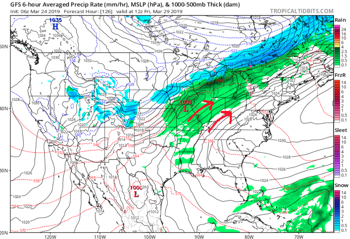
Scattered showers will spread across central Indiana at times through the day. Most of this rain will be light in nature through the afternoon hours, but a couple of moderate showers are also possible.
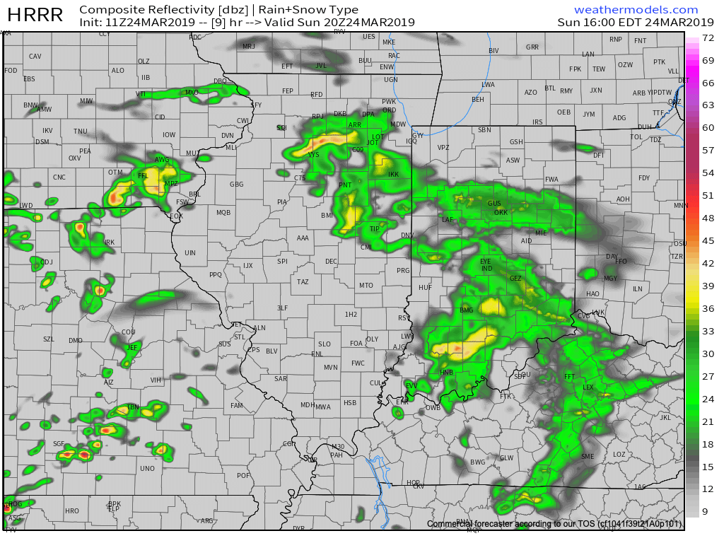
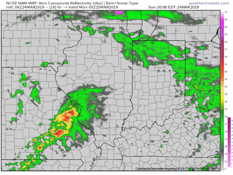
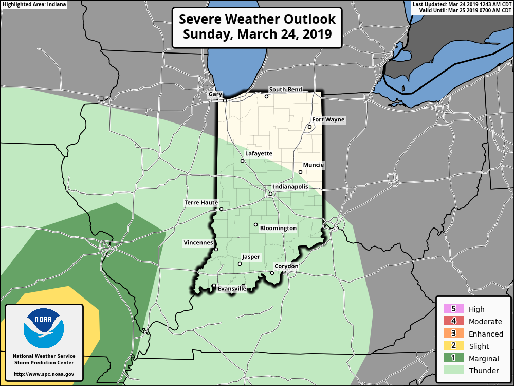
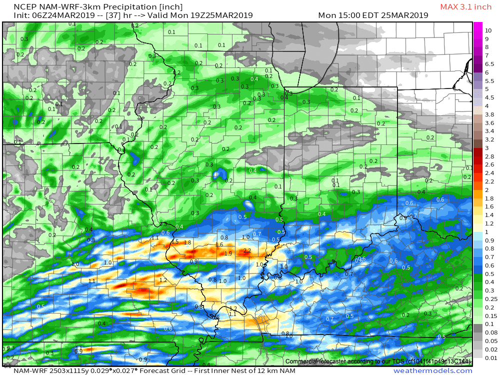
A surface low will track east across the lower Ohio Valley tonight and this will result in more concentrated heavy rain falling across the southern portion of the state this evening into early Monday morning. This is a bit further south than model guidance suggested yesterday. Additionally, a couple of strong thunderstorms are also possible tonight across far southern Indiana.
It wouldn’t surprise us to see the Storm Prediction Center (SPC) include portions of southern Indiana in a ‘Marginal’ or ‘Slight’ risk of severe weather tonight with future updates.
With the more southern track now expected from this storm system, the corridor of .50″ to 1″ rainfall totals will settle across the southern portions of Indiana, with 0.10″ to 0.25″ expected for central Indiana on average.
Rain will come to an end for all of the state by mid to late morning Monday with dry conditions returning Monday evening into the middle of the week, thanks to high pressure.
Dry and pleasant conditions will remain in place through the daytime hours Thursday before a storm system approaches Thursday night into Friday. The gusty southwesterly air flow in advance of this storm will help pull warmer conditions northeast into the Ohio Valley. Highs between 65-70 are on tap by Thursday afternoon. Unsettled weather is anticipated to remain through next weekend along with progressively colder conditions.
Permanent link to this article: https://indywx.com/2019/03/24/heavy-rain-couple-strong-storms-possible-across-southern-in-tonight/
Mar 23
Spring Flood Outlook…
It’s been since 2013 since the Lower 48 has seen greater snow cover on the 23rd of March.

Officially, 25.4% of the Lower 48 is currently snow covered, including crucial areas that feed downstream rivers in the north-central Plains and upper Midwest.
NOAA released their Spring Flood Outlook Friday. This shows major to moderate flooding expected on area rivers from the northern Plains south along the MS River. Even moderate to minor river flooding is anticipated across the east, including the Ohio Valley.
The full report can be found here.
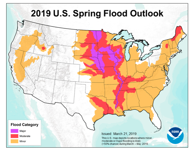
As we move into April, a ridge is expected to back west and result in an active storm track from the west into the Mid West and Great Lakes. The end result will be a favorable pattern for above average precipitation. Factor that in with the above average late season snowpack currently in place across the exact same region, and the stage is set for moderate to significant river flooding through the remainder of the spring.
More specific to central Indiana, we also expect an active spring storm track- including precipitation that is around “average” from the March through May (meteorological spring) period. As warmth expands as we move into mid-April, expect an uptick in severe weather episodes further north during the 2nd half of April into May.
Permanent link to this article: https://indywx.com/2019/03/23/spring-flood-outlook/
Mar 19
Disruption In The Force…
There are growing indications the once thought warm flip in the pattern will be delayed. While “seasonality” is helping us certainly improve in the temperature department from the frigid open to March, data is trending (and some dramatically so) colder for late March and early April.
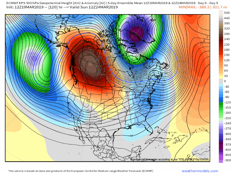
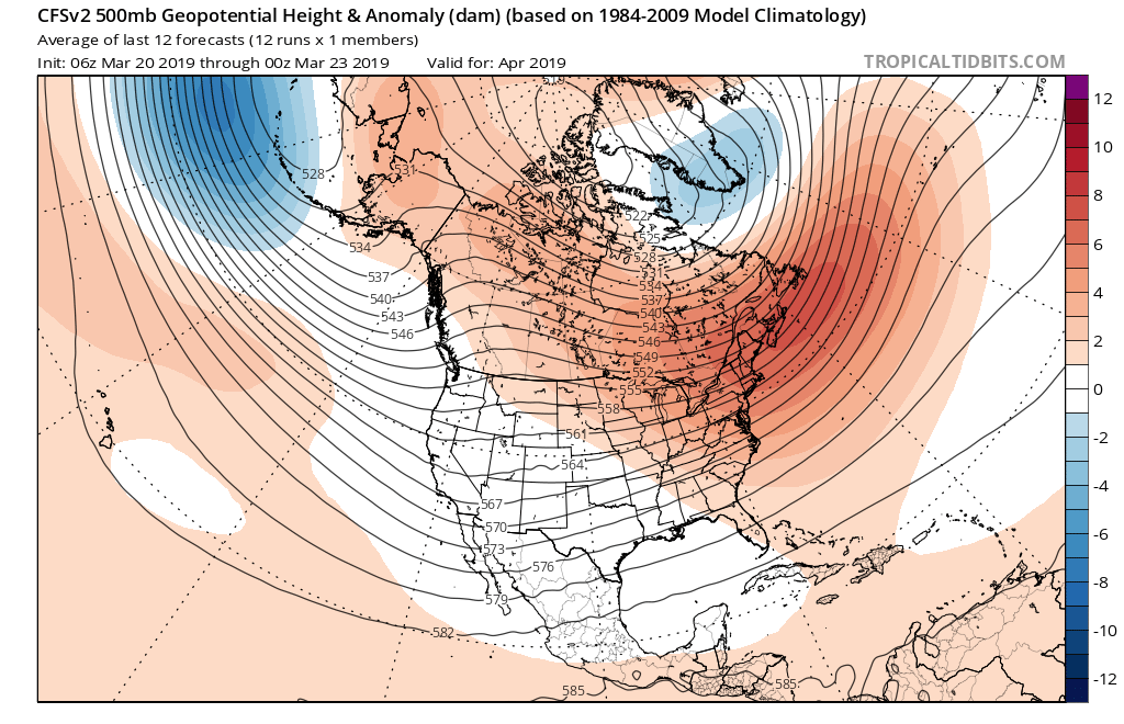
Part of this can be attributed to the persistent AK ridge and positive PNA/ negative EPO pattern in place. Without question, medium and long range modeling as early as less than a week ago missed this. Note the above image and tendency for prolonged ridging across AK into early April. This will favor cooler anomalies downstream, including here across central Indiana. That’s not to say there won’t be multiple warm and pleasant days thrown in the mix (it’s late March, after all), but instead to say that the pattern overall looks much cooler when compared to what the majority of data was painting only a handful of days ago.
Embedded within this pattern will come a return of active times, including multiple storm systems of note over the upcoming 10-14 days. The flavor of said systems will change from originally thought as hefty rain and potential severe events to rain and perhaps some wintry precipitation. With that said, specifics are impossibly to come by in this “chaotic” pattern and we suggest staying tuned as we get closer to the arrival of the first system early next week.
Like your weather pattern “interesting?” You’re in luck over the upcoming couple of weeks…
Permanent link to this article: https://indywx.com/2019/03/19/disruption-in-the-force/
Mar 18
Quiet Pattern Turns Much More Active As We Close March…
This week is about as boring as it gets around these parts in mid to late March. With the active pattern as of late, we’ll gladly take it.
While we have a weak system that will deliver raw conditions and light rain Wednesday (touch of light snow and, or sleet across northern and east-central Indiana), that’s about it for “excitement” between now and early next week. High pressure will return as we get set to close the work week and head into the weekend, along with increasing sunshine and moderating temperatures. We still forecast highs to reach the 50s Thursday and Friday and 60s over the weekend.
It’d be wise to enjoy the “lull” in the action now, as things turn much more active as we flip the page forward to Week 2.
First up, in what will be a series of storm systems to impact the area as we close March and open April, will be a coast-to-coast storm that tracks east during the early portions of the Week 2 time frame. More specific to our area, this would likely be a system that begins to impact central Indiana during the early to middle parts of next week.
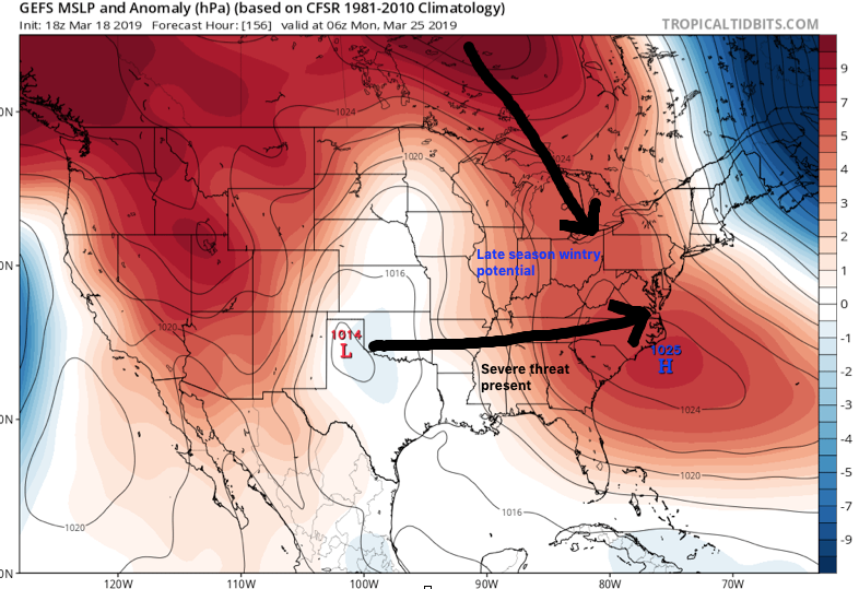
We’ve highlighted a couple of the items that have our attention, and if they come to fruition, will result in one more wintry “setback” before we say spring has officially sprung.
This is a bullish signal for an ominous spring storm, including the risk of severe weather to the south of the storm’s track and late season wintry potential to the north. It’s, obviously, far too early to get specific with this event, but it’s worth keeping a close eye on. Note that as the surface low (SL) is tracking east, a late season arctic high is pegged to be dropping southeast.
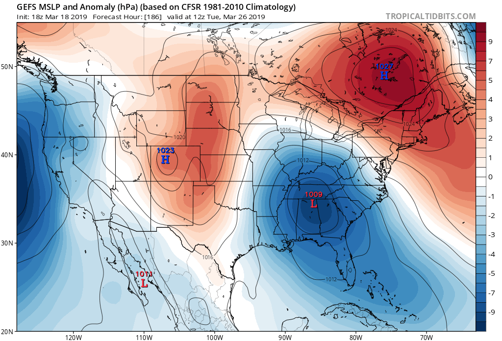
By the time we get to the middle of next Tuesday, the surface low is deepening across the TN Valley region. Despite the strong high nosing into New England, I’d expect a northward trend in the system as time gets closer, especially considering we’ll be in late March by this time. Stay tuned.
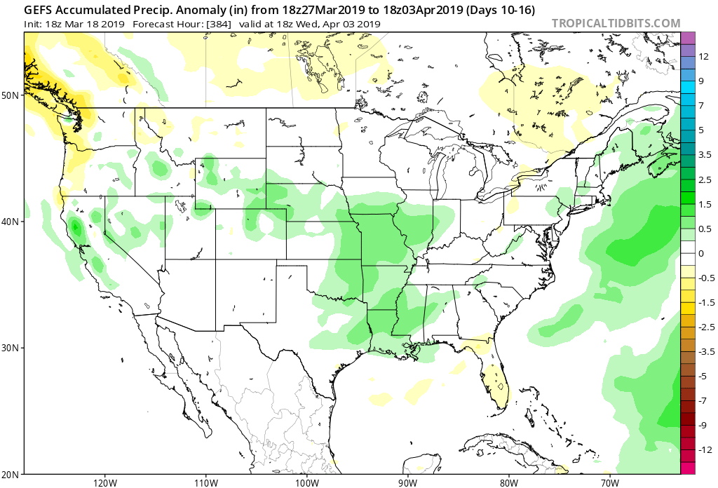
Thereafter, the pattern is set to remain quite active as we head into the 4th month of the year (2019 is flying by already). Buckle up; the well deserved quiet times now won’t last much longer…
By the way, despite what may be one last push of wintry conditions early next week, data remains in excellent agreement of a significant warmup as we flip the page to April. We continue to believe the month, overall, will average above normal in the temperature department.
Permanent link to this article: https://indywx.com/2019/03/18/quiet-pattern-turns-much-more-active-as-we-close-march/
Mar 16
VIDEO: 50/50 Weekend; Closer Look At The Late March-Early April Pattern…
A quiet open to the weekend is replaced with accumulating snow for portions of the state Sunday…
You must be logged in to view this content. Click Here to become a member of IndyWX.com for full access. Already a member of IndyWx.com All-Access? Log-in here.
Permanent link to this article: https://indywx.com/2019/03/16/video-50-50-weekend-closer-look-at-the-late-march-early-april-pattern/
Mar 14
Long Range Update: Cool “Set Back” Doesn’t Last; Looking Ahead To April…
You must be logged in to view this content. Click Here to become a member of IndyWX.com for full access. Already a member of IndyWx.com All-Access? Log-in here.
Permanent link to this article: https://indywx.com/2019/03/14/long-range-update-cool-set-back-doesnt-last-looking-ahead-to-april/
Mar 14
VIDEO: Busy Weather Day Across Central Indiana…
Significant weather alert day across central IN, including damaging wind potential and severe thunderstorms…
You must be logged in to view this content. Click Here to become a member of IndyWX.com for full access. Already a member of IndyWx.com All-Access? Log-in here.
Permanent link to this article: https://indywx.com/2019/03/14/video-busy-weather-day-across-central-indiana/
Mar 13
Client Brief: Thursday Severe Weather Update…
Type: Damaging Winds And Severe Potential
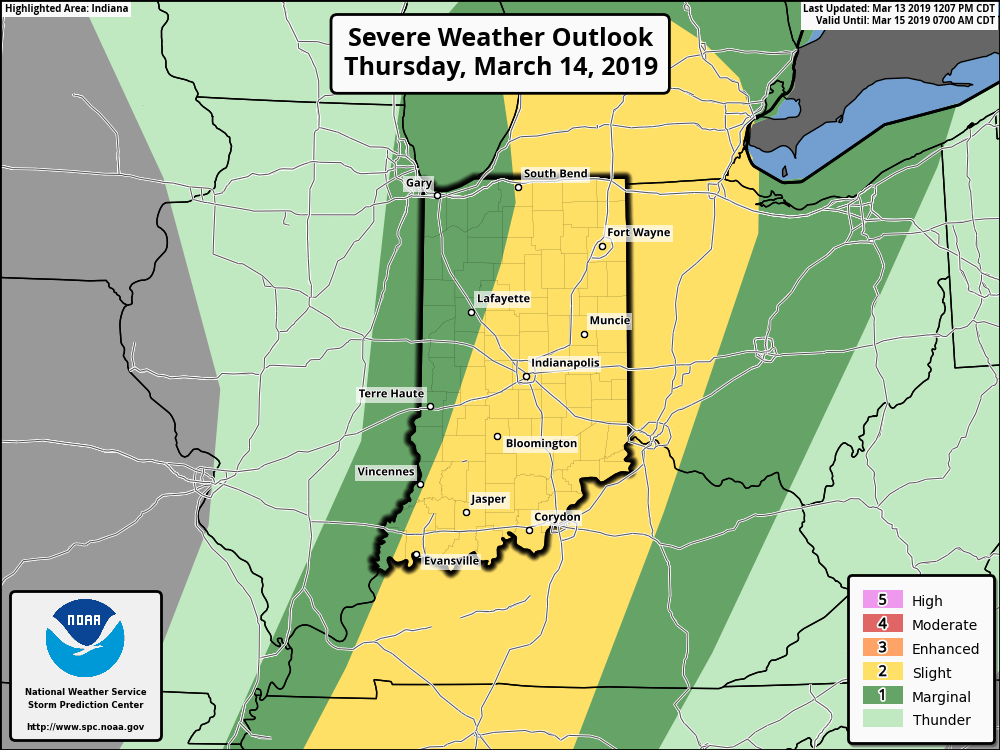
What: All modes of severe weather, including tornadic potential. Damaging wind gusts.
When: Damaging wind gusts develop late tonight into the predawn Thursday. Severe storms are most likely Thursday afternoon into early Thursday evening.
Wind: SW 45-55 MPH with gusts of 60 MPH+
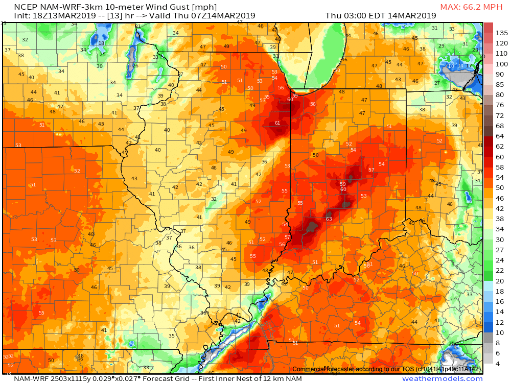
A couple of rounds of thunderstorms will impact central Indiana during the overnight and again Thursday afternoon and evening. It’s the second round tomorrow afternoon that has us most concerned for the potential of strong to severe thunderstorms. A lot of this hinges on just how much clearing takes place from the morning round of showers and embedded thunder. Should we clear things out in significant fashion, and introduce some sunshine, the threat of severe weather tomorrow afternoon will grow significantly. Conversely, should we hold onto a mostly overcast sky, this will limit the overall severity of afternoon storms. The sun would help destabilize things in rather rapid fashion and given some of the other parameters in place, would lead to all modes of severe weather with storms that develop tomorrow afternoon- including large hail and tornadoes.
Additionally, due to the sheer strength of the storm system, damaging winds are still in play tomorrow (even outside of thunderstorms). In fact, winds will begin to gust upwards of 50 MPH+ during the overnight period tonight. If you haven’t already, please take the time now to tie down or secure loose objects to keep them from being blown about in the wind.
Conditions will begin to improve as early as tomorrow night, although we’ll turn much colder. Air will grow cold enough to promote “wrap around” moisture to fall in the form of snow by Friday afternoon.

Permanent link to this article: https://indywx.com/2019/03/13/client-brief-thursday-severe-weather-update/
Mar 13
Morning Video Update On The Damaging Wind Threat; Severe Potential Thursday…
Thursday is shaping up to be a significant weather day across the state. Multi-threat severe potential and damaging wind event both on the table…
You must be logged in to view this content. Click Here to become a member of IndyWX.com for full access. Already a member of IndyWx.com All-Access? Log-in here.
Permanent link to this article: https://indywx.com/2019/03/13/morning-video-update-on-the-damaging-wind-threat-severe-potential-thursday/