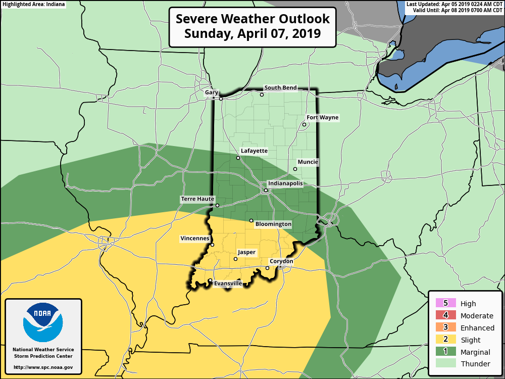
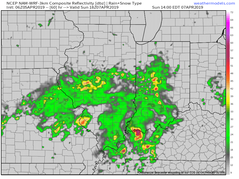
The daytime Thursday will be dominated by a summer-like feel as highs approach the 80 degree mark, along with an increasingly gusty SW wind ahead of an approaching cold front. We’ll stay dry through the day and it’s not until we get to the overnight hours when storm chances will begin to increase.
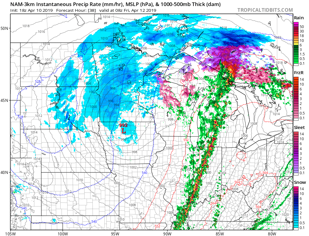
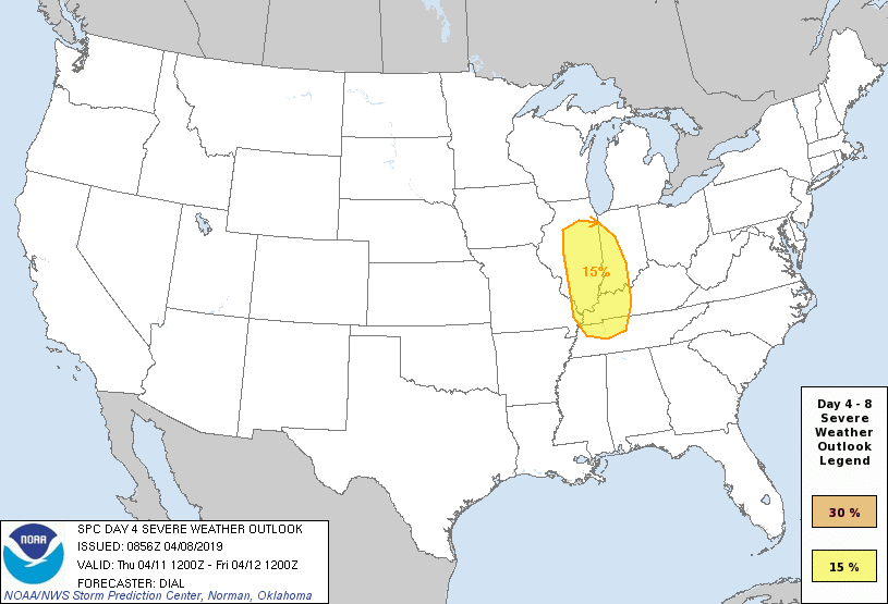
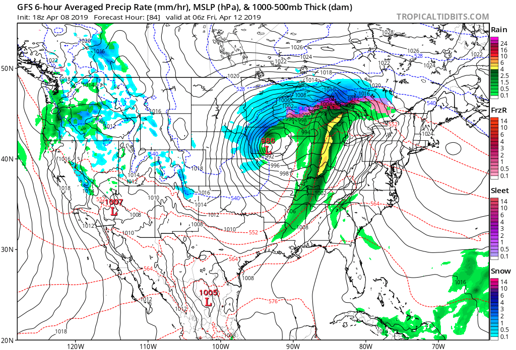
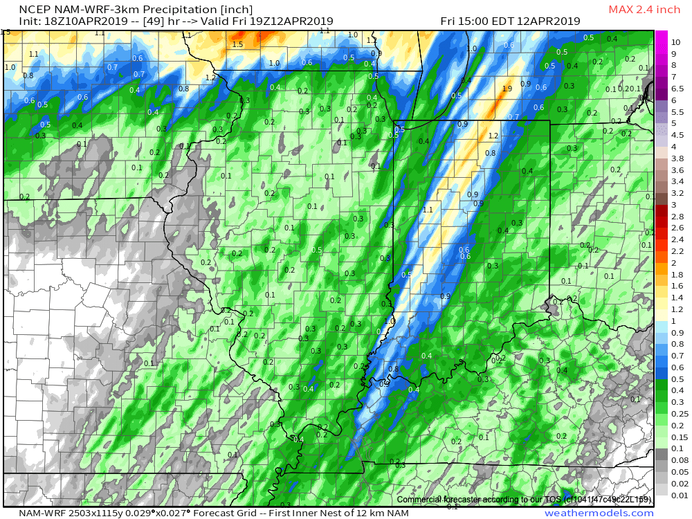
More specifically, we think the hours between 12a and 5a will offer up the best chance of a slow moving line of storms to track across central Indiana. A couple of these storms could produce damaging winds. Locally heavy rainfall can also be expected with widespread amounts of 0.50″ to 1″ with a few 1″+ totals likely by the time we get to sunrise Friday. The rain will be well to our east by lunchtime Friday and a dry close to the day is on tap.
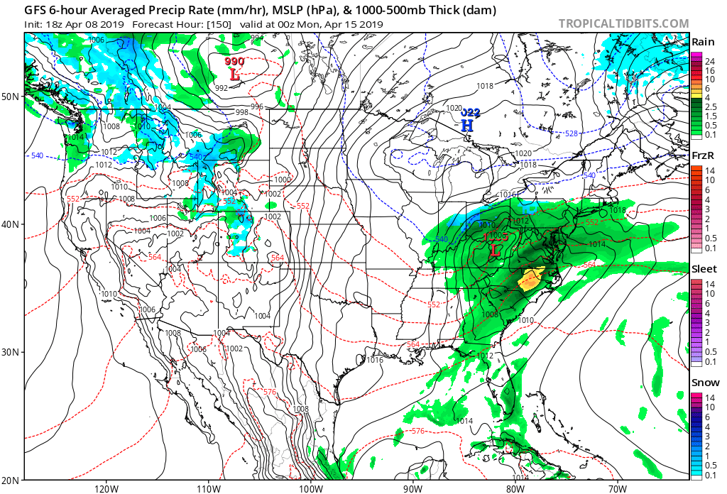
On the heels of this storm will come another wet weather maker Saturday night and Sunday and tomorrow morning’s video update will have more details around timing and rainfall amounts with that system.
Early Summer Ideas
I. Weak El Nino anticipated to persist through the Summer of 2019.
II. Warm SSTs in the Gulf of Mexico and off the Southeast Coast.
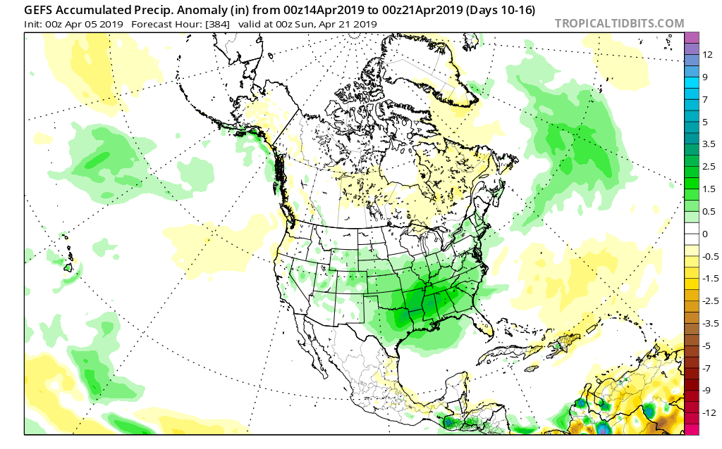
We’ll have our complete official Summer Outlook posted during the first week of May, but wanted to share our early thoughts. Overall, a warmer than average summer is expected with average to slightly above normal rainfall, locally.
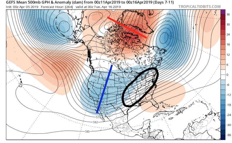
The warmer than average sea surface temperatures (SSTs) raise concern for the potential of well above average precipitation across the Southeast and MidAtlantic regions. Additionally, those warm water conditions also mean we’ll need to keep close eyes on the potential of tropical activity early on in the season in the Gulf or off the SE coastline.
Much more next month, including graphics!
Talk with you bright and early in the AM!