Category: Severe Weather

VIDEO: Fingers Crossed For More Widespread Rain Tomorrow; Longer Range Pattern Takes On A Drier, Warmer Than Average Look…

Updated 07.07.22 @ 8:42a

You must be logged in to view this content. Click Here to become a member of IndyWX.com for full access.  Already a member of IndyWx.com All-Access?  Log-in here.

Permanent link to this article: https://indywx.com/2022/07/07/video-fingers-crossed-for-more-widespread-rain-tomorrow-longer-range-pattern-takes-on-a-drier-warmer-than-average-look/

And Then Came The Rain (And Storms)…

Updated 07.05.22 @ 7:58a

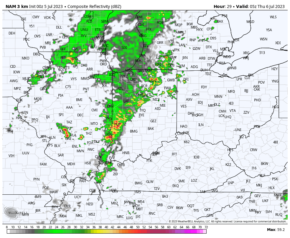
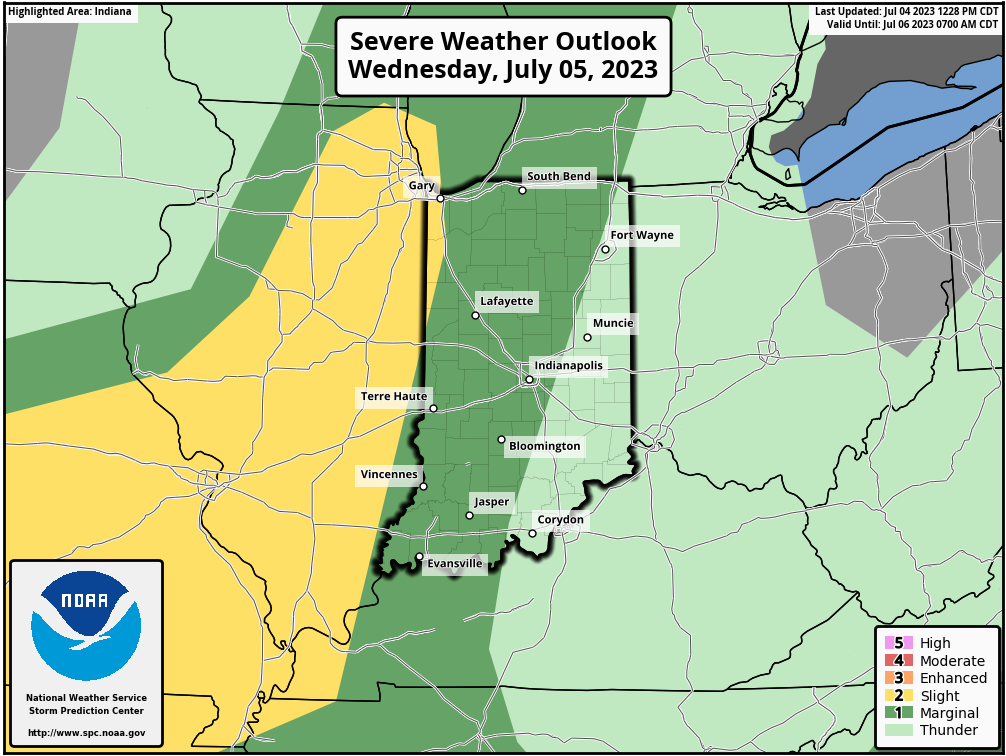
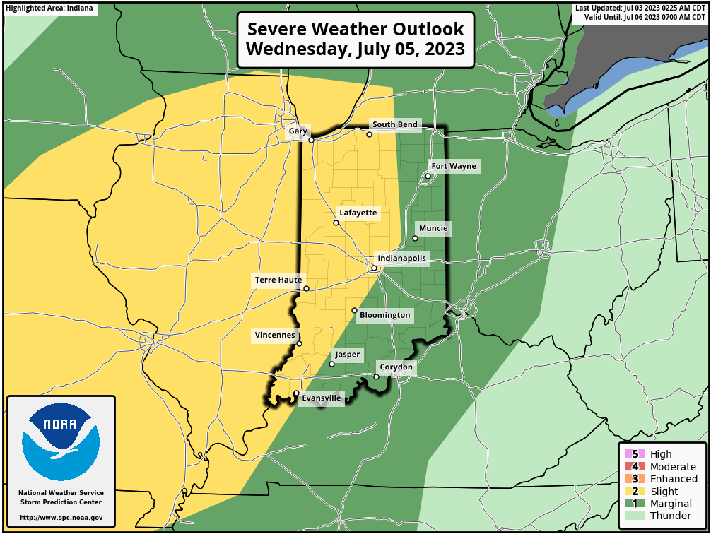
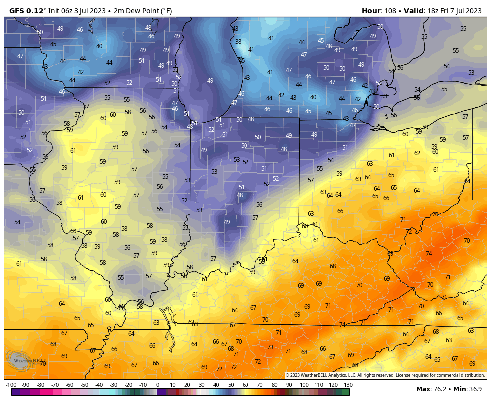
A very busy mid-summer pattern will take up residence through the remainder of the week. Multiple storm clusters will ride southeast into the region, some of which will feature severe wind gusts. The Storm Prediction Center includes a threat of severe weather for Indiana today through Thursday (this will likely get extended into the Friday/ Saturday time period before drier, more stable air can work in here).

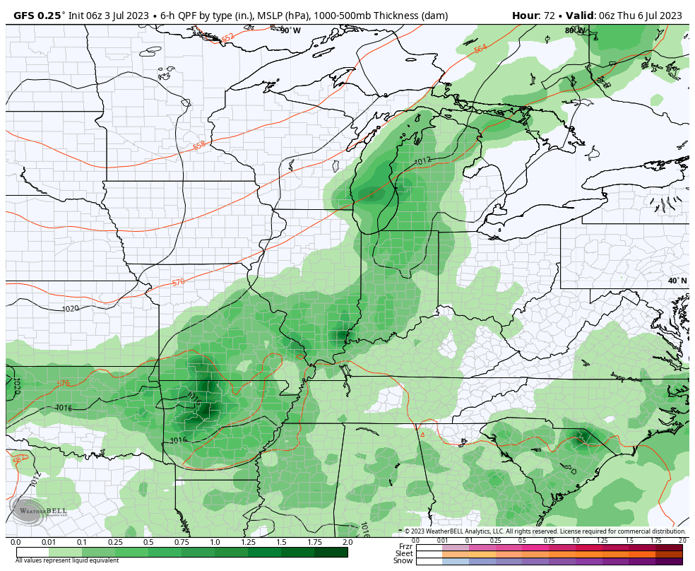
Localized flash flooding will also become a concern, especially towards mid and late week as these storm clusters track over the same areas. Juicy precipitable water values (2”+) will help feed these storm clusters, turning them into prolific rain makers at times. It should be noted that some central IN communities have missed out on recent rains, so rainfall rates of 2”+ / hour falling on rock hard soils will have no problem running off and leading to flash flooding at times.

Drier air will eventually build in here by the weekend and this will lead to a temporary pull back in rain/ storm coverage, and a much more pleasant airmass. Timing, yet again, is on our side.

Tomorrow is a travel day so please expect a later than normal client video post. Should have things online by mid evening, or so, Wednesday.

Permanent link to this article: https://indywx.com/2022/07/05/and-then-came-the-rain-and-storms/

Weekly #AGwx And Severe Weather Outlook…

Updated 07.03.22 @ 6:40a

The axis of the upper ridge will retrograde west over the upcoming week, putting our region on the outer periphery of the hot dome anchored in the Plains.
Cooler than normal temperatures are expected along the West Coast and Northeast during the upcoming 10 days as a whole. Serious heat will bake the Front Range and Plains.
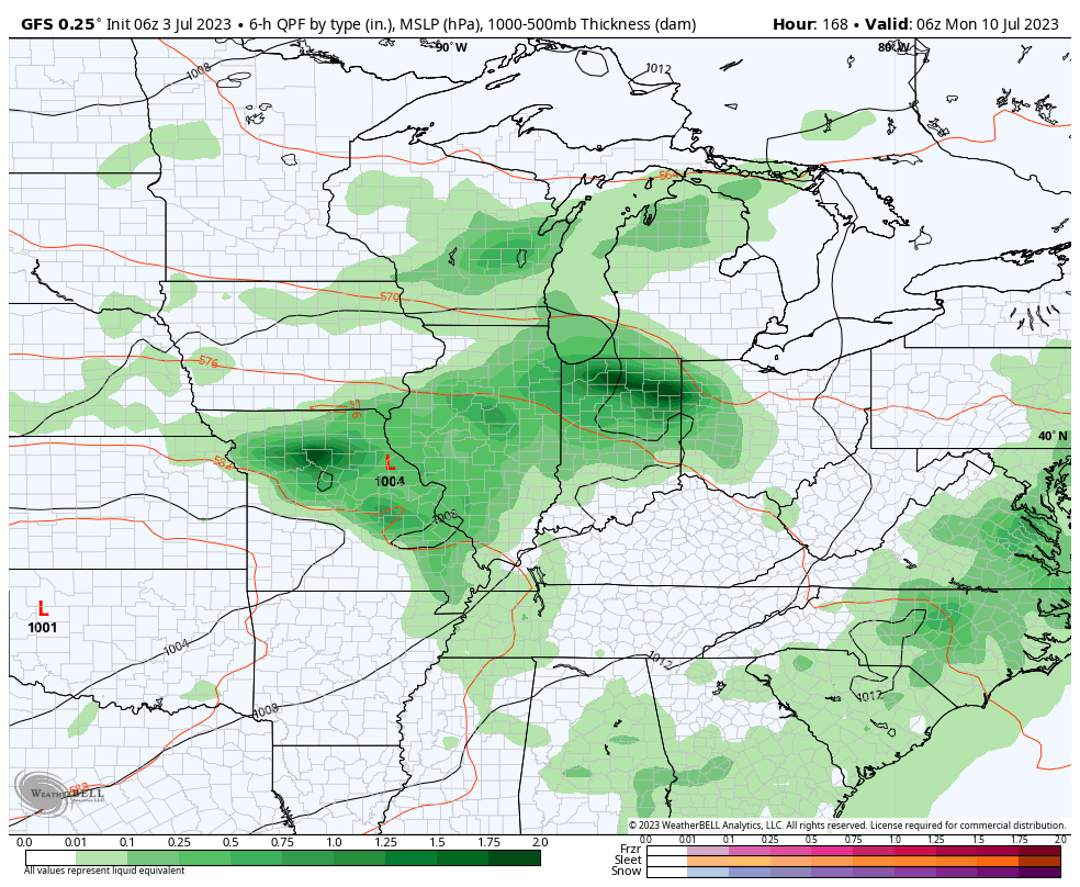
To no surprise, an axis of above normal rain is anticipated to take up residence from the northern Rockies, southeast into the Ohio Valley and Deep South through the coming 10 day period.
We expect widespread rainfall between 1”-2” over the upcoming 10 day period, but there will be localized significantly heavier totals.

Forecast Period: 07.03.22 through 07.13.22

After a quiet holiday weekend, a much more active pattern will take hold as we navigate the 1st half of July. It won’t rain everyday, but chances of benefitting from soaking rain in more widespread fashion will be on the rise as we move into the middle and latter part of this week into the following week.

Serious heat will bake the Plains while a cooler pattern dominates the Northeast region. In between, here on the home front, we’ll note heat trying to expand northeast into the Ohio Valley (and there will be several 90°+ days thrown in the 10-day period), but each time it may look like the heat is here to stay for more than a few days, we’ll likely get cooling relief from cold fronts moving southeast around the periphery of the ridge.

We’ll have to pay close attention to some of the more “mature” storm complexes including a heightened threat of damaging straight line winds give the overall pattern. It’s impossible to pin down which complexes may include a better threat of severe weather from this distance, but this threat may include a closer look as we move into the middle and latter part of the week.

10-Day Rainfall Forecast: 1”-2”

Permanent link to this article: https://indywx.com/2022/07/03/weekly-agwx-and-severe-weather-outlook-44/

Weekly Severe And #AGwx Outlook…

Updated 06.14.22 @ 7:33a

After getting beaten down this weekend, the upper ridge will flex it’s muscle yet again next week, significantly influencing our pattern.
Widespread above normal temperatures can be expected given the 500mb pattern above from the Plains into the Southeast and up into the Great Lakes.
Widespread drier than normal conditions are anticipated from the Plains, Southeast, and up into the Ohio Valley as the ridge dominates.

Forecast Period: 06.14.22 through 06.24.22

A cold front will slide through the area Thursday with the potential of a widely scattered shower or storm. The bigger story will be a significant reduction of heat and humidity as we close out the work week and head through the weekend. After dealing with heat indices in the 105º+ range today and Wednesday, lows that drop back into the 50s this weekend sure will feel nice. After Thursday, dry conditions should dominate through the weekend.

The upper ridge will then expand northeast once again as we head into the new work week. You know what this means, oppressive heat and humidity will return next week. Like this week, the most oppressive conditions come in the Tuesday-Thursday time frame before another cold front returns us to cooler, more seasonal temperatures next weekend. Get the idea that we’re locked into a “transitional” pattern for the foreseeable future?

From a rainfall perspective, we’re in that time of year where it’s all but impossible to predict rainfall amounts down to a specific backyard (case in point yesterday where many north and eastern Indianapolis ‘burbs clocked in a quick 2″+, while others on the south and west side didn’t see a drop of rain). From an overall perspective, rainfall amounts will run well below normal over the next 7-10 days. We will keep an eye on storm clusters that may round the periphery of the upper ridge early next week, and these could influence our weather Monday into Tuesday (similar to what we dealt with yesterday).

As we look beyond the 10 day period, the ‘mean’ upper pattern should feature the ridge pulling back west and placing our immediate region into a northwesterly flow aloft to close the month of June. This should translate to relatively wetter, cooler times.

10-Day Rainfall Forecast: 0.50″ to 1.00″

Permanent link to this article: https://indywx.com/2022/06/14/weekly-severe-and-agwx-outlook-2/

VIDEO: Chance Of Severe Storms This Afternoon; Evening Before The Heat Builds. Much Cooler, Less Humid Weekend On Tap…

Updated 06.13.22 @ 6:40a

You must be logged in to view this content. Click Here to become a member of IndyWX.com for full access.  Already a member of IndyWx.com All-Access?  Log-in here.

Permanent link to this article: https://indywx.com/2022/06/13/video-chance-of-severe-storms-this-afternoon-evening-before-the-heat-builds-much-cooler-less-humid-weekend-on-tap/

VIDEO: Strong-Severe Storms To Open The Period; Late Week Cold Front Offers Big Relief From A Hot Midweek…

Updated 06.12.22 @ 8:30a

You must be logged in to view this content. Click Here to become a member of IndyWX.com for full access.  Already a member of IndyWx.com All-Access?  Log-in here.

Permanent link to this article: https://indywx.com/2022/06/12/video-strong-severe-storms-to-open-the-period-late-week-cold-front-offers-big-relief-from-a-hot-midweek/

VIDEO: Detailing Today’s Severe Threat; Few Days Of Intense Heat, Humidity Arrives Next Week…

Updated 06.08.22 @ 7:27a

You must be logged in to view this content. Click Here to become a member of IndyWX.com for full access.  Already a member of IndyWx.com All-Access?  Log-in here.

Permanent link to this article: https://indywx.com/2022/06/08/video-detailing-todays-severe-threat-few-days-of-intense-heat-humidity-arrives-next-week/

VIDEO: Severe Weather Episode Tomorrow Afternoon? 1st Heat Wave Of The Season Dialed Up Next Week…

Updated 06.07.22 @ 6:35p

You must be logged in to view this content. Click Here to become a member of IndyWX.com for full access.  Already a member of IndyWx.com All-Access?  Log-in here.

Permanent link to this article: https://indywx.com/2022/06/07/video-severe-weather-episode-tomorrow-afternoon-1st-heat-wave-of-the-season-dialed-up-next-week/

Weekly Severe And #AGwx Outlook…

Updated 06.06.22 @ 7:50a

The ‘mean’ upper air pattern will continue to favor a trough and northwest flow aloft across our general region through the upcoming 7-10 days.
While heat bakes across the Southwest and southern Plains, the theme, locally, will continue to be a refreshing one for June standards.
Precipitation is forecast to run slightly above normal for the 10 day period across the Great Lakes, Ohio / TNValley region, and Northeast.

Forecast Period: 06.06.22 through 06.16.22

After a calm open to our Monday, a storm system will blow in from the west and lead to an expanding area of storms this afternoon into the evening. From the area in and around Indianapolis and points south, some of these storms could become strong to severe (large hail and damaging winds being of greatest concern). Localized flash flooding is also possible due to the training nature some cells may take. Unfortunately, a rough evening commute is a good bet due to the timing of this storm complex.

After a quiet Tuesday, a similar setup can be expected of that from today on Wednesday. We’ll time the afternoon and evening hours for the arrival of the unsettled, stormy conditions. Additional chances of strong to severe storms will be likely, including threats that are similar to today.

Finally, another system will deliver a round of showers and storms Friday. The good news is that for the 3rd consecutive weekend, it appears as if the area will enjoy pleasant weather, including unseasonably cool, refreshing temperatures.

As we flip the page to next week, the week will open with a similar pattern dominating (northwesterly flow aloft) that will have to be monitored for the likelihood of additional storm clusters. Thereafter, models are in a bit of a disagreement on what takes place with building heat to our west. It’s possible this hot dome nudges far enough east to heat us up the middle of next week. With that said, indications are that even if this is the case, we wouldn’t see prolonged hot, humid times that our friends across the southern Plains and Southwest are contending with.

10-Day Rainfall Forecast: 1.5” to 2” (localized heavier amounts in excess of 2” will be likely where storms train).

Notes and Asides: Have been on the road the past few days. Travel day tomorrow but will be back at home base by evening. As such, please expect a delay in tomorrow’s post. We’ll have a client video posted towards late afternoon.

Permanent link to this article: https://indywx.com/2022/06/06/weekly-severe-and-agwx-outlook/

Sunday Afternoon Rambles…

Updated 06.05.22 @ 4p 1.) Our pleasant weekend will give way to an unsettled open to the work week as the first in a series of storm systems blows into…

You must be logged in to view this content. Click Here to become a member of IndyWX.com for full access.  Already a member of IndyWx.com All-Access?  Log-in here.

Permanent link to this article: https://indywx.com/2022/06/05/sunday-afternoon-rambles-4/

IndyWx.com