Severe Threat Tonight For Portions Of The Region…
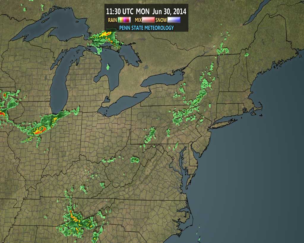
We spoke Sunday of a couple complexes of thunderstorms potentially impacting the region today. The first complex of thunderstorms is moving into northwestern portions of the state as we write this and short-term modeling is already struggling on the track of this complex. Note the forecast radar, via the HRRR and 4km NAM, valid 8am versus the actual radar snapped at 7:30am.


The first complex of thunderstorms will likely blow through north-central Indiana counties later this morning.
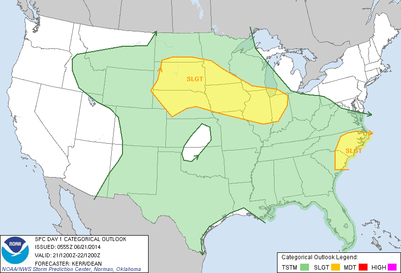
The Storm Prediction Center has outlined portions of the region under a slight risk of severe today, including a heightened moderate risk across Iowa, MO, and IL. All modes of severe weather are in play, including potential tornadoes, large hail, and damaging straight line winds.

The latest 4km NAM shows complex number 2 erupting over Iowa later this afternoon.

This is the complex of storms that could pose a rather active time of things across Indiana tonight.
Moisture and energy will be plentiful, meaning storms will likely remain strong to severe as they push into central Indiana. Additionally, locally heavy downpours are a good bet.
Forecast CAPE is to be around 3500-4500 J/kg tonight when complex number 2 is eyeing the region. In short, this means “energy” will be plentiful for storms to remain strong to severe as they blow into the region. Think of CAPE as fuel for storms.

Forecast PWAT, or precipitable water, shows a ribbon of 2″ streaking through the central portions of the state and suggests torrential downpours with any storm.

Bottom line, it’ll be important to have a means of getting your latest weather information and radar trends later this evening. The greatest severe threat to our immediate region appears to be with a straight line wind component, but as stated above, we’ll have to be on guard for all modes of severe weather.
Now casting will be key later tonight as we eye another round of potential severe weather impacting the state. While the first complex of storms will impact northern counties this morning, it’s complex number 2 late tonight that could pack a punch across a more widespread portion of the region. More later this afternoon!