Monday Evening Video Update!

This evening’s video covers a potential round of thunderstorms Tuesday morning and takes a deeper look at the mid range.  Yet ANOTHER unseasonably cool blast of air awaits on deck for mid-month and will provide a hint of early fall, per the EC ensemble run below for next week.  This is just one piece of data amongst several pieces pointing towards a big mid-month cool down.  Much more in the video update below!

Geopotential32at32500hPa_North32America_192


Here We Go Again…

What a weather year this has been for central Indiana.  Snow and cold translated to wet and stormy as winter turned to spring.  Now as summer rumbles into the supposed “dog days” we’re really left with the exact opposite.  Our weather pattern will be dominated by a fast moving northwest flow over the upcoming (7) days and this spells an active and stormy open to the work week and next weekend, with an “island” of cool, pleasant weather thrown in the mix Wednesday through Friday.

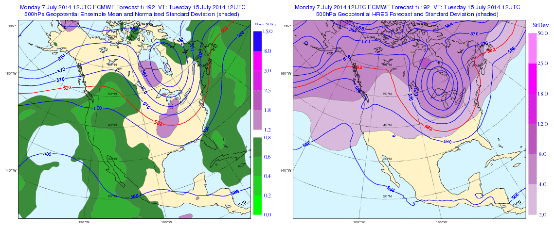
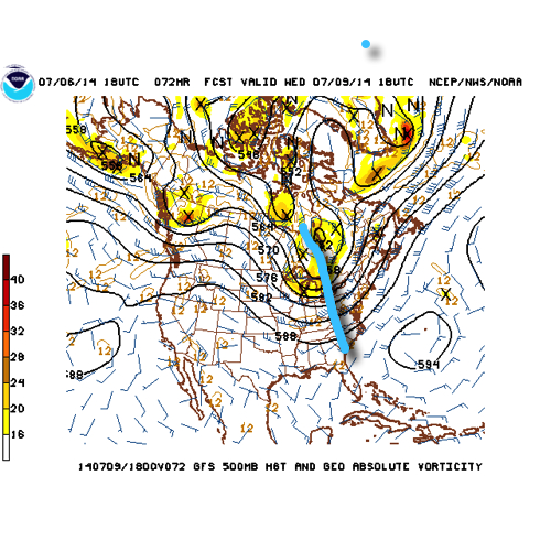
The GFS operational run shows that we’ll remain locked into the rather active northwest flow pattern through the upcoming week.  Note that while the trough axis moves east with time, the northwest flow remains intact.

1


2


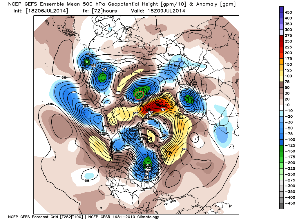
There’s excellent ensemble support from the GEFS and EC, as well.

a

b

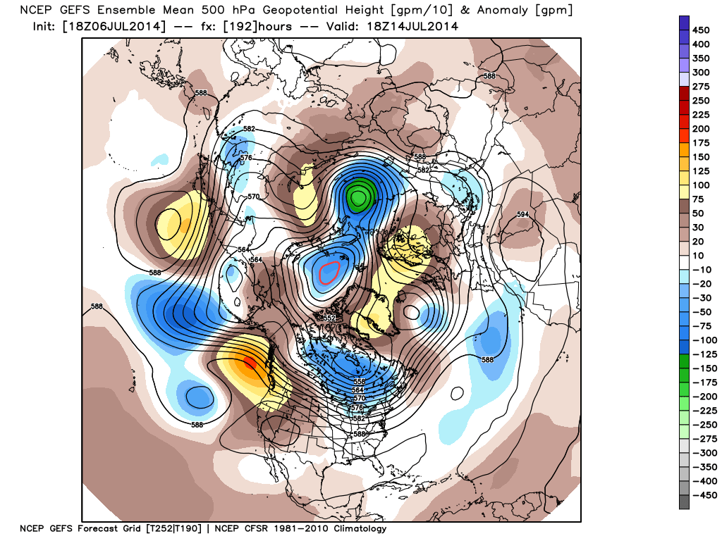
The end result is a (7) day stretch that remains cooler than normal when all added up, highlighted by the cooler punch of air (worthy of open windows yet again) Wed-Fri.

4

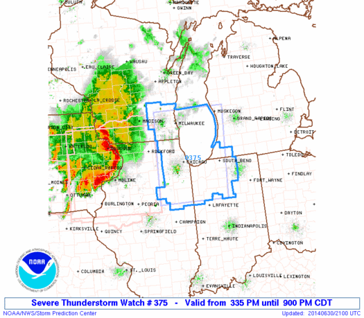
This also remains quite the active pattern in regards to thunderstorm complexes and rounds of locally heavy rainfall.  We bracket late tonight into Monday morning and again Monday night into Tuesday, followed by next weekend for possible storm complexes that will make for a rather noisy time of things here.  As for the severe threat, we’ll have to keep a close eye on each complex.  It’s possible one or two of these could pose a damaging wind threat as they race southeast and that’s our biggest concern as of now.

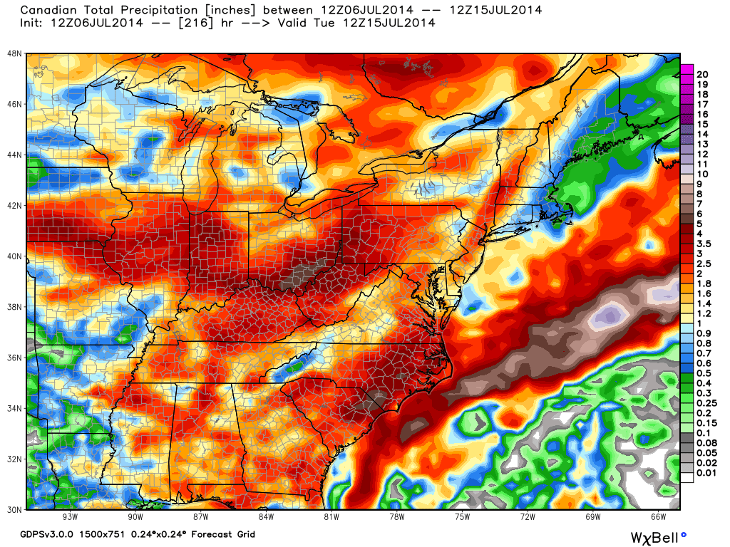
When you total it all up, the upcoming (7) day period, July 7th-14th, is likely to lead to more significant rainfall over the region.  The Canadian isn’t holding back, suggesting widespread 2-3″ totals.  That may be a bit “bullish,” but we’ll forecast 1.5″-2″ with ease during the upcoming week, including locally heavier totals.

5

Quick summary:

Monday through Tuesday will be highlighted by rainy and stormy periods before we introduce a much cooler and drier regime Wednesday through Friday.  Humidity builds over the upcoming weekend with additional rain and thunderstorm chances returning.

Busy Week Of Weather Ahead…

Sun.

Mon.

Tue.

Wed.

Thr.

Fri.

Sat.

 Status-weather-showers-day-icon

 Status-weather-showers-day-icon

 Status-weather-showers-day-icon

 Status-weather-clouds-icon

 Status-weather-clouds-icon

 Status-weather-clouds-icon

 Status-weather-showers-day-icon

62/ 83

66/ 83

70/ 81

61/ 78

52/ 75

54/ 81

62/ 83 

Light

Light

Light

– – –

– – –

– – –

Light

A round of scattered showers impacted portions of north-central Indiana during the early morning hours.  Those showers have since pushed east and we’re now back into dry conditions (for now). We’ll watch the radar closely as outflow boundaries to our west this morning could ignite possible scattered thunderstorm redevelopment once again this afternoon.  This is just the beginning of a busy few days ahead as we track multiple thunderstorm complexes that have potential to impact the region.  We’ll watch late tonight and early Monday and again late Monday into Tuesday for possible more widespread storm complexes and an associated severe weather risk- mainly from damaging straight line wind potential.  Once to Wednesday morning we should note a drier and cooler air mass pressing in which will set the stage for a beautiful close to the work week.  Once to the weekend, a warmer and increasingly moist flow will return with renewed storm chances.

Sun-Filled And Unseasonably Cool…

Fri.

Sat.

Sun.

Mon.

Tue.

Wed.

Thr.

 Status-weather-clear-icon

 Status-weather-clear-icon

 Status-weather-clouds-icon

 Status-weather-showers-day-icon

 Status-weather-showers-day-icon

 Status-weather-showers-day-icon

 Status-weather-clouds-icon

51/ 76

55/ 80

59/ 83

68/ 87

68/ 82

58/ 78

57/ 82 

– – –

– – –

– – –

Light

Moderate

Light

– – –

Happy Independence Day!  Canadian high pressure remains firmly in control of our weather today and for the majority of the weekend for that matter.  As a result, look for plentiful amounts of sunshine and temperatures that will continue the cooler than normal regime we enjoyed Thursday.  Today’s conditions, once again, will have that feeling of early fall.  ENJOY!  A more active weather pattern will return early next week as we potentially have to deal with a couple thunderstorm complexes in the Monday-Tuesday time period.  Heavy rain and the chance of severe weather will return to your forecast Monday night into Tuesday and we’ll have more details around this as we move closer.  A cooler and drier regime will build in by the middle portion of next week.

More On Tonight’s Severe Threat…

As we type this, a PDS (Particularly Dangerous Situation) Severe Thunderstorm Watch has been hoisted to include much of northwestern Indiana.  The concern is that the complex of storms, already responsible for damaging weather across Iowa, gains steam as it plows east and intensifies this evening.

ww0375_radar


There’s no doubt in overall thinking that northern Indiana is at greatest risk for damaging severe weather later this evening and overnight, but we do have some concern that areas further south aren’t out of the woods.  Is there risk at being wrong in the further south idea?  Absolutely.  However, a look over the latest model data continues to suggest there’s plenty of moisture and fuel readily available.  Additionally, similar thunderstorm complexes have been known to “hook” south as they intensify racing east and short-term modeling has been known to have to play catch up at the very end in some particular cases.  That’s not something we want to play around with tonight, given what the potential is.  Will potential become reality here across central Indiana?  Big question at the moment, but one can’t be too careful with this particular situation as a rather widespread damaging wind event should expand in the coming hours.  Nowcasting will be key.  Should central Indiana get in on the stormy action it would be late this evening and overnight- midnight-ish, and after, for most.

Our best educated projection at this juncture would place north-central Indiana (a line from Crawfordsville to Muncie) and points north under the greatest risk for potential severe weather late tonight.  Damaging straight line winds are of greatest concern with this complex tonight.  Know that we’ll keep a close eye on things moving forward and suggest setting the weather radio on alert mode before heading off to bed this evening.  As always, have a means to get watches and warnings issued by the National Weather Service.