Category: Severe Weather

Happy Labor Day: Getting To Be That Time Of Year Where Cold Fronts Become A Bit More Potent; Mid-September Pattern Evolution…

Updated 09.05.22 @ 8:45a

I hope this finds you enjoying a relaxing Labor Day. Below are some headlines that have our attention as we progress through the week ahead and look forward to the middle of September.

1.) Brighter Days Ahead: Our region has been under the influence of an area of low pressure and associated upper level trough for the past few days. Unfortunately, gloomy skies will prevail today along with scattered slow moving downpours. While everyone won’t get wet, those that do find themselves under one of these convective downpours could easily pick up a quick 1″+ of rain in under an hour. Thankfully, a drier airmass will begin to build in Tuesday before really taking hold in earnest Wednesday through Friday. This will deliver an increasingly sunny sky and lower humidity levels.

A drier airmass will arrive by midweek. This will allow overnight lows to fall into the 50s for most areas Thursday and Friday mornings.

2.) Potent Weekend Cold Front: When the calendar turns to September, we always have to start paying a little more attention to approaching cold fronts. That, of course, becomes even more the case the deeper into the fall season we go. The fall severe weather season occasionally rivals that of the spring around these parts and temperature changes become more significant as the days go by. This weekend will feature the 1st true autumn-like frontal passage of the young meteorological fall season.

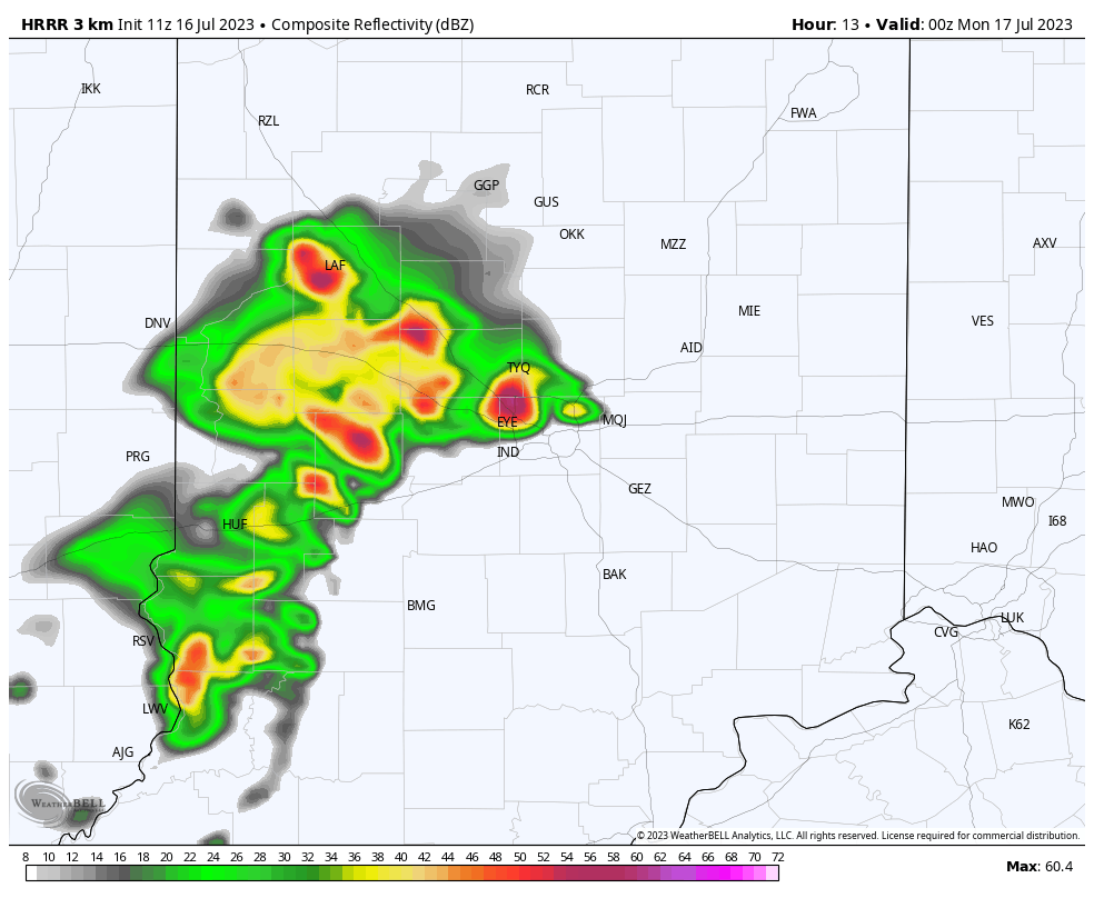
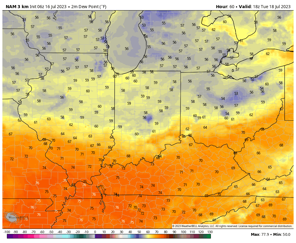
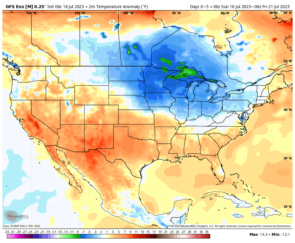
Ahead of the boundary, southerly winds will pull an increasingly moist and unstable airmass northward (you’ll really notice a difference in the airmass Friday morning compared to that of Saturday morning). It also wouldn’t surprise me if the Storm Prediction Center is forced to hoist a risk of severe weather across the Ohio Valley Saturday, including here in Indiana. The front is expected to sweep through the state Sunday morning and then we’ll deal with a brief, but significant, “pop” of much cooler, drier air (coolest so far of the season) as we open up next week.

Moisture will be pulled back northward ahead of an approaching front Saturday.
Note the drastic change in dew points Sunday morning as the fall front progresses east.
Some gusty to severe storms are possible ahead of the front Saturday.

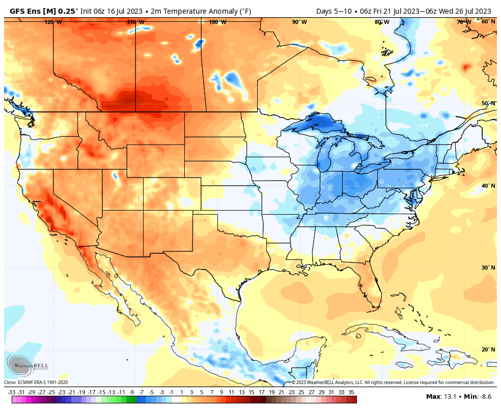
3.) Mid-September Warm Up…Despite the aforementioned “pop” of cooler air to open up next week, all indications continue to point towards another significant warmup with a building ridge over our part of the country as we head into the middle of September. In fact, don’t be shocked if we’re still not quite done with the 90s for the year…

As it sits right now, it appears as if the heat will really start to build towards the end of next week and into the weekend of the 17th. Based on longer range pattern drivers, the balance of the 2nd half of September should run above normal.

An upper ridge will expand over our part of the country through the middle and latter part of September.

Permanent link to this article: https://indywx.com/2022/09/05/happy-labor-day-getting-to-be-that-time-of-year-where-cold-fronts-become-a-bit-more-potent-mid-september-pattern-evolution/

VIDEO: Gusty Storm Complex Takes Aim On The Region Later This Evening…

Updated 08.29.22 @ 7:00a

You must be logged in to view this content. Click Here to become a member of IndyWX.com for full access.  Already a member of IndyWx.com All-Access?  Log-in here.

Permanent link to this article: https://indywx.com/2022/08/29/video-gusty-storm-complex-takes-aim-on-the-region-later-this-evening/

VIDEO: Unsettled Stretch Of Weather Into The Early Part Of Next Week…

Updated 08.03.22 @ 7:35a

You must be logged in to view this content. Click Here to become a member of IndyWX.com for full access.  Already a member of IndyWx.com All-Access?  Log-in here.

Permanent link to this article: https://indywx.com/2022/08/03/video-unsettled-stretch-of-weather-into-the-early-part-of-next-week/

VIDEO: Tracking A Couple Rounds Of Storms Today; Southeastern IN At Risk Of Severe Storms Tonight…

Updated 08.01.22 @ 7:20a

You must be logged in to view this content. Click Here to become a member of IndyWX.com for full access.  Already a member of IndyWx.com All-Access?  Log-in here.

Permanent link to this article: https://indywx.com/2022/08/01/video-tracking-a-couple-rounds-of-storms-today-southeastern-in-at-risk-of-severe-storms-tonight/

VIDEO: Several Days Of Rain And Storms To Get Through Ahead Of A Stellar Close To July…

Updated 07.24.22 @ 8:40a

You must be logged in to view this content. Click Here to become a member of IndyWX.com for full access.  Already a member of IndyWx.com All-Access?  Log-in here.

Permanent link to this article: https://indywx.com/2022/07/24/video-several-days-of-rain-and-storms-to-get-through-ahead-of-a-stellar-close-to-july/

VIDEO: Wet, Stormy Pattern; Heat Backs Off In The Coming Days…

Updated 07.23.22 @ 7:55a

You must be logged in to view this content. Click Here to become a member of IndyWX.com for full access.  Already a member of IndyWx.com All-Access?  Log-in here.

Permanent link to this article: https://indywx.com/2022/07/23/video-wet-stormy-pattern-heat-backs-off-in-the-coming-days/

VIDEO: Line Of Strong Storms For Some This Evening; Serious Weekend Heat And Looking Ahead To An Unsettled Pattern Next Week…

Updated 07.20.22 @ 7:45a

You must be logged in to view this content. Click Here to become a member of IndyWX.com for full access.  Already a member of IndyWx.com All-Access?  Log-in here.

Permanent link to this article: https://indywx.com/2022/07/20/video-line-of-strong-storms-for-some-this-evening-serious-weekend-heat-and-looking-ahead-to-an-unsettled-pattern-next-week/

VIDEO: Wet Sunday Gives Way To A Dry And Progressively Hotter Rest Of The Week…

Updated 07.17.22 @ 9:15a

You must be logged in to view this content. Click Here to become a member of IndyWX.com for full access.  Already a member of IndyWx.com All-Access?  Log-in here.

Permanent link to this article: https://indywx.com/2022/07/17/video-wet-sunday-gives-way-to-a-dry-and-progressively-hotter-rest-of-the-week/

VIDEO: Potential Of Scattered Strong-Severe Storms This Evening; Refreshing By Mid-July Standards Thereafter…

Updated 07.11.22 @ 7:11a

You must be logged in to view this content. Click Here to become a member of IndyWX.com for full access.  Already a member of IndyWx.com All-Access?  Log-in here.

Permanent link to this article: https://indywx.com/2022/07/11/video-potential-of-scattered-strong-severe-storms-this-evening-refreshing-by-mid-july-standards-thereafter/

Central Indiana Poised To Finally Cash In On Heavy Rains…

Updated 07.08.22 @ 7:30a

0.14″. That’s it in the rainfall department, officially recorded at IND, for the month so far. While several neighborhoods have seen much more rainfall than that, it reiterates just how dry it’s been here for most immediate central Indiana communities. In fact, we have to go all the way back to June 12th to find the last 24 hour period where IND recorded anything close to even half an inch of rain (0.49″).

With all of that said, a combination of ingredients should come together to finally allow a widespread chunk of central Indiana to accumulate hefty rain totals as we get set to close out the work week.

I. We have added forcing from a cold front and wave of low pressure that will move along the boundary as it sags south this evening. This will aid in helping more widespread coverage of rain and thunderstorms fire, especially as we progress into the afternoon and evening.

II. A truly tropical airmass engulfs the region this morning and this will remain in place until the cold front clears the area late tonight. Precipitable water values in excess of 2″ combined with dew points in the lower to middle 70s will allow rain and storms to feed off the juicy air this afternoon and evening. Rainfall rates of 2″+ per hour will be common in the heavier cells. Should storms train over the same areas, flash flooding will likely develop.

III. As the wave of low pressure moves across the state this afternoon and evening, it could help enhance the threat of severe weather, especially along and south of the I-70 corridor. A quick spin-up tornado isn’t out of the realm of possibility but the bigger severe threats appear to be from wet microbursts (damaging wind/ hail).

We anticipate many central Indiana neighborhoods to accumulate at least an inch of rain today with some communities seeing locally heavier totals. Again, where heavier cells train, localized flash flooding will develop.

Eventually the front will settle south and clear the state tonight. This will allow drier and MUCH less humid to return to the region just in time for the weekend. We expect plentiful sunshine, low humidity, and cooler temperatures to dominate through the day Monday.

Permanent link to this article: https://indywx.com/2022/07/08/central-indiana-poised-to-finally-cash-in-on-heavy-rains/

IndyWx.com