Video Update: Monday Morning Thoughts On A Busy Week Ahead…
You must be logged in to view this content. Click Here to become a member of IndyWX.com for full access. Already a member of IndyWx.com All-Access? Log-in here.
You must be logged in to view this content. Click Here to become a member of IndyWX.com for full access. Already a member of IndyWx.com All-Access? Log-in here.
 Highlights:
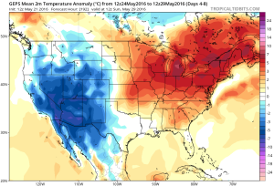
Busy Week Ahead…The overall pattern features the mean ridge position across the Four Corners region and sets up an active NW flow for our part of the country. It’s a pattern we need to get used to as it’ll remain intact to close the month and open July. Challenges are present in regards to specifics with timing and track of thunderstorm complexes we’ll deal with this week, particularly Wednesday.
In the shorter term, a frontal boundary will slip into central IN Monday night and a broken band of thunderstorms will accompany it. A few storms could reach strong to severe levels Monday evening.
Attention will then shift to Wednesday. Ingredients are coming together to present both a severe component (damaging wind the biggest threat) and localized flash flood threat. We’ll update our latest thinking Monday morning.
As we progress into late week, additional shower and thunderstorm complexes are possible, but we stress timing issues abound. It’ll be a warm and humid end to the week.
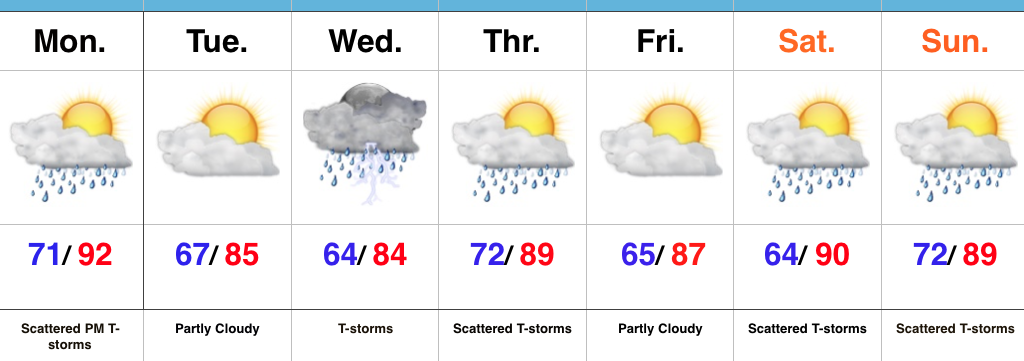
Upcoming 7-Day Precipitation Forecast:
Do we rid the morning convection and cloudiness to allow strong to severe thunderstorms to develop this afternoon and evening? This morning’s video has more.
You must be logged in to view this content. Click Here to become a member of IndyWX.com for full access. Already a member of IndyWx.com All-Access? Log-in here.
A hot and humid weekend is in store, but we’re eyeing increasingly wet and unsettled times by the middle of next week…
You must be logged in to view this content. Click Here to become a member of IndyWX.com for full access. Already a member of IndyWx.com All-Access? Log-in here.
After a damp and chilly open to the weekend, drier air began to infiltrate the region this afternoon and led to a brighter/ warmer finish to the day. We’ll add more sunshine and tack on a few degrees to the afternoon high on Sunday. It’ll be a phenomenal weather day across central IN, thanks to high pressure. Get out and enjoy it!
 Dry and sunny weather will greet us to open the new work week, along with temperatures that will approach the 80 degree mark by Tuesday. Have yard work to get caught up on? Take advantage of the early week weather.
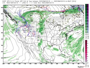
Things will begin to change towards an unsettled regime as early as Tuesday evening/ Wednesday as the region gets into an increasingly moist southwesterly air flow.
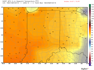
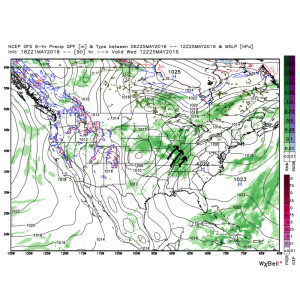 As such, we’ll increase the chances of showers and thunderstorms in our mid week forecast. It’ll also be a much more humid feel of things (really for the first time this year) as surface dew points surge into the upper 60s to lower 70s. (In other words, “oppressive”).
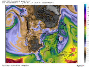
 Factor in PWATs (precipitable water values) zooming to 1.5″-1.8″ and the threat is there for localized heavy downpours around mid week.
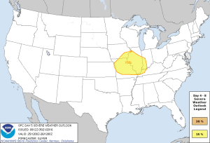
 Additionally, we also note the Storm Prediction Center (SPC) has placed western sections of our forecast area in a risk of severe weather Wednesday. We’ll keep a close eye on things.
 As we progress into the late week period and on into the long holiday/ race weekend, a warm, humid, and unsettled time of things is expected to continue. It’s tough to pinpoint specifics from this distance, but just keep note of the threat of thunderstorms into and through the upcoming busy weekend, along with warm (highs in the lower to middle 80s; lows in the upper 60s) and humid conditions.