VIDEO: Busy Night Of Severe Weather On Tap…
You must be logged in to view this content. Click Here to become a member of IndyWX.com for full access. Already a member of IndyWx.com All-Access? Log-in here.
You must be logged in to view this content. Click Here to become a member of IndyWX.com for full access. Already a member of IndyWx.com All-Access? Log-in here.
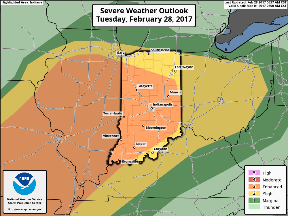
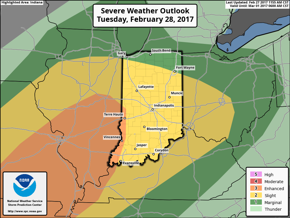
The updated outlook from the Storm Prediction Center shows an expanded “Enhanced Risk” to encompass all of central Indiana.
 This morning’s showers and thunderstorms were the first of (3) rounds of storms expected today. Ironically, most of the daytime hours should be rain and storm-free. We’ll note scattered showers and thunderstorms across northern portions of the state this afternoon, as a warm front continues to lift north.
As we progress into the overnight hours tonight into Wednesday morning, that’s when we’re most concerned for potential severe weather impacts to central Indiana. Short-term, high resolution, modeling continues to suggest individual storms (perhaps super cells) will develop around midnight across the region. These would include all modes of severe weather, including the potential of large hail and a tornado.
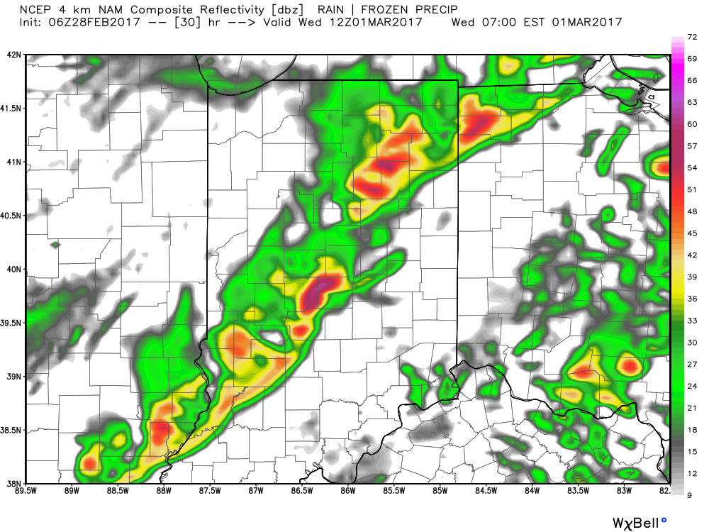
 Finally, our severe weather threat will come to an end with the passage of a squall line during the pre-dawn hours Wednesday morning. The biggest threat with this line of storms will be damaging wind, but a quick spin-up tornado can’t be ruled out either.
 With the majority of this event occurring when most are sleeping, please have a way to get the latest information on watches and warnings that are sure to come tonight. We highly encourage everyone to have a weather radio, and be sure to set the alert mode to “on” before bedtime tonight.
We’ll be back this evening with a fresh 7-day update! Make it a great Tuesday!
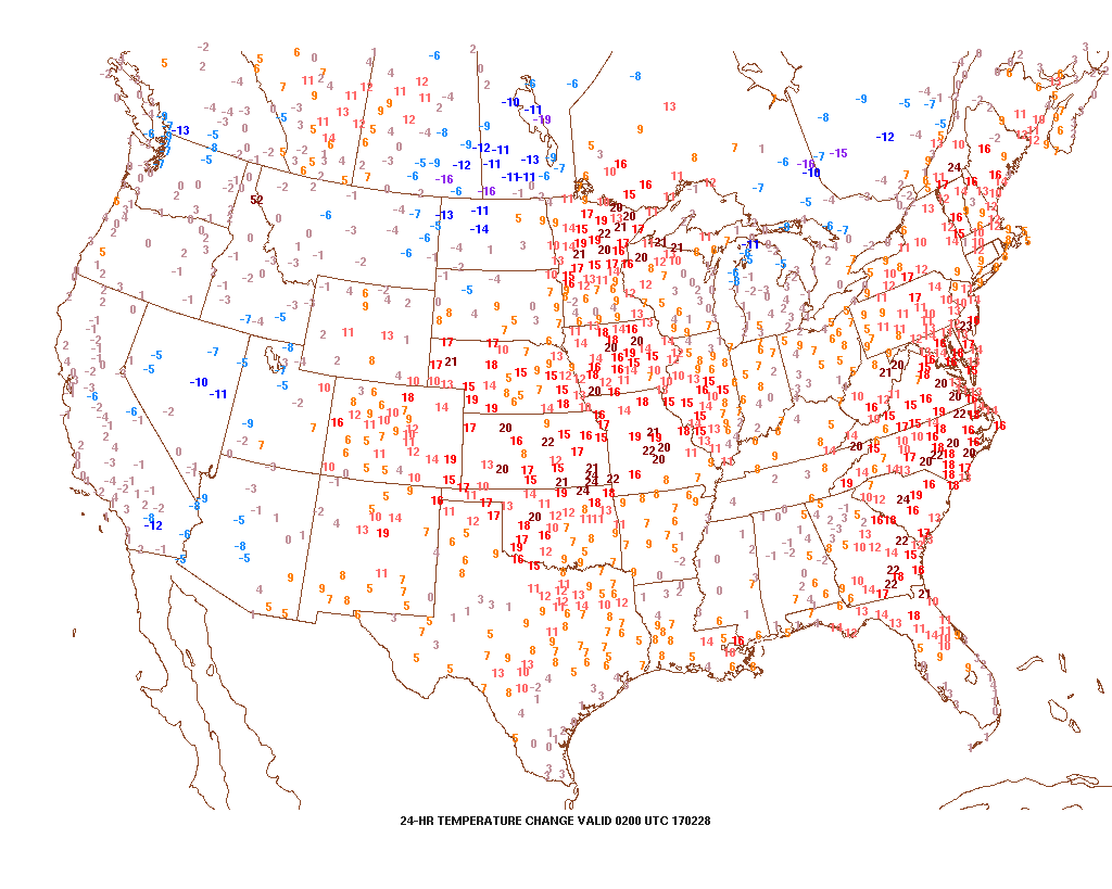
Monday evening is running much warmer than this time Sunday across most of the central, including right here in Indiana.
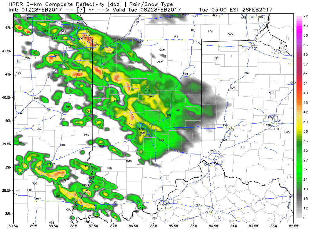
 This warmer regime is the sign of stormy times that will develop as we move into Tuesday. An initial round of showers and thunderstorms will impact central Indiana Tuesday morning and the HRRR forecast radar is picking up on this nicely, especially during the predawn hours.
 The wet, stormy start to the day will give way to a mostly dry time of things through the majority of the daylight hours Tuesday, but our concentration will be on the Tuesday night-Wednesday morning period, as the potential exists for some rather turbulent weather.
We note the National Weather Service’s Storm Prediction Center outlines all of the region for the chance of severe weather Tuesday night and also note the possibility the “enhanced” risk area may expand in future updates. Additionally, given some of the ingredients we’re observing this evening, there’s also the possibility we may see an upgrade to a “moderate” risk for portions of the region. It’ll be particularly important to pay attention to weather updates Tuesday night. Primary concerns are for large hail and damaging winds in a possible squall line that develops ahead of an approaching cold front. Additionally, if storms develop ahead of the primary line of storms, the potential exists for a couple of tornadoes. Have a means of getting the latest watches and warnings Tuesday night.
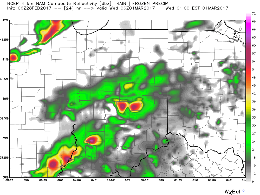
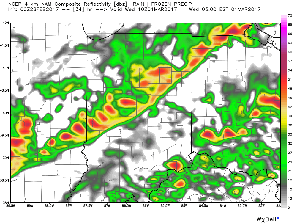
 Modeled radar suggests things may begin to get “busy” around these parts late evening and during the overnight. The latest high resolution NAM (hot off the press as of this update) paints a rather ominous look as midnight nears Wednesday morning.
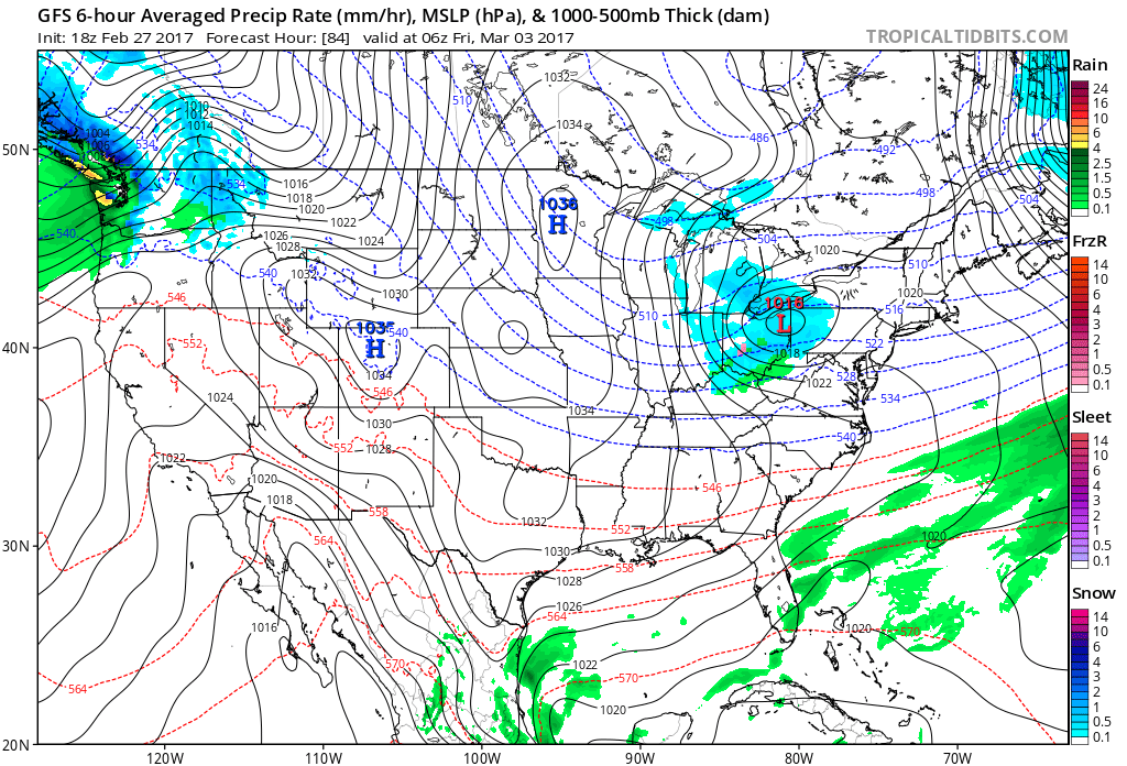
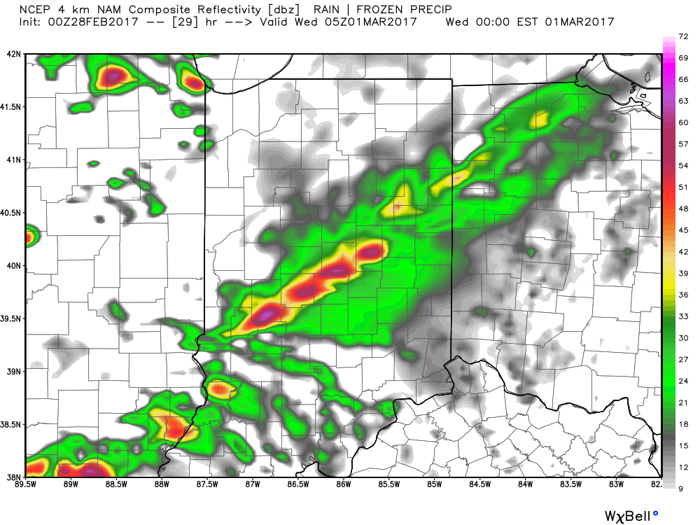 We then note modeling bringing the squall line through central Indiana during the overnight and predawn hours. We’ll have to fine tune timing as we move through the day Tuesday, but we bracket the hours of 2a and 6a when a concentrated line of strong to severe storms rumbles through the state (northwest to southeast). Hail and damaging straight line winds are of greatest concern, but a quick spin-up tornado can’t be ruled out.
 Our weather will turn quieter, but colder, as Wednesday progresses into Wednesday evening, including blustery conditions with falling temperatures.
A fast-moving clipper system will dive southeast Thursday evening into early Friday morning and this could produce a snow shower, or two, across the region, but shouldn’t amount to much from a snow perspective (keeping true to the tune of the winter, heh?). The bigger story will be the “rude” feel to the air mass as we wrap up the work week, as highs only reach the upper 30s with a gusty wind.
 That said, the chilly late week conditions won’t last long, and a gusty southwesterly air flow will develop as early as Saturday. This will help give temperatures a significant boost Saturday afternoon after a cold start to the day. 60° is possible Saturday afternoon and the mercury may approach 70° Sunday!
More updates in the AM! Have a great night, friends!
Meteorological spring begins in a few days (runs March through May). We’ve already touched on the expected busy severe weather season and want to dedicate this post towards looking deeper into the weather pattern and the resulting precipitation and temperature impacts.
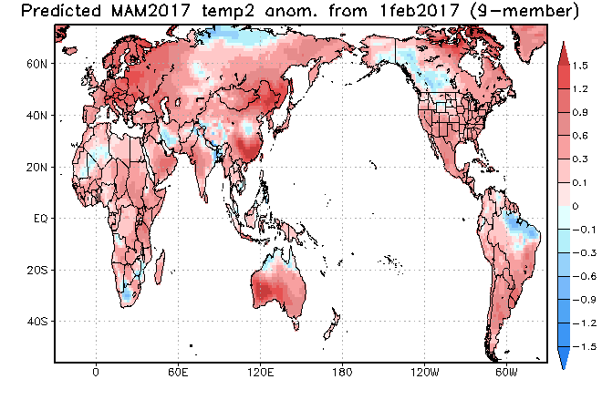
The latest longer-range data continues to be in very good agreement on the upper air pattern. In short, the balance of the spring season looks to offer up a continued theme of warmer than average temperatures for our region. (Not saying we won’t have to deal with a wintry “trick or two” over the first couple weeks of March). When we look at spring, as a whole, we believe it’ll be one known more for the warmth and active, stormy times.

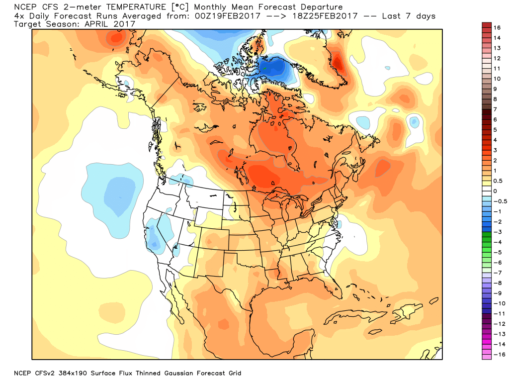
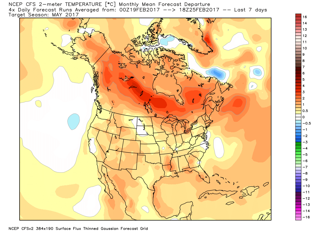
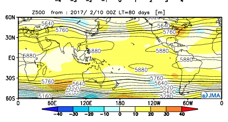
The latest JMA monthly idea is one that has to raise an eye brow as it would paint an early summer across the Ohio Valley and Great Lakes. Anomalous warmth (true summer-like air) would develop with a strong ridge over the Great Lakes and northeast. This is something we’ll have to keep an eye on. A big caveat here is how strong and quickly the coming El Nino develops. It should be noted, El Nino years can feature some of the hottest air early, not late, in the summer season (relative to averages), and the JMA would, indeed, yield an early summer with such a look.
It should also be noted modeling is suggesting a wet look, locally, especially during the early portions of spring. The JAMSTEC and JMA are particularly bullish on a wet pattern.


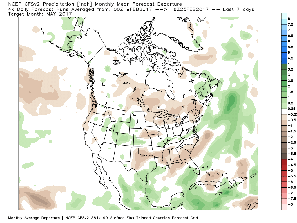
The CFSv2 hits the wet March hard before a drier regime mid and late spring.


In closing, we seem to have a bit of a bumpy ride in front of us as meteorological spring begins. While Old Man Winter hasn’t been seen much as of late, don’t be shocked if he makes his presence felt a few more times through the first half of March- both from a cold and snow perspective. That said, data really points towards more of an overall warm regime developing the second half of the month, and continuing through the majority of spring, for that matter. We’re keeping a close eye on May for an early summer-like feel to take hold, locally. Subsequent JMA updates will be monitored closely. We also remain confident of an active severe weather season. Note the tendency of model data (above) to pull the mean trough position to the northwest March into April. The clash of late-season wintry conditions west, combined with unseasonably warm temperatures across the east (not to mention the warmer than average Gulf of Mexico) likely will equal busy times as we progress through the spring severe weather season.
 Highlights:
Focused On Severe Weather This Evening…Though the day is beginning on a quiet note, we’re concerned it might not end that way, as strong to severe thunderstorms impact central Indiana this afternoon and evening. The sunshine this morning is actually something that adds further concern for the potential of explosive thunderstorm development later today. More specifically, we’re bracketing the hours of 4p and 10p for the likelihood of storms impacting central parts of the state (west to east), and some of these may become severe. All modes of severe weather are in play today, including large hail, damaging winds, and a tornado or two. Please have a means of getting the latest warning information and ensure you know your family’s severe plan. Otherwise, we forecast to shatter the record high today as we zoom all the way into the middle 70s with a gusty southerly wind.
Winter will return with authority tonight and set-up a much colder weekend. That high in the upper 40s Saturday will actually come at midnight with falling temperatures (most of the daytime hours will feature low-mid 30s with ‘chills in the 20s), windy conditions, and scattered snow showers.
A weak weather system is looking less and less impressive for the second half of the weekend, but we’ll continue to keep a chance of light rain in our forecast by evening.
Better rain chances will begin to ramp up Monday evening and become widespread Tuesday, including the possibility of thunderstorms, as well. The second half of next week will trend colder…
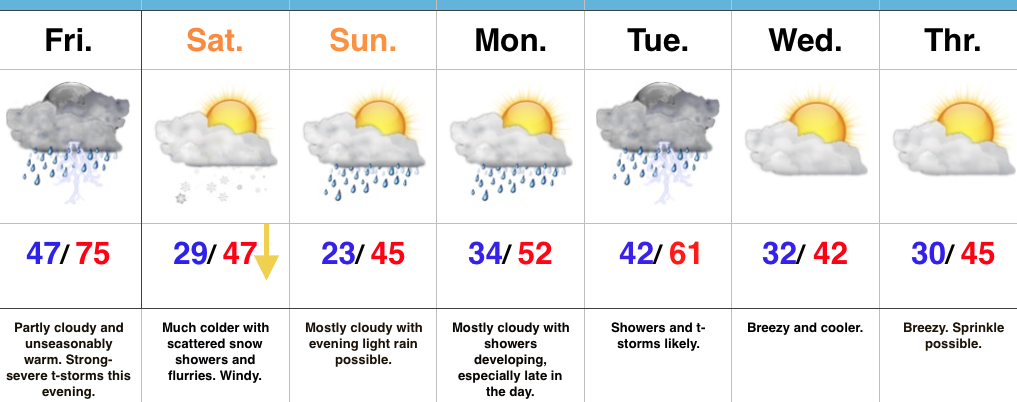
Upcoming 7-Day Precipitation Forecast: