High winds and storms arrive Thursday. We also look ahead towards late-March and April…
You must be logged in to view this content. Click Here to become a member of IndyWX.com for full access. Already a member of IndyWx.com All-Access? Log-in here.
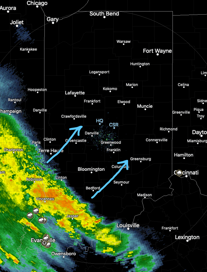
Our quiet Saturday will transition to a rather “bumpy” time of things by the afternoon into tonight as a storm system moves through. Showers and embedded thunder off to our southwest this morning will rumble across central Indiana this afternoon and evening.
Radar update at 11:15a
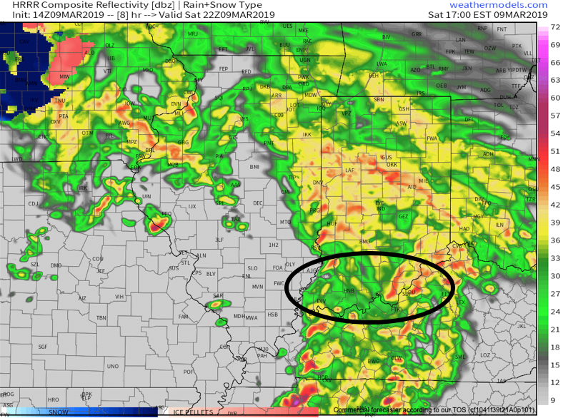
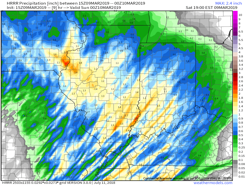
Forecast radar products show widespread showers and embedded thunder through the afternoon hours into the evening. Coverage of rain will be greatest between 2p and 6p. Some locally heavy downpours are possible. While severe weather isn’t expected across central Indiana, a few strong to severe storms, capable of damaging straight line winds, will be possible across southern parts of the state. Storm total rainfall amounts of 0.75″ to 1.25″ will be common across the region.
Attention will then shift to strong and gusty winds this evening into tonight. Gusts of 50-55 MPH will be common across central Indiana during this timeframe. Unfortunately, downed trees and potential for power outages will be on the increase tonight.
Winds will remain gusty into Sunday morning, but begin to diminish through the day.
A wet and stormy time of things will develop this afternoon, followed by increasingly gusty winds tonight and early Sunday. Winds will gust in excess of 50 MPH at times…
You must be logged in to view this content. Click Here to become a member of IndyWX.com for full access. Already a member of IndyWx.com All-Access? Log-in here.
The weekend will feature showers and thunderstorms along with strong and gusty winds (in excess of 50 MPH at times Saturday evening-night)…
You must be logged in to view this content. Click Here to become a member of IndyWX.com for full access. Already a member of IndyWx.com All-Access? Log-in here.
You must be logged in to view this content. Click Here to become a member of IndyWX.com for full access. Already a member of IndyWx.com All-Access? Log-in here.