Harvest ’19: Tracking Another Significant Storm This Week…

*Starting November 1st, our weekly agriculture and harvest updates will transition to weekly winter storm outlooks. We’ll maintain a lot of the feedback y’all have provided with the new weekly winter products. Come next growing season, the weekly agriculture and severe weather updates will return.

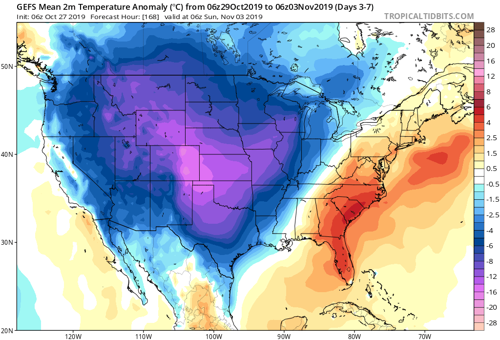
Forecast Period: 10.27.19 through 11.03.19

7-Day Precipitation: Average average precipitation is expected through the period.

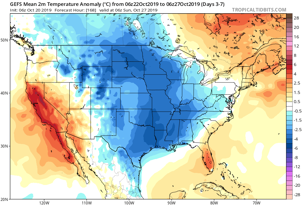
7-Day Temperatures: Once the forecast period is said and done, below average temperatures can be expected, overall.

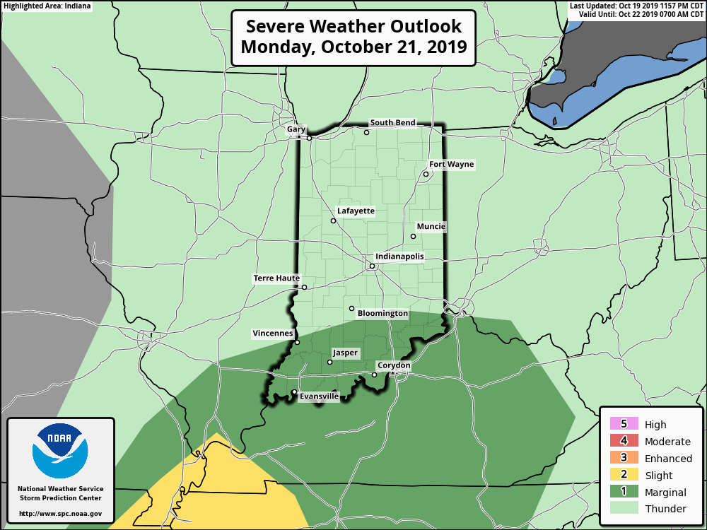
Severe Weather: Organized severe weather isn’t expected during the period.

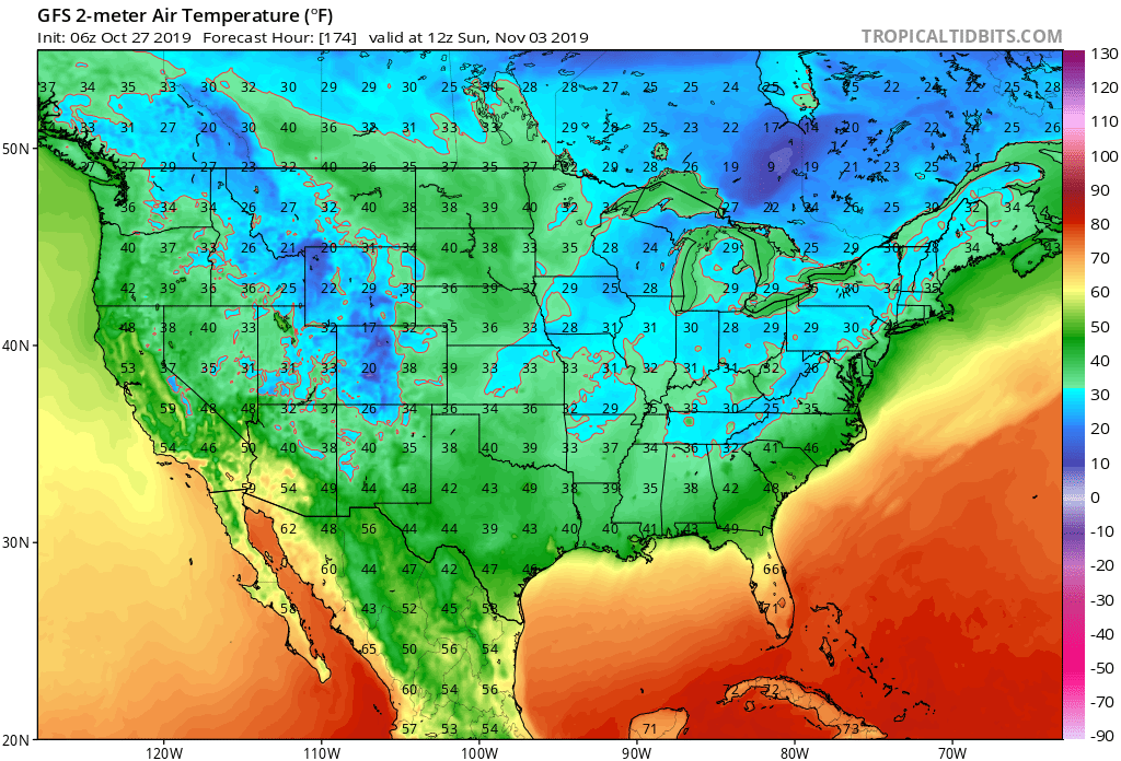
Frost/ Freeze: The first frost and freeze of the fall season will likely take place next weekend across portions of the Deep South.

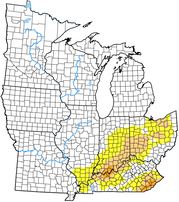
Drought Monitor: The latest drought monitor (taken before Friday and Saturday’s rain) shows abnormally dry/ drought conditions in place across southern IN into central OH. Thankfully, a long-term drought isn’t expected here. The pattern not only at present, but throughout the upcoming winter will feature plentiful precipitation, erasing any of the abnormally dry conditions that are currently in place.

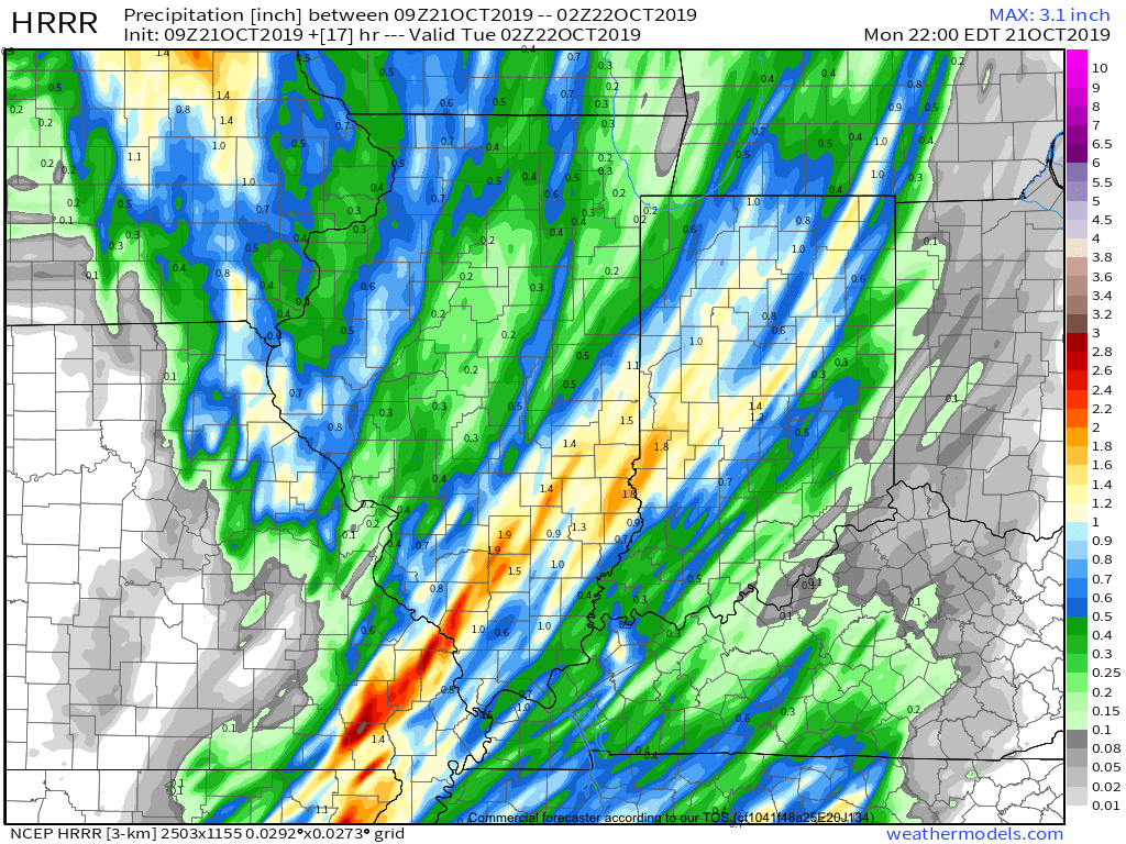
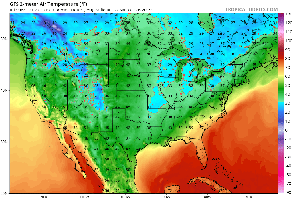
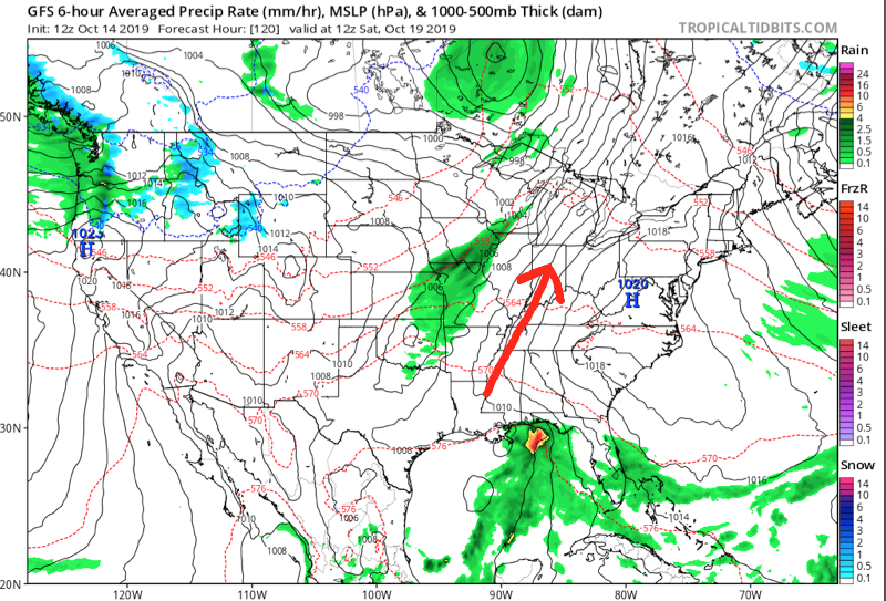
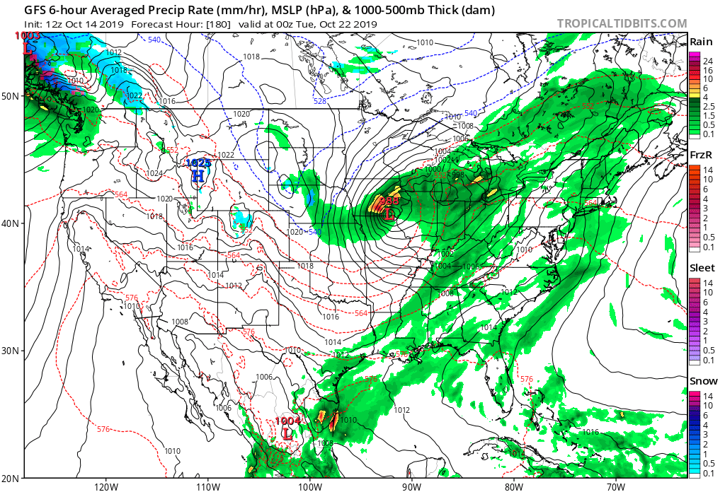
Summary: We’re monitoring a couple of storm systems this week. The first system will scoot by to our northwest with a band of rain and snow from KS, IA, and into IL and WI during the early part of the work week. A second, stronger system will impact the region Wednesday into Friday. Another wind-driven rain will be the result, locally, Wednesday into Thursday before sharply colder air arrives to close the work week. The air will grow cold enough to support the potential of flurries or scattered snow showers late Thursday night into Friday. The first official freeze of the season is likely next weekend. Upcoming 7-day rainfall totals are expected to fall in the 0.75″ to 1.25″ range for most of immediate central Indiana.

Wet, Windy, And Stormy Day Ahead…

A cold front will push across the Ohio Valley today. Ahead of the front, widespread showers and thunderstorms are expected. A few of these storms may become strong to severe with damaging straight line winds being the biggest concern.

The Storm Prediction Center now includes portions of central Indiana in a ‘marginal’ risk for severe weather.

We expect a couple of rounds of storms today- one mid to late morning followed by another this evening directly ahead of the cold front.

Forecast radar 10a
Forecast radar 7p

Rain will end from west to east during the evening as the cold front sweeps across the state. Before that, some area rain gauges may accumulate around an inch of rain today (a few locally heavier totals possible).

The other headline today will be strong and gusty winds (originally out of the southwest before shifting to west this evening). Even outside of thunderstorms, gusts in excess of 40 MPH can be expected.

Drier and cooler air will arrive Tuesday through Thursday before another chilly, wet weather maker blows into town Thursday evening into Friday.

Harvest ’19: Severe Storms For Southern IN Tomorrow? Precipitation And Temperature Trends Over The Upcoming 7-Days…

*Starting November 1st, our weekly agriculture and harvest updates will transition to weekly winter storm outlooks. We’ll maintain a lot of the feedback y’all have provided with the new weekly winter products. Come next growing season, the weekly agriculture and severe weather updates will return.

Forecast Period: 10.20.19 through 10.27.19

7-Day Precipitation: Average to slightly above average precipitation is expected through the period.

7-Day Temperatures: Below average temperatures are expected through the period.

Severe Weather: We’re monitoring the potential of a few strong to severe thunderstorms- mostly across southern portions of the state Monday afternoon and evening. The biggest concern has to do with the potential of damaging straight line winds with embedded cells that form directly ahead of the cold front tomorrow evening.

Frost/ Freeze: While most of the immediate region has already dealt with multiple hard frosts, frost and freeze conditions will expand south over the upcoming week. The coldest morning, overall, appears to be Saturday with the potential of a freeze extending south into the Ozarks and northern TN Valley.

Drought Monitor: The southern and eastern portion of the region remains in abnormally dry or drought conditions. The pattern ahead longer term does look favorable to erase a lot, if not all, of these dry/ droughty areas before the end of the year.

Summary: The upcoming 7-day period will feature two primary storm systems. The first arrives Monday with showers and thunderstorms. We’ll continue to monitor the potential of strong-severe storms across southern portions of Indiana tomorrow PM and update accordingly later this evening. The second system will be a colder feature and thunderstorms aren’t anticipated with Friday’s storm system. The pattern still seems poised to produce the coldest air so far this season just beyond the forecast period. Overall, upcoming 7-day rainfall totals are expected to range between 0.50″ and 0.75″ for most of immediate central Indiana.

VIDEO: Rain Develops By Evening; Potential Of Pre-Halloween Snow?

You must be logged in to view this content. Click Here to become a member of IndyWX.com for full access.  Already a member of IndyWx.com All-Access?  Log-in here.

Taste Of Winter Before Month’s End?

A cold front will whip through central Indiana Tuesday evening. Showers will accompany the frontal passage, but we still don’t anticipate much in the way of significant moisture across central Indiana. Heavier rainfall totals in excess of 0.50″ will likely fall across drought-stricken areas downstate.

Colder and blustery conditions will be with us Wednesday and Thursday, including wind chills in the upper 20s at times Wednesday morning.

A moderating trend will get underway this weekend as a gusty southwesterly breeze takes hold on the backside of retreating high pressure. This will lead to a couple of days of above normal warmth early next week (not quite done with the 70s just yet).

We’ll continue to monitor for a wet and stormy time of things Monday PM into Tuesday. The severe threat is to be determined and will require fine tuning as we push ahead over the next several days.

Once this area of low pressure and associated cold front blow through, colder air will arrive on gusty northwest winds by the middle to latter portions of next week.

This will set the tone for a rather significant colder shift as we get set to put a bow on the month of October. A secondary and more significant trough will descend into the region just after Day 10. With a developing negative EPO, positive PNA, and MJO heading for Phase 2, it’s time to start “beating the cold drum” a bit harder. In fact, latest 500mb charts would indicate there’s the potential of at least a little wintry mischief present to go along with the colder shift.

This should at least kick up the lake effect snow guns for the first time this season, and we’ll have to monitor things for the possibility of “backside” energy digging south at the base of the trough that would present the possibility of a little early season snow across parts of the Ohio Valley region as Halloween week nears…

Times, they are, indeed, ‘a changing…