Weekly #AGwx And #Severe Outlook…
Weekly Highlights:
I. Potent area of low pressure will track along the Ohio River, spreading rain across the Ohio Valley and into the Northeast, including higher elevation wet snow.
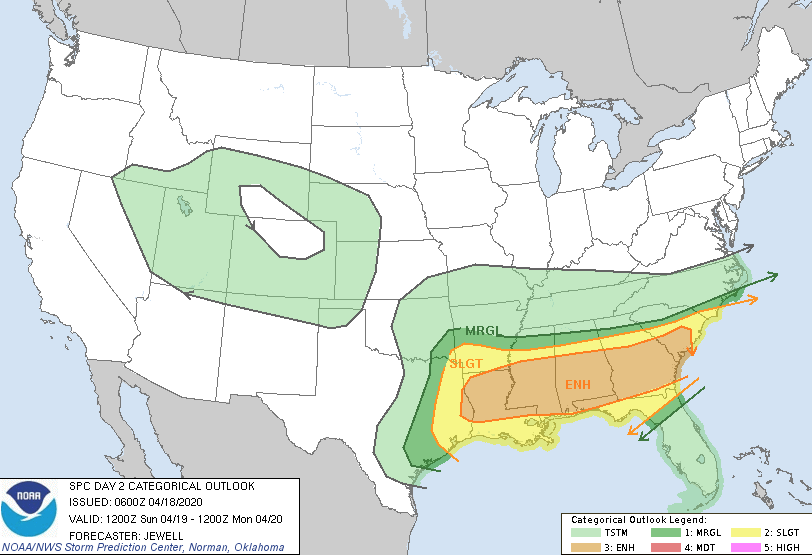
II. A surface low and associated cold front will sweep into Plains Tuesday and to the eastern seaboard by Thursday. This system will have to be monitored for not only the potentially of locally heavy rain, but the threat of strong to severe thunderstorms on the journey southeast.


Forecast Period: 04.25.20 through 05.02.20
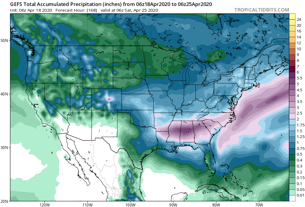
Central Indiana and the Ohio Valley, as a whole, will have to deal with both storm systems highlighted above. While we still believe dry conditions will prevail through a good portion of our Saturday, rain will become more widespread this evening into Sunday morning in response to a surface low moving northeast along the Ohio River. A couple heavier bands of rain may develop across the region tonight into Sunday morning and by the time all is said and done, the southern half of the state (along and south of the I-70 corridor) can expect 0.50″ to 1″ of rain by Sunday afternoon. Further north, amounts between 0.25″ and 0.50″ will be more common. Drier air will build in late Sunday afternoon, along with a cooler northeasterly and northerly flow behind our departing storm system.
Monday morning will open dry, but a weak weather maker will scoot through the state during the afternoon, resulting in scattered showers making a return Monday PM. These will be quick-moving showers and rainfall totals are expected to remain light for those that do see rain.
A much more organized storm system will push southeast Tuesday evening and Wednesday leading to more widespread shower and thunderstorm activity during this time frame. Stronger storms and locally heavy rain will be a good bet with this particular system. Drier, cooler air returns behind this system as we get set to wrap up the work week.